Pamplona Park Subdivision
Pamplona Park Subdivision is a neighborhood in Cavite, Calabarzon. Pamplona Park Subdivision is situated close to the quarter Pamplona Dos and the neighborhood Remarville.Notable Places in the Area

Zapote Bridge
Bridge
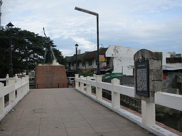
Photo: Seav, CC BY-SA 4.0.
Zapote Bridge is a stone arch pedestrian bridge crossing the Zapote River in the Philippines.
Localities in the Area
Bacoor
Photo: Cookie Nguyen, CC BY-SA 4.0.
Bacoor is a suburban city in Cavite. It is a large, overwhelmingly sprawling community south of Manila, and the gateway to the province from the north.
Las Piñas
Photo: Charles Boris Manez, CC BY-SA 3.0.
Las Piñas (, officially the City of Las Piñas, is a 1st class highly urbanized city in the National Capital Region of the Philippines.
San Isidro
Quarter
San Isidro is a barangay in Parañaque, Metro Manila, Philippines with a population of 79,372 as of the 2020 census. San Isidro is situated 4 km northeast of Pamplona Park Subdivision.
Pamplona Park Subdivision
- Type: Neighborhood
- Categories: residential area and locality
- Location: Cavite, Calabarzon, Luzon, Philippines, Southeast Asia, Asia
- View on OpenStreetMap
Latitude
14.451° or 14° 27' 4" northLongitude
120.97522° or 120° 58' 31" eastOpen Location Code
7Q62FX2G+C3OpenStreetMap ID
way 28050316OpenStreetMap Feature
landuse=residentialOpenStreetMap Feature
place=neighbourhoodPamplona Park Subdivision Satellite Map
© OpenStreetMap, Mapbox and Maxar
Localities in the Area
- Pamplona DosQuarter
- RemarvilleNeighborhood
- Sterling HomesNeighborhood
- Patricia HomesNeighborhood
- Sta. CristinaNeighborhood
Landmarks in the Area
- Pamplona Dos Barangay HallTown hall
- STICollege
- Department of Labor and EmploymentGovernment office
- Las Piñas Driving RangeGolf course
- EZ Quest SpaRecreation area
Popular Destinations in Cavite
Discover Tagaytay, Dasmariñas, Cavite City and Imus.
Escape to a Random Place
Discover other neighborhoods in the world.
About Mapcarta. Thanks to Mapbox for providing amazing maps. Data © OpenStreetMap contributors and available under the Open Database License. Text is available under the CC BY-SA 4.0 license, excluding photos, directions and the map. Photo: Wikimedia, Public domain.