Share

Scan the QR code and open PeakVisor on your phone
Scan the QR code and open PeakVisor on your phone
Occupying approximately 20 percent of the land area on Hong Kong Island, Tai Tam Country Park sprawls over the eastern side of the frog-shaped island where nature blends with history. There are 13 named hills in Tai Tam Country Park, the highest and most prominent of which is Mount Parker (532 m/1,745 ft).
Designated in 1977, Tai Tam Country Park and its Quarry Bay Extension (added two years later) are actually managed as separate entities, though most people never notice since they can easily cross from one of them to the other without encountering any boundaries.

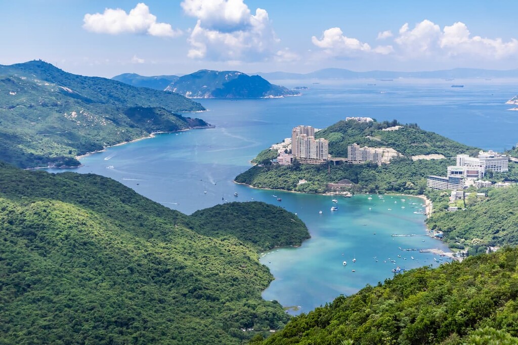
With an area of 1,315 hectares (3,249 acres), Tai Tam Country Park occupies a good part of eastern Hong Kong island, bordering on Wong Nai Chung Gap to the west and Stanley Gap Road to the south. The Quarry Bay Extension is an addition of 270 hectares (667 acres) at the north-eastern corner, which is only a stone’s throw away from the bustling urban area of Quarry bay.
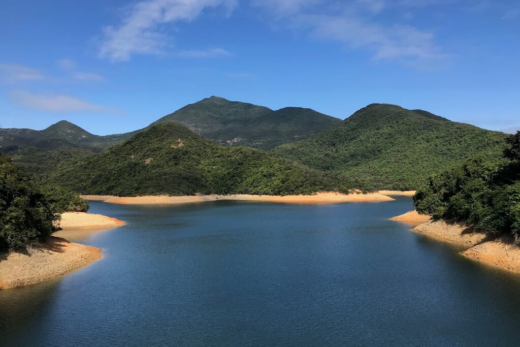
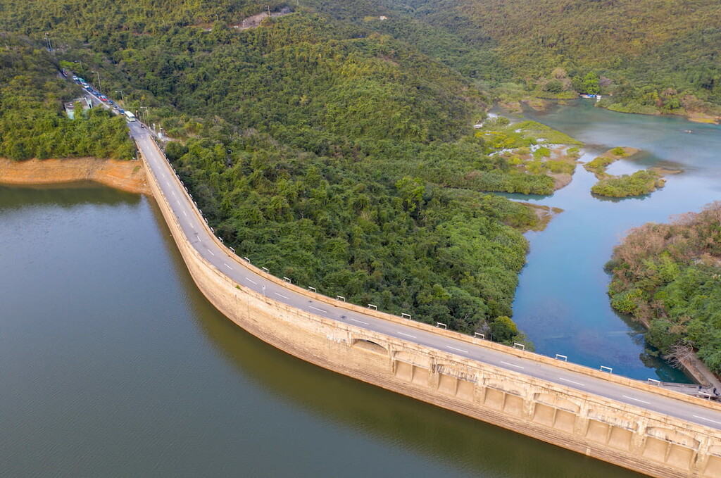
The south-eastern portion of the park lies close to Tai Tam Bay, and part of Tai Tam Tuk Reservoir even sits right next to the sea, with the two bodies of water separated only by a dam. The reservoir’s water level is higher than sea level, making it sort of an infinity pool.
Across from Tai Tam Bay is Shek O Peninsula, where Shek O Country Park is located. There is a small section where these two parks are next to each other with Tai Tam Road as the boundary between them, and it is possible to walk from one park to the other.
The area consists of granitic rocks in the north and volcanic rocks in the south. Most of the volcanic rocks are made up of homogeneous fine ash tuff. The summit of Violet Hill, however, is capped by eutaxite, a type of banded volcanic rock. To the south-east of Wong Nai Chung Gap, there is a thin band of fine-grained sandstone about 15 meters (49 feet) thick.

There was a granite quarry on Mount Butler which operated from 1954 to 1991. Now the unsightly open-pit mine remains exposed and barren on the hillside.
The area of Tai Tam Country Park was once degraded to a patchwork of barren slopes during World War II (WWII) when a large amount of the vegetation cover was stripped by Japanese forces for fuel. The ecology has since made a remarkable recovery thanks to intensive reforestation efforts.
The Taiwan acacia (Acacia confusa) and the slash pine (Pinus elliottii) are among the most common trees, and there are self-guided tree walks with bilingual (English and Chinese) signage that introduces different species of trees.
A wide variety of plants flourishes in the mild climate and protected environment of the park.
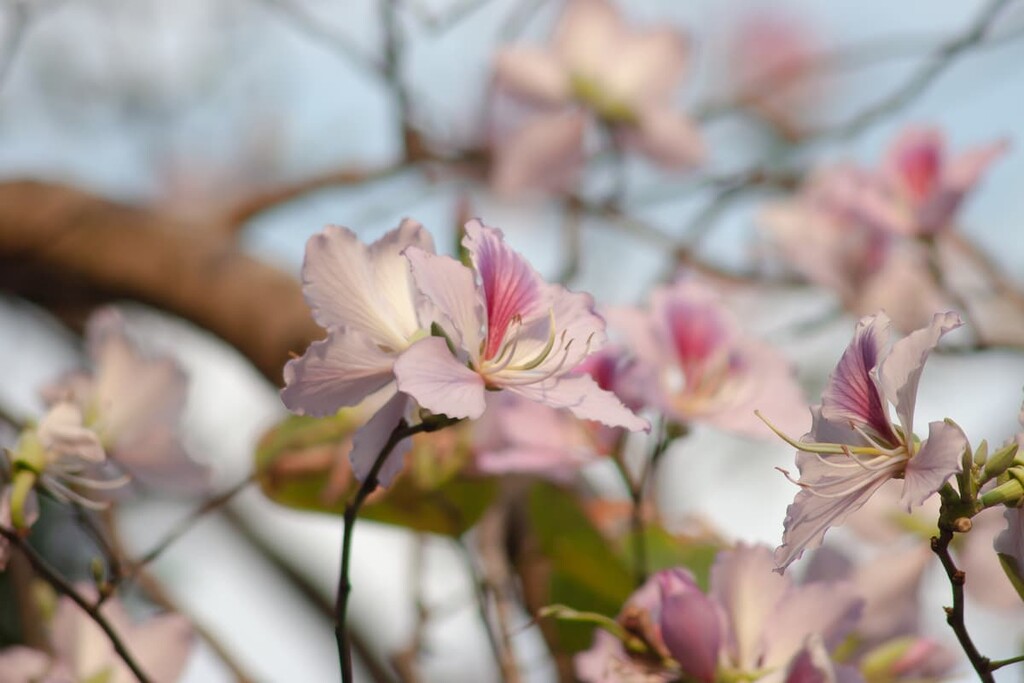
While the landscape remains green all year round, flowering plants blooming in different seasons make themselves noticed with their vibrant colors. Among the most common are rhododendrons, Hong Kong camellia and Hong Kong gordonia (Polyspora axillaris). A few types of carnivorous plants, including the pitcher plant, can be spotted close to the creeks.

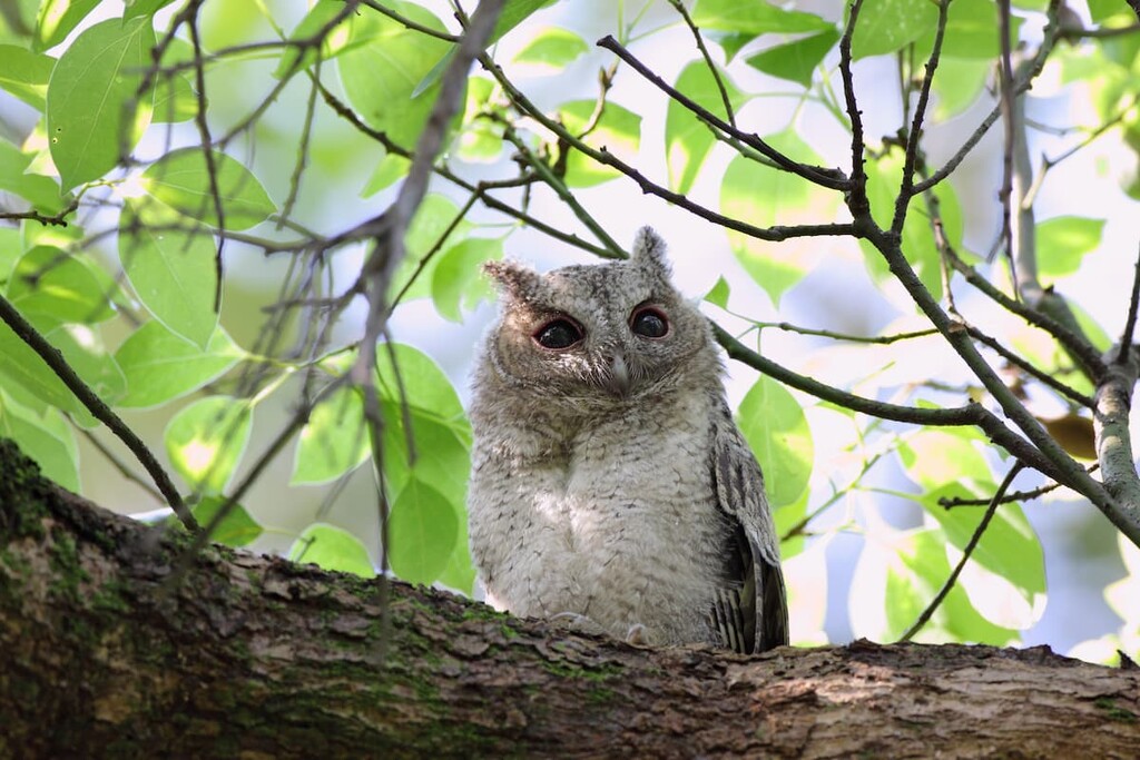
Flowering plants in the park sustain nectar-feeding birds such as the fork-tailed sunbird and the Swinhoe’s white-eye. Other common bird species include black kite, collared Scops owl, yellow-crested cockatoo and common kingfisher.
The abundance of creeks and streams provide perfect habitat for amphibians, including the Romer’s tree frog which is found only in Hong Kong, though the population in Tai Tam was relocated from what is now the international airport in Chek Lap Kok. There are also various types of shellfish, reptiles and insects found within the park.
The dense woodlands harbor mammals like Chinese leopard cat, common muntjac, Chinese porcupine and Chinese ferret badger though these species are quite elusive.

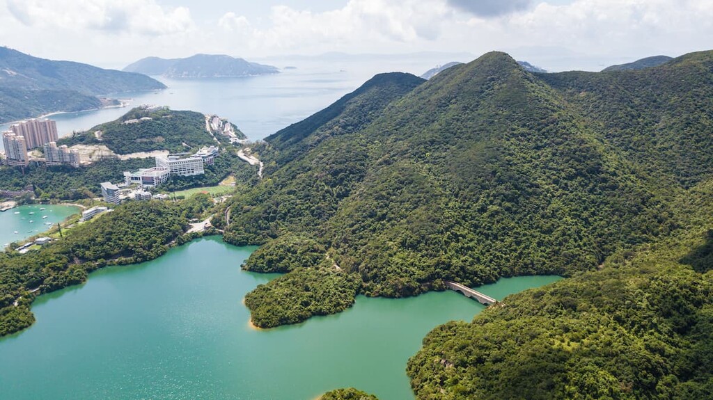
The Tai Tam area used to be a valley beside the sea with few inhabitants. From 1883 to 1917, the valley was dammed for the construction of four reservoirs that were designed to supply freshwater to the island’s growing population.
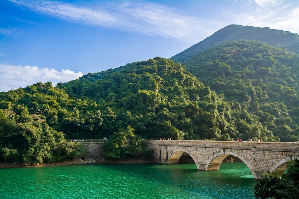
Known as the Tai Tam Group of Reservoirs, the group of reservoirs consists of Tai Tam Upper Reservoir (completed in 1888), Tai Tam Byewash Reservoir (1904), Tai Tam Intermediate Reservoir (1907), and Tai Tam Tuk Reservoir (1917).
Once vital to Hong Kong’s development, this group of reservoirs, alongside other local reservoirs, now play a secondary role in water supply. Indeed, most of the freshwater in the city is imported from mainland China so use of the reservoirs is dwindling rapidly.
Tai Tam was a strategic location during World War II, which came to Hong Kong in early December 1941 with the arrival of Japanese troops. By mid-December the Japanese had crossed over from Kowloon Peninsula to Hong Kong Island, where the defending troops put up strong resistance in several places including Tai Tam and Wong Nai Chung gap.

However, the Battle of Hong Kong was short-lived, ending on December 25, 1941 or “Black Christmas.” The day also marked the beginning of the Japanese occupation that lasted for 3 years and 8 months.
Today, against the scenic and tranquil backdrop of the countryside, remnants such as bunkers, pillboxes and communal stoves serve as stark reminders of the war. In a landscape dominated by more than a dozen verdant peaks and four jade-green reservoirs, historical remnants in the park attest to early developments of the city’s waterworks as well as fierce battles fought during the Second World War.
Tai Tam is one of Hong Kong’s most popular hiking areas. Here are some of the best trails and attractions to check out in the park:
The route is a moderate 12-kilometer (7.5 mi) hike that begins at Wong Nai Chung Reservoir Park which lies just outside Tai Tam Country Park to the east. It also includes a 5-kilometer (3.1 mi) detour of the Tai Tam Waterworks Heritage Trail.
Built in 1899, Wong Nai Chung Reservoir is one of the oldest reservoirs in Hong Kong, though it no longer serves as a source of water supply and its function is now purely recreational.
This route follows Tai Tam Reservoir Road from Wong Nai Chung eastward to the Tai Tam group of reservoirs, then turns north to Mount Parker Road all the way to Quarry Bay. A shorter alternative is to exit the park from its south entrance at the southeast end of Tai Tam Tuk Reservoir (intersection between Tai Tam Road and Tai Tam Reservoir Road).

Points of interest include:

This is a steep and strenuous 5-kilometer (3.1 mi) hike that also begins at Wong Nai Chung Reservoir Park, where the route heads south over two hills—the relatively gentle Violet Hill and the much steeper Twins—to end at Stanley Gap Road. You won’t get close to the Tai Tam reservoir group but will admire them from far above, along with sweeping views of Stanley Peninsula and the ocean beyond.
Violet Hill was named for the color of flowers that grow there, which could be the Hong Kong iris (Iris speculatrix) that covers the slopes in the spring and/ or the balloon flower (Platycodon grandifloras) that blossoms in summertime. During the winter, the violet color is replaced by red as the bell-shaped Chinese New Year flower (Enkianthus quinqueflorus) takes its turn to bloom.
Climbing up “The Twins,” named as such because the hill has two peaks of similar height, is an arduous ascent of 1,200 steps straight up with little shade. The hill sides are covered with the white and yellow Hong Kong gordonia (Polyspora axillaris) in winter.

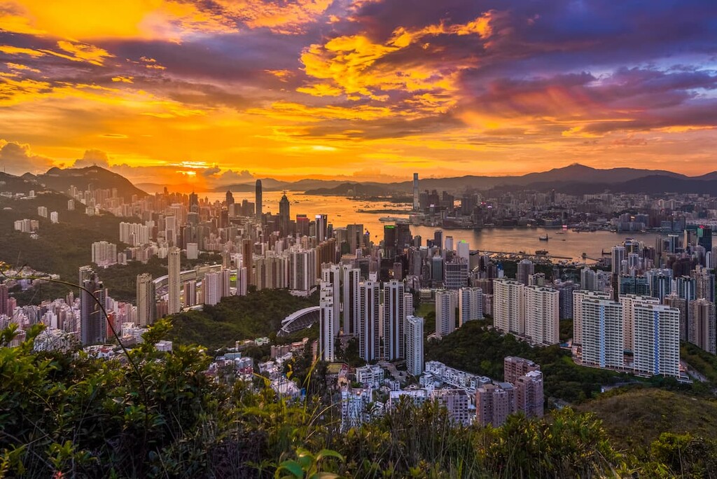
Jardine’s Lookout is a hill on the eastern side of the country park to the north of Wong Nai Chung Reservoir. Part of the hill is outside the park and has been developed for residential buildings that are much sought after because of the literally million-dollar views of the city’s world-famous skyline.
Apartments and houses with good views usually cost about US$4,000/square foot while the most expensive ones can cost a whopping US$10,000/square foot. Fortunately, the western part of the hill is free from commercial development since it is inside the country park where everyone can enjoy the views.
Easily accessible from the urban area or Wong Nai Chung Reservoir, Jardine’s Lookout is connected to Mount Butler Viewing Point and then Quarry Pass Pavilion to the west via Hong Kong Trail Section 5. It is a gentle uphill walk of 1.4 km (0.9 mi) to the crossroads of Quarry Pass Pavilion, where one trail heads south to the Tai Tam reservoir group, one goes north to Quarry Bay, and one continues west to Mount Parker, the highest peak in the park.

Apart from Jardine’s Lookout, the other neighborhoods bordering on the park also have some interesting sights to see.

There are several entry points to the park and all are served by public transport.


Explore Tai Tam Country Park with the PeakVisor 3D Map and identify its summits.