

TCAR - Typhoon Committee
TCAR - Typhoon Committee
TCAR - Typhoon Committee

Create successful ePaper yourself
Turn your PDF publications into a flip-book with our unique Google optimized e-Paper software.
ESCAP/WMO<br />
<strong>Typhoon</strong> <strong>Committee</strong><br />
KUJIRAI<br />
CHAN-HOM<br />
LINFA<br />
NANGKA<br />
SOUDELOR<br />
MOLAVE<br />
GONI<br />
MORAKOT<br />
ETAU<br />
VAMCO<br />
KROVANH<br />
DUJUAN<br />
MUJIGAE<br />
CHOI-WAN<br />
KOPPU<br />
KETSANA<br />
PARMA<br />
MELOR<br />
NEPARTAK<br />
LUPIT<br />
MIRINAE<br />
NIDA<br />
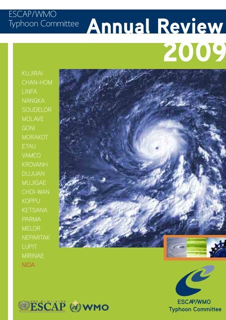
Annual Review<br />
2009<br />
ESCAP/WMO<br />
<strong>Typhoon</strong> <strong>Committee</strong>
On the Cover:<br />
2<br />
ESCAP/WMO<br />
<strong>Typhoon</strong> <strong>Committee</strong> Annual Review 2009<br />
MTSAT-1R VS imagery of NIDA (0922) at 18UTC, 25 November 2009.<br />
(By courtesy of Japan Meteorological Agency)
CONTENTS<br />
ESCAP, WMO and the ESCAP/WMO <strong>Typhoon</strong> <strong>Committee</strong><br />
<strong>Typhoon</strong> <strong>Committee</strong> (2007-2008)<br />
ESCAP/WMO <strong>Typhoon</strong> <strong>Committee</strong> Annual Review 2009<br />
Foreword<br />
Introduction<br />
Chapter 1 TC ACTIVITIES 2009<br />
1.1.Summary of Member’s Key Result Areas<br />
1.2 <strong>Typhoon</strong> <strong>Committee</strong> Secretariat (TCS)<br />
Chapter 2 TROPICAL CYCLONES 2009<br />
KUJIRAI (0901)<br />
CHAN-HOM (0902)<br />
LINFA (0903)<br />
NANGKA (0904)<br />
SOUDELOR (0905)<br />
MOLAVE (0906)<br />
GONI (0907)<br />
MORAKOT (0908)<br />
ETAU (0909)<br />
VAMCO (0910)<br />
KROVANH (0911)<br />
DUJUAN (0912)<br />
MUJIGAE (0913)<br />
CHOI-WAN (0914)<br />
KOPPU (0915)<br />
KETSANA (0916)<br />
PARMA (0917)<br />
MELOR (0918)<br />
NEPARTAK (0919)<br />
LUPIT (0920)<br />
MIRINAE (0921)<br />
NIDA (0922)<br />
<strong>TCAR</strong><br />
Contents<br />
7<br />
9<br />
9<br />
11<br />
13<br />
15<br />
153<br />
164<br />
165<br />
166<br />
167<br />
168<br />
169<br />
170<br />
171<br />
172<br />
173<br />
174<br />
175<br />
176<br />
177<br />
178<br />
179<br />
180<br />
181<br />
182<br />
183<br />
184<br />
185<br />
2009<br />
3
4<br />
ESCAP/WMO<br />
<strong>Typhoon</strong> <strong>Committee</strong> Annual Review 2009<br />
Chapter 3 CONTRIBUTED PAPERS<br />
1. Application of Satellite Rain Rate Estimates to the Prediction of Tropical Cyclone Fall<br />
Chan Sai-tick, Scientific-Officer, HKO<br />
2. Improved Error Diagnostics for Model Verification<br />
Tieh-Yong KOH, Assistant Professor, School of Physical & Mathematical Science, Singapore<br />
3. Flood and Storm Surge Monitoring, Forecasting and Warning System<br />
LEONG Weng Kun, Meteorologist, SMG, Macao, China<br />
4. International Best Tracks Archive for Climate Stewardship (IBTrACS)<br />
David LEVINSON, NOAA’s National Climatic Data Center (NCDC)<br />
5. Recent Challenges for Reducing Sediment-related Disaster Risk by<br />
Utilizing Hazard Map And Early Warning System with Community in Japan<br />
Hisashi HOSHINO, Director, Research and Quality Control Division, Rokko Sabo Office,<br />
Kinki Regional Development Bureau, MLIT<br />
6. Precipitation Analysis and Numerical Simulation of MORAKOT<br />
QIAN Chuanhai, National Meteorological Centre of CMA, China<br />
7. An introduction on WMO Landfall <strong>Typhoon</strong> Forecast Demonstration Project<br />
YU Hui, Shanghai <strong>Typhoon</strong> Institute of CMA, China<br />
8. Wind-related disaster risk and reduction<br />
Yukio TAMURA, President of International Association for Wind Engineering; Director,<br />
Global COE Program “New Frontier of Education and Research in Wind Engineering”;<br />
President of International Association of Wind EngineSering-Tokyo Polytechnic University<br />
9. THORPEX Activities Relevant to <strong>Typhoon</strong> <strong>Committee</strong><br />
Tetsuo NAKAZAWA - WMO/WWRP THORPEX<br />
10. Re-analysis and Prediction of <strong>Typhoon</strong> Vera (5915) -<br />
The Most Destructive <strong>Typhoon</strong> Hitting Japan 50 Years Ago<br />
Mitsuhiko HATORI, Director-General of Forecast Department, JMA<br />
11. Predictability of Western North Pacific Tropical Cyclone Events on<br />
Intraseasonal Timescales with the ECMWF Monthly Forecast Model<br />
Elsberry Russ, Chair of Tropical Cyclone Panel of WWRP/WMO<br />
12. Community Weather Station & Warning Dissemination<br />
Hilda Lam, Hong Kong Observatory
Chapter 4 WMO TC NEWS<br />
<strong>TCAR</strong><br />
ESCAP, WMO and the ESCAP/WMO <strong>Typhoon</strong> <strong>Committee</strong><br />
Chapter 5 RESEARCH FELLOWSHIP TECHNICAL REPORT<br />
Use of the JMA Ensemble Prediction System for Tropical Cyclone Intensity Forecasting<br />
Chen Pei-yan and Chan Sai-tick<br />
269<br />
2009<br />
5
6<br />
ESCAP/WMO<br />
<strong>Typhoon</strong> <strong>Committee</strong> Annual Review 2009
ECONOMIC AND SOCIAL COMMISSION<br />
FOR ASIA AND THE PACIFIC (ESCAP)<br />
The Economic and Social Commission for Asia and<br />
the Pacific (ESCAP) aims to initiate and participate in<br />
measures for concerted action towards the development<br />
of Asia and the Pacific, including the social aspects of<br />
such development, with a view to raising the level of<br />
economic activity and standards of living and maintaining<br />
and strengthening the economic relations of countries<br />
and territories in the region, both among themselves and<br />
with other countries in the world. The Commission also:<br />
• provides substantive services, secretariats<br />
and documentation for the Commission and its<br />
subsidiary bodies;<br />
• undertakes studies, investigations and other activities<br />
within the Commission’s terms of reference;<br />
• provides advisory services to Governments at<br />
their request;<br />
• contributes to the planning and organization of<br />
programmes of technical cooperation and acts<br />
as executing agency for those regional projects<br />
decentralized to it.<br />
WORLD METEOROLOGICAL<br />
ORGANIZATION (WMO)<br />
The World Meteorological Organization (WMO), a<br />
specialized agency of the United Nations, serves:<br />
• to facilitate international cooperation in the<br />
establishment of networks of stations and centres<br />
to provide meteorological and hydrological<br />
services and observations;<br />
• to promote the establishment and maintenance<br />
of systems for rapid exchange of meteorological<br />
and related information;<br />
• to promote standardization of meteorological<br />
and related observations and ensure the uniform<br />
publication of observations and statistics;<br />
• to further the application of meteorology to<br />
aviation, shipping, water problems, agriculture<br />
and other human activities;<br />
• to promote activities in operational hydrology<br />
and to further close cooperation between<br />
Meteorological and Hydrological Services;<br />
• to encourage research and training in meteorology<br />
and, as appropriate, in related fields.<br />
<strong>TCAR</strong><br />
ESCAP, WMO and the ESCAP/WMO <strong>Typhoon</strong> <strong>Committee</strong><br />
ESCAP/WMO TYPHOON COMMITTEE<br />
(TC)<br />
Under the auspices of ESCAP and WMO, the <strong>Typhoon</strong><br />
<strong>Committee</strong> was constituted with a view to promoting<br />
and coordinating efforts for minimizing tropical cyclone<br />
damage in the ESCAP region. The incipient stage of<br />
the <strong>Typhoon</strong> <strong>Committee</strong> dated back to 1964 when<br />
the United Nations Economic Commission for Asia<br />
and the Far East (ECAFE) 11 at its twentieth session<br />
recommended that the Secretariat, in cooperation with<br />
WMO, should study the practical means of initiating a<br />
joint programme of investigations of tropical cyclones<br />
in the ECAFE region. Accordingly, a meeting of the<br />
Working Group of Experts on <strong>Typhoon</strong> was organized<br />
by ECAFE and WMO with financial assistance from<br />
the United Nations Development Programme (UNDP)<br />
in Manila in December 1965.<br />
Noting the extensive damage caused by tropical<br />
cyclones in the region, the meeting recommended<br />
that a Preparatory Mission on <strong>Typhoon</strong>s be organized<br />
to visit the countries in the ECAFE region and<br />
neighbouring countries affected by tropical cyclones,<br />
in order to formulate an action programme to mitigate<br />
tropical cyclone damage. It also recommended<br />
that a second meeting of experts be convened to<br />
examine the report of the Mission. Consequently,<br />
the ECAFE/WMO Preparatory Mission on <strong>Typhoon</strong>s<br />
was organized during the period from December<br />
1966 to February 1967, with financial assistance<br />
from UNDP. Broadly, the report of the Mission<br />
provided recommendations to improve meteorological<br />
observing networks, telecommunication facilities,<br />
tropical cyclone forecasting and arrangements for<br />
warnings. It also described requirements for the<br />
improvement or establishment of new pilot flood<br />
forecasting and warning systems on a key river basin<br />
in each of the countries visited.<br />
The establishment of a Regional <strong>Typhoon</strong> Centre was<br />
also dealt with in the report. The second meeting<br />
of the Working Group of Experts on <strong>Typhoon</strong> was<br />
held in Bangkok in October 1967 and the meeting<br />
endorsed the report of the Preparatory Mission and<br />
reiterated the need for early action to mitigate tropical<br />
cyclone damage as a means of speeding economic<br />
development in the region. It also re-affirmed that<br />
national as well as joint efforts were necessary to<br />
combat effectively the detrimental effect of tropical<br />
cyclones.<br />
Accordingly, the meeting recommended that a<br />
2009<br />
7
8<br />
ESCAP/WMO<br />
<strong>Typhoon</strong> <strong>Committee</strong> Annual Review 2009<br />
<strong>Typhoon</strong> <strong>Committee</strong> with a Regional <strong>Typhoon</strong> Centre<br />
as its executive body be established under the<br />
auspices of ECAFE in cooperation with WMO; and<br />
the ECAFE and WMO secretariats were requested<br />
to draft jointly the statute and rules of procedure of<br />
the proposed <strong>Typhoon</strong> <strong>Committee</strong> and to convene<br />
an ad hoc meeting of government representatives to<br />
consider and finalize the drafts. The ad hoc meeting<br />
on the statute of the <strong>Typhoon</strong> <strong>Committee</strong> was held<br />
in Bangkok from 29 February to 2 March 1968. The<br />
meeting, besides finalizing and adopting the statute<br />
and rules of procedure of the <strong>Typhoon</strong> <strong>Committee</strong>,<br />
recommended that the statute of the <strong>Typhoon</strong><br />
<strong>Committee</strong> be submitted to the twenty-fourth session<br />
of ECAFE and the appropriate body of WMO for<br />
consideration. It also recommended that ECAFE and<br />
WMO should provide a small staff to undertake the<br />
preparatory work required for the implementation of<br />
the programme recommended by the Mission.<br />
At its twenty-fourth session in April 1968, ECAFE<br />
endorsed the establishment of the <strong>Typhoon</strong> <strong>Committee</strong><br />
in accordance with the statute as adopted by the ad<br />
hoc meeting. In a parallel action, the WMO Executive<br />
<strong>Committee</strong>, at its twentieth session in 1968, endorsed<br />
the establishment of the <strong>Typhoon</strong> <strong>Committee</strong>. The<br />
inaugural session of the <strong>Typhoon</strong> <strong>Committee</strong> was<br />
convened in Bangkok in December 1968. The<br />
functions of the <strong>Committee</strong> are to:<br />
• review regularly the progress made in the various<br />
fields of tropical cyclone damage prevention;<br />
• recommend to the participating Government<br />
plans and measures for the improvement of<br />
meteorological and hydrological facilities needed<br />
for tropical cyclone damage prevention;<br />
• recommend to the participating Government plans<br />
and measures for the improvement of community<br />
preparedness and disaster prevention;<br />
• promote the establishment of programmes and<br />
facilities for training personnel from countries<br />
of the region in tropical cyclone forecasting and<br />
warning, flood hydrology and control within the<br />
region and arrange for training outside the region,<br />
as necessary;<br />
• promote, prepare and submit to participating<br />
Governments and other interested organizations<br />
plans for coordination of research programmes<br />
and activities concerning tropical cyclones;<br />
• consider, upon request, possible sources of<br />
financial and technical support for such plans and<br />
programmes;<br />
• prepare and submit, at the request and on behalf of<br />
the participating Governments, requests for technical,<br />
financial and other assistance offered under the<br />
UNDP and by other organizations and contributors.<br />
In carrying out these functions, the <strong>Typhoon</strong> <strong>Committee</strong><br />
maintains and implements action programmes under<br />
the five components, namely meteorology, hydrology,<br />
disaster prevention and preparedness, training, and<br />
research with contributions and cooperation from<br />
its Members and assistance by the UNDP, ESCAP,<br />
WMO and other agencies. The <strong>Typhoon</strong> <strong>Committee</strong> is<br />
currently composed of 14 Members: Cambodia, China,<br />
Democratic People’s Republic of Korea (DPRK), Hong<br />
Kong-China, Japan, Lao PDR, Macau-China, Malaysia,<br />
the Philippines, Republic of Korea, Singapore,<br />
Thailand, Viet Nam and the United States of America.
TYPHOON COMMITTEE (2009)<br />
Chairman<br />
Mr. Thosakdi Vanichkajorn (Thailand)<br />
<strong>Typhoon</strong> <strong>Committee</strong> Secretariat<br />
Secretary<br />
Mr. Olavo Rasquinho<br />
Meteorologist<br />
Mr. Derek Leong<br />
Hydrologist<br />
Mr. Liu Jinping<br />
Administrative Staff<br />
Ms. Denise Lau<br />
Ms. Lisa Kou<br />
<strong>TCAR</strong><br />
ESCAP, WMO and the ESCAP/WMO <strong>Typhoon</strong> <strong>Committee</strong><br />
ESCAP/WMO TYPHOON<br />
COMMITTEE ANNUAL REVIEW<br />
2009<br />
Chief Editor<br />
Mr. Olavo Rasquinho<br />
(<strong>Typhoon</strong> <strong>Committee</strong> Secretariat)<br />
National Editors<br />
Ms. Seth Vannareth<br />
(Cambodia)<br />
Mr. Zhang Guocai<br />
(China)<br />
Dr. Kang Bom Jin<br />
(Democratic People’s Republic of Korea)<br />
Mr. Leung Wing-Mo<br />
(Hong Kong, China)<br />
Mr . Noritake Nishide<br />
(Japan)<br />
Mrs. Souvanny Phonevilay<br />
(Lao People’s Democratic<br />
Republic)<br />
Ms. Leong Ka Cheng, Florence<br />
(Macao, China)<br />
Mr. Subramaniam Moten<br />
(Malaysia)<br />
Mr. Roberto T. Rivera<br />
(Philippines)<br />
Dr. Eun-Jeong Cha<br />
(Republic of Korea)<br />
Ms. Wong Chin Ling<br />
(Singapore)<br />
Ms. Pham Thi Thanh Nga<br />
(Socialist Republic of Viet Nam)<br />
Mr. Sampan Thaikruawan<br />
(Thailand)<br />
Ms. Genevieve C. Miller<br />
(United States of America)<br />
2009<br />
9
10<br />
ESCAP/WMO<br />
<strong>Typhoon</strong> <strong>Committee</strong> Annual Review 2009
FOREWORD<br />
The ESCAP/WMO <strong>Typhoon</strong><br />
<strong>Committee</strong> (TC) has<br />
accomplished 41 years in<br />
2009. Created in 1968 under<br />
the auspices of ESCAP1<br />
and WMO, the <strong>Committee</strong><br />
has been ameliorating its<br />
performance. The TC has<br />
improved its action program,<br />
now called strategic plan,<br />
with a view to better collaborate in meeting the<br />
challenges that humanity is facing, particularly in<br />
relation to climate change.<br />
The activities of the <strong>Committee</strong> in 2009 covered a<br />
wide range of issues and significant improvements<br />
were achieved in the three main components of<br />
the TC: Meteorology, Hydrology and Disaster Risk<br />
Reduction (DRR)2.<br />
For the fourth time, an integrated workshop was<br />
held, involving meteorologists, hydrologists and<br />
DRR experts. Professionals from these three areas<br />
had again the opportunity to discuss matters of<br />
common interest. The workshop was held in Cebu,<br />
the Philippines, and the main theme was “Building<br />
Sustainability and Resilience in High Risk Areas of<br />
the <strong>Typhoon</strong> <strong>Committee</strong>: Assessment and Action”. It<br />
provided a great opportunity to exchange information,<br />
to review progress in the implementation of the<br />
Annual Operating Plan for 2009 and to identify<br />
priority and strategic needs of the TC Members for<br />
2010 and beyond.<br />
In the meteorological component, special attention<br />
was given to the assessment on change of frequency<br />
and intensity of tropical cyclones, the progress of<br />
information and processing systems, early warning<br />
systems, storm surge models in use by Members and<br />
Web-based forum on discussions and exchanging<br />
information of tropical cyclone among forecasters.<br />
1At that time called ECAFE- Economic Commission for Asia and the Far<br />
East.<br />
2 It was decided at the 42nd TC Session (Singapore, 25-29 January<br />
2010) to change the name of Working Group on Disaster Prevention and<br />
Preparedness (WGDPP) to Working Group on Disaster Risk Reduction<br />
(WGDRR) in order to enhance the <strong>Typhoon</strong> <strong>Committee</strong>’s cooperation with<br />
the United Nations organizations especially WMO and use a common<br />
name.<br />
<strong>TCAR</strong><br />
Foreword<br />
As regards the hydrological component, progress has<br />
been made in ongoing projects, such as those related<br />
to the establishment of flood disaster preparedness<br />
indices, hazard mapping, debris and landslides<br />
warning systems, urban flood risk management,<br />
socio-economic impacts of water-related disasters<br />
and training.<br />
In respect to disaster risk reduction component,<br />
good progress has been made in the development<br />
of the Web GIS based <strong>Typhoon</strong> <strong>Committee</strong> Disaster<br />
Information System (WGTCDIS), a system for sharing<br />
disaster related information among members to<br />
reduce damage from tropical cyclones.<br />
The Training and Research Coordinating Group (TRCG)<br />
conducted two important events, the 8th Roving<br />
Seminar and the first TRCG Technical Forum. The<br />
Seminar was held in Nanjing with the collaboration of<br />
the Working Group on Meteorology (WGM), WMO and<br />
the China Meteorological Administration through the<br />
Regional Meteorological Training Center of Nanjing. It<br />
focused mainly on “Analysis and forecasting of highimpact<br />
weather associated with tropical cyclones”,<br />
“Formulation and compilation of tropical cyclone<br />
warning messages” and “Communication and<br />
broadcasting of tropical cyclone warning messages<br />
through the mass media”. The Forum was held in<br />
Jeju, Republic of Korea, and focused mainly on the<br />
exchange of experience on information and processing<br />
systems and lectures on ensemble prediction system<br />
(EPS). WGM, WMO and the Korea Meteorological<br />
Administration (KMA) collaborated to organise this<br />
forum.<br />
With invitations from various international institutions,<br />
staff of the TC Secretariat had the opportunity to<br />
give presentations in some international meetings,<br />
namely “First Meeting of the <strong>Committee</strong> on Disaster<br />
Risk Reduction-DRR” (Bangkok, 25-27 March 2009);<br />
“Expert Group Meeting on Innovative Strategies<br />
towards Flood Resilient Cities in Asia-Pacific”<br />
(Bangkok, Thailand, 21-23 July 2009); “AOGS 6th<br />
Annual Meeting”(Singapore, 11-15 August, 2009);<br />
“Second WMO International Workshop on Tropical<br />
Cyclone Landfall Processes - IWTCLP-Il” (Shanghai,<br />
China, 19-23 October 2009); “First International<br />
Conference on Policy and Research for Global<br />
Disaster Management” (Seoul, Republic of Korea, 11-<br />
13 November 2009).<br />
The 2009 typhoon season was characterized by some<br />
2009<br />
11
12<br />
ESCAP/WMO<br />
<strong>Typhoon</strong> <strong>Committee</strong> Annual Review 2009<br />
very active tropical storms and typhoons that deeply<br />
affected some Members, where floods, landslides and<br />
mudslides occurred, causing a significant death toll. In<br />
the Philippines, tropical storm Ketsana unleashed the<br />
heaviest rains in more than four decades on Manila<br />
and surrounding areas, resulting in the declaration of<br />
state of calamity thatencompassed most of Luzon. In<br />
Taiwan, typhoon Morakot was nearly stationary for<br />
several days over the island, causing torrential rain<br />
never recorded before in that region. The torrential<br />
rain caused severe mudslides with catastrophic<br />
consequences.<br />
I would like to conclude this foreword by paying<br />
tribute to Dr. Chow Kok Kee, who passed away very<br />
peacefully on the 9th August, 2009. He was well-loved<br />
by family, friends and colleagues; and respected by all.<br />
He was strongly linked to the activities of the <strong>Typhoon</strong><br />
<strong>Committee</strong>, either as Director of the Malaysian<br />
Meteorological Department, or as Chairman of TC,<br />
elected at the thirty-sixth annual session (December<br />
2003), or as Chairman of the Advisory Working Group<br />
for the period between the 37th and 38thSessions<br />
(2005).<br />
Mr. Foong Chee Leong,<br />
Chairman of <strong>Typhoon</strong> <strong>Committee</strong><br />
(January 2010-January 2011)
Introduction<br />
The <strong>Typhoon</strong> <strong>Committee</strong> Annual Review (<strong>TCAR</strong>) has<br />
been published since 1985. From 1985 to 1994, the<br />
Royal Observatory of Hong Kong provided a chief<br />
editor for the preparation and publication of the annual<br />
review. In 1995, the <strong>Typhoon</strong> <strong>Committee</strong> Secretariat<br />
(TCS) took over the task of the publication of <strong>TCAR</strong>.<br />
The <strong>Typhoon</strong> <strong>Committee</strong>, in its 39th Session held<br />
in Manila, Philippines, from 4 to 9 December 2006,<br />
appointed the <strong>Typhoon</strong> <strong>Committee</strong> Secretary as the<br />
Chief Editor.<br />
Chapter 1 provides an overview of the activities<br />
of the <strong>Typhoon</strong> <strong>Committee</strong> in 2009. It contains<br />
detailed information of its Members’ respective<br />
national programmes and activities related to<br />
meteorology, hydrology, disaster prevention and<br />
preparedness, training and research, as well as the<br />
achievements of ESCAP and WMO related to water<br />
resources management and disaster prevention<br />
and preparedness. It also includes summary of the<br />
activities of TCS undertaken in 2009.<br />
Chapter 2 includes a summary of the 22 tropical<br />
cyclones with tropical storm intensity or higher, in<br />
2009. A new method of assigning Asian names to<br />
tropical cyclones in the Western North Pacific and<br />
South China Sea was implemented on 1 January<br />
2000. Each tropical cyclone is identified by a fourdigit<br />
code assigned by the Japan Meteorological<br />
Agency (JMA). In accordance with the WMO Guide<br />
to Marine Meteorological Sciences (WMO No. 471)<br />
and WMO Manual on Marine Meteorological Services<br />
(WMO-No. 558), the intensity of a tropical cyclone is<br />
classified following the table below.<br />
As the classification of tropical cyclones is not<br />
the same in all TC Members, a table1 comparing<br />
this classification in several Members, which also<br />
includes the USA classification in North Atlantic, is<br />
also presented below.<br />
This chapter also includes the narrative accounts of<br />
tropical cyclones in 2009 based on post analyses<br />
submitted by Members. Each report includes an<br />
account of the movement and intensity change of<br />
the tropical cyclone. The extent of damage caused<br />
1This table is the Annex I to the “Assessment Report on impacts of Climate<br />
Change on Tropical Cyclone Frequency and Intensity in the <strong>Typhoon</strong><br />
<strong>Committee</strong> Region” to be published by <strong>Typhoon</strong> <strong>Committee</strong> in 2010.<br />
<strong>TCAR</strong><br />
Introduction<br />
by the tropical cyclone is documented as accurately<br />
as possible utilizing available data supplied by the<br />
national editors.<br />
Sustained winds as referred to are wind speeds<br />
averaged over a period of 10 minutes. The velocity unit<br />
of kilometers per hour (kph) is used for wind speed as<br />
well as speed of movement of tropical cyclones and<br />
other weather systems. The SI unit of hectopascal<br />
(hPa) is used for atmospheric pressure. Reference<br />
times used in this Chapter are primarily in Coordinated<br />
Universal Time (UTC). Whenever possible, station<br />
names and numbers contained in WMO Weather<br />
Reporting-Observing Stations (WMO-No. 9, Volume<br />
A) are used for geographical references. Composite<br />
tracks and satellite images of the tropical cyclones are<br />
provided as well. Are also provided 00 UTC Sea Level<br />
Synoptic Analysis Charts on the day, a day before and<br />
a day after peak intensity was attained and upper air<br />
charts referring to the day when maximum strength<br />
was reached.<br />
Chapter 3 consists of 12 contributed papers, which<br />
were presented at the 42nd TCSession by Hong Kong,<br />
China; Singapore; Macao, China; USA; Japan; China;<br />
International Association for Wind Engineering; WMO/<br />
WWRP THORPEX; JMA; Tropical Cyclone Panel of<br />
WWRP/WMO. Chapter 4 provides the 2009 activities<br />
of the WMO Tropical Cyclone Programme. The final<br />
chapter consist of one Research Fellowship Technical<br />
Report.<br />
The <strong>TCAR</strong> has been published through the joint<br />
support of ESCAP and WMO. It would have not been<br />
made possible without the contributions of the National<br />
Editors of Members of the <strong>Typhoon</strong> <strong>Committee</strong>.<br />
Special thanks to TCS staff Mr. Leong Kai Hong<br />
(Derek), meteorologist, Mr. Liu Jinping, hydrologist ,<br />
Ms. Denise Lau, senior administrative secretary and<br />
Ms. Lisa Kou senior finance clerk , for assisting in the<br />
editorial work and layout.<br />
Chief Editor<br />
November 2010, Macao<br />
2009<br />
13
14<br />
ESCAP/WMO<br />
<strong>Typhoon</strong> <strong>Committee</strong> Annual Review 2009<br />
CLASSIFICATION MAXIMUM SUSTAINED WINDS<br />
CLASSIFICATION MAXIMUM SUSTAINED WINDS<br />
Mps Knots Kph<br />
(a) Tropical Depression up to 17.2 Up to 34 up to 62<br />
(b) Tropical Storm 17.2 - 24.4 34 – 47 62 – 88<br />
(c) Severe Tropical Storm 24.5 - 32.6 48 – 63 89 – 117<br />
(d) <strong>Typhoon</strong> 32.7 or more 64 or more 118 or more<br />
Comparison of the Tropical Cyclone Classification<br />
Note : the conversion between kts to km/h and kts to m/s may vary slightly subject to rounding practices and conversion factor decimal places.<br />
Acronyms
I.I. Summary of progress in Key Result Area<br />
Cambodia<br />
METEOROLOGICAL ASSESSMENT<br />
Meteorological services in Cambodia had not properly<br />
established before the<br />
independence in 1954, although there had been some<br />
minimal activities before Cambodia had became a<br />
member of the World Meteorological Organization<br />
(WMO) on November 08, 1955.<br />
In 1964 the meteorological network consisted of<br />
10 synoptic and climatological stations and more<br />
than 100 rain gauges across the country. There<br />
was the National Forecasting Center at Pochentong<br />
International Airport, located at southwest of Phnom<br />
Penh, the Capital of Cambodia.<br />
In 1971, WMO had introduced some programs for further<br />
strengthening the Cambodia National Meteorological<br />
Services (CNMS). The project, funned by the United<br />
Nations Development Programme (UNDP) and<br />
planned fro 1972-1977 was discontinued in 1975 due<br />
to political upheavals in Cambodia. Between 1975<br />
and 1979 the CNMS was abandoned, resulting in a<br />
complete disruption of entire meteorological network.<br />
After 1979, with the assistance of Russia, some<br />
services for the aviation purposes have been restored.<br />
Since 1982 some out-of-date Russia instruments and<br />
about 33 rain gauges were brought in and installed at<br />
selected five synoptic stations.<br />
However in 1992, all the supports from Russia<br />
assistance finished and the Meteorological services<br />
have many difficulties.<br />
The Department of Agriculture Hydraulic and Hydro-<br />
Meteorology (DAHHM) has become the General<br />
Directorate of Irrigation, Meteorology and Hydrology<br />
(GDIMH) on September 30, 1996.<br />
The General Directorate of Irrigation Meteorology and<br />
Hydrology has then become the Ministry of Water<br />
<strong>TCAR</strong><br />
CHAPTER 1 - TYPHOON COMMITTEE ACTIVITIES<br />
TC ACTIVITIES 2009<br />
Resources and Meteorology (MOWRAM) on November<br />
30, 1998. At the present, all meteorological activities<br />
in Cambodia are conducted by the Department of<br />
Meteorology (DOM), under the umbrella of Ministry of<br />
Water Resources and Meteorology.<br />
The Department of Meteorology has the following<br />
responsibilities in Cambodia:<br />
-Prepare the short, medium and long term plan for<br />
rehabilitation and development the meteorology<br />
throughout the country.<br />
-Construction and manage the meteorological stations<br />
-Observe the weather condition on both surface and<br />
atmosphere for the purpose to serve for all concerned<br />
sector.<br />
-Collect and exchange the meteorological data in<br />
external and internal.<br />
-Do forecast for the period short and long for the need<br />
of various organizations and inform in advance the<br />
natural disaster which may be happened and to have<br />
the protective procedure on time.<br />
-Exchange and search the recent the technologies in<br />
the meteorology throughout national and international.<br />
-Prepared the annual report on the situation of<br />
meteorology in the Kingdom of Cambodia and other<br />
reports, which are necessary for the Royal Government<br />
of Cambodia in the fulfilling the obligation and<br />
responsibilities, which concern with the international<br />
agreement.<br />
-Manage and co-ordinate the collaboration on<br />
Cambodia meteorology with United Nation agencies,<br />
Meteorological organizations of difference countries<br />
on behalf of the permanence representative of World<br />
Meteorological Organization to Cambodia.<br />
-Strengthen and broaden national and international<br />
cooperation on Meteorology.<br />
PRESENT SITUATION OF METEOROLOGICAL<br />
NETWORK:<br />
There are 24 synoptic stations observing stations and<br />
200 rainfall reporting station equipped only with rain<br />
gauges only.<br />
2009<br />
15
16<br />
ESCAP/WMO<br />
<strong>Typhoon</strong> <strong>Committee</strong> Annual Review 2009<br />
From 1996, synoptic stations report maximum and<br />
minimum temperatures and daily rainfall amounts<br />
once daily to the Department of Meteorology Phnom<br />
Penh. None of rainfall reporting stations provide<br />
their readings to Department of Meteorology Phnom<br />
Penh on the same day of observation. Data are only<br />
available in a delayed mode in paper form.<br />
Some stations do not have any cup anemometers.<br />
Autographic instruments for rainfall, temperature,<br />
humidity and pressure are mostly defunct at present.<br />
Department of Meteorology Phnom Penh maintains<br />
contact with the synoptic stations via SSB radios.<br />
However, these radios are also old and reaching<br />
the end of their useful life. The data at the synoptic<br />
stations are also sent to Department of Meteorology<br />
headquarters in paper form several months after<br />
observation time.<br />
GTS telecommunication means exist for Department<br />
of Meteorology Phnom Penh. Data from these station<br />
are recorded in paper form. These centers dispatch<br />
the colleted data to Phnom Penh when the opportunity<br />
arises, which could occasionally mean a year or even<br />
after the event.<br />
National Future Plan of Meteorological Network<br />
Strategic Plan:<br />
A. Short-time plan<br />
• To renovate and install equipment for observation<br />
in the 14 existing provincial meteorological<br />
stations.<br />
• To improve and monitor the existing 124 raingauges<br />
stations in all provinces and cities.<br />
• To construct 1 new agro-meteorological station<br />
and install their observation equipment.<br />
• To increase the technical meteorological staff in<br />
the provinces and cities.<br />
• To strengthen and extend the technical<br />
collaboration with the World Meteorological<br />
Organization and donor communities.<br />
• To establish the meteorological radar in Phnom<br />
Penh at Meteorological station.<br />
B. Medium term plan<br />
• To construct 11 new meteorological stations and<br />
rainfall then observations equipment.<br />
• To construct 5 new agro-meteorological station<br />
and install their observation equipment.<br />
• To establish the GTS and equip additional<br />
forecasting instruments.<br />
• To establish the meteorological radar in Siem<br />
Reap provincial meteorological station.<br />
• To install 100 rain-gauges stations in some<br />
provinces and cities.<br />
• To train the meteorological staff up to the degree<br />
of post-graduate.<br />
• To strengthen and extend the technical<br />
collaboration with the World Meteorological<br />
Organization and donor communities.<br />
• To research and analyze for a precise<br />
meteorological information in order to better<br />
serve Cambodia and other countries in the region.<br />
C. Long-term plan<br />
• To improve and install additional equipment in the<br />
meteorological stations and rain gauges stations<br />
to be built in all provinces and cities.<br />
• To install the automatic observation instruments<br />
in 4 meteorological stations.<br />
• To install 200 rain-gauges stations in some<br />
provinces and cities<br />
• To establish the meteorological radar in Ratanakiri<br />
province.<br />
• To install forecasting instruments and<br />
broadcasting directly visa the TV.<br />
• To equip the broadcasting emergency help system<br />
in all cases of disaster phenomenal.<br />
• To collect and exchange on time the meteorological<br />
data from the meteorological stations and rainfall<br />
stations at national and international level.<br />
• To strengthen the technical collaboration with<br />
the World Meteorological Organization and donor<br />
communities.<br />
• To research and analyze in order to create<br />
precisemeteorological information to better serve<br />
Cambodia and the World.
Table of Comparison data reported from all provinces<br />
<strong>TCAR</strong><br />
CHAPTER 1 - TYPHOON COMMITTEE ACTIVITIES<br />
No. STATION<br />
Number<br />
of Station<br />
2008/December<br />
Number of data (Reported)<br />
2009/December<br />
Number of data(Reported)<br />
Remarks<br />
Rain Tmax Tmin Rain Tmax Tmin<br />
1 Pochentong 991 Synoptic Synoptic 1time/day<br />
2 Svay Rieng 998 30 30 30 30 30 30 1time/day<br />
3 Prey Veng 997 30 30 30 30 30 30 1time/day<br />
4 Kompong Cham 995 30 30 30 30 30 30 1time/day<br />
5 Kratie 970 30 30 30 30 30 30 1time/day<br />
6 Stung Treng 972 30 30 30 30 30 30 1time/day<br />
7 Pursat 968 30 30 30 30 30 30 1time/day<br />
8 Battambang 962 30 30 30 30 30 30 1time/day<br />
9 Siem Reap 966 30 30 30 30 30 30 1time/day<br />
10 Sihanouk ville 983 30 30 30 30 30 30 1time/day<br />
11 Kampot 985 30 30 30 30 30 30 1time/day<br />
12 Bonteay Mean Chey 963 30 30 30 30 30 30 1time/day<br />
13 Kompong Thom 965 30 - - 30 - - 1time/day<br />
14 Ratanakiri 975 30 30 30 30 30 30 1time/day<br />
15 Oudor Mean Chey 961 30 30 30 30 30 30 1time/day<br />
16 Pailin 963 30 30 30 30 30 30 1time/day<br />
17 Preah Vihear 965 30 30 30 30 30 30 1time/day<br />
18 Kompong Chhnang 967 30 - - 30 - - 1time/day<br />
19 Kep 984 30 - - 30 - - 1time/day<br />
20 Takeo 993 30 - - 30 - - 1time/day<br />
21 Koh Kong 986 30 30 30 30 30 30 1time/day<br />
22 Modulkiri 971 30 - - 30 - - 1time/day<br />
23 Kandal 990 30 - - 30 - - 1time/day<br />
24 Kompong Spoeu 992 30 - - 30 - - 1time/day<br />
CHARACTERISTIC OF TROPICAL BEST TRACKS<br />
OVER CAMBODIA<br />
Frequency of Tropical Cyclones landfall over Cambodia<br />
in the past 30 years 1991- 2008.<br />
No of TCs<br />
25<br />
20<br />
15<br />
10<br />
5<br />
0<br />
Frequency of Tropical Cyclone in Cambodia(1991-2008)<br />
Jan Feb Mar Apr May Jun Jul Aug Sep Oct Nov Dec<br />
Months<br />
On an average about 3.4 Tropical Cyclones of various<br />
intensities make landfallandover Cambodia per annum. In<br />
the past 30 years the total annual frequency of the tropical<br />
cyclones best tracks over Cambodia observed less than 9<br />
tropical cyclones, which equivalence about 8.82 % from<br />
the past period before from1991 to 2008.<br />
No of TCs<br />
Figure 1. Shows the comparison of monthly frequency of tropical best tracks over Cambodia from 1911- 2008.<br />
Max<br />
2009<br />
17
18<br />
ESCAP/WMO<br />
<strong>Typhoon</strong> <strong>Committee</strong> Annual Review 2009<br />
The highest monthly frequency of tropical best tracks<br />
over Cambodia country observed during July to<br />
September. Almost The monthly frequency of tropical<br />
best tracks over Cambodia from 1991-2008.<br />
Before landfall the distribution of rainfall mostly<br />
observed less than 50 mm and 200 – 300 mm<br />
(28.57%).The impact by TCs and associated with<br />
heavy monsoon rainfall such as: storm winds,<br />
torrential rains, landslide and causing damages to<br />
national infrastructures, agriculture production, and<br />
human settlements, and results in losses to livestock<br />
and human lives.<br />
During landfall over landfall over Cambodia, mostly<br />
the total rainfall caused by TCs observed about 100<br />
– 200 mm and 400 – 500 mm. Some time about<br />
550 – 750 mm. When the Tropical Cyclones landfall<br />
and over Cambodia, the speed of movement is rapidly<br />
decreasing and steady in low Pressure areas about<br />
two consecutive days over Cambodia territory. This<br />
weather disastrous phenomenon is associated<br />
with strong southwest monsoon prevailed over the<br />
country and with Iter-Tropical Convergence Zone<br />
(ITCZ) lies over south China Sea and approach<br />
Indochina Peninsula. As a resulted heavy rain in to<br />
two consecutive days observed in radii of expanded<br />
of Tropical Cyclones. Storm winds, torrential rains<br />
phenomenon cause damage to property and result<br />
in loses to livestock and human lives. Cambodia is<br />
located in the areas where in the most amount of<br />
rainfall in Indochina Peninsula including the Mekong<br />
basin, especially in the mountainous areas in the<br />
northern and central parts of the country receive<br />
more than 3000 mm of annual rainfall. Therefore the<br />
accurate of Tropical Cyclone Forecast and Warning<br />
at DoM of Cambodia is a great importance to assist<br />
the government and public users to take prevention<br />
activities when a tropical cyclone is approaching or<br />
landing over Indochina peninsula.<br />
TROPICAL CYLONE MONITORING AND<br />
WARNINGSERVICESATTHE DEPARTMENT OF<br />
METEOROLOGY<br />
The Department of Meteorology is considered as a<br />
technical Department directly under Ministry of Water<br />
Resources and Meteorology with it function to provide:<br />
The weather forecasts for short, medium and long<br />
range.<br />
The Tropical Cyclone Warnings.<br />
Issue the Forecasts and warnings to public.<br />
The Tropical cyclone warnings in Cambodia usually<br />
commence during rainy season, which period from<br />
June or July to October of the year.<br />
Meteorological Network :<br />
- Main synoptic station = 24 stations<br />
- Secondary synoptic station = 15 stations (monthly<br />
data recording only)<br />
- Rain gauges = 200 stations.<br />
Data collection at DoM<br />
At national level: Public telephone that used for<br />
domestic data collection.<br />
International level:DoM in Phnom Penh is connected<br />
to Bangkok by GTS. The satellite MTSAT receiving<br />
station.<br />
Tropical Cyclone monitoring in Cambodia<br />
When the Tropical cyclone activity in the area near<br />
Indochina Peninsula,DoM is monitored 24 hours a day<br />
by:<br />
- Meteorological observation network<br />
- Satellite images<br />
- Weather maps<br />
- Guidance from RSMC Tokyo, Hong Kong, Bangkok<br />
and ADPC trough Global<br />
telecommunication system and Internet.<br />
Utilization of Numerical Weather prediction for<br />
Tropical Cyclone monitoring.<br />
- JMA Tokyo Rainfall prediction and other parameters<br />
by Internet.<br />
- From European Weather forecast center model and<br />
Navy USA Center. The products consist:<br />
>MSLP, Z500 and T850 charts (Forecast for 24, 48,<br />
72 and 96 hrs).<br />
> Upper air Charts 850 and 200 Mb (Forecast for24,<br />
48 and 72 hrs).<br />
Sample of Tropical Cyclone and Thunderstorm<br />
Warnings/Weather Forecast<br />
Warning issued by DoMat: 10:00 am<br />
Weather condition expected:
- Heavy rain with speed winds 10-15 mps at areas.<br />
- Light rain with thunders over Cambodia. Therefore<br />
inhabitants within these above mentioned areas<br />
are advised to be aware of damages which may be<br />
caused by flash flood and flood.<br />
- Please follow next warning for the necessary action<br />
taking<br />
Forecasts and Tropical Cyclone Warnings<br />
Dissemination.<br />
The Public telephone, Facsimile and E-Mail are used<br />
for delivering the weather and flood forecasts and<br />
Tropical Cyclone Warnings to public.<br />
DoM releases the massage to public trough TV, Radio<br />
and News papers.<br />
Report the massage to Ministry Water Resources and<br />
Meteorology.<br />
In case Urgent warning:<br />
- DoM make interview to Mass – media.<br />
- DoM provides an announcement warning and send<br />
to MOWRAM, after that MOWRAM reports to Prime<br />
minister.<br />
- Ministry of Water Resources and Meteorology<br />
releases the warning message to Public through TV,<br />
Radio and News papers (present in to TV studio by<br />
minister of MOWRAM or Directorof DoM).<br />
- At the same time DoM send the warning to NCDM<br />
and Mass-media.<br />
- National and Municipality Radio Stations is frequently<br />
broadcaster in to many programs of the day.<br />
Natural Disasters<br />
1) Floods<br />
In Cambodia there two main types of floods: flash<br />
flood and river flood. They frequently occur during<br />
the rainy season (South-East Asian monsoon). The<br />
country is rarely hit by coastal floods. The floods are<br />
mainly caused by deforestation, erosion of river banks<br />
causing the river to become shallower. Cambodia has<br />
so far lack of building and engineering codes, lack<br />
of appropriate irrigation systems and the domestic<br />
rainfall is heavy in mountainous areas, North and<br />
West of Phnom Penh Capital.<br />
2) Drought<br />
The imbalance in the distribution of monsoon rainfall<br />
over recent years has resulted in drought condition<br />
<strong>TCAR</strong><br />
CHAPTER 1 - TYPHOON COMMITTEE ACTIVITIES<br />
in some parts of Cambodia. During the rainy season<br />
from May-November, a dry spell of 10-20 days can<br />
give rise to extensive drought and damage to paddy<br />
field. Some areas in Cambodia have been affected<br />
by prolonged drought from 1997 to 1998. Cambodian<br />
people would face food shortage and poverty if this<br />
disaster continued to exist.<br />
3) Forest Fire<br />
This disaster is very rare in Cambodia. In 1997 there<br />
was a forest fire occurred in Kirirum mountain, but<br />
it was a small scale disaster which lasted for a few<br />
days. Frequently, Cambodia is affected by house fire,<br />
especially in the big cities, and the fire fighting engines<br />
are not sufficient for the whole country and could not<br />
access to the building on fire due to the lack of laws<br />
and legislation relating to construction.<br />
4) Landslide<br />
In 1997 the flow of Mekong River has caused landslide<br />
in Kandal, Kampong Chain, Prey Veng provinces and<br />
in Phnom Penh city. The current of water has carried<br />
along with it houses, fruit trees. Cambodian people<br />
living on the river bank are facing hazards of landslide<br />
and they are not equipped with appropriate measures<br />
of prevention and reduction.<br />
5) Storms<br />
Some provinces of Cambodia are also hit by storms<br />
and <strong>Typhoon</strong>. By the end of 1997, Linda <strong>Typhoon</strong> hit<br />
Pou lo wei island causing wreckage of 81 fishing<br />
boats and hundred of victims. In 1999, 2 cyclones hit<br />
one district of Phnom Penh city and another district<br />
of Kandal province causing destruction of nearly 500<br />
houses.<br />
DISASTER 2009<br />
Two time flooding:<br />
1. On 1-4 August was flooding by Mekong River at<br />
Stung Treng, Kroties and Kompong Cham. There are<br />
17 person died.<br />
2. On 4-10 September was flooding by heavy rain at<br />
Preah Vihear, Ratanakiri, Modulkiri, Kroties, Kompong<br />
Thom, Kompot, Preah Sihanouk and Koh Kong.<br />
Infratructure and7 dams were destroyed. And 13<br />
person died and 15,729 families affected.<br />
Drought from mid-July to end of August at 13<br />
provinces: Takeo, Prey Veng, Kompong Thom, Svay<br />
Reng, Kompong Chnang, Kompong Spoeu, Kandal,<br />
2009<br />
19
20<br />
ESCAP/WMO<br />
<strong>Typhoon</strong> <strong>Committee</strong> Annual Review 2009<br />
Battambang, Pursat, Bantey Mean Chey, Kompong<br />
Cham and Siem Reap.<br />
From April to October was affected by 6 low pressure,<br />
2 tropical depression, ITCZ effected as rainfall<br />
depression almost in the whole country.<br />
TY KETSANA affected to 12 provinces: Preah Vihear,<br />
Oudor Mean Chey, Rattanakiri, Modukiri, Stung Treng,<br />
Kroties, Kompong Cham, Kompong Thom, Siem<br />
Reap, Kompong Chnang, Bantey Mean Chey and<br />
Battambang.<br />
43 person died and 76 person injured. Infrastructure<br />
and Yield was destroyed.<br />
140 person died by lightning/thunder, 59 injured and<br />
38 Cow/Buffalo killed.<br />
The NCDM has been established as well as responsible<br />
on Disaster management in Cambodia.<br />
The NCDM consists of representatives from 6<br />
ministries and 3 Agencies:<br />
NCDM consists of the following:<br />
-Prime Minister: President<br />
-Minister of Interior: vice President<br />
-Minister of National Defence: vice President<br />
-Minister in charge of the council of Ministers:<br />
member<br />
-Minister of Economy and finance: member<br />
-Minister of Foreign Affairs and International Cooperation:<br />
member<br />
-Minister of Water Resources and<br />
Meteorology:member<br />
-Secretary of State for Civil Aviation:member<br />
-Higher Commander of RCAF: member<br />
NCDM has a General Secretariat to act as Executive<br />
Board headed by one Secretary General and 1 Deputy<br />
Secretary General. The General Secretariat of NCDM<br />
consists of 4 Departments:<br />
Department of Emergency Co-ordination and<br />
Rehabilitation (ECR)<br />
Department of Emergency Preparedness and Training<br />
(EPT)<br />
Department of Administration and Finance (AdF)<br />
Department of Search and Rescue (SAR)<br />
The Sub-national structure of NCDM consists of<br />
Provincial <strong>Committee</strong> for Disaster Management<br />
(PCDM) and District <strong>Committee</strong> for Disaster<br />
Management (DCDM).<br />
National Strategy<br />
The strategy of NCDM has been identified to meet its<br />
responsibilities as follows:<br />
- An institutional philosophy based on understanding<br />
and using the terms of hazards analysis, vulnerability<br />
analysis, emergency management and disaster<br />
reduction.<br />
- Emphasis on linking emergency management to the<br />
national development strategy<br />
- Promotion of support for and implementation of the<br />
IDNDR Yokohama Strategy and Plan of Action for a<br />
Safer World.<br />
- Emphasis on the co-ordination function of NCDM.<br />
- Adoption of a partnership approach with other<br />
actors in the field, including government Ministers,<br />
Departments, Authorities and Agencies, technical and<br />
academic institutions (local and international), intergovernmental<br />
bodies, donors, local and international<br />
NGOs and UN agencies.<br />
-Intensification of collaborating relations between<br />
CRC and NCDM in terms of disaster reduction and<br />
emergency response operation.<br />
- Development of network of collaborating academic<br />
center.<br />
- Focus on key issues as identified by the members<br />
of NCDM.<br />
- Adoption of a role for NCDM in general safety<br />
promotion.<br />
- Adoption of a role for NCDM in advocacy for the<br />
protection of victims, emergency response personnel<br />
and infrastructure in emergency situations.<br />
- Promotion and encouragement of a spirit of selfreliance<br />
and mutual benefit in government agencies<br />
and local communities.<br />
IMPROVEMENT OF NATURAL DISASTER<br />
MANAGEMENT CAPACITY IN COMMUNITIES<br />
AND LOCAL SOCIETIES<br />
Sub-National Strategy<br />
The following elements have been identified as defining<br />
the NCDM strategy for working at sub-national level:<br />
Work primarily through the Provincial and Municipal<br />
CDM.<br />
Ensure that the provision of emergency and<br />
humanitarian relief is timely, relevant and well coordinate.
Co-operate with local community organizations,<br />
Encourage national programmers for emergency<br />
management to support local initiatives,<br />
Ensure that emergency response can be used to<br />
promote long-term development,<br />
Provide support for rehabilitating damaged<br />
infrastructure,<br />
Use all available resources in the local area before<br />
asking for assistance from higher authority,<br />
Broaden activities to include sectors other than<br />
government m disaster reduction activities,<br />
Assess and analyses vulnerability of communities,<br />
their environment and their infrastructure to specific<br />
hazards,<br />
Strengthen and streamline procurement, supply and<br />
personal procedures,<br />
Promote local purchasing and employment of local<br />
expertise.<br />
CONCLUSION<br />
The strong SW monsoon heavy rainfall from Bay<br />
Bengal is associated with Tropical disturbances<br />
caused frequently severe flooding and flash flood in<br />
Cambodia.<br />
For today not real-time of meteorological data for<br />
analyzing and monitoring the weather situation on the<br />
Cambodia region.Means of Meteorological networks,<br />
communication as well as upper air observation<br />
needs to establish.<br />
Improvement of forecasting capacity in the near<br />
feature:<br />
Installation of Automatic Weather Station, Data<br />
transmission system.<br />
Improvement of tropical cyclone monitoring capability.<br />
Improvement of precision of rainfall monitoring.<br />
Upgrade of forecasts and warnings during severe<br />
weather conditions.<br />
<strong>TCAR</strong><br />
CHAPTER 1 - TYPHOON COMMITTEE ACTIVITIES<br />
CHINA<br />
1. Progress on Key Result Area 1: Reduced Loss<br />
of Life from <strong>Typhoon</strong>-related Disasters.(List<br />
progress on the Strategic Goals and Associated<br />
Activities in the Strategic Plan and progress on<br />
the 2009 <strong>Typhoon</strong> <strong>Committee</strong> Annual Operating<br />
Plan goals)<br />
a. Meteorological Achievements/Results<br />
Improvement in <strong>Typhoon</strong> Warning System<br />
In 2009, Meteorological establishments servicing<br />
5 provinces issued 234 typhoon warnings and 127<br />
typhoon alarm signals on their potential impacts<br />
during the typhoon season. Additionally, 1926 TC<br />
warning messages (SMS) were disseminated via<br />
mobile phone networks to about 466 million people.<br />
The other means of dissemination include TV, radio,<br />
electronic display screens, newspapers, dedicated<br />
telephone (phone number 12121),,weather websites,<br />
community-targeted broadcasts & SMS, marine radio,<br />
DAB alarm radios and meteorological information<br />
delivery by volunteers etc.<br />
Improvement in TC warning and advisories<br />
In order to improve the time validity of the operational<br />
typhoon forecasts and early warnings, National<br />
Meteorological Centre (NMC) began to issue official<br />
forecasts for 96-hour TC tracks in 2009, and it<br />
conducted operational experiment on 120-hour TC<br />
track forecasting. NMC will issue operational 120hour<br />
TC track forecasts starting from the next year.<br />
Revision of <strong>Typhoon</strong> Operation Standard<br />
In order to meet the refined services and demands of<br />
national agencies and general public for TC-induced<br />
disaster prevention and preparedness, CMA revised<br />
typhoon operation standard in 2009 and it plans to<br />
put into operation in the next typhoon season. The<br />
revised contents mainly include:<br />
The TC warning zone has been enlarged, including<br />
the whole South China Sea, waters east of Taiwan,<br />
China and the sea east of the Luzon Island.<br />
The forecasts for all depressions developed over the<br />
Western North Pacific and the South China Sea will<br />
be issued starting from the next year.<br />
Intensive upper observations during any emergency.<br />
b. Hydrological Achievements/Results<br />
To enhance flood alert and prediction capacity,<br />
the Hydrological Bureau under the Ministry of<br />
Water Resources upgraded existing operational<br />
2009<br />
21
22<br />
ESCAP/WMO<br />
<strong>Typhoon</strong> <strong>Committee</strong> Annual Review 2009<br />
flood forecasting system in 2009. The upgraded<br />
system is able to simulate floods in areas where<br />
neither monitoring stations nor data are available.<br />
The capability has been enhanced in breaking<br />
flood forecasting during such emergencies as the<br />
earthquake in Sichuan in 2008 and the landslides<br />
in Tibet. Emergency flood prediction module has<br />
been developed which facilitate decision-making for<br />
addressing any breaking water events. Moreover, the<br />
Hydrological Bureaus at all levels, in coordination with<br />
river basin management authorities,revised the flood<br />
forecast scheme for key sections in major rivers so as<br />
to improve forecast accuracy and to extend the lead<br />
time of the forecasts.<br />
In 2009, the Ministry of Water Resources prepared<br />
and released the technical the Guidelines for Mapping<br />
Flood Risks (on trial basis), which greatly promoted the<br />
applications of flood risk mapping technique in China.<br />
c. Disaster Prevention and Preparedness<br />
Achievements/Results<br />
Emergency response and typhoon-induced<br />
disasters relief<br />
In 2009, the Ministry of Civil Affairs (MCA) further<br />
improved emergency disasters management<br />
mechanisms, and improved the warning mechanism<br />
in response to typhoon disasters focusing on the<br />
characteristics of the work in addressing typhooninduced<br />
disasters. In 2009, nine tropical cyclones<br />
landed on China. The National <strong>Committee</strong> for<br />
Disaster Reduction (NCDR) and MCA initiated 9<br />
emergency response actions, and overall measures<br />
& deployments regarding personnel coordination,<br />
supply of goods and clothes, information delivery<br />
and emergency commanding to prevent, mitigate<br />
and relieve typhoon disasters. Due to accurate and<br />
timely forecasts/warning and effective measures,<br />
notable success was achieved in response to<br />
typhoon “Morakot”, NCDR together with MCA initiated<br />
category-IV emergency response plan in Fujian,<br />
Zhejiang, Jiangxi and Anhui provinces, and 4 working<br />
groups were dispatched to the disaster area to guide<br />
disaster relief work. 6 provinces including Zhejiang,<br />
Fujian, Jiangsu, Anhui and others moved more than<br />
1.5 million people urgently to safety, which minimized<br />
possible casualties. Local governments initiated<br />
contingency plans at once and got rescue & relief<br />
teams ready when called on. The proven experiences<br />
and knowledge in combating typhoons from those at<br />
the grass-roots levels including community residents<br />
proved to be useful to avoid human casualties and<br />
building damages by strong wind associated with<br />
typhoons, which reduced houses ruins and properties<br />
substantively.<br />
Emergency standard of living of disaster victims<br />
Both NCDR and MCA continued to enhance<br />
emergency goods supply mechanism to ensure daily<br />
life of the affected population, to improve their living<br />
quality. For those who were evacuated in emergency<br />
typhoon responses, the local Civil Affairs Bureaus at<br />
various levels followed the people-centreed policy<br />
and mandates of delivering “food to eat, clothes<br />
to wear, places to live, clean water to drink, timely<br />
health caret “, and they mobilized human material<br />
and financial resources in time to help overcome<br />
temporary difficulties for the displaced population.<br />
MCA also urged its local establishments to strengthen<br />
their efforts in reserving relief goods and materials.<br />
At present, 10 warehouses of disaster rescue &<br />
relief goods have been established by Central and,<br />
local governments, each having their own storages,<br />
including tents, clothes and other goods needed<br />
by affected people in the disaster zones. Local<br />
governments have agreement with supermarkets and<br />
other institutions for food supply to disaster victims.<br />
In order to ensure safety of local residents who are<br />
exposed to typhoon threats, the provincial Bureaus<br />
of Civil Affairs in Zhejiang and Fujian have set up<br />
emergency disaster response networks to ensure<br />
every community has a certified shelter safe enough<br />
to avoid secondary causalities therein.<br />
d. Research, Training, and Other Achievements/<br />
Results - Shanghai <strong>Typhoon</strong> Institute, Chinese<br />
Academy of Meteorological Sciences, and National<br />
Meteorological Centre,<br />
N/A<br />
e. Regional Cooperation Achievements/Results<br />
International Training Courses and Academic<br />
meeting<br />
The international training courses on early warning<br />
of natural disasters were held in Nanjing, China in<br />
June 2009. It was organized by Nanjing University<br />
of Information and Technology This event provided<br />
training and experience on new knowledge and<br />
techniques on forecasts and warnings of natural<br />
disasters, including tropical cyclones.<br />
f. Identified Opportunities/Challenges for Future<br />
Achievements/Results<br />
N/A
2. Progress on Key Result Area 2: Minimized<br />
<strong>Typhoon</strong>-related Social and Economic Impacts.<br />
(List progress on the Strategic Goals and<br />
Associated Activities in the Strategic Plan and<br />
progress on the 2009 <strong>Typhoon</strong> <strong>Committee</strong> Annual<br />
Operating Plan goals)<br />
a. Meteorological Achievements/Results<br />
The climate prediction in relation to the frequency of<br />
tropical cyclone (TC) released in Early April 2009 was<br />
as follows:<br />
It was estimated total TC number would be within<br />
25 ~ 27 in 2009 in the Northwest Pacific and the<br />
South China Sea, which would be less than normal<br />
compared to the climatology (27 for 1971-2000 on<br />
average), while more than that in 2008 (22). The<br />
numbers of landing TCs on China would be 7 to 9,<br />
slightly more than normal (7). The initial landing date<br />
would be earlier than normal (June 29) and the last<br />
landing time would be near normal (October 7).<br />
In fact, the total number of TC was 21 over the<br />
Northwest Pacific and the South China Sea up to<br />
mid-November, 2009, which was less than normal.<br />
The number of landing TC was above normal (9). The<br />
initial landing time of TC on China was June 21, which<br />
was earlier than normal.<br />
The correct predictors can be analyzed as follows:<br />
According to the interannual and decadal TC<br />
variations, the number of TCs in 2009 fall in the lessthan-normal<br />
phase, while number of landing TCs is in<br />
its above-normal phase. The initial landing time is in<br />
the earlier phase, and the final landing time is in the<br />
later phase.<br />
The summer troposphere vertical wind shear index<br />
(weaker) and 850hPa vorticity by the dynamic model<br />
indicates the numbers of TC would be less than<br />
normal in 2009.<br />
Considering the relationship between the landing TC<br />
numbers and SLP in previous winter, the numbers of<br />
landing TC would be more than normal in 2009.<br />
According to statistical analysis, when the Northwest<br />
Pacific Subtropical High is stronger in summer, the<br />
landing TCs tend to be more than normal.<br />
b. Hydrological Achievements/Results<br />
During the 41 st meeting of the <strong>Typhoon</strong> <strong>Committee</strong><br />
held in 19-24 Jan. 2009 in Chiang Mai, Thailand,<br />
the <strong>Typhoon</strong> <strong>Committee</strong> approved the new project<br />
proposal from the hydrological working panel and<br />
launched the new project led by China, i.e., Urban<br />
<strong>TCAR</strong><br />
CHAPTER 1 - TYPHOON COMMITTEE ACTIVITIES<br />
Flood Risk Management for Members of the <strong>Typhoon</strong><br />
<strong>Committee</strong>. The project aims to exchange and share<br />
experiences in urban flood management among<br />
Members, including urban flood monitoring, prediction<br />
and warning technologies, and ultimately improve the<br />
capacity for urban flood control in the region.<br />
In 2009 China has completed a survey in Phase 1 as<br />
planned, which is to understand current practices for<br />
Member in managing urban floods and urgent problems<br />
to be addressed in urban flood control. In March<br />
2009, the Hydrological Bureau of China prepared a<br />
questionnaire and disseminated it to Members through<br />
the <strong>Typhoon</strong> <strong>Committee</strong>. 5 countries (regions) have<br />
provided feedbacks, including Hong Kong, China,<br />
Japan, the Philippines, Vietnam and China. Based on<br />
the feedbacks, the Hydrological Bureau prepared an<br />
investigation report, summarizing the current status<br />
and key issues to be attended, and proposing a work<br />
plan for next phase.<br />
c. Disaster Prevention and Preparedness<br />
Achievements/Results<br />
N/A<br />
d. Research, Training, and Other Achievements/<br />
Results<br />
In 2009, to meet the needs for the seasonal TC<br />
predictions over the Northwest Pacific, the National<br />
Climate Centre studied the relationship between TC<br />
tracks, intensity, frequency and genesis location and<br />
large-scale atmospheric circulations. Furthermore, a<br />
seasonal ensemble prediction system was developed<br />
for Northwest Pacific TC modeling with WRF.<br />
e. Regional Cooperation Achievements/Results<br />
Since 2005, the seasonal TC forecasts for the Western<br />
Pacific and the South China Sea were discussed<br />
at the Forum on Regional Climate Monitoring,<br />
Assessment and Prediction for Asia (FOCRAII) with<br />
the experts from Hadley Centre, IRI, Korea, China and<br />
other countries/regions. The meeting addressed the<br />
seasonal scale circulations in relation to quantification<br />
of TC tracks, intensity, genesis and frequency<br />
f. Identified Opportunities/Challenges for Future<br />
Achievements/Results<br />
N/A<br />
2009<br />
23
24<br />
ESCAP/WMO<br />
<strong>Typhoon</strong> <strong>Committee</strong> Annual Review 2009<br />
3. Progress on Key Result Area 3: Enhanced<br />
Beneficial <strong>Typhoon</strong>-related Effects for the<br />
Betterment of Quality of life. (List progress on the<br />
Strategic Goals and Associated Activities in the<br />
Strategic Plan and progress on the 2009 <strong>Typhoon</strong><br />
<strong>Committee</strong> Annual Operating Plan goals)<br />
a. Meteorological Achievements/Results<br />
N/A<br />
b. Hydrological Achievements/Results<br />
In 2009, altogether 9 TCs landed on China. To do<br />
a better job in disaster prevention and mitigation<br />
in this connection, the Ministry of Water Resources<br />
enhanced flood-control through video consultations<br />
or conferences, during which hydrological predictions<br />
were provided targeting to the areas under possible<br />
impacts of a typhoon. The prediction not only helped<br />
reduce loss caused by typhoons, but also effectively<br />
guided local authorities to take advantage of the<br />
typhoon-induced rainfall for drought relief and water<br />
storage in reservoirs. For example, large reservoirs<br />
in Hainan and Guangxi increased water retention in<br />
major reservoirs following the landfall of <strong>Typhoon</strong><br />
Parma (No. 17). Compared to that prior to the typhoon<br />
landing, the total volume in 6 large reservoirs in Hainan<br />
alone was increased by 340 million m 3 , and that in 28<br />
major reservoirs in Guangxi AR was increased by 160<br />
million m 3 .<br />
c. Disaster Prevention and Preparedness<br />
Achievements/Results<br />
N/A<br />
d. Research, Training, and Other Achievements/<br />
Results<br />
N/A<br />
e. Regional Cooperation Achievements/Results<br />
N/A<br />
f. Identified Opportunities/Challenges for Future<br />
Achievements/Results<br />
N/A<br />
4. Progress on Key Result Area 4: Improved <strong>Typhoon</strong>related<br />
Disaster Risk Management in Various Sectors.<br />
(List progress on the Strategic Goals and Associated<br />
Activities in the Strategic Plan and progress on the<br />
2009 <strong>Typhoon</strong> <strong>Committee</strong> Annual Operating Plan<br />
goals)<br />
a. Meteorological Achievements/Results<br />
Meteorological departments strengthened the<br />
management of typhoon risks. For the high-risk areas<br />
under typhoon threats, such as Guangdong, Guangxi,<br />
Fujian, Zhejiang and Hainan, The, pre-assessments<br />
on and early warning of typhoon risks were provided<br />
to enhance typhoon risk management, to reduce the<br />
typhoon impact on the urban population, agriculture,<br />
transportation, electricity supply, dam safety, etc.<br />
Based on different risk areas and typhoon risk rating,<br />
disaster prevention and mitigation measures were<br />
proposed for the governments at various levels in<br />
managing typhoon emergencies, and to mitigate the<br />
impact of typhoon disasters, as useful information for<br />
decision-making process.<br />
Technical specification for typhoon disaster<br />
impact assessment<br />
A composite index for calculating typhoon damages<br />
(TDCI) was developed based on damage data<br />
collected in 1984-2008, which was used to analyze<br />
the characteristics of inter-annual disasters in terms<br />
of deaths and missing, affected crop area, ruined<br />
houses, and immediate economic loss by using<br />
EOF method. <strong>Typhoon</strong> disaster impact rating and<br />
classification criteria at national and provincial levels<br />
were also defined. The meteorological standard -<br />
“Technical Specification for <strong>Typhoon</strong> Disaster Impact<br />
Assessment” was prepared and submitted for<br />
approval.<br />
The improvement in typhoon damage assessment<br />
system<br />
The typhoon damage assessment system has<br />
been improved for quasi-operational use. Main<br />
improvements of system are as follows: adding a<br />
pre-assessment module for TCs over seas; adding a<br />
processing module for TCs with time being numbered<br />
is less than 24 hours before the initial prediction<br />
time; and improved module to process incorrect<br />
surface data. The quasi-operational typhoon damage<br />
assessment system is started at 9:00 AM each day.<br />
It provides 9 pre-assessment damage information,<br />
including possible ruined houses, affected crop<br />
areas, immediate economic loss/rate, disaster<br />
index (TDCI), and severity categories. There are 4<br />
options in pre-assessment scenarios such as using<br />
model precipitation or not, and overlapping damages<br />
calculated at national level with individual provincial<br />
data or not, etc. Outputs of all models are timely<br />
displayed in diagrams (histogram and 2-D pattern)
on web. The module outcomes are still under further<br />
improvements.<br />
TC activities and its impacts<br />
Climatology and interannual variation in TC intensity,<br />
track and locations of landfall on China from the<br />
Northwest Pacific (WNP) are statistically analyzed,<br />
using 28 years (1979—2006) TC dataset from the<br />
U.S. Joint <strong>Typhoon</strong> Warming Centre. The results<br />
indicate that landing TCs are mostly originated in the<br />
western part of the WNP and the mid-northern part<br />
of the South China Sea. The landing locations of TCs<br />
in coastal China show a trend of northeastward shift,<br />
leading to the increase of landed TC number to the<br />
north of Xiamen (Fujian province) and the decrease<br />
in south of Xiamen.<br />
TC activities have greater impacts on other rainfallproducing<br />
weather systems. A statistical analysis is<br />
used investigate the relationship between typhoon in<br />
the western North Pacific and meiyu in the Yangtze<br />
and Huaihe valleys from 1949 to 2005. It is found that<br />
there is an obvious negative correlation between plum<br />
rainfall (called meiyu in China, baiu or tsuyu in Japan<br />
or jangma in Korea) and typhoon frequency both<br />
annually and in typhoon season. It could be attributed<br />
to the different positions of monsoon trough, and the<br />
changes in intensity and locations of subtropical high.<br />
<strong>Typhoon</strong> tends to be inactive in the year when meiyu<br />
rainfall is abundant, and vice versa (i.e. number of<br />
typhoons landed on China would be doubled when<br />
meiyu rainfall is short).<br />
b. Hydrological Achievements/Results<br />
In 2009, for establishing a Flood Disaster Preparedness<br />
Index,- a project under the Working Group on<br />
Hydrology, the Ministry of Water Resources actively<br />
collected and compiled relevant data, prepared an<br />
questionnaire for a survey, and submitted to Japan.<br />
c. Disaster Prevention and Preparedness<br />
Achievements/Results<br />
<strong>Typhoon</strong> disasters monitoring, warning and<br />
information management<br />
Making decisions in emergency disaster management<br />
rely on disaster information. In 2009, MCA further<br />
improved typhoon monitoring, warning and evaluation<br />
mechanism. Firstly, it improved disaster monitoring<br />
mechanism in 24 hours to collect real-time warning<br />
and forecasts on typhoons from meteorological and<br />
oceanic agencies, to track and monitor typhoon-<br />
<strong>TCAR</strong><br />
CHAPTER 1 - TYPHOON COMMITTEE ACTIVITIES<br />
induced disasters nationwide. Secondly, it launched<br />
typhoon monitoring, warning and assessments<br />
on typhoon risks by tracking typhoon motions,<br />
evaluating possible losses, preparing and delivering<br />
typhoon impact and disaster situation information &<br />
products. In 2009, NDRCC/MCA issued 20 typhoon<br />
risk monitoring products and 12 risk early warning<br />
& assessment reports. Thirdly, MCA enhanced<br />
cooperation with agencies under coordination of the<br />
National <strong>Committee</strong> for Disaster Reduction, Each<br />
day, it delivered information about disaster situation,<br />
rescue & relief work through its bulletins like Disaster<br />
Situation Yesterday, Disasters Express, Emergence<br />
Response Report in support to decision making by<br />
central government. Fourthly, it set up information<br />
delivery system and associated certification system<br />
for recruiting qualified staff. Under these systems,<br />
professional disaster information delivery teams<br />
have been set up across the country, which provide<br />
a solid basis for further enhancing and improving<br />
management in disaster information delivery.<br />
d. Research, Training, and Other Achievements/<br />
Results<br />
N/A<br />
e. Regional Cooperation Achievements/Results<br />
International cooperation on typhoon disasters<br />
reduction<br />
In 2009, the Ministry of Civil Affairs (MCA) enhanced<br />
the international cooperation and exchanges in the<br />
field of disasters reduction with UN agencies in China,<br />
emergency disaster management institutions in other<br />
countries, international entities for disaster risk<br />
management, which also promoted the technological<br />
R&D. In August, at the request of United Nation<br />
agencies in China, in cooperation with the Ministry<br />
of Commerce, MCA organized an assessment on<br />
impacts of typhoon “Morakot” in disaster areas for<br />
humanitarian aid. An assessment working group<br />
was set up with 4 experts from OCHA and UNDP.<br />
During investigations, the UN working group would<br />
know the specific needs for humanitarian aid to the<br />
affected population and urgent technique problems<br />
to be addressed after disasters. Related authorities<br />
in Zhejiang and Fujian provided some specific<br />
requirements for the ongoing rescue & relief work. At<br />
the same time, they also provided the Working Group<br />
with some successful experiences and practices.<br />
In September, NDRCC of MCA negotiated with U.S<br />
RMS Company, they planed to jointly develop disaster<br />
2009<br />
25
26<br />
ESCAP/WMO<br />
<strong>Typhoon</strong> <strong>Committee</strong> Annual Review 2009<br />
pre-assessment techniques used for typhoon risk<br />
management, which will improve the typhoon-induced<br />
warning and assessment techniques in China.<br />
f. Identified Opportunities/Challenges for Future<br />
Achievements/Results - National Meteorological<br />
Centre, CMA Training Centre, Shanghai <strong>Typhoon</strong><br />
Institute, Guangzhou Institute of Tropical and<br />
Oceanic Meteorology, and Chinese Academy of<br />
Meteorological Sciences.<br />
N/A<br />
5. Progress on Key Result Area 5:Strengthened<br />
Resilience of Communities to <strong>Typhoon</strong>-related<br />
Disasters.(List progress on the Strategic Goals<br />
and Associated Activities in the Strategic Plan<br />
and progress on the 2009 <strong>Typhoon</strong> <strong>Committee</strong><br />
Annual Operating Plan goals)<br />
a. Meteorological Achievements/Results<br />
Establishment of Shanghai <strong>Typhoon</strong> Warning Centre<br />
As a component of the Multiple Hazard Early Warning<br />
System (MHEWS), the Shanghai <strong>Typhoon</strong> Warning<br />
Centre was established in May 2009. This centre<br />
is jointly supported by Shanghai <strong>Typhoon</strong> Institute,<br />
Shanghai Meteorological Centre, Shanghai Satellite<br />
Remote Sensing and Monitoring Application Centre,<br />
to more effectively use the available resources for<br />
improving typhoon forecasting and warning services.<br />
b. Hydrological Achievements/Results<br />
In recent years, China has enhanced research on flash<br />
flood early warning system. In December 2007, the<br />
Hydrological Bureau of MWR launched a dedicated<br />
research project of Monitoring and Prediction<br />
Technology Research for Flash Flood in Medium<br />
and Small-sized River Basins which was funded by<br />
MWR for public good. The project results provided a<br />
basis for developing a GIS-based Central Rivers Flash<br />
Flood Prediction and Warning Prototype. Currently<br />
the System can be used for automatic prediction of<br />
flash flood and warning with 4 functions, i.e., static<br />
critical rainfall flash flood warning, soil moisturebased<br />
dynamic and rainfall-induced critical flash flood<br />
warning, flash flood warning based on distributed<br />
hydrological model outputs, and flash flood warning<br />
based on simple forecast practices.<br />
c. Disaster Prevention and Preparedness<br />
Achievements/Results<br />
Disaster prevention and reduction in communities<br />
Combined with the efforts in building up civilized<br />
communities in urban areas and new villages<br />
in rural areas, Ministry of Civil Affairs (MCA)<br />
vigorously promoted disasters reduction activities<br />
in communities, schools and villages. Billboards,<br />
showcases, plates and pamphlets (e.g. handout<br />
for self-relief measures in prevention of risks and<br />
disasters) were put up or made available in residential<br />
blocks for public outreach in the social communities<br />
and for increasing public awareness to avoid risks<br />
and dangers. During the “Disasters Reduction Month”,<br />
“International day for Disasters Reduction”, and the<br />
“Disaster Prevention and Reduction Day”, in order to<br />
enhance public capabilities to handle emergencies,<br />
organized public outreach activities and drills. To<br />
ensure emergency safety of community residents,<br />
MCA promoted the set-ups of local emergency<br />
response network for disaster prevention in cities and<br />
countryside, to enable every community to provide a<br />
safe and reliable public shelter, in which emergency<br />
necessities must be prepared to secure their daily life.<br />
In response to national emergency action plans for<br />
natural disasters at all levels, MCA establishments at<br />
all levels mobilized urban and rural communities to<br />
set up contingency plans in case of natural disasters<br />
and to enhance management of disaster prevention<br />
and relief activities. Through public outreach for<br />
preventative measures in prevention and reduction<br />
of disasters, in conjunction with network-buildup<br />
and community-oriented early warning system, the<br />
urban and rural residents especially those who live in<br />
the areas frequently hit by typhoons have increased<br />
capacities to combat typhoons, with casualties and<br />
property losses being decreased sharply.<br />
d. Research, Training, and Other Achievements/<br />
Results<br />
N/A<br />
e. Regional Cooperation Achievements/Results<br />
N/A<br />
f. Identified Opportunities/Challenges for Future<br />
Achievements/Results<br />
N/A<br />
6. Progress on Key Result Area 6:Improved<br />
Capacity to Generate and Provide Accurate,<br />
Timely, and understandable Information on<br />
<strong>Typhoon</strong>-related Threats.(List progress on the<br />
Strategic Goals and Associated Activities in the
Strategic Plan and progress on the 2009 <strong>Typhoon</strong><br />
<strong>Committee</strong> Annual Operating Plan goals)<br />
a. Meteorological Achievements/Results<br />
Improvement in Marine Observation System<br />
By the end of 2009, 191 Shore-based stations and<br />
84 island AWSs had been set up. Recently, 17 buoys,<br />
2 storm surge stations, 6 oil drilling platform-based<br />
stations and 4 ship stations are under construction,<br />
out of which the 6 buoy stations become operational.<br />
Improvement in Upper Air Observing System<br />
In 2009, 27 upper air stations were up-graded by<br />
L-band radar-based upper air observing systems.<br />
Improvement in Radar Observing System<br />
156 Doppler weather radars have been already<br />
installed in China for observing precipitation,<br />
rainstorms and typhoons by 2009. They further<br />
improved the capability in monitoring typhoons along<br />
the Chinese southeast coasts, among others.<br />
In 2009, a plan for installing additional 58 newgeneration<br />
Doppler weather radars has been approved<br />
by government to improve monitoring, forecasting and<br />
warning of severe weather events. According to the<br />
latest plan, 8 CINRAD radars will be set up in 2010.<br />
Improvement in Satellite Observing System<br />
The FY-2E satellite of the FY-2 geostationary<br />
meteorological satellite series has been delivered to<br />
the China Meteorological Administration (CMA) from<br />
the State Administration of Science, Technology and<br />
Industry for National Defense on 19 May 2009. FY-<br />
2E is the third satellite of the FY-2 series and is the<br />
successor of FY-2C and FY-2D. FY-2E has been<br />
successfully launched in Xichang Satellite Launch<br />
Centre on 23 December 2008 and located at 123.5ºE<br />
in the orbit on 27 December 2008. The satellite has<br />
such features as follows:<br />
• Observation ability: satellite-borne scanning<br />
radiometer.<br />
• Able to obtain a panoramic picture an hour in the<br />
none-flooding season and a picture half an hour<br />
in the flooding season covered about 1/3 earth.<br />
• Data collection ability: various ground data<br />
collection platform deliver meteorology, hydrology,<br />
ocean and environment data et al, then digitize all<br />
kinds of obtained data, modulate UHF frequency<br />
and send to application system via FY-2E satellite.<br />
Receive and demodulate data in the CDAS, then<br />
deliver them to the data processing centre.<br />
<strong>TCAR</strong><br />
CHAPTER 1 - TYPHOON COMMITTEE ACTIVITIES<br />
• Production distribution ability: application system<br />
applies the stretching and section pictures,<br />
quantitative product and platform data produced<br />
by the satellite observation data to the user via<br />
broadcasting-satellite channel and other means<br />
of communication.<br />
• Stretched picture broadcasting ability: stretching<br />
picture broadcasting is generated by the<br />
application system while the satellite scanning<br />
and observing the earth. The application system<br />
processes the observation data and then produces<br />
original resolution figure information that can be<br />
used by the user.<br />
• Low-velocity data broadcasting ability: lowvelocity<br />
data broadcasting deliver figures and data<br />
production processed by the DPC to the users via<br />
satellite low-velocity data broadcasting channel.<br />
During the flooding season of this year, in order to<br />
satisfy the demands of TCs’ analysis, NSMC switches<br />
on the multi-temporal twin-satellite observational<br />
mode as usual i.e., 96 pictures can be obtained<br />
(one quarter an hour) everyday from the FY-2C<br />
and FY-2D satellites. Through the higher temporal<br />
resolution satellite data, we can be better to catch<br />
the characteristic of TCs, such as their occurrences,<br />
developments and evolutions. NMC and meteorological<br />
observatories in coastal areas give a high evaluation<br />
to the twin-satellite data according to there behavior<br />
in monitoring and forecasting TCs in this flood-prone<br />
season.<br />
Improvement of Tele-communication System<br />
CMA’s DVB-S data broadcasting system extended<br />
its receiving stations from 430 to 649 in 2009. And,<br />
the satellite-based data transmission services were<br />
switched from AsiaSat-2 to AsiaSat-5 successfully,<br />
which greatly increases the received S/N ratio. At<br />
present, the total broadcasting rate for the new<br />
system is 8.5Mbps, and the daily broadcasting data<br />
volume is over 36GB. The new data which is available<br />
via CMA’s DVB-S includes CMA’s NWP products<br />
generated by T639 model, FY-3 satellite observations<br />
and products, etc.<br />
To support the typhoon-related services, CMA has<br />
made the following data and products available in its<br />
real-time database, and established the quality control<br />
system for the automatic precipitation observations<br />
obtained from regional stations. Automatic quality<br />
control and manually checked are being made for<br />
precipitation observations in real-time to ensure the<br />
high reliability for the data.<br />
2009<br />
27
28<br />
ESCAP/WMO<br />
<strong>Typhoon</strong> <strong>Committee</strong> Annual Review 2009<br />
• Automatic weather station sunshine observations<br />
• AMDAR data in BUFR codes<br />
• Automatic soil moisture observations<br />
• FY3A L1C products<br />
• Hourly precipitation observations with quality<br />
information obtained from regional automatic<br />
stations in flood season<br />
• Dropsound and Dripsound data<br />
• Lightning location data<br />
CMA’s video conference system has strengthened the<br />
backup function, several sub-meeting rooms such as<br />
the CAAC venue is constructed, and standardization<br />
work is also improved significantly.<br />
The design and manufacture of the dual-band<br />
emergency vehicle for meteorological service delivery<br />
were completed, and the construction of portable<br />
stations was accomplished, which improved CMA’s<br />
emergency response capabilities.<br />
CMA has upgraded its metadata from WMO profile<br />
version 0.2 to version 1.1, and it developed the OAI-<br />
PMH based metadata synchronization, DAR and data<br />
subscription in its WIS/GISC system.<br />
Operational Run of Guangzhou Tropical Cyclone<br />
Model<br />
A next-generation NWP system for the South China<br />
Sea area (Guangzhou Tropical Cyclone Model, referred<br />
to as “GZTCM”), was developed by the Guangzhou<br />
Institute of Tropical and Oceanic Meteorology, and it<br />
was put into operational run in 2009. The GZTCM’s<br />
resolution was increased to 0.36º and the forecast<br />
period extended to 120 hours. Bogus and typhoon<br />
re-positioning were used for the initialization of<br />
GZTCM and 3-dimensional variational assimilation (of<br />
GRAPES_3D-Var) was adopted to further improve<br />
the pattern of water vapor advection program and<br />
re-adjust the physics schemes. Thus, GZTCM has<br />
improved the forecasts of TC tracks and intensities<br />
and it is also capable to forecast TC formation process<br />
to some extent.<br />
A mesoscale reanalysis system was established<br />
during the intensive observation period (IOP)<br />
Based on the operational GRAPES model, a system<br />
was set up for hourly cycle and assimilation, which<br />
assimilated conventional surface, upper air, radar,<br />
aircraft data, cloud-derived wind, satellite-based<br />
thickness, etc. Figures 12 and 13 show TS Goni (0907)<br />
and TY Koppu (0915) in the hourly field of assimilation<br />
and analysis, respectively. Figures 12 (a) (b) (c)<br />
shows Goni 10 hours before, during and 26 hours<br />
after landing overlapped with 850hPa wind field and<br />
radar echoes, which relatively well captured TC wind<br />
field structure and precipitation. Figures 13 (a) (b) (c)<br />
shows 850hPa wind field plus radar echoes of TS<br />
Goni 11 hours before, during landing and 7 hours after<br />
landing, which gave good description of TC wind field<br />
structure and precipitation.<br />
Fig. 12: 850hPa Wind and Radar Echo (shade) of Goni<br />
(0907) through Assimilation Analysis<br />
(a)10 hours before landing , (b)landing, (c)26 hours<br />
after landing.
Fig. 13: 850hPa Wind and Radar Echo (shade) of<br />
Koppu (0915) through Assimilation Analysis (a)11<br />
hours before landing; (b)landing; (c)7 hours after<br />
landing.<br />
A field observation experiment<br />
An outfield observation experiment was launched in<br />
2008 and 2009 and tropical cyclones Kammuri, Nuri,<br />
and Hagupit in 2008 as well as Goni and Koppu in 2009<br />
were obtained regarding their motions. Observational<br />
data was acquired at the Maoming scientific<br />
experiment base. Field experiments were conducted<br />
and observational data were collected, and other<br />
<strong>TCAR</strong><br />
CHAPTER 1 - TYPHOON COMMITTEE ACTIVITIES<br />
cooperators assisted in selecting observation sites<br />
and conducting observations. Main field observation<br />
equipment used in the 2008 field experiments<br />
included a wind profiler, a microwave radiometer, and<br />
a mobile microwave radiometer at Beishan station, in<br />
Maoming base. Main outfield observation equipment<br />
used in the 2009 experiments consisted of 4 fixed<br />
wind profilers (Beishan of Maoming, Zhuhai and<br />
Shenzhen), a mobile observing system (including a<br />
mobile wind profiler and ultrasonic pulse instrument),<br />
and a GPS sounding set.<br />
Figure 4 shows that the mobile wind profiler at<br />
Taishan, Guangdong province, captured the TS Goni<br />
as it passed the observation site and the wind speed<br />
decreased and then increased, indicating that the<br />
centre of the typhoon was going through the site and<br />
began to tilt at 2,500 m level.<br />
Fig. 14: The Vertical Wind Profile of TS Goni (0907) by<br />
Mobile Radar Wind Profiler<br />
Figure 5 shows, under the impact of Koppu, the<br />
mobile observation system on Hailing Island of<br />
Yangjiang recorded significant deflection in wind<br />
direction without showing any TC-eye structure, at<br />
the observation point.<br />
Fig. 15:Vertical Wind Profile of TS Koppu (0915) from<br />
mobile radar wind profiler<br />
Shanghai <strong>Typhoon</strong> Institute, CMA carried out the<br />
field experiment on typhoon “Morakot “ that landed in<br />
2009<br />
29
30<br />
ESCAP/WMO<br />
<strong>Typhoon</strong> <strong>Committee</strong> Annual Review 2009<br />
southern China at 21:10, August 6 2009 and at 7:46<br />
on August 10 2009. The mobile radar observation<br />
was made at Sports Centre in Ningde City of Fujian<br />
Province (119.3295° E, 26.3975° N). A variety of<br />
weather information about typhoon “Morakot” (August<br />
6-10) and the atmospheric boundary layer before<br />
and after landing were obtained, including GPS data<br />
observed about every 3 hours, as long as 80 hours<br />
or more consecutive wind profiler radar, ultrasonic<br />
anemometer-thermometer system, automatic<br />
weather stations, laser raindrop spectrometer, as well<br />
as multi-channel microwave radiometer observations.<br />
b. Hydrological Achievements/Results - Ministry of<br />
Water Resources (MWR)<br />
To improve capacity of hydrological service,<br />
the Hydrological Bureau, MWR upgraded its<br />
comprehensive operational hydrological systems<br />
across the country and organized Phase 2 project<br />
for establishing a National Flood Control and<br />
Drought Relief Database. Breaking events monitoring<br />
display and teleconference functions were added<br />
to address urgent water-related public events.<br />
The function of flash flood warning and feedback<br />
module was improved to achieve automatic retrieval<br />
of warning information and automatic feedbacks.<br />
GIS functionality was upgraded and improved to<br />
enhance inquiry efficiency in flood control. Rainfall<br />
distribution mapping system suitable for PDA devices<br />
was developed, which provides new functions for<br />
accessing rainfall.. Warning information access was<br />
also enabled, while existing geographic information<br />
and data were improved.<br />
Moreover, the Hydrological Bureau organized and<br />
held workshops and seminars on hydrological<br />
information prediction at different levels and for<br />
different practitioners aimed at enhancing local<br />
hydrological service capabilities. For example,<br />
Hydrological Prediction Training Course for Tibetans<br />
was held in September 2009 in Linzhi, Tibet AR. Over<br />
30 local hydrological staff attended it. In October, a<br />
National Hydrological Information Prediction Capacity<br />
Workshop was held in Xining, Qinghai Province, and<br />
representatives from hydrological establishments<br />
in 31 provinces, river basin authorities and Xinjiang<br />
Production and Construction Corps attended it.<br />
c. Disaster Prevention and Preparedness<br />
Achievements/Results<br />
N/A<br />
d. Research, Training, and Other Achievements/<br />
Results<br />
Research progress on typhoon mechanisms<br />
Unusual Variation of Landing Tropical Cyclone<br />
Behavior and Associated Physical Mechanism - A<br />
National Basic Research Program of China (2009 -<br />
2013)<br />
A 5-year project entitled “Unusual Variation of<br />
Landing Tropical Cyclone Behavior and Associated<br />
Physical Mechanism” is funded by the Chinese<br />
National Basic Research Program in2009, aiming<br />
to improve the forecast ability of landing TCs by<br />
studying the mechanism of unusual change of<br />
landing TC behaviors, including track, intensity,<br />
high wind and heavy precipitation. Leading institute<br />
of the project is Shanghai <strong>Typhoon</strong> Institute/<br />
CMA in collaboration with the Chinese Academy of<br />
Meteorological Sciences, National Meteorological<br />
Centre, Institute of Tropical and Marine Meteorology<br />
under CMA, Institute of Atmospheric Physics/CAS,<br />
Nanjing University, Beijing University and Nanjing<br />
Information Science and Technology University.<br />
The main goals are to: (1) reveal the ocean-landatmosphere<br />
interaction characteristics during TC<br />
landing process; (2) understand the role of oceanland-atmosphere<br />
interaction that leads to unusual<br />
change of landing TC behavior including the its track,<br />
intensity and torrential rain; (3) develop an oceanland-atmosphere<br />
coupled TC model and ensemble TC<br />
prediction system; (4) improve the theory and models<br />
for landing TC prediction, including the landing point,<br />
intensity change, high-wind and heavy precipitation<br />
and related disasters; (5) set up a high resolution four<br />
dimensional analyses system for the fine structure<br />
of landing TC and provide high-quality re-analyses<br />
datasets for typical landing TCs.<br />
Research progress on rain bands associated with<br />
tropical cyclones<br />
Fine-scale spiral rain bands at a length ranging from<br />
10 to nearly 100 km with a band width varying from 5<br />
to 15 km have been simulated in the inner-core region<br />
of a typhoon using a high-resolution model. The finescale<br />
rain bands have two types: one intersecting the<br />
eyewall and causing damaging wind streaks, and the<br />
other distributed azimuthally along the inner edge<br />
of the eyewall with a relatively short lifetime. The<br />
formation of the high-velocity wind streaks results<br />
from the interaction of the azimuthal flow with the<br />
banded vertical vorticity structure triggered by tilting<br />
of the horizontal vorticity. The vertical advection of<br />
azimuthal momentum also leads to acceleration of<br />
tangential flow at a relatively high altitude. Further<br />
investigation suggests that the boundary inflection
points are related tightly to the development of the<br />
fine-scale rain bands. In particular, the presence of<br />
the level of inflow reversal in the boundary layer is a<br />
crucial factor controlling the formation of these bands.<br />
The near-surface wavy peaks of vertical vorticity<br />
always follow the inflection points in radial flow.<br />
The mesoscale vortices and associated convective<br />
updrafts in the eyewall are believed to strengthen<br />
the activity of fine-scale bands, and the updrafts can<br />
trigger the formation of the bands as they reside in<br />
the environment with inflow reversal in the boundary<br />
layer.<br />
Research progress on inner-dynamic core<br />
evolution of tropical cyclones<br />
Eyewall contraction, breakdown, and reformation<br />
of a typhoon are successfully simulated by a highresolution<br />
numerical model. The eyewall accordantly<br />
shrinks through the whole troposphere prior to landfall,<br />
while it presents different changes in the lower and<br />
upper troposphere, respectively, after landing. It is<br />
found that the dry air advected into the storm inner<br />
core through a low-θe channel, the reduced surface<br />
latent heat transfer, and the increased inflows in<br />
the coastal region are associated with the eyewall<br />
contraction. Accompanied with the high-to-low<br />
wavenumber change in the vortex Rossby waves,<br />
the initial polygonal eyewall transforms to an elliptical<br />
one. Such a wavenumber change is likely associated<br />
with the change of interaction between the rain bands<br />
and the eyewall. A corresponding tangential wind<br />
budget indicates that a strong acceleration due to the<br />
total contribution of the eddy and mean circulation is<br />
located in the lower layer in the eyewall during prelandfall,<br />
and the mean contributions to the change in<br />
the tendency of the azimuthally averaged tangential<br />
wind counteract the eddy contributions.<br />
By analyzing the results of a high-resolution numerical<br />
simulation, it is found that the meso- vortices form<br />
only in the lower troposphere in the eyewall in the<br />
presence of the non-unidirectional vertical shear.<br />
Both closed and unclosed circulations associated<br />
with these vortices are observed. In addition, some<br />
of the meso-vortices are accompanied by small-scale<br />
updrafts, while no updrafts are found in the other<br />
vortices. If the environmental inflow meets the outflow<br />
of the vortex circulations, or if the vortices themselves<br />
act as obstacles to prevent the inflow, small-scale<br />
updrafts associated with the mesovortices occur.<br />
The mesovortices and corresponding updrafts move<br />
cyclonically along the eyewall, characterized by the<br />
behavior of vortex Rossby waves. When moving in<br />
<strong>TCAR</strong><br />
CHAPTER 1 - TYPHOON COMMITTEE ACTIVITIES<br />
the down-shear direction, the convective updrafts<br />
strengthen, so that the associated mesovortices also<br />
become stronger by stretching the vorticity tubes. By<br />
contrast, the updrafts weaken as they proceed towards<br />
the upshear direction. At the middle and upper levels<br />
of the eyewall, there are no meso-vortices and the<br />
strongest convection with the small-scale intense<br />
updrafts is concentrated on the southeastern side<br />
of the eyewall. The updrafts > 1 and 2 m/s occupy<br />
only 14% and 7% of the eyewall region, respectively.<br />
However, the updrafts >1 m/s contribute to 30% of<br />
the mass transport in the eyewall. This indicates that,<br />
although these small-scale intense updrafts occupy<br />
relative smaller areas in the eyewall, they play an<br />
important role in the mass transport in the eyewall. It<br />
is further found that the active updrafts may appear<br />
positively buoyant. In addition, the locations of the<br />
buoyancy of large magnitude are superposed with the<br />
strongest upward motions, a further indicative of the<br />
significant role of the small-scale intensive updrafts.<br />
An observational analysis of satellite blackbody<br />
temperature data and radar images suggests that<br />
the mesoscale vortex generation and merging<br />
process appeared to be essential for a tropicaldepression<br />
(TD)-related heavy rain in Shanghai,<br />
China. A numerical simulation reproduced the<br />
observed mesoscale vortex generation and merging<br />
process and the corresponding rain pattern, and then<br />
the model outputs were used to study the related<br />
dynamics through diagnosing the potential vorticity<br />
(PV) equation. The TD was found to weaken firstly at<br />
the lower levels and then at the upper levels due to<br />
negative horizontal PV advection and diabatic heating<br />
effects. The meso-vortices developed gradually also<br />
from the lower to the upper levels as a result of<br />
positive horizontal PV advection and diabatic heating<br />
effects on the left downshear quadrant of the TD. One<br />
of these newly-generated vortices replaced the TD<br />
ultimately, while others merged due to the horizontal<br />
PV advection process. This triggered the very heavy<br />
rain in Shanghai.<br />
A new parameterization scheme of sea surface<br />
momentum roughness length for all wind regimes<br />
including high winds under tropical cyclone conditions<br />
is constructed based on measurements from Global<br />
Positioning System dropsondes. It reproduces the<br />
observed regime transition, namely, an increase of the<br />
drag coefficient with the increase of wind speed up to<br />
40 ms -1 followed by a decrease with further increase<br />
of wind speed. The effect of this parameterization<br />
on the structure and intensity of tropical cyclones is<br />
evaluated using TCM4. The results show that the final<br />
2009<br />
31
32<br />
ESCAP/WMO<br />
<strong>Typhoon</strong> <strong>Committee</strong> Annual Review 2009<br />
intensity is increased by 10.5% (8.9%) in the maximum<br />
surface wind speed and by 8.1 hPa (5.9 hPa) increase<br />
in the minimum sea surface pressure drop with<br />
(without) dissipative heating. This intensity increase<br />
is found to be mainly due to the reduced frictional<br />
dissipation in the surface layer and with little to do<br />
with either the surface enthalpy flux or latent heat<br />
release in the eyewall convection. The effect of the<br />
new parameterization on the storm structure is found<br />
insignificant and occur only in the inner core region<br />
with the increase in tangential winds in the eyewall<br />
and the increase in temperature anomalies in the<br />
eye. This is because the difference in drag coefficient<br />
appears only in a small area under the eyewall.<br />
Impact of large-scale environments on tropical<br />
cyclone activity<br />
Based on the 1°×1°NCEP reanalysis data, the track and<br />
intensity of typhoon Neoguri (2008) were analyzed.<br />
The results indicate that the change of the track of<br />
Neoguri was closely related to the change of the<br />
subtropical high. Besides the inner-core structure,<br />
environmental flow, and surface influences, the<br />
vortex scale contributed to the intensity change. The<br />
abnormally northward ridge line of the subtropical<br />
high and the abnormally high SST in the South China<br />
Sea caused by the former La Nina event were the<br />
main reasons for the formation and development of<br />
typhoon Noguri. Additionally, using the 1°×1°NCEP<br />
reanalysis data, 2.5°×2.5°NECP reanalysis data, and<br />
1°×1° NOAA SST data, we find that, the movement<br />
of Fengshen was associated with the subtropical<br />
high. The intensity change was not only related to its<br />
asymmetric structure and environment flow, but also<br />
to the invasion of cold air at the low levels from south,<br />
which weakened <strong>Typhoon</strong> Fengshen.<br />
Research progress on wind and precipitation<br />
structure associated with tropical cyclones<br />
Through analyzing hourly rainfall dataset from<br />
raingauge observations and radar-derived rainfall,<br />
it was found that typhoon Saomai (2006) had dual<br />
concentric eyewalls before its landfall, and during the<br />
period, the inner and outer eyewalls as well as its<br />
rain band were dominated with heavy rainfall, and<br />
rainfall rate increased with time, the mean rainfall<br />
rate in the outer-eyewall region was higher than that<br />
in the inner-eyewall region, but the rainfall rate did<br />
not decrease as the radius of outer eye-wall became<br />
smaller. However, the rainfall rate of the outer rain<br />
band changed little with time, although it was slightly<br />
reduced. The mean rainfall rate in the inner-core<br />
region abruptly increased about three hours before<br />
Saomai’s landfall, and then it was weakened, with<br />
its rainfall rate being rapidly decreased after landing.<br />
The precipitation of typhoon Saomai was in an<br />
asymmetric structure. Before landing, the maximum<br />
rainfall occurred in the right quadrant relative to its<br />
track. After landing, heaviest precipitation appeared in<br />
the rear quadrant of the inner- and outer eye-walls.<br />
Based on the results of a high-resolution simulation<br />
with the finest grid size of 600 meters, the evolution<br />
of the energy cascade between different scales and<br />
the circulation structure in landfall was examined.<br />
The helicity on different scales is also investigated,<br />
accompanied with diagnostic analysis of vertical shear,<br />
convective available potential energy, and potential<br />
vorticity. A boundary dynamic and thermodynamic<br />
mechanism for heavy rainfall induced by landing<br />
tropical cyclones and an associated conceptual model<br />
are provided.<br />
The thermodynamic and dynamic structure of a<br />
landing tropical depression (TD) was analyzed<br />
based on high-resolution model output. It was found<br />
that contours of generalized equivalent potential<br />
temperature (q*) near the TD centre were almost<br />
vertical to the horizontal surface. Then, a new<br />
vector, namely the generalized convective vorticity<br />
vector (CVV*), was used to diagnose the rainfall<br />
process associated with the landing TD. Since CVV*<br />
could reflect both the secondary circulation and the<br />
variation of horizontal moist baroclinicity, it was found<br />
that the vertical integration of CVV* can reflect the<br />
rainfall areas better, with high values corresponding<br />
to heavy rain areas. By carrying out a sensitivity<br />
numerical experiment of removing the HangzhouBay,<br />
it was also found that the CVV* was weaker than<br />
the control experiment, corresponding with the<br />
decrease of rainfall. Further analyses showed that the<br />
HangzhouBayprovides good water vapor channel and<br />
flux of latent heat and sensible heat to the TD system<br />
and therefore, it created a favourable condition for<br />
the genesis and development of meso-scale cloud<br />
clusters around the TD and its rainfall.<br />
Through investigating the temporal and spatial<br />
variations of precipitation structure within 300 km<br />
in radius of the typhoon centre by using reflectivity<br />
data taken from Doppler radars located at Wenzhou<br />
and Taiwan, six typhoons landed on southeast coast<br />
of China in 2004~2007 were selected to examine the<br />
change of precipitation distributions about 18 h before<br />
landfall and 6 h after landfall. The axial-symmetric<br />
component of typhoon rainfall, represented by the<br />
radial distribution of azimuthal mean reflectivity,<br />
revealed that the maximum rainfall occurred in the
eyewall and that the next maximum rainfall took<br />
place in the outer rain bands about 9-18 hours<br />
before landing. With increasing storm intensity, the<br />
maximum rainfall rate increased, while its radius from<br />
the typhoon centre decreased. When typhoons are<br />
approaching the coast, the mean rainfall rate in the<br />
inner-core region increases abruptly, accompanied<br />
with the rapid contraction of the precipitation toward<br />
the typhoon centre. The highest strengthening rate of<br />
the mean rain rate in the inner core of the six typhoons<br />
reaches to 3.2. The precipitation of the peripheral<br />
rain bands concentrates to the typhoon centre<br />
simultaneously, and the rate of contraction decrease<br />
with the intensification of storms. After landing, the<br />
eye is filled by rain, thus the intensity decreases<br />
quickly and the precipitation shrinks continuously.<br />
As a result, the amount of rainfall in the inner core<br />
attenuates gradually. Finally, a model was proposed to<br />
fit the observed precipitation curve before TC landfall.<br />
This model can be used to quantitatively describe<br />
the outline of azimuthal mean rain of typhoons, and<br />
gives out the characteristics of two-peak profiles of<br />
the outline. The maximum of the RMSE between the<br />
observed curves and the fitnesses was 5.3 mm/h,<br />
while the minimum was only 0.46 mm/h, thus the<br />
model can fit the real profile of typhoon precipitation.<br />
Water vapor, cloud, and surface rainfall budgets<br />
associated with the landing <strong>Typhoon</strong> Krosa (2007)<br />
were analyzed based on a two-dimensional cloudresolving<br />
model simulation. The simulation data that<br />
were validated with observations were examined<br />
to study physical causes associated with surface<br />
rainfall processes during the landfall. The time-<br />
and domain-mean analysis showed that when<br />
Krosa approached the eastern coast of China, the<br />
water vapor convergence over land caused a local<br />
atmospheric moistening and a net condensation that<br />
further produced surface rainfall and an increase<br />
of cloud hydrometeor concentration. Meanwhile,<br />
latent heating was balanced by advective cooling<br />
and local atmospheric warming. One day later, the<br />
enhancement of net condensation led to an increase<br />
of surface rainfall and local atmospheric drying, while<br />
the water vapor convergence weakened as a result<br />
of the landfall-induced deprivation of water vapor<br />
flux. At the same time, the latent heating is mainly<br />
compensated by the advective cooling. Further<br />
weakening of vapor convergence enhanced the local<br />
atmospheric drying, while the net condensation and<br />
associated surface rainfall was maintained. The latent<br />
heating was ballanced by advective cooling and a<br />
local atmospheric cooling.<br />
<strong>TCAR</strong><br />
CHAPTER 1 - TYPHOON COMMITTEE ACTIVITIES<br />
Landing TC intensity change<br />
Some typhoons become intensified rapidly when<br />
they approach the land, which is a big challenge to<br />
forecasting. <strong>Typhoon</strong> Saomei (0608) was a typical<br />
case. A dynamic analysis was made on its abrupt<br />
intensification. The results showed that the total kinetic<br />
energy in the lower troposphere increased suddenly,<br />
mainly depending on the increasing rotational kinetic<br />
energy. Meanwhile, these two energies in the upper<br />
levels significantly decrease while the divergent<br />
kinetic energy rises. The downward transport of the<br />
upper tropospheric kinetic energy is a major reason<br />
behind a rapid intensification.<br />
After TC landfall, the intensity could be changed with<br />
the variation of the underlying features such as lakes.<br />
Statistical study was carried on TC activity from 1949<br />
to 2001. Results demonstrate that a total of 36 TCs<br />
moved deep into land and passed through lakes in this<br />
53 years, and all occur in June-September. These<br />
TCs have long duration over land and are usually<br />
strong during landfall. The lakes tends to delay the<br />
intensity reduction, in other words, when passing<br />
through inland lakes, most of them maintain or<br />
decrease their central pressure while increasing wind<br />
speed. However, this is just the statistics based on<br />
observations, and the mechanism of this phenomenon<br />
needs further studies.<br />
TC mesoscale structure and rainstorm<br />
The development of models provides a good platform<br />
for meso-scale TC researches. The characteristics of<br />
quasi-balanced and unbalanced vertical circulations<br />
are diagnosed by applying the PV- w equation<br />
system to a high-resolution simulation of <strong>Typhoon</strong><br />
Nari (0116) in order to gain insight into their relative<br />
roles in organizing process of deep moist convection<br />
in tropical storms. Results show that quasi-balanced<br />
flows represent well the organized circulations in<br />
the storm. The spatial and temporal distributions<br />
of short waves indicate that the unbalance flow is<br />
nonstationary and associated with the dispersion of<br />
gravity-inertia1 wave. It is found that when the lowlevel<br />
weak updrafts caused by the quasi-balanced<br />
dynamic forcing are intense enough, the release of<br />
latent heat results in the superimposition of quasibalanced<br />
and unbalanced updrafts, which form the<br />
strong updrafts in the eyewall. This process, together<br />
with the compensating and adjusting processes of<br />
unbalanced flows, plays important roles in creating<br />
deep moist convection in tropical storms.<br />
Based on modeling of <strong>Typhoon</strong> Aere (0418), using<br />
band-pass filter and numerical modeling to separate<br />
2009<br />
33
34<br />
ESCAP/WMO<br />
<strong>Typhoon</strong> <strong>Committee</strong> Annual Review 2009<br />
the large- and meso-scale system, a vorticity<br />
equation was derived, which includes interactions<br />
mechanism of various scales to diagnose and analyze<br />
the main factors for the development of mesoscale<br />
systems and the interaction mechanism of the<br />
large- and meso-scale systems. Results indicate<br />
that the interactions are an important mechanism<br />
for development and intensification. When the mesoscale<br />
systems develop to the certain stage, divergence<br />
and twisting terms dominated by the allocation of the<br />
divergence, vorticity and vertical velocity fields of<br />
the meso-scale systems may cause the dissipation<br />
of the meso-scales. The inner adjusting mechanism<br />
determines the meso-scale character of the heavy<br />
rain from temporal prospective.<br />
The study on the local heavy rainfall caused by<br />
meso-scale convective system (MCS) was a focus<br />
of attention in the past. High resolution satellite data<br />
showed that MCS associated with heavy rainfall<br />
caused by <strong>Typhoon</strong> Bilis (0604) developed quickly<br />
and kept active, but distributed asymmetrically. After<br />
Bilis landfall, structure transfered into asymmetric<br />
baroclinic gradually impacted by the mid-latitude<br />
baroclinic atmosphere. Thermal wind deviation force,<br />
induced by dynamic and thermodynamic unbalance,<br />
produced a secondary circulation, in which triggered<br />
the development of MCS in unstable stratification.<br />
Sensitivity experiments are performed in simulating<br />
Bilis (0604). Results indicated that the influence of<br />
environmental vertical wind shear on wave number-1<br />
asymmetric rainfall structure of Bilis was significantly<br />
more important than the terrain, underlying surface<br />
properties during landfall, and storm speeds. But<br />
the factors that have impacts on convection pattern<br />
may vary from one to another. For instance, the<br />
stronger convection was located in the eastern and<br />
northern quadrants for both TCs Chanchu (0601) and<br />
Prapiroon (0606). But the former is mainly associated<br />
with the influences of a strong environmental vertical<br />
wind shear and low-level horizontal wind shear, while<br />
the latter is influenced by low-level convergence and<br />
divergence.<br />
Oceanic effects<br />
Statistical characteristics of the multi-year variation<br />
of the frequency of TCs activity in 1949-2003 over<br />
the Northwest Pacific and the relationship with<br />
sea surface temperature (SST) were studied, and<br />
it was found that they had good correlation. The<br />
negative SST anomaly in equatorial eastern Pacific<br />
would result in early positive anomaly of TCs over<br />
West Pacific at later stage, which was related to<br />
abnormality in atmospheric circulation. However, SST<br />
of the Northwest Pacific had a lag-correlation with TC<br />
frequency. By analyzing the effective vertical diffusion<br />
and temperature abnormality induced by cyclone,<br />
it was found that this phenomena was caused by<br />
stirring and mixing processes in the upper layer.<br />
The SST pattern not only affects TC frequency,<br />
but also their tracks, intensity, etc... Sensitivity<br />
modeling experiments for <strong>Typhoon</strong>s Chanchu (0601)<br />
demonstrated that decreasing SST could change a TC<br />
track in a complicated way and the lowest TC pressure<br />
would change about 16hPa when SST varies in about<br />
1°C. The wind field of <strong>Typhoon</strong> Dujuan (0313) was<br />
very sensitive to SST, strong wind could be induced<br />
rapidly by high SST. Both studies suggested that the<br />
influence of different SST on TC was mainly done by<br />
the changing sensible heat flux and latent heat flux<br />
between the sea and the atmosphere. The closer it is<br />
to a TC centre, the more evident the effect would be.<br />
Progress on typhoon prediction techniques<br />
Error analysis of operational forecasting of typhoon<br />
tracks<br />
Through the detailed analysis of the subjective forecasts<br />
issued by CMA, JMA, and JTWC, the operational TC<br />
track forecasts had been largely improved in the last<br />
12 years (1997-2008). Much improvement was made<br />
in 48-h forecast than the 24-h forecast. However,<br />
most improvement in TC track forecast was noted in<br />
early 21 st century (2000-2004), little progress was<br />
made in recent years (2005-2008). Further analysis<br />
shows that the 24h TC track forecast error of weak<br />
typhoons is 40-50 km, which is larger than that of the<br />
stronger typhoons, and the TC track forecasts over<br />
the Yellow Sea and the ocean east to Japan is found<br />
less reliable than those made for the other regions.<br />
For the typhoons over the South China Sea, the 24hour<br />
TC track forecasts issued by CMA and JTWC<br />
seem to more accurate than those from JMA, and<br />
JTWC forecasts are better in the 48 hour forecasts.<br />
Dynamic Similitude Scheme for TC Quantitative<br />
Precipitation Forecasts<br />
A prediction scheme based on the dynamic similarity<br />
was proposed for TC quantitative precipitation<br />
forecasts. The scheme adopts initial TC parameters,<br />
initial and historical weather patterns, physical fields<br />
and other NWP products, to provide an objective<br />
and multivariate similarity criteria for judging<br />
current large-scale atmospheric environments,<br />
and their future trends. A similarity index is set up<br />
by using a successive dynamic method, which is<br />
nonlinear in nature and can quantitatively describe
the degree of similarity. According to this index,<br />
several historical tropical cyclones were identified<br />
as the samples similar to the predicted ones. 6-48<br />
precipitation predictions were made at each station<br />
using the weighted similarity index from historical<br />
precipitation records. Tests demonstrated that this<br />
technique showed a certain prediction skill in terms of<br />
quantitative precipitation at specific sites, compared<br />
with the climatology and persistency method.<br />
Vortex Cycle Assimilation in GRAPES-TCM<br />
Based on MC-3DVAR approach (Liang et al., 2007a,<br />
b), vortex cycle assimilation was implemented on the<br />
IBM supercomputer for the initialization of GRAPES-<br />
TCM. The real time verification on the new scheme,<br />
in comparison with the original operational vortex<br />
relocation scheme, showed that the new scheme<br />
improved the 24-48h TC track forecasts in 2009 to<br />
some extent.<br />
Advances of Physics Parameterization Schemes for<br />
GRAPES-TCM<br />
An improved Kain-Fritsch scheme (Ma and Tan,<br />
2009) was implanted in GRAPES-TCM. In addition, in<br />
an effort to improve the TC intensity prediction, the<br />
original roughness drag parameterization scheme in<br />
GRAPES-TCM was improved according to a number<br />
of recent observational and numerical studies (Powell<br />
et al. 2003; Moon et al. 2007).<br />
Tropical Cyclone Initialization based on UWPBL<br />
Model<br />
A new approach was proposed to improve the<br />
initialization of regional TC prediction model. This<br />
approach first modified the roughness according to<br />
the TC-induced high wind in the planetary boundary<br />
layer model. Then the QuikSCAT sea surface winds<br />
were used to satisfy the related gradient winds, and<br />
wind pressure fields controlled by the secondary<br />
circulations and thermal stratification in the boundary<br />
layer. Finally, the 3DVAR was used to assimilate the<br />
wind fields in the meso-scale model, to improve<br />
initialization of TC circulation and prediction. . The<br />
numerical sensitivity experiments on two typical<br />
typhoons suggested that this approach improved<br />
TC initial wind fields and intensity at sea level while<br />
maintaining the non-geostrophic equilibrium between<br />
TC wind fields and the steering flow.<br />
Development on Regional Ocean-Atmosphere<br />
Coupled Model<br />
A Regional Ocean-Land-Atmosphere Coupled<br />
Model was preliminary developed in combination<br />
with an advanced ocean model, GRAPES-TCM,<br />
<strong>TCAR</strong><br />
CHAPTER 1 - TYPHOON COMMITTEE ACTIVITIES<br />
and a numerical coupler for dynamical and energy<br />
transition. Numerical experiments on this coupled<br />
model showed promising results.<br />
TC Ensemble prediction<br />
The sensitivity of TC rainfall and intensity prediction<br />
to physics parameterization was preliminary<br />
investigated. Results provided a basis for upgrading<br />
the Shanghai <strong>Typhoon</strong> Ensemble Prediction System.<br />
Research was carried out to apply dropwindsondes<br />
and intensive sounding data in typhoon forecasting<br />
models.<br />
Fig. 16:The Track of <strong>Typhoon</strong> Morakot (0908)<br />
(Red curve: assimilation tests; blue curve: control test;<br />
black curve: observations)<br />
For the control test (i.e., in the operational model),<br />
the typhoon track prediction was satisfactory for<br />
72 h. For the 06-24 h forecasts, the largest error<br />
was 91 km. The maximum error appeared in 30 h<br />
(137 km). For the forecast from then on to 72-h, the<br />
error was less than 80 km, suggesting that GZTCM<br />
was relatively accurate in forecasting the tracks of<br />
<strong>Typhoon</strong> Morakot. Compared with the control test,<br />
the assimilation test was more than 30 km larger in<br />
the 66-h forecast error but smaller in the other time<br />
periods than those in the control test. Clearly, with the<br />
assimilation of dropwindsondes, the typhoon path was<br />
forecasted much better within 72 hours. For typhoon<br />
intensity prediction, the two tests were weaker than<br />
observation for the time within 54 hours but stronger<br />
than it beyond 54 hours, as shown in Figure 12. Within<br />
72 hours, except for being a bit poorer in 24-36 hours<br />
in the assimilation test than in the control, the forecast<br />
was closer to reality at other times.<br />
Progress on short-term climate prediction in<br />
relation to typhoon activity<br />
New schemes for seasonal prediction of frequencies<br />
2009<br />
35
36<br />
ESCAP/WMO<br />
<strong>Typhoon</strong> <strong>Committee</strong> Annual Review 2009<br />
of TCs affecting China, South China and East China,<br />
which are determined by the CMA’s specialized wind<br />
and precipitation observational dataset for Tropical<br />
Cyclones, have been developed and put into quasioperational<br />
run in Shanghai <strong>Typhoon</strong> Institute of CMA.<br />
Progress in storm surges and sea waves<br />
A numerical forecast system for storm surges in the<br />
coastal area of China was established by the Shanghai<br />
<strong>Typhoon</strong> Institute based on the 3-D baroclinic ocean<br />
circulation model POM. The typhoon model wind field<br />
was constructed considering asymmetry of wind<br />
fields and it adopted a more reliable equation for sea<br />
surface wind stress under strong wind. Many storm<br />
surges over past years were well re-represented and<br />
the model showed good performance in real time<br />
forecast. Apart from graphic displays of prediction<br />
outputs, other displays in MICAPS (Meteorological<br />
Information Comprehensive Analysis and Process<br />
System) format was also used to meet the needs for<br />
the operational platform.<br />
The operational wave forecast system was established<br />
based on the third generation wave model of<br />
WAVEWATCH III (WW3). And the SWAN nesting with<br />
WaveWatch was used for wave forecast in coastal<br />
seas.<br />
Training Course on Meteorological Satellite data<br />
application in the weather analysis and forecast<br />
From January to October, 2009, a training course<br />
was held in CMATC on Meteorological Satellite data<br />
application in the weather analysis and forecast for 62<br />
participants. The training mainly includes fundamental<br />
principle of satellite meteorology; application of<br />
multi-channel observation to weather and climate<br />
analysis and forecasting; satellite monitoring and<br />
application of mesoscale system; creation and<br />
application of TOVS data; derived gust products<br />
from geostationary meteorological satellite; typhoon<br />
location and intensity estimation with satellite images;<br />
precipitation estimation techniques with satellite data;<br />
analysis application of water vapor imagery; analysis<br />
application of TBB; generation and application of OLR<br />
data; FY-2 satellite cloud product introduction; FY-2<br />
satellite sand storm monitoring principle and product<br />
introduction; large scale cloud system analysis; FY-2<br />
satellite dense fog monitoring principle and product<br />
introduction; FY-2 satellite image interpretation in the<br />
nowcasting; the operational use of FY-2 satellite data<br />
in South China weather forecasting.<br />
Distance Training on Basic Meteorological<br />
Satellite data analysis and application<br />
From January to October, 2009, CMATC held one<br />
distance training course on basic meteorological<br />
satellite data analysis and application. Course mainly<br />
covered development and detection principle of<br />
meteorological satellite; image classification and their<br />
major characters; methods for identifying satellite<br />
image; common cloud types and cloud system<br />
characteristics identification in cloud imagery in mid<br />
and high latitudes; tropical cyclone and other tropical<br />
weather cloud system; rainfall analysis and forecasting<br />
with satellite image; analysis and forecasting of heavy<br />
rain and strong convection; satellite monitoring and<br />
products application of mesoscale system; TBB<br />
data in the application of typhoon and other tropical<br />
system; large scale cloud system analysis method;<br />
satellite data analysis to sustained torrential rainfall<br />
caused by severe tropical storm Bilis; Satellite picture<br />
analysis in summer in Huaihe river basin; mesoscale<br />
analysis on Jinan; excessively heavy rainfall in “7.18<br />
case”; a preliminary analysis of features and causes<br />
of the snow storm over southern China in January<br />
2008.<br />
Training course on the application of new<br />
generation Doppler weather radar<br />
From January to October in 2009, the CMATC<br />
organized two training courses on the application of<br />
new generation Doppler weather radar for 95 trainees,<br />
the training courses mainly covered:the principle of<br />
Doppler radar, identification of velocity chart, quality<br />
control of radar data, the characteristics of radar echo<br />
in convective storm, radar products and algorithms,<br />
nowcasting in strong convective weather.<br />
A distance training course on the application of new<br />
generation weather radar data on meteorological<br />
operations<br />
From January to October in 2009, the CMATC<br />
organized a distance training course on the application<br />
of new generation weather radar data to meteorological<br />
operations. The training course mainly covered:<br />
introduction of the principles of new generation<br />
weather radar and operation application; character<br />
and significance of the speed echo data, analysis and<br />
application of speed echo in large-scale precipitation;<br />
features of speed echo in meso and micro-scale<br />
strong convective weather; characteristics of Doppler<br />
velocity of typhoons; analysis and applications of<br />
spectral width data; analysis of radar reflectivity and<br />
Secondary products.
Advanced training seminar on theory and method<br />
of meteorological data assimilation<br />
From January to October in 2009, the CMATC<br />
organized an advanced training seminar on theory<br />
and method of meteorological data assimilation<br />
for 60 participants, the training mainly included<br />
mathematical interpolation and meteorological<br />
interpolation; the noise filtering and mathematical<br />
methods; optimal estimation theory and application in<br />
statistics; variational theory and application in calculus;<br />
optimization theory, methods and applications; the<br />
definition, development and application of the adjoint<br />
model; different data assimilation methods and<br />
their approximate assumptions; characteristics of<br />
GPS occultation data and its assimilation method;<br />
characteristics of satellite radiation data and its<br />
assimilation methods; purposes, methods and cases<br />
of quality control.<br />
Advance Training course on Sea-land-atmosphere<br />
interaction, assess interaction and assessment<br />
techniques<br />
From January to October in 2009, the CMATC<br />
organized an advanced training course on Sealand-atmosphere<br />
interaction, assess interaction<br />
and assessment techniques for 40 participants, the<br />
training mainly included the prior knowledge of sealand-atmosphere<br />
interaction; feedback process and<br />
its effect on tropical sea - atmosphere interaction;<br />
climate noise and its effects on local sea - atmosphere<br />
interaction with comprehensive feedback process of<br />
the sea–land system.<br />
e. Regional Cooperation Achievements/Results<br />
- National Meteorological Centre, National Climate<br />
Centre, National Satellite Meteorological Centre,<br />
CMA Training Centre, Shanghai <strong>Typhoon</strong> Institute,<br />
Guangzhou Institute of Tropical and Oceanic<br />
Meteorology, and Chinese Academy of Meteorological<br />
Sciences.<br />
Improvement in GTS<br />
The Beijing-Hanoi link was upgraded from 75baud<br />
ASYNC circuit to 64kbps IP link in November, 2009.<br />
The upgrade of Beijing-Ulan Bator GTS circuit is<br />
ongoing. RTH Beijing backup connections via internet<br />
for exchanging GTS data with NMC Hanoi and NMC<br />
Ulan Bator.<br />
The Second International Workshop on TC Landing<br />
Processes (IWTCLP-II)<br />
WMO IWTCLP-II was held in Shanghai China from 10<br />
to 19 October 2009. The purpose of this meeting is<br />
to assess the recent findings and forecast advances<br />
<strong>TCAR</strong><br />
CHAPTER 1 - TYPHOON COMMITTEE ACTIVITIES<br />
since last session and to improve forecast and early<br />
warning on landing TCs. This event was also a forum<br />
to transfer new science and technology to National<br />
Meteorological and Hydrological Services in TC<br />
landing countries in the world. The workshop focused<br />
on reduction of disaster risks through improved<br />
forecast of landing TCs.<br />
f. Identified Opportunities/Challenges for Future<br />
Achievements/Results<br />
N/A<br />
7. Progress on Key Result Area 7: Enhanced<br />
<strong>Typhoon</strong> <strong>Committee</strong>’s Effectiveness and<br />
International Collaboration. (List progress on the<br />
Strategic Goals and Associated Activities in the<br />
Strategic Plan and progress on the 2009 <strong>Typhoon</strong><br />
<strong>Committee</strong> Annual Operating Plan goals)<br />
a. Meteorological Achievements/Results<br />
N/A<br />
b. Hydrological Achievements/Results<br />
Entrusted by ESCAP TC /WMO, the Hydrological<br />
Bureau of the Pearl River Water Resources<br />
Commission collaborated with the Department of<br />
Geography Planning of the Sun Yat-Sen University<br />
for a workshop and training program oriented at Thai<br />
Meteorological Department (TMD) from July 20- 26,<br />
2009. Over 20 representatives from secretariat of<br />
TC, TMD Hydrologic and Meteorological Research<br />
Centre, the Bureau of Hydrology and the Foreign<br />
Affairs Office of the Pearl River Water Resources<br />
Commission, the Sun Yat-Sen University attended<br />
the event. Experts of the University and the Pearl<br />
River Water Resources Commission gave lectures to<br />
TMD representatives on prediction technique, made<br />
field tour along the mainstream of Xijiang River, and<br />
visited local hydrological departments in Guangxi AR<br />
and Guangdong province.<br />
2009<br />
37
38<br />
ESCAP/WMO<br />
<strong>Typhoon</strong> <strong>Committee</strong> Annual Review 2009<br />
Fig. 17: The training workshop held at Thai<br />
Meteorological Department (TMD) hosted by the Pearl<br />
River Water Resources Commission collaborated with<br />
the Department of Geography Planning of the Sun<br />
Yat-Sen University<br />
To further promote the flood prediction technology<br />
of China, the Bureau of Hydrology of the Ministry of<br />
Water Resources of China completed the joint project<br />
of OFFSIA and provided at free software, technical<br />
report and instruction for users (English versions) to<br />
TC secretariat who publicized the documents on its<br />
website for its member countries/cities to download<br />
and use. China will continue to provide technical<br />
support for use of China Flood Forecasting System<br />
by TC members.<br />
In 2009, the Hydrological Bureau under the Ministry<br />
of Water Resources sent 2 professionals to the OJB<br />
training program held in Malaysia.<br />
c. Disaster Prevention and Preparedness<br />
Achievements/Results<br />
N/A<br />
d. Research, Training, and Other Achievements/<br />
Results<br />
N/A<br />
e. Regional Cooperation Achievements/Results<br />
Assessment of the impact of climate change on<br />
TC frequency and intensity<br />
A scientist of the Shanghai <strong>Typhoon</strong> Institute (STI)<br />
participated in the ‘Assessment of the impact of<br />
climate change on TC frequency and intensity’ as a<br />
member of the expert group. Up to now, literature<br />
references and recent related progress in China<br />
have been provided to the coordinator, as well as<br />
suggestions on data differences and correct usage of<br />
statistical parameters and methods in assessment.<br />
<strong>Typhoon</strong> Forum<br />
The <strong>Typhoon</strong> Forum, which is oriented to Members of<br />
the <strong>Typhoon</strong> <strong>Committee</strong>, was officially set up in July<br />
2009. It is open to all nominated users and the Shanghai<br />
<strong>Typhoon</strong> Institute (STI) has appointed a coordinator<br />
for it. The objectives of the forum are to provide a<br />
real-time communication platform for forecasters<br />
and researchers within the Asia and Pacific <strong>Typhoon</strong><br />
committee, to exchange information about ongoing<br />
TC track, associated wind & rainfall, forecasts and<br />
impacts, to share and access data, to make on-line<br />
discussions on TC related scientific issues, all aimed<br />
at improving the TC forecast accuracy andreducing<br />
the potential damage by TCs. The forum is divided into<br />
3 sections, i.e. ‘TC real time information and forecast’,<br />
‘History cases’ and ‘Forecast verification’. So far,<br />
it has 38 registered users in the <strong>Typhoon</strong> Forum,<br />
coming from 11 Members of <strong>Typhoon</strong> <strong>Committee</strong>.<br />
Workshop on <strong>Typhoon</strong> Information Processing<br />
System (TIPS)<br />
A STI scientist participated in the workshop on TIPS<br />
held in Jeju Island, Republic of Korea in April 2009 and<br />
he took this opportunity to introduce to the <strong>Typhoon</strong><br />
<strong>Committee</strong> Members the <strong>Typhoon</strong> Forecast Tool - a<br />
module of MICAPS3 (Meteorological Information<br />
Comprehensive Analysis and Process System).<br />
f. Identified Opportunities/Challenges for Future<br />
Achievements/Results<br />
N/A<br />
III. Resource Mobilization Activities<br />
N/A<br />
IV. Update of Members’ Working Groups<br />
representatives<br />
1. Working Group on Meteorology<br />
Dr. LEI Xiaotu<br />
Director of the Shanghai <strong>Typhoon</strong> Institute, CMA<br />
Tel: +86 21 54896415<br />
E-mail: leixt@mail.typhoon.gov.cn<br />
2. Working Group on Hydrology<br />
Dr. LIU Zhiyu<br />
Deputy Division Director<br />
Bureau of Hydrology, Ministry of Water Resources<br />
2 Lane 2, Baiguang Road, Beijing 100053, China<br />
Tel:(86-10) 63204513 (Office)<br />
Fax:(86-10) 63202471<br />
Email:liuzy@mwr.gov.cn<br />
3. Working Group on Disaster Prevention and<br />
Preparedness<br />
Dr. XU Ming<br />
Shanghai <strong>Typhoon</strong> Institute, CMA<br />
4. Training and Research Coordinating Group<br />
Mr. QIAN Chuanhai<br />
Director of <strong>Typhoon</strong> and Marine Meteorological<br />
Forecast Centre, CMA<br />
Tel:(86-10) 68409321 (Office)<br />
Fax:(86-10) 62172956<br />
Email:chqian@cma.gov.cn<br />
5. Resource Mobilization Group
HONG KONG, CHINA<br />
1. Progress on Key Result Area 1: Reduced Loss<br />
of Life from <strong>Typhoon</strong>-related Disasters.(List<br />
progress on the Strategic Goals and Associated<br />
Activities in the Strategic Plan and progress on<br />
the 2008 <strong>Typhoon</strong> <strong>Committee</strong> Annual Operating<br />
Plan goals)<br />
a. Meteorological Achievements/Results<br />
A web-based application for automatic Dvorak<br />
analysis of tropical cyclones over the northwest<br />
Pacific and South China Sea was developed and<br />
on trial use as additional tools for forecasters in the<br />
operational analysis of tropical cyclones intensity.<br />
The Tropical Cyclone Information Display and<br />
Processing System (TIPS) was enhanced:<br />
i) to support the construction of multi-model<br />
ensemble forecast track using the ‘Motion Vector<br />
Consensus’ method as an alternative to positionbased<br />
consensus to cater for incomplete forecasts<br />
from individual ensemble members;<br />
ii) to incorporate the ensemble mean track predictions<br />
by the <strong>Typhoon</strong> Ensemble Prediction System (EPS) of<br />
JMA; and<br />
iii) to allow the overlay of tropical cyclone strike<br />
probability information derived from the JMA Oneweek<br />
EPS, in addition to ECMWF EPS, to facilitate the<br />
formulation of the subjective warning track.<br />
Figure 10An overlay of the tropical cyclone strike<br />
probability map derived from the JMA One-week EPS<br />
on Hong Kong Observatory’s warning track<br />
Tropical cyclone predictions from CMA EPS<br />
<strong>TCAR</strong><br />
CHAPTER 1 - TYPHOON COMMITTEE ACTIVITIES<br />
encoded in CXML format and made available under<br />
the THORPEX GIFS-TIGGE project were routinely<br />
acquired and processed.Retrieval of EPS tropical<br />
cyclone products from other centres, such as NCEP<br />
and KMA, was underway and would be incorporated<br />
into TIPS to support tropical cyclone operations.<br />
With dual wind sensors put in place at all the reference<br />
anemometer stations for operation of the local tropical<br />
cyclone warning system, a composite data stream for<br />
each site was derived and presented to the forecasting<br />
office in a reliably and timely fashion.The Integrated<br />
Weather Monitoring Panel (IWMP) was also enhanced<br />
to assimilate the combined data stream for tropical<br />
cyclone monitoring.<br />
b. Hydrological Achievements/Results<br />
Since 1997, about HK$8 billion worth of major rivertraining<br />
works and flood-control projects had been<br />
completed in the New Territories over the northern<br />
part of Hong Kong. As a result, the flooding situation<br />
in the New Territories had improved significantly.<br />
To alleviate flooding in low-lying villages, the<br />
Government completed 27 village flood pumping<br />
stations to protect 35 villages where river-training<br />
works could not be effectively undertaken due to<br />
topography.<br />
For the rural areas, the construction of 26 km of<br />
drainage channels and 5 km of stormwater drains<br />
were in progress. Major flood prevention works<br />
under planning and design included 14 km of drainage<br />
channels.<br />
For the urban area in West Kowloon, 43 km of<br />
stormwater drains and 2 km of drainage tunnel had<br />
been completed.Plan was also in hand to construct<br />
another 3 km of drainage tunnel.<br />
For other urban areas, the construction of 32 km<br />
of stormwater drains and 11 km of drainage tunnel<br />
were underway.Further major flood prevention<br />
works under planning and design included 5 km of<br />
stormwater drains.<br />
Data from rain gauges operated by the Drainage<br />
Service Departmentand Geotechnical Engineering<br />
Office were relayed to the Observatory to support<br />
the operation of the Rainstorm Warning System, the<br />
Special Announcement on Flooding in the northern<br />
2009<br />
39
40<br />
ESCAP/WMO<br />
<strong>Typhoon</strong> <strong>Committee</strong> Annual Review 2009<br />
New Territories and the Landslip Warning System.<br />
Savings in operational cost were achieved by using<br />
the government data network instead of commercial<br />
leased lines.General Packet Radio Services (GPRS)<br />
mobile networks and solar panels were used for data<br />
acquisition in some out-stations where land-based<br />
telemetry and electricity supply were unreliable.Over<br />
80 automated gauging stations were installed at<br />
major river channels in the territory to provide roundthe-clock<br />
real-time monitoring of water depth, rainfall<br />
and video surveillance.<br />
Over 2,000 km of drains, engineered channels,<br />
culverts and watercourses were inspected and<br />
maintained in 2008 (2009 figure to be available<br />
after the end of the year).At locations where flooding<br />
might cause high risks to local residents, local flood<br />
warning systems were installed to monitor the<br />
flooding situations and to alert them about the arrival<br />
of floodwater.To effectively and precisely alert the<br />
residents and shop-keepers in a local low-lying urban<br />
district on Hong Kong Island for possible flooding due<br />
to coincidence of high tide and heavy rainstorm, an<br />
automated flooding information dissemination system<br />
had been implemented since the 2006 wet season.<br />
When the forecast or recorded hydrological data reach<br />
the triggering criteria, advisory flood alerts would<br />
be sent to registered users via mobile phone Short<br />
Message Service (SMS) messages or pre-recorded<br />
voice phone calls.A list of flooding blackspots was also<br />
compiled to facilitate the deployment of resources to<br />
carry out immediate relief measures during adverse<br />
weather situations.(Key Result Areas 2, 4)<br />
To enhance typhoon rainfall forecast, a new forecast<br />
tool “QMORPH Tropical Cyclone Rainfall Forecast”<br />
was developed and launched for operational use in<br />
the 2009 typhoon season.The tool provides rainfall<br />
predictions up to 3 days ahead by extrapolating the<br />
microwave satellite rain rate estimate “QMORPH”<br />
from NOAA Climate Prediction Center along the<br />
subjective forecast track.<br />
Figure 11 Forecast rainfall accumulation for day 3<br />
ending 12 UTC, 9 July 2009 output by the QMORPH<br />
Tropical Cyclone Rainfall Forecast tool during Tropical<br />
Storm Soudelor (0905).<br />
c. Disaster Prevention and Preparedness<br />
Achievements/Results<br />
Talks and booth displays on disaster prevention and<br />
preparedness were conducted by the Hong Kong<br />
Observatory for students and the general public.<br />
d. Research, Training, and Other Achievements/<br />
Results<br />
A training course on radar meteorology was provided<br />
to 10 meteorologists from 10 WMO Members by Hong<br />
Kong Observatory during 30 November to 4 December<br />
2009 covering, amongst other topics, applications of<br />
weather radar in tropical cyclone monitoring.<br />
An inter-comparison of WRF and an adapted version<br />
of the NHM from JMA was conducted for a number<br />
of tropical cyclone cases that affected Hong Kong in<br />
2008.Preliminary results revealed that the forecast<br />
skill of both models, in terms of the track and intensity<br />
of tropical cyclone, were in general comparable.<br />
Nevertheless, WRF was found to be computationally<br />
more efficient than NHM.<br />
Significant eastward biases were registered with<br />
nearly all the global models in the forecast track of<br />
Fengshen (0806).In a numerical study using WRF,<br />
with the introduction of a suitably constructed tropical<br />
cyclone bogus, the bias was largely corrected.<br />
The results highlighted the importance of proper<br />
initialization of tropical cyclone in NWP models to<br />
track predictions.<br />
(a)
(b)<br />
Figure 12Hong Kong Observatory best track of<br />
Fengshen (blue) during 00 UTC 23 June 2008 to 00<br />
UTC 26 June 2008 and the corresponding forecast<br />
tracks by (a) JMA GSM; and (b) WRF, both initialized<br />
at 00 UTC 23 June 2008.<br />
A study was conducted to examine the potential<br />
application of EPS tropical cyclone track information<br />
for probability forecast of heavy rain using QMORPH.<br />
Results showed that the EPS tracks could provide<br />
some hints on the uncertainty of the rainfall predictions<br />
but a gross over-confidence was apparent in the<br />
probability forecasts thus generated.<br />
A meteorologist of the Observatory served as a<br />
resource person for the <strong>Typhoon</strong> <strong>Committee</strong> Roving<br />
Seminar 2009 held in Nanjing, China from 16-<br />
19 November 2009 to share with the participants<br />
his expertise and experience in the analysis and<br />
forecasting of high-impact weather associated with<br />
tropical cyclones.<br />
A multiple regression model to correlate tropical<br />
<strong>TCAR</strong><br />
CHAPTER 1 - TYPHOON COMMITTEE ACTIVITIES<br />
cyclone wind structure parameters including<br />
strong/gale/storm/hurricane wind radii in different<br />
quadrants to the tropical cyclone intensity, latitudinal<br />
position, 6-hour speed of movement and the radius<br />
of maximum wind was developed based on the<br />
multi-platform satellite surface wind analysis data<br />
generated by the National Oceanic and Atmospheric<br />
Administration (NOAA) for tropical cyclones over the<br />
western North Pacific and the South China Sea during<br />
2006-2008.Coupled with the tropical cyclone forecast<br />
track and intensity as well as surface characteristics<br />
information, the model could help generate wind<br />
forecasts at specific locations during the passage of<br />
the tropical cyclone.Its performance in forecasting<br />
surface wind at the Hong Kong International Airport<br />
was evaluated using tropical cyclone datasets for<br />
2008 and 2009. Verification results showed that the<br />
mean RMS error for 24-hour forecast was about 13<br />
km/h (7 knots).This tool would be put into operational<br />
trial in 2010.<br />
e. Regional Cooperation Achievements/Results<br />
Attachments to the Hong Kong Observatory were<br />
arranged for meteorologists from Vietnam and<br />
Malaysia. (Key Result Area 2)<br />
f. Identified Opportunities/Challenges for Future<br />
Achievements/Results<br />
Efforts would be expended by the Hong Kong<br />
Observatory to further improve the forecast of tropical<br />
cyclone intensity.<br />
2. Progress on Key Result Area 2:Minimized<br />
<strong>Typhoon</strong>-related Social and Economic Impacts.<br />
(List progress on the Strategic Goals and<br />
Associated Activities in the Strategic Plan and<br />
progress on the 2008 <strong>Typhoon</strong> <strong>Committee</strong> Annual<br />
Operating Plan goals)<br />
a. Meteorological Achievements/Results<br />
Early notification of issuance of tropical cyclone signal<br />
for increasing gale force winds was communicated<br />
to the major transport operators.Regular signal<br />
change assessment was also relayed to the container<br />
terminal to facilitate their operational planning.An<br />
enhanced level of preparedness in the transport and<br />
logistics infrastructure ensured an orderly response<br />
to the threats of tropical cyclones and facilitated more<br />
efficient traffic management to minimize the potential<br />
2009<br />
41
42<br />
ESCAP/WMO<br />
<strong>Typhoon</strong> <strong>Committee</strong> Annual Review 2009<br />
societal and economic impact.<br />
b. Hydrological Achievements/Results<br />
Please refer to Key Result Area 1(b).<br />
c. Disaster Prevention and Preparedness<br />
Achievements/Results<br />
The Drainage Service Department was provided<br />
with the probability of Amber Rainstorm Warning<br />
(widespread and persistent heavy rain with hourly<br />
rainfall at 30 mm or higher) in the next couple of<br />
hours to facilitate their flood control operations.<br />
Rainfall and wind information on a district by district<br />
basis were provided to the Home Affairs Department<br />
through specialized web pages to allow them to<br />
prepare for relief operations in their districts.<br />
As a continuing effort to promote awareness and<br />
preparedness of natural disasters, courses, lectures,<br />
briefings and visits to the Observatory were held<br />
for the general public, government departments,<br />
various stakeholders and private organizations such<br />
as transport operators, container terminal operators,<br />
insurance sectors to promote the effective use of the<br />
weather forecasting and warning services provided<br />
by the Observatory.<br />
d. Research, Training, and Other Achievements/<br />
Results<br />
e. A series of public talks on “Weather and Everyday<br />
Life” was held at various districts in Hong Kong<br />
between 25 May and 9 June 2009. The talks elaborated<br />
on weather phenomena affecting the daily life and the<br />
precautionary measures to be taken during tropical<br />
cyclones and severe weather. (Key Result Areas 4, 5)<br />
f. Regional Cooperation Achievements/Results<br />
Please refer to Key Result Area 1(e).<br />
g. Identified Opportunities/Challenges for Future<br />
Achievements/Results<br />
Nil.<br />
3. Progress on Key Result Area 3:Enhanced<br />
Beneficial <strong>Typhoon</strong>-related Effects for the<br />
Betterment of Quality of life.(List progress on the<br />
Strategic Goals and Associated Activities in the<br />
Strategic Plan and progress on the 2008 <strong>Typhoon</strong><br />
<strong>Committee</strong> Annual Operating Plan goals)<br />
a. Meteorological Achievements/Results<br />
Nil.<br />
b. Hydrological Achievements/Results<br />
Nil.<br />
c. Disaster Prevention and Preparedness<br />
Achievements/Results<br />
Nil.<br />
d. Research, Training, and Other Achievements/<br />
Results<br />
Nil.<br />
e. Regional Cooperation Achievements/Results<br />
Nil.<br />
f. Identified Opportunities/Challenges for Future<br />
Achievements/Results<br />
Nil.<br />
4. Progress on Key Result Area 4:Improved<br />
<strong>Typhoon</strong>-related Disaster Risk Management in<br />
Various Sectors.(List progress on the Strategic<br />
Goals and Associated Activities in the Strategic<br />
Plan and progress on the 2008 <strong>Typhoon</strong> <strong>Committee</strong><br />
Annual Operating Plan goals)<br />
a. Meteorological Achievements/Results<br />
Nil.<br />
b. Hydrological Achievements/Results<br />
The Drainage Service Department liaised closely<br />
with other relevant Government departments and<br />
persons in charge of construction sites to avoid<br />
flooding due to blockage of roadside gullies, drains<br />
or watercourses by rubbish or construction waste.<br />
Television announcements were broadcast from time<br />
to time soliciting the support of the public to keep the<br />
drainage system from blockage.<br />
The Drainage Service Department provided a 24-hour<br />
hotline to facilitate reception of flooding complaints<br />
and to mobilize their labour force and contractors.<br />
Complaints received by the department were<br />
recorded by a computerized Drainage Complaints<br />
Information System so that data could be retrieved
and analyzed later.When the situation warranted, an<br />
Emergency Control Centre under the charge of senior<br />
professionals would be activated.<br />
c. Disaster Prevention and Preparedness<br />
Achievements/Results<br />
Nil.<br />
d. Research, Training, and Other Achievements/<br />
Results<br />
An officer of the Hong Kong Observatory attended the<br />
Training Course on “Multi-hazard Early Warning” held<br />
in Nanjing, China, on 8 – 26 June 2009. (Key Result<br />
Area 7)<br />
Please also refer to Key Result Area 2 (d).<br />
e. Regional Cooperation Achievements/Results<br />
The WMO Commission for Aeronautical Meteorology<br />
(CAeM) pilot project on "Aviation Weather Disaster<br />
Risk Reduction" (ADRR) in RA II, established in its 13th<br />
session in 2006 and with a focus on tropical cyclone<br />
hazards, was making steady progress.<br />
In 2009, the dedicated website (http://adrr.weather.<br />
gov.hk) developed by the Hong Kong Observatory<br />
for the pilot project was further enhanced to include<br />
tropical cyclone strike probability maps generated<br />
from NWP ensemble prediction system of the China<br />
Meteorological Administration (CMA), in addition<br />
to that of ECMWF.The geographical coverage of the<br />
tropical cyclone forecast on the website was also<br />
extended eastward from 125°E to 140°E to cover<br />
a larger part of the Pacific Ocean in response to<br />
feedback from aviation users.<br />
<strong>TCAR</strong><br />
CHAPTER 1 - TYPHOON COMMITTEE ACTIVITIES<br />
Figure 13Strike<br />
probability of<br />
tropical cyclone<br />
Lupit (from CMA)<br />
shown on the<br />
ADRR pilot project<br />
website.<br />
f. Identified Opportunities/<br />
Challenges for Future Achievements/Results<br />
Nil.<br />
5. Progress on Key Result Area 5:Strengthened<br />
Resilience of Communities to <strong>Typhoon</strong>-related<br />
Disasters.(List progress on the Strategic Goals<br />
and Associated Activities in the Strategic Plan<br />
and progress on the 2008 <strong>Typhoon</strong> <strong>Committee</strong><br />
Annual Operating Plan goals)<br />
a. Meteorological Achievements/Results<br />
A sensitivity analysis was conducted by the Hong<br />
Kong Observatory on the magnitude of storm surge<br />
as a result of a change of tropical cyclone track.<br />
b. Hydrological Achievements/Results<br />
Staff of the Drainage Service Department attended<br />
various training classes, workshops and conferences<br />
(both local and overseas) to acquire the latest<br />
knowledge on advanced technology relating to flood<br />
prevention, including flooding caused by tropical<br />
cyclones.Overseas experts were also invited to<br />
Hong Kong to provide in-house training to staff of<br />
the department on advanced hydraulic modelling<br />
techniques for the drainage systems.<br />
c. Disaster Prevention and Preparedness<br />
Achievements/Results<br />
A local alert system on storm surge flooding for a small<br />
village community on Lantau Island in Hong Kong,<br />
operated in collaboration with other key government<br />
departments and emergency response units, was<br />
implemented.The village was severely flooded during<br />
the passage of <strong>Typhoon</strong> Hagupit in 2008.Early alerts<br />
with lead time of a few hours were communicated to<br />
key operational personnel as well as to the community<br />
leaders using SMS.The early alert system proved very<br />
effective in its first season of operation and favourable<br />
feedback was received from users and residents.<br />
2009<br />
43
44<br />
ESCAP/WMO<br />
<strong>Typhoon</strong> <strong>Committee</strong> Annual Review 2009<br />
Fig. 14Hong Kong Observatory staff, in collaboration<br />
with other key government departments and<br />
emergency response units, gave a media briefing on<br />
the alert system on storm surge flooding.<br />
Fig. 15A large-scale drill on the alert system on storm<br />
surge flooding was conducted in collaboration with<br />
other key government departments and emergency<br />
response units.<br />
A pamphlet on Storm Surge was published in 2009<br />
providing information on the cause and effect on<br />
storm surge, monitoring and forecasting of storm<br />
surge and the precautions to take.<br />
d. Research, Training, and Other Achievements/<br />
Results<br />
Please refer to Key Result Area 2(d).<br />
e. Regional Cooperation Achievements/Results<br />
Enhancements to the “Aviation Weather Disaster<br />
Risk Reduction” pilot website, to extend coverage of<br />
tropical cyclone forecasts to Indian Ocean as well<br />
as evaluation of tropical cyclone strike probability<br />
forecasts would be considered for implementation in<br />
the coming year.<br />
f. Identified Opportunities/Challenges for Future<br />
Achievements/Results<br />
Nil.<br />
6. Progress on Key Result Area 6:Improved<br />
Capacity to Generate and Provide Accurate,<br />
Timely, and understandable Information on<br />
<strong>Typhoon</strong>-related Threats.(List progress on the<br />
Strategic Goals and Associated Activities in the<br />
Strategic Plan and progress on the 2008 <strong>Typhoon</strong><br />
<strong>Committee</strong> Annual Operating Plan goals)<br />
a. Meteorological Achievements/Results<br />
To enhance public awareness on the potential threats<br />
of intense typhoons, as well as for the documentation<br />
and analysis of tropical cyclone long-term intensity<br />
trends in the face of climate change, typhoons were<br />
sub-divided into three intensity categories, namely:<br />
typhoon, severe typhoon and super typhoon.The new<br />
intensity classification, as shown in the table below,<br />
incorporating such changes was launched in the<br />
2009 tropical cyclone season.<br />
Classification of Tropical<br />
Cyclones<br />
M a x i m u m<br />
sustained wind<br />
speed near the<br />
centre<br />
(km/h)<br />
Tropical Depression 41 - 62<br />
Tropical Storm 63 – 87<br />
Severe Tropical Storm 88 – 117<br />
<strong>Typhoon</strong> 118 – 149<br />
Severe <strong>Typhoon</strong>* 150 – 184<br />
Super <strong>Typhoon</strong>* 185 or above<br />
* New categories starting 2009<br />
A recent analysis of tropical cyclone activity in western<br />
North Pacific and South China Sea reveals that the<br />
annual total number of tropical cyclones decreased<br />
from about 35 in the 1960s to about 27 after 2000.<br />
Closer to Hong Kong, the annual number of tropical<br />
cyclones making landfall along the south China coast<br />
within 300 km of the Observatory Headquarters in<br />
the past 40 years or so (1961–2008) had decreased<br />
from about 3 tropical cyclones in the 1960s to about<br />
2.5 between 1990 and 2008, but the rate of change<br />
is not statistically significant.The total number of<br />
typhoons, severe typhoons and super typhoons<br />
making landfall within 300 kilometers of Hong Kong<br />
remained unchanged at around one per year during<br />
the period 1961-2008.<br />
b. Hydrological Achievements/Results<br />
The Observatory provided support to the Drainage<br />
Service Department in their review of the Drainage<br />
Master Plans in Yuen Long & North Districts<br />
and feasibility study of applying integrated water<br />
resources management system in real-time flood<br />
forecasting.Results showed that direct output from<br />
SWIRLS (Short-range Warning of Intense Rainstorms
in Localized Systems) nowcasting system agreed<br />
reasonably well with the measurement at the nearest<br />
rain gauge but did not serve as a good predictor<br />
of flooding over a small catchment due to spatial<br />
variation and time fluctuation.Further studies would<br />
be conducted to establish a better correlation between<br />
actual rainfall over the catchment area and flooding.<br />
Rainfall nowcast data would be usedas an input later.<br />
The Observatory provided the Drainage Service<br />
Department with a forecast guidance on the likelihood<br />
of having rainstorms (widespread and persistent<br />
heavy rain with hourly rainfall at 30 mm or higher) in<br />
Hong Kong in the next couple of hours to facilitate their<br />
flood control operations.It was presented in iconic<br />
form, with intuitive graphical content flipping between<br />
two possible states: “(80%” or “
46<br />
ESCAP/WMO<br />
<strong>Typhoon</strong> <strong>Committee</strong> Annual Review 2009<br />
for monitoring and displaying the latest hourly<br />
temperature/relative humidity readings and weather<br />
warnings from the Observatory’s website was very<br />
popular.The Observatory proposed to adapt this<br />
gadget in providing weather warnings to the public<br />
worldwide through the SWIC platform based on the<br />
warning data from WMO Members.To begin with, a<br />
pilot project among Hong Kong, China; Macau, China;<br />
and Guam was under testing in 2009.<br />
7. Progress on Key Result Area 7:Enhanced<br />
<strong>Typhoon</strong> <strong>Committee</strong>’s Effectiveness and<br />
International Collaboration.(List progress on the<br />
Strategic Goals and Associated Activities in the<br />
Strategic Plan and progress on the 2008 <strong>Typhoon</strong><br />
<strong>Committee</strong> Annual Operating Plan goals)<br />
a. Meteorological Achievements/Results<br />
Please refer to Key Result Area 1(e).<br />
b. Hydrological Achievements/Results<br />
Nil.<br />
c. Disaster Prevention and Preparedness<br />
Achievements/Results<br />
Nil.<br />
d. Research, Training, and Other Achievements/<br />
Results<br />
Two technical papers summarizing the project findings<br />
of the <strong>Typhoon</strong> <strong>Committee</strong> Research Fellowship<br />
Scheme in 2006 and 2007 respectively were finalized<br />
and submitted to the <strong>Typhoon</strong> <strong>Committee</strong> Annual<br />
Review for publication.<br />
Please also refer to Key Result Area 4 (d).<br />
e. Regional Cooperation Achievements/Results<br />
The WMO RA II Pilot Project on the Provision of<br />
City-Specific Numerical Weather Prediction (NWP)<br />
Products to Developing Countries was making steady<br />
progress.18 RA II Members, 4 of which were <strong>Typhoon</strong><br />
<strong>Committee</strong> Members, participated in the project.<br />
Forecast time series for a total of 160 cities were<br />
being provided to 13 participating Members.<br />
Based on numerical experiments of several tropical<br />
cyclone cases in 2008, it was found that NHM<br />
showed promising results in simulating the structure<br />
of intense tropical cyclones like <strong>Typhoon</strong> Hagupit. A<br />
new scheme of surface flux exchange coefficients and<br />
roughness length over sea surface was developed.<br />
It was demonstrated that the scheme had positive<br />
impact on the forecast of wind distribution of tropical<br />
cyclones.<br />
A meteorologist from the China Meteorological<br />
Administration was attached to the Observatory<br />
under the TCRFS from 29 October to 28 December<br />
2009 to study the tropical cyclone bogus in NHM and<br />
its impact on forecast track and intensity.<br />
f. Identified Opportunities/Challenges for Future<br />
Achievements/Results<br />
Nil.<br />
g. Resource Mobilization Activities<br />
Nil.<br />
8. Update of Members’ Working Groups<br />
representatives<br />
1. Working Group on Meteorology–<br />
Mr. H.G. Wai – email: hgwai@hko.gov.hk<br />
Facsimile: 852 23119448<br />
Telephone: 852 29268232<br />
2. Working Group on Hydrology –<br />
Mr. H.Y. Mok – email: hymok@hko.gov.hk<br />
Facsimile:852 23119448<br />
Telephone: 852 29268451<br />
3. Working Group on Disaster Prevention and<br />
Preparedness –<br />
Ms. Hilda Lam- email: hildlam@hko.gov.hk<br />
Facsimile:852 23119448<br />
Telephone: 852 29268222<br />
4. Training and Research Coordinating Group –<br />
Mr. Edwin S.T. Lai - email: stlai@hko.gov.hk<br />
Facsimile:852 23119448<br />
Telephone: 852 29268371<br />
5. Resource Mobilization Group<br />
Nil.
JAPAN<br />
1. Progress on Key Result Area 1: Reduced Loss<br />
of Life from <strong>Typhoon</strong>-related Disasters.<br />
a. Meteorological Achievements/Results<br />
b. Hydrological Achievements/Results<br />
c. Disaster Prevention and Preparedness<br />
Achievements/Results<br />
c-1. Major Disaster and Response Measures since<br />
January 2009<br />
In 2009, Japan suffered from a number of bouts of<br />
torrential rain. In particular, heavy rain from<br />
19 to 21 July 2009 caused 31 deaths, and resulted<br />
in 2,191 houses with inundation above floor level.<br />
<strong>Typhoon</strong> No.9 (ETAU) also caused 25 deaths, and<br />
resulted in 962 houses with inundation above floor<br />
level. The national government’s response included<br />
early warning reports from the Japan Meteorology<br />
Agency (JMA), inter-ministerial meetings for<br />
response coordination, and same-day dispatching of<br />
governmental on-site damage survey teams, headed<br />
by the Minister of State for Disaster Management.<br />
c-2. Technical Investigation on Large-Scale Flood<br />
Countermeasures<br />
There has been a large reduction in the total area<br />
inundated by flood disasters thanks to<br />
weather forecasting system improvement and the<br />
promotion of land conservation and flood control<br />
projects over many years. However, in terms of<br />
general assets, the amount of damage in flooded<br />
areas has greatly increased in recent years (Figure 3).<br />
Additionally, the frequency of downpours depositing<br />
more than 100 mm of rain per hour has seen an<br />
increasing trend throughout the country over the last<br />
30 years (Figures 4, 5).<br />
This increasing trend necessitates the strengthening<br />
of countermeasures for quick and smooth<br />
evacuation and relief activities in the event of largescale<br />
flooding. The Central Disaster Management<br />
Council is working on analysis of anticipated situations<br />
and reviewing measures against large-scale flood<br />
disasters that are expected to cause immense damage<br />
to the capital region.<br />
The Central Disaster Management Council, chaired by<br />
the Prime Minister and manned by<br />
other Ministers of State, focuses on the promotion<br />
of comprehensive disaster countermeasures. The<br />
<strong>TCAR</strong><br />
CHAPTER 1 - TYPHOON COMMITTEE ACTIVITIES<br />
Cabinet Office of the Japanese Government initiated an<br />
expert study for analysis of possible large-scale flood<br />
damage in Japan. The trigger for this investigation<br />
was Hurricane Katrina, which caused devastating<br />
damage in the U.S. in August 2005. Another reason<br />
was the fact that there have been no incidents of such<br />
devastating typhoons or floods in Japan for as long as<br />
50 years (since <strong>Typhoon</strong> Ise-wan in 1959), meaning<br />
that the majority of the population is unaware of the<br />
possibility of such a catastrophe.<br />
The study was started in 2006 and is still under way,<br />
but some interesting analysis has already<br />
been conducted. One such example is the simulation<br />
of a potential flood area in the Tone River basin (the<br />
largest river basin in Tokyo). A map of the flood area<br />
was simulated, assuming river dike bleach caused<br />
by hypothetical deadly rainfall with a once-in-200year<br />
likelihood. In the worst-case scenario, more than<br />
two million people could be affected by the flood, and<br />
nearly a million houses could be damaged. Although<br />
this is only a simulation, it is important that the potential<br />
magnitude of related damage is properly understood<br />
by the government and residents alike. (Figure 6)<br />
amount of damage<br />
(billion yen)<br />
(times/year)<br />
10<br />
5<br />
0<br />
1977<br />
400<br />
300<br />
200<br />
100<br />
0<br />
amount of damage amount of damage per flooded area<br />
1986〜’901991〜’951996〜’002001〜’05<br />
Figure 3 Amount of damage to general assets in flooded areas<br />
1977〜1986<br />
average:2.2times<br />
’80<br />
1987〜1996<br />
average:2.4times<br />
’85<br />
’90 ’95<br />
Figure 4 Tendency of downpours (over 100 mm/hr)<br />
60<br />
50<br />
40<br />
30<br />
20<br />
10<br />
0<br />
amount of damage per flooded area<br />
(million yen<br />
100 mm/hr<br />
1997〜2006<br />
average:5. 1times<br />
2000<br />
’05<br />
2009<br />
47
48<br />
ESCAP/WMO<br />
<strong>Typhoon</strong> <strong>Committee</strong> Annual Review 2009<br />
Flooded area (hectares) 53,000<br />
Affected population 2,300,000<br />
Flooding above floor level 690,000 houses<br />
Flooding below floor level 170,000 houses<br />
Figure 6 Flood area simulation for the Tone River in<br />
Tokyo<br />
d. Research, Training, and Other Achievements/<br />
Results<br />
d-1. Technical Emergency Control Force for<br />
Disaster Assistance<br />
Established in 2008, the Technical Emergency Control<br />
Force (TEC-FORCE) consists of teams<br />
of experts for different purposes formed by different<br />
agencies within the Ministry of Land, Infrastructure,<br />
Transport and Tourism (MLIT), such as the River<br />
Bureau, the National Institute for Land and<br />
Infrastructure Management, the Japan Meteorological<br />
Agency, the Geographical Survey Institute and<br />
regional branch bureaus. When a large-scale disaster<br />
occurs or is likely to occur due to a typhoon or<br />
earthquake, TEC-FORCE teams are dispatched to<br />
provide technical assistance by swiftly assessing<br />
disaster situations and working to prevent and contain<br />
damage. They assist in early recovery and smooth,<br />
swift implementation of emergency measures<br />
required by municipalities in affected areas.<br />
Immediately after the occurrence of a large-scale<br />
disaster, damage to infrastructure supporting<br />
local lifelines such as roads often interrupts lifesaving<br />
activities and the stable daily lives of residents.<br />
However, municipalities originally responsible for such<br />
infrastructure are very likely to be overwhelmed in<br />
responding to residents’ emergency needs, meaning<br />
that they cannot fully perform the tasks needed to<br />
confirm infrastructure damage and start recovery<br />
efforts. Composed of national government employees<br />
with expertise in infrastructure management and<br />
experience in disaster response, TEC-FORCE is<br />
designed to provide professional support to assist<br />
municipalities across Japan in the event of such<br />
circumstances.<br />
In 2009, TEC-FORCE teams were dispatched to the<br />
Chugoku region and northern Kyushu due<br />
to heavy rainfall from July 19 to 26. Other teams were<br />
also sent to areas affected by <strong>Typhoon</strong> No.9 from<br />
August 8 to 11 and the earthquake of August 11 centered<br />
in Surugawan Bay. In these three disasters, a total of<br />
1,287 personnel, including TEC-FORCE members and<br />
other experts, participated in damage assessment by<br />
helicopter and on the ground. A TEC-FORCE team<br />
also provided assistance in quick recovery by giving<br />
advice on recovery work. Their efforts were greatly<br />
appreciated by the municipalities involved, and in<br />
some cases the dispatched teams received letters<br />
of appreciation.<br />
Figure 7 Damage assessment on<br />
the ground<br />
Figure 8 Damage assessment by helicopter
Figure 9 Technical assistance team<br />
(advising on recovery works) (KRA2, 4)<br />
e. Regional Cooperation Achievements/Results<br />
e-1. Projects for the Debris Flow and Landslide<br />
Warning System and Hazard Mapping for<br />
Sediment-related Disasters<br />
Japan has taken the initiative in the Project for the<br />
Debris Flow and Landslide Warning System<br />
since 2002 up until this year through activities of the<br />
<strong>Typhoon</strong> <strong>Committee</strong> (TC). To start with, we proposed<br />
the Japanese method for setting the base rainfall<br />
used to trigger warnings and evacuations as a<br />
criterion to release sediment-related disaster warning<br />
information. Since then, individual TC member<br />
countries have selected model sites and worked to<br />
put the method into domestic operation by modifying<br />
it based on their own needs and conditions. The final<br />
project report published this fiscal year reported<br />
progress in several member countries including<br />
China, Malaysia, Vietnam, the Philippines, Thailand,<br />
the United States and Japan.<br />
In light of increased technical understanding regarding<br />
the issuance of warning information<br />
among these countries, the next project, Hazard<br />
Mapping for Sediment-related Disasters, was<br />
launched in 2009 for the purpose of identifying areas<br />
at high risk of sediment-related disasters.<br />
Each participating country is currently selecting a<br />
model site for hazard mapping.<br />
In Japan, a heavy rainfall event caused large-scale,<br />
simultaneous sediment-related disasters in<br />
July 2009 in Yamaguchi Prefecture’s Hofu City,<br />
resulting in 14 deaths including 7 elderly people who<br />
were killed when debris flow directly hit their nursing<br />
home. Under Japan’s Sediment-Related Disaster<br />
Prevention Law, local municipalities are responsible<br />
for the development of warning and evacuation<br />
systems in areas deemed to have a certain level of<br />
<strong>TCAR</strong><br />
CHAPTER 1 - TYPHOON COMMITTEE ACTIVITIES<br />
disaster risk. The nursing home was located in such<br />
an area. In this fatal incident, human lives were lost<br />
because of problems with information communication<br />
despite sediment-related disaster warning information<br />
having been issued before the actual debris flow<br />
occurred. The incident demonstrated that forecasting<br />
and warnings alone will not always be adequate as<br />
countermeasures for sediment-related disasters, and<br />
reminded us that hazard mapping for such disasters<br />
can be an effective countermeasure to prevent<br />
damage by designating high-risk areas and promoting<br />
precautions.<br />
2009<br />
49
50<br />
ESCAP/WMO<br />
<strong>Typhoon</strong> <strong>Committee</strong> Annual Review 2009<br />
f. Identified Opportunities/Challenges for Future<br />
Achievements/Results<br />
2. Progress on Key Result Area 2: Minimized<br />
<strong>Typhoon</strong>-related Social and Economic Impacts.<br />
a. Meteorological Achievements/Results<br />
a-1. JMA’s Five-day Track Forecasts<br />
As of 22 April 2009, the RSMC Tokyo - <strong>Typhoon</strong><br />
Center of the Japan Meteorological<br />
Agency (JMA) started issuing five-day track forecasts<br />
every six hours in addition to the existing three-day<br />
track and intensity forecasts. The new reports include<br />
center positions and radii of probability circles* for<br />
the fourth and fifth forecast days, which contribute<br />
to improving early warning activities against tropical<br />
cyclones (TCs). These five-day track forecasts<br />
have been realized mainly as a result of recent<br />
improvements in numerical weather prediction,<br />
including the development of the <strong>Typhoon</strong> Ensemble<br />
Prediction System (TEPS).<br />
* Probability circle: a circular range in which a TC is<br />
expected to be located with a probability of 70% at<br />
each forecast time, indicating the uncertainty of the<br />
forecast<br />
Figure 12 Examples of a five-day track forecast,<br />
tropical cyclone Melor (0918)<br />
(KRA1, 4, 5, 6)<br />
b. Hydrological Achievements/Results<br />
b-1. Enhancement of Countermeasures for Largescale<br />
Sediment-related Disasters Involving<br />
Landslide Dams<br />
Based on the understanding that it is the national<br />
government’s essential responsibility to protect the<br />
lives and property of the country’s citizens from<br />
earthquakes, floods and other disasters, the Ministry<br />
of Land, Infrastructure, Transport and Tourism (MLIT)<br />
organizes and dispatches Technical Emergency<br />
Control Force (TEC-FORCE) teams to affected areas<br />
to quickly assess damage status as part of efforts<br />
to better respond to natural disasters, which have<br />
been increasingly frequent in recent years. As local<br />
governments have little experience in coping with<br />
major natural disasters, they lack the technical<br />
expertise needed to respond to them.<br />
In March 2009, MLIT amended a Ministerial<br />
Ordinance to allow the national government to initiate<br />
countermeasures for sediment-related emergencies<br />
in the event of a large-scale natural disaster,<br />
regardless of the responsibilities and jurisdiction of<br />
the local governments that usually lead such efforts.<br />
The revised ordinance was soon applied to the July<br />
2009 disaster in Yamaguchi Prefecture’s Hofu City<br />
for the first time, and countermeasures for sedimentrelated<br />
disasters were directly conducted by a local<br />
MLIT branch office. In the face of a large-scale natural<br />
disaster, it is essential for the national government<br />
to step in and take direct countermeasures based on<br />
experience and knowledge gained by coping with a<br />
variety of natural disasters in the past.<br />
Heavy rainfall events and earthquakes have resulted<br />
in the formation of as many as 82 landslide dams<br />
throughout Japan in the past 200 years. A landslide<br />
dam is created when a landslide blocks a river<br />
channel, and can result in large-scale disaster once<br />
the river breaches it and causes debris flow. In 2008<br />
when an inland earthquake affected parts of Iwate<br />
and Miyagi Prefectures, 15 landslide dams formed<br />
in a limited area within a 20-km radius. The affected<br />
area is basically under the jurisdiction of the local<br />
government, but since it required a high level of<br />
technical expertise to implement measures against<br />
landslide dams breach, we directly implemented<br />
countermeasure work such as pump drainage and<br />
construction of an interim diversion to lower water<br />
levels, thereby coping with 9 urgent major landslide<br />
dams among the 15 in response to requests from<br />
local governors.<br />
Based on the case of Iwate and Miyagi, MLIT set up a<br />
research committee on risk management<br />
for large-scale landslide dams. The committee has<br />
made recommendations for such management and<br />
contributed to further progress in the field.
Figure 13 Removal process of a landslide dam<br />
<strong>TCAR</strong><br />
CHAPTER 1 - TYPHOON COMMITTEE ACTIVITIES<br />
A landslide dam is formed<br />
by a landslide<br />
Pumps are used to drain<br />
water while a drainage<br />
channel is constructed<br />
The trapped water drains<br />
through the drainage channel<br />
(KRA1, 4, 5)<br />
c. Disaster Prevention and Preparedness<br />
Achievements/Results<br />
d. Research, Training, and Other Achievements/<br />
Results<br />
e. Regional Cooperation Achievements/Results<br />
e-1. Publication of “Practical Guideline on<br />
Strategic Climate Change Adaptation Planning –<br />
Water-related Disasters –”<br />
Severer floods due to climate change occur on a global<br />
scale and are common issues facing the international<br />
community, although the degree of impact varies by<br />
region. Located in the Asian Monsoon region, some<br />
Asia-Pacific countries have climatic and geological<br />
conditions similar to those of Japan, and their areas<br />
of production and inhabitation are based mostly on<br />
alluvial plains.<br />
The guideline prepared by experts in the Ministry of<br />
Land, Infrastructure, Transport and Tourism (MLIT)<br />
describes a framework for procedures to develop<br />
adaptation measures against severer flood disasters<br />
due to climate change based on experiences,<br />
strategies and technologies accumulated in Japan.<br />
The publication mainly targets countries facing<br />
conditions such as: 1) expected socio-economic<br />
development and urbanization due to population<br />
growth; 2) a basis of living and production situated<br />
on alluvial plains; and 3) underdeveloped flood control<br />
measures (e.g., countries in the Asia-Pacific region<br />
and others). Compared with existing guidelines on<br />
flood management, the importance of estimating<br />
future meteorological external forces such as<br />
precipitation is higher in the development of climate<br />
change adaptation measures. Accordingly, the<br />
publication contains a full account outlining the setting<br />
of meteorological external forces.<br />
In order to make an international contribution by<br />
implementing technical support to concrete climate<br />
change adaptation planning in the Asia-Pacific region,<br />
MLIT established “Advisory board on promotion of<br />
international contribution regarding climate change<br />
adaptation measures”, which consists of academic<br />
experts (chaired by Prof. Toshio KOIKE of Tokyo<br />
University) in June 2009.Based on suggestions from the<br />
advisory board, the guideline will be further improved.<br />
MLIT hopes to contribute to the promotion of effective<br />
adaptation measures in the Asia-Pacific region<br />
by utilizing the guideline through various activities<br />
such as Climate Change and Adaptation Knowledge<br />
Hubs in Asia Pacific Water Forum (APWF), bilateral<br />
cooperation<br />
by JICA, and<br />
so on.<br />
(http://www.<br />
mlit.go.jp/<br />
river/basic_<br />
info/english/<br />
climate.html)<br />
(KRA1,5 ,7)<br />
2009<br />
51
52<br />
ESCAP/WMO<br />
<strong>Typhoon</strong> <strong>Committee</strong> Annual Review 2009<br />
f. Identified Opportunities/Challenges for Future<br />
Achievements/Results<br />
3. Progress on Key Result Area 3: Enhanced<br />
Beneficial <strong>Typhoon</strong>-related Effects for the<br />
Betterment of Quality of life.<br />
a. Meteorological Achievements/Results<br />
b. Hydrological Achievements/Results<br />
c. Disaster Prevention and Preparedness<br />
Achievements/Results<br />
d. Research, Training, and Other Achievements/<br />
Results<br />
e. Regional Cooperation Achievements/Results<br />
f. Identified Opportunities/Challenges for Future<br />
Achievements/Results<br />
4. Progress on Key Result Area 4: Improved<br />
<strong>Typhoon</strong>-related Disaster Risk Management in<br />
Various Sectors.<br />
a. Meteorological Achievements/Results<br />
a-1. JMA’s Climate Change Monitoring Report<br />
JMA describes inter-annual variability and long-term<br />
trends regarding typhoon activity in its “Climate Change<br />
Monitoring Report” every year. This is distributed to<br />
the Japanese public as well as to NHMSs via the<br />
Tokyo Climate Center’s website (http://ds.data.jma.<br />
go.jp/gmd/tcc/tcc/products/gwp/gwp.html).<br />
Figure 16 The number of tropical cyclones (TS or<br />
higher) forming in the western North Pacific (top),<br />
those that approached Japan (middle) and those<br />
that hit Japan (bottom). The thin, solid and dashed<br />
lines represent annual/five-year running means and<br />
normal values (1971–2000 averages), respectively.<br />
(KRA1, 2, 5, 6,)<br />
b. Hydrological Achievements/Results<br />
c. Disaster Prevention and Preparedness<br />
Achievements/Results<br />
c-1. Visiting Researchers from ADRC Member<br />
Countries<br />
The ADRC receives visiting researchers from member<br />
countries; 44 officials from participatingnations have<br />
so far taken part in this program.<br />
A list of visiting researchers is provided below.
<strong>TCAR</strong><br />
CHAPTER 1 - TYPHOON COMMITTEE ACTIVITIES<br />
Name Country Term at the ADRC<br />
1 Shim Kee-Oh Republic of Korea 1999/07/23 −1999/10/11<br />
2 Ngo Van Sinh Vietnam 1999/12/10 −2000/03/17<br />
3 Lek Nath Pokharel Nepal 2000/01/12 −2000/05/07<br />
4 Nimal D. Hettiarachchi Sri Lanka 2000/04/13 −2000/10/12<br />
5 M. Babul Aknter Bangladesh 2000/05/12 −2000/11/16<br />
6 W. A. Chulananda Perera Sri Lanka 2000/11/13 −2001/04/05<br />
7 Hiripsime Vardanyan Armenia 2001/03/09 −2001/06/04<br />
8 Philomena Miria Papua New Guinea 2001/06/04 −2001/12/03<br />
9 So Ban Heang Cambodia 2001/06/04 −2001/12/04<br />
10 Md. Atikuzzaman Bangladesh 2002/01/09 −2002/06/30<br />
11 Tigran Sayiyan Armenia 2002/02/23 −2002/08/22<br />
12 Khun Sokha Cambodia 2002/07/29 −2002/12/25<br />
13 V. P. Pasrija India 2002/10/05 −2002/12/25<br />
14 Dilli Pd. Shiwakoti Nepal 2003/01/08 −2003/07/02<br />
15 Bolormaa Borkhuu Mongolia 2003/01/08 −2003/07/05<br />
16 Vilayphong Sisomvang Lao PDR 2003/07/08 −2003/12/25<br />
17 Rachman Sobarna Indonesia 2003/07/09 −2003/09/30<br />
18 Om Prakash India 2003/10/08 −2003/12/24<br />
19 Rahmonov Suhrobsho Tajikistan 2004/01/14 −2004/06/10<br />
20 Nguyen Thanh Phuong Vietnam 2004/01/27 −2004/06/29<br />
21 Yuan Yi China 2004/07/19 −2004/10/15<br />
22 Bouasy Thammasack Lao PDR 2004/07/21 −2004/12/24<br />
23 Shyam Sunder India 2005/10/02 −2005/12/25<br />
24 Ross Sovann Cambodia 2005/01/23 −2006/06/30<br />
25 Bal Bahadur Malla Nepal 2005/01/30 −2006/06/29<br />
26 Maria Matilde Limpahan Go Philippines 2005/07/13 −2005/12/27<br />
27 Diloro Mirzovatanovna Mirova Tajikistan 2005/07/15 −2005/12/21<br />
28 Lyudmila Harutyunyan Armenia 2006/01/11 −2006/04/10<br />
29 G.M.J.K. Gunawardana Sri Lanka 2006/03/01 −2006/06/30<br />
30 San-Hyeok Kang Republic of Korea 2006/07/01 −2006/12/15<br />
31 Altanchimeg Shaazan Mongolia 2007/01/09 −2007/06/30<br />
32 Arun Pinta Thailand 2007/01/14 −2007/06/30<br />
33 Nwet Yin Aye Myanmar 2007/07/06 −2007/12/31<br />
34 Karybai uulu Kanat Kyrgyz Republic 2007/07/04 −2007/12/31<br />
35 Zhang Yunxia China 2008/01/01 −2008/05/28<br />
36 Zafar Waqar Taj Pakistan 2008/02/23 −2008/06/24<br />
37 Vu Thanh Liem Viet Nam 2008/07/11 −2008/12/17<br />
38 Shambhu Prasad Marasini Nepal 2008/07/11 −2008/12/19<br />
39 Muhammad Khalil Bin Aziz Malaysia 2009/1/15 −2009/06/24<br />
40 Areerat Wijitpatchraphon Thailand 2009/1/15 −2009/06/24<br />
41 Predeep Kodippili Sri Lanka 2009/8/6 −2009/10/17<br />
42 Porcil Josefina Tan Philippines 2009/8/5 −<br />
43 Mishra Sagar Nepal 2009/8/6 −<br />
44 Shahid Hussain Malik Pakistan 2009/8/7 −<br />
2009<br />
53
54<br />
ESCAP/WMO<br />
<strong>Typhoon</strong> <strong>Committee</strong> Annual Review 2009<br />
d. Research, Training, and Other Achievements/<br />
Results<br />
d-1. Disaster Management Policy Program: Waterrelated<br />
Risk Management Course<br />
To cope with the growing threat of water-related<br />
disasters, there is an urgent need to build an active<br />
network of experts and professionals to deal with the<br />
issues involved, particularly in developing countries<br />
that have proven to be more vulnerable to natural<br />
disasters. Such experts are expected to acquire<br />
a broad understanding of all aspects of disaster<br />
management. In response to this need, ICHARM offers<br />
a master’s degree program called the Water-related<br />
Risk Management Course in Disaster Management<br />
Policy Program, which started in October 2007. This<br />
is a one-year program jointly organized by ICHARM<br />
and the National Graduate Institute for Policy Studies<br />
(GRIPS) with the support of the Japan International<br />
Cooperation Agency (JICA). As of the beginning of<br />
2010, 13 master’s course students were enrolled<br />
in the course, 4 of whom were from the TC region<br />
(Japan, China, Thailand and Philippines).<br />
Figure 17 Management course students for the year 2009-2010<br />
(KRA1, 2, 5, 7)<br />
d-2. Implementation of JICA’s Comprehensive<br />
Management of Rivers and Dams Group Training<br />
Program<br />
The River Bureau of the Ministry of Land, Infrastructure,<br />
Transport and Tourism(MLIT), the National Institute<br />
for Land and Infrastructure Management, PWRI and<br />
JICA have served as implementing agencies for<br />
the JICA Comprehensive Management of Rivers and<br />
Dams group training program that began in 1973.<br />
These organizations have provided engineers working<br />
on flood control administration and water resources<br />
development plans worldwide to give lectures on<br />
the Japanese Government’s flood management<br />
measures. They have also conducted exercises related<br />
to hydrological statistics and runoff analysis, lectures<br />
and exercises on dam design and construction, and<br />
on-the-spot visits to relevant facilities. As of 2009,<br />
engineers had been invited from China, Indonesia,<br />
Iraq, the Philippines, Myanmar, Syria and Pakistan<br />
during the period from September to December for<br />
the training.<br />
Figure 18 Trainees of the program<br />
(KRA1, 2, 5, 7)<br />
e. Regional Cooperation Achievements/Results<br />
e-1. Project for the Development of Flood Disaster<br />
Preparedness Indices<br />
Strengthening disaster preparedness and identifying,<br />
assessing and monitoring disaster risk are issues<br />
highlighted in the Five Priorities for Action under<br />
the Hyogo Framework for Action adopted in Jan.<br />
2005. In many countries, however, assistance from<br />
the central government is often insufficient and<br />
slow when disasters occur. In such cases, raising<br />
the disaster preparedness level of communities/<br />
local governments is an essential part of disaster<br />
management. However, there are no widely<br />
recognized indicators that can be used for periodical<br />
self-assessment in localities. To fill this gap, this<br />
project was proposed and adopted for implementation<br />
with the objective of improving disaster preparedness<br />
in local governments and communities. In order<br />
to create a well-organized set of indicators, it was<br />
agreed that these would be developed according to<br />
the disaster management cycle enriched based on<br />
feedback from TC members. To this end, ICHARM<br />
developed a crude set of indicators for model trial/<br />
evaluation and launched a new website exclusively<br />
for this purpose (www.fdpi.info) in Jan. 2010. TC<br />
members are currently encouraged to select several<br />
model communities and model-test the proposed set<br />
of indicators using a questionnaire-based approach.
Reporting on intermediate results is expected at the<br />
42ndTC annual session.<br />
Figure 19 Disaster management cycle<br />
(KRA1, 2, 5, 6, 7)<br />
f. Identified Opportunities/Challenges for Future<br />
Achievements/Results<br />
5. Progress on Key Result Area 5: Strengthened<br />
Resilience of Communities to <strong>Typhoon</strong>-related<br />
Disasters.<br />
a. Meteorological Achievements/Results<br />
a-1. JMA Mobile Observation Team<br />
In October 2008, JMA named its disaster survey team<br />
the Mobile Observation Team (JMA-MOT). Survey<br />
teams from JMA carry out field surveys to ascertain<br />
actual conditions and provide scientific explanations of<br />
events after natural disasters such as severe storms,<br />
earthquakes, tsunamis, volcanic eruptions and storm<br />
surges. JMA gave a unified name to the survey team to<br />
familiarize the public with its activities and contribute<br />
to the reinforcement of community resilience and<br />
risk management authorities after disasters. Once<br />
a disaster occurs, the relevant local meteorological<br />
observatory organizes and dispatches the Mobile<br />
Observation Team based on agreement with the local<br />
government. Another mission of this Team involves<br />
public relations; the local meteorological observatory<br />
issues an official announcement on the dispatch<br />
of JMA-MOT just after the decision to send them<br />
out, and releases the field survey report as soon as<br />
possible, which is expected to reduce anxiety among<br />
the public.<br />
(KRA4, 6)<br />
b. Hydrological Achievements/Results<br />
c. Disaster Prevention and Preparedness<br />
Achievements/Results<br />
d. Research, Training, and Other Achievements/<br />
Results<br />
d-1. Training Course on Local Disaster<br />
Management Planning with Flood Hazard Maps<br />
<strong>TCAR</strong><br />
CHAPTER 1 - TYPHOON COMMITTEE ACTIVITIES<br />
ICHARM ran the Flood Hazard Map Training Course<br />
from 2004 to 2008, representing a significant<br />
contribution to promoting the TC project of the same<br />
name. To build on past achievements and further<br />
promote the establishment of solid local disaster<br />
management plans in developing countries, this new<br />
training course was launched and conducted for a<br />
period of three weeks in Nov. 2009 in collaboration<br />
with JICA. The Overall Goal is to reduce flood<br />
damage in participants’ countries by making local<br />
disaster management plans that combine flood<br />
hazard maps and flood forecasting/warning systems<br />
and by strengthening local resilience against floods.<br />
The program’s objective is to help trainees develop<br />
the direction and scheduling of local disaster<br />
management plans combined with flood hazard maps<br />
and flood forecasting/warning systems. The first<br />
year of training on this three-year systematic course<br />
was successfully implemented for eight trainees,<br />
two of whom were from the TC region (Lao PDR and<br />
Thailand).<br />
Figure 20 Training course opening ceremony<br />
attendees<br />
(KRA1, 2, 6, 7)<br />
e. Regional Cooperation Achievements/Results<br />
e-1. Flood Hazard Mapping Project<br />
In the Flood Hazard Mapping Project, <strong>Typhoon</strong><br />
<strong>Committee</strong> member countries are called on to make<br />
efforts to reduce damage, particularly that related<br />
to humans, caused by flood disasters resulting<br />
from typhoons. To this end, it is essential that flood<br />
forecasts and warnings and evacuation advisories<br />
and directives be made as functional and effective as<br />
possible. Accordingly, improving the accuracy and<br />
dissemination of flood forecasts and warnings is<br />
of extreme importance, as is the creation of flood<br />
hazard maps providing knowledge of flood risks and<br />
2009<br />
55
56<br />
ESCAP/WMO<br />
<strong>Typhoon</strong> <strong>Committee</strong> Annual Review 2009<br />
clarifying the point at which evacuation is required.<br />
The synergetic effects of these efforts are expected<br />
to lead to voluntary and rapid evacuation when<br />
necessary.<br />
The year 2009 marks the final part of a three-year<br />
extension of these efforts. The WS, which was held in<br />
Cebu in the Philippines as a pre-meeting on September<br />
13 and as a WHG workshop from September 14 to 18,<br />
confirmed the related activities undertaken over the<br />
past eight years and also discussed the draft final<br />
report for the whole project. First, Japan, which has<br />
provided leadership in the FHM project, outlined the<br />
activities of member countries and highlighted the<br />
key achievements of the project. In response, China,<br />
the Philippines, Vietnam and other members made<br />
comments to reflect latest efforts of each country.<br />
After the workshop, each country confirmed the<br />
content of the final report, and participating members<br />
presented knowledge and obtained know-how from<br />
each other. The achievements of the FHM project<br />
include actual recommendations for water-related<br />
disaster prevention.<br />
The lessons learned from the project were<br />
summarized as follows in the final report:<br />
I. Effectiveness of FHM<br />
1) FHM is an essential countermeasure to reduce<br />
flood damage at national/local/individual level.<br />
2) FHM can be effective within shorter-period of time,<br />
while structural measures such as embankment or<br />
dams need a longtime to be constructed.<br />
3) The most suitable FHM for a certain area can be<br />
built-up, combining topographic<br />
map, past flood investigation, inundation analysis and<br />
required data.<br />
II. Role of the central government<br />
1) To reduce human/economic losses, FHM should<br />
acquire a primary position in national disaster<br />
prevention policy.<br />
2) Through the FHM project, a right perception on<br />
supposed disaster and facilities’ capacity shall be<br />
recognized in local society.<br />
3) For popularization of FHM, the central government<br />
is expected to set up a legal<br />
regulation, immediate target and technical domestic<br />
support system.<br />
III. Action in local community<br />
1) Local government/NGO shall connect flood fighting<br />
services and residents by FHM, and brush it up by<br />
referring to many activities in other regions.<br />
2) Residential collaborative action of information/<br />
experience sharing is a key factor of FHM to ensure<br />
the local livelihood sustainability.<br />
3) FHM work may become a culture to live in floodprone<br />
area through identification of<br />
area-specific dangers, resources and warning<br />
messages.<br />
(KRA1, 2, 6, 7)<br />
f. Identified Opportunities/Challenges for Future<br />
Achievements/Results<br />
6. Progress on Key Result Area 6: Improved<br />
Capacity to Generate and Provide Accurate, Timely<br />
and understandable Information on <strong>Typhoon</strong>related<br />
Threats.<br />
a. Meteorological Achievements/Results<br />
a-1. Improvement of Observation Systems<br />
Radar observation<br />
Five Conventional Radars Replaced with Doppler<br />
Radars by JMA JMA operates 20 weather radars<br />
that are designed to collectively cover the whole<br />
areas around Japan to observe the development of<br />
precipitation systems three dimensionally, and in 2006<br />
JMA began replacements of conventional radars with<br />
new Doppler radars. By April 2010, 5 conventional<br />
radars, those at Sapporo, Fukui, Osaka, Hiroshima<br />
and Ishigakijima, will be newly replaced with Doppler<br />
radars in addition to the existing 11 Doppler radars<br />
that are already operating. After April 2010, the<br />
network of those 16 Doppler radars will contribute to<br />
disaster prevention through the provision of detailed<br />
meteorological information about strong wind and<br />
through the incorporation of the data into Numerical<br />
Weather Prediction to give more accurate products.<br />
Interval of Weather Radar Observation Shortened<br />
In response to the extensive damage caused by a<br />
series of local heavy rains in many parts of Japan<br />
during the summer of 2008, JMA shortened the<br />
observing interval of weather radars from 10 to 5<br />
minutes in July 2009 with the aim of early detection<br />
of developing precipitation cells which may bring local<br />
heavy rainfall. This shortening was made possible after<br />
we reorganized the scan sequence of each of the 20<br />
countrywide weather radars, and as a result we can<br />
produce the nationwide radar-echo composite maps<br />
every 5 minutes. Those maps are used in real-time by
JMA for issuing weather warnings and also provided<br />
to the general public through the JMA website.<br />
Upper-air observation<br />
Change in the Wind-finding Method of Radiosondes<br />
in Japan<br />
Upper-air observation by radiosondes in Japan is<br />
now carried out through two different wind-finding<br />
methods – one involving radio theodolites and the<br />
other involving GPS (Global Positioning System)<br />
using satellites. JMA is planning to introduce the<br />
GPS wind-finding method to all 16 of its observation<br />
sites by March 2010 to improve data acquisition and<br />
accuracy. The Agency will also install an integrated<br />
system that gathers all data at its headquarters in<br />
order implement quality control more effectively for<br />
advanced use of the data.<br />
Satellite observation<br />
Switchover of Meteorological Mission from MTSAT-1R<br />
to MTSAT-2<br />
Since 1977, JMA has been operating a series of<br />
geostationary meteorological satellites<br />
Himawari (meaning “sunflower” in Japanese). The<br />
imagery data they produce are used for observing<br />
and forecasting weather and contributing to disaster<br />
prevention, and are particularly crucial in typhoon<br />
analysis.<br />
At present, JMA operates an imaging function on<br />
Multi-functional Transport Satellite-1R (MTSAT-<br />
1R, also known as Himawari-6), which has been in<br />
geostationary orbit at 140 degrees east since 28<br />
June 2005. The satellite observes the Northern<br />
Hemisphere every 30 minutes and the Southern<br />
Hemisphere on an hourly basis.<br />
After the imager on board MTSAT-1R reaches the end<br />
of its operational life, JMA plans to switch its imaging<br />
function to MTSAT-2 (also known as Himawari-7),<br />
which is placed in geostationary orbit at 145 degrees<br />
east and is now on stand-by, on 1 July 2010. The<br />
geostationary orbiting positions of MTSAT-1R and -2<br />
will not change, and cloud imagery will be acquired<br />
from 145 degrees east after the switchover.<br />
MTSAT-2’s imager carries one visible and four<br />
infrared channels in the same way as<br />
MTSAT-1R. The spectral characteristics of both<br />
satellites’ imagers are almost identical, and their<br />
spatial and quantization resolutions are the same. As<br />
the observation timetable of MTSAT-2 will be also the<br />
same as that of MTSAT-1R, it will continuously provide<br />
similar information on typhoon observation.<br />
Regarding the HRIT/LRIT image dissemination<br />
<strong>TCAR</strong><br />
CHAPTER 1 - TYPHOON COMMITTEE ACTIVITIES<br />
service for MDUS/SDUS provided by the satellite,<br />
MTSAT-1R will deliver MTSAT-2’s images after the<br />
switchover, meaning that MDUS and SDUS users will<br />
not need to reposition receiving antennas. After the<br />
switchover, full-disk visible images will be additionally<br />
disseminated on LRIT.<br />
(KRA1, 2, 4, 5)<br />
a-2. Improvement of the Global Telecommunication<br />
System<br />
Three regional and interregional circuits connected<br />
with RTH Tokyo migrated from Frame<br />
Relay services to an MPLS-based IP-VPN in March<br />
2009 in order to avoid interruption of GTS operation<br />
due to the discontinuation of the Frame Relay service.<br />
The migration plan was coordinated by RTH Tokyo in<br />
cooperation with RTH Bangkok and NMCs Hong Kong<br />
and Manila. In addition, two Main Telecommunication<br />
Network (MTN) circuits connecting RTH Tokyo with<br />
WMCs Washington and Melbourne also migrated to the<br />
RA-VI Regional Meteorological Data Communication<br />
Network (RMDCN), which is operated over an MPLS<br />
based IP-VPN, in September and November 2009,<br />
respectively.<br />
(KRA1, 2, 4, 5, 7)<br />
a-3. Upgrade of the Operational Mesoscale 4D-Var<br />
System<br />
On 7 April 2009, the operational mesoscale analysis<br />
system was upgraded. The previous version was a<br />
four-dimensional variational data assimilation system<br />
(Meso 4D-Var) based on a hydrostatic spectral model<br />
that used to act as a forecast tool for the Meso Scale<br />
Model (MSM). The forecast model was upgraded from<br />
this hydrostatic spectral model to a nonhydrostatic<br />
grid model (NHM) in September 2004, since which<br />
time there had been a need to develop a new 4D-Var<br />
based on JMA-NHM. This new 4D-Var, named<br />
JNoVA, was introduced to replace the Meso 4D-Var<br />
system. This upgrade also includes enhancement of<br />
the analysis resolution from 10 km to 5 km horizontally<br />
and from 40 to 50 layers vertically. Twin month-long<br />
experiments both in summer and in winter showed<br />
that quantitative precipitation forecasts (QPFs) were<br />
improved significantly by initializing the NHM with<br />
JNoVA rather than with Meso 4D-Var (Fig. 21). In<br />
the case of <strong>Typhoon</strong> Wukong in 2006, the improved<br />
typhoon track forecast led to better forecasting of<br />
precipitation patterns (Fig. 22). The upgrade of the<br />
analysis system is expected to contribute significantly<br />
to enhancing the accuracy of meteorological<br />
advisories/warnings and aviation forecasts.<br />
2009<br />
57
58<br />
ESCAP/WMO<br />
<strong>Typhoon</strong> <strong>Committee</strong> Annual Review 2009<br />
Figure 21 Equitable threat scores of three-hourly<br />
accumulated precipitation forecasts in summer<br />
(right) and winter (left). The red and green lines<br />
show the results of JNoVA (Test) and Meso 4D-Var<br />
(CTRL), respectively. The horizontal axis represents<br />
the threshold values of the rainfall amount.<br />
Figure 22 Three-hourly accumulated precipitation of<br />
24-hour forecasts from the 15 UTC initial time on<br />
17 Aug. 2006. From the left, analyzed precipitation,<br />
the forecast of JNoVA and that of Meso 4D-Var are<br />
shown.<br />
(KRA1, 2, 4, 5, 7)<br />
a-4. Improvements to JMA’s <strong>Typhoon</strong> Ensemble<br />
Prediction System (TEPS)<br />
In June 2009, the Japan Meteorological Agency<br />
(JMA) upgraded the forecast model used for<br />
its <strong>Typhoon</strong> Ensemble Prediction System (TEPS).<br />
This model is a low-resolution version (TL319L60,
approximately 60 km horizontally and 60 layers up<br />
to 0.1 hPa) of JMA’s Global Spectral Model (GSM).<br />
In this upgrade, a new dynamical core and a number<br />
of calculation modifications were introduced into<br />
the low-resolution GSM. The core uses a reduced<br />
Gaussian grid and is being used in JMA operational<br />
high resolution GSM. The impact of the upgrade was<br />
investigated through forecast experiments from 20<br />
August to 9 October 2008. The ensemble mean track<br />
forecast error of tropical cyclones (TCs) in RSMC<br />
Tokyo’s area of responsibility was reduced as a result<br />
of the enhancement (Figure 23).<br />
The TEPS upgrade is expected to contribute to<br />
improving the accuracy of TC forecasts.<br />
Figure 23 Ensemble mean track forecast error (km)<br />
of TCs in RSMC Tokyo’s are of responsibility from<br />
20 August to 9 October 2008. The blue and red<br />
lines show the error of TEPS with the old dynamical<br />
core (a standard Gaussian grid) and that with the<br />
new dynamical core (a reduced Gaussian grid),<br />
respectively.<br />
The black dots denote the number of verification<br />
samples.<br />
(KRA1, 2, 4, 5, 7)<br />
a-5. Weekly report on extreme climate events<br />
JMA issues the weekly reports on extreme climate<br />
events around the world, including extremely heavy<br />
precipitation and/or weather-related disasters caused<br />
by tropical cyclones. These reports are distributed to<br />
NMHSs via the TCC website in near-real time (http://<br />
ds.data.jma.go.jp/gmd/tcc/tcc/products/climate/).<br />
<strong>TCAR</strong><br />
CHAPTER 1 - TYPHOON COMMITTEE ACTIVITIES<br />
Figure 24 Distribution of global extreme climate<br />
events (7 Oct 2009 - 13 Oct 2009); The figure<br />
indicates areas where extreme climate events were<br />
identified from SYNOP messages, and also shows<br />
the tracks of tropical cyclones based on preliminary<br />
data from Tropical Cyclone Centers worldwide.<br />
(KRA1, 2, 4, 5, 7)<br />
b. Hydrological Achievements/Results<br />
b-1. Approach of the International Flood Network<br />
(IFNet) and the Global Flood Alert System<br />
(GFAS)<br />
(1) IFNet and GFAS<br />
IFNet operates the Global Flood Alert System<br />
(GFAS) - a project offering the information needed<br />
to rank the risk of flood occurrence utilizing satellite<br />
observation of rainfall amounts. GFAS began<br />
automatic distribution of information in June 2006,<br />
and uses IFNet to suply rainfall information and flood<br />
occurrence probability (flood possibility) statistics<br />
based on global rainfall data observed every three<br />
hours by multiple earth observation satellites. This is<br />
considered to provide valuable information for flood<br />
forecasting and warnings in areas along large rivers,<br />
where it takes several days for data on rainfall in<br />
upstream areas to reach downstream regions where<br />
telemeter systems have not been developed, or in<br />
international rivers where it is difficult to transmit<br />
information on upstream areas to downstream<br />
regions. GFAS offers two types of services - one<br />
providing basic information and the other providing<br />
customized information.<br />
(2) The 5th IFNet General Meeting<br />
The 5th IFNet General Meeting was held on Thursday,<br />
19 March in Istanbul, Turkey, in<br />
conjunction with the 5th World Water Forum.<br />
Following a complimentary address by Mr. Hiroaki<br />
2009<br />
59
60<br />
ESCAP/WMO<br />
<strong>Typhoon</strong> <strong>Committee</strong> Annual Review 2009<br />
Taniguchi, Vice Minister for Engineering Affairs<br />
at the Japanese Government’s Ministry of Land,<br />
Infrastructure, Transport and Tourism (MLIT), the<br />
meeting itself was chaired by Mr. Avinash C. Tyagi,<br />
Director of WMO’s Climate and Water Department.<br />
The event was closed by Vice Chairperson Mr.<br />
Toshiyuki Adachi, Director of the River Planning<br />
Division at MLIT.<br />
At this meeting, IFNet members discussed the<br />
following three matters:<br />
1) A report of activities following the Asia-Pacific<br />
Water Summit in December 2007 in Beppu, Japan<br />
2) Introduction of the Global Flood Alert System<br />
utilizing satellite-based rainfall data to mitigate flood<br />
damage<br />
3) The activities of the <strong>Typhoon</strong> <strong>Committee</strong> Working<br />
Group on Hydrology<br />
Figure 25 Discussion at the meeting<br />
(3) GFAS Validation Workshop<br />
IFNet and the International Centre for Water Hazard<br />
and Risk Managemen (ICHARM) ran the International<br />
Workshop on Application and Validation of GFAS from<br />
August 3 to 7, 2009.<br />
Six participants in charge of water-related disaster<br />
prevention in their countries (Bangladesh, India,<br />
Indonesia, Lao PDR, Nepal and Vietnam) gathered at<br />
ICHARM in Tsukuba, Japan.<br />
Information necessary for GFAS was provided in a<br />
series of intensive lectures:<br />
- Flood Forecasts and Hydrological Observation in<br />
Japan, by Mr. Fukami, ICHARM<br />
- Applicability of Satellite Rainfall Data, by Dr. Oki and<br />
Dr. Kachi, JAXA<br />
- Introduction of GFAS and IFNet, by Mr. Matsuki: IDI<br />
- Result of Comparison between Satellite and Groundbased<br />
Rainfall Data, by Mr. Ito, IDI<br />
- Presentations on water-related disaster prevention,<br />
by all participants<br />
- Introduction of IFAS, by Mr. Sugiura, ICHARM<br />
- Introduction of Modification Method of Satellitebased<br />
Rainfall, by Mr. Ozawa, ICHARM<br />
- Introduction of GIS data, by Dr. Magome, ICHARM<br />
- Example of IFAS Operation in Japan and its Validation<br />
Result, by Mr. Sugiura, ICHARM<br />
- IFAS Training using Example Data, by Mr. Sugiura,<br />
ICHARM<br />
- Introduction of IFAS (BTOP model), by Dr. Magome,<br />
ICHARM<br />
A field trip in the Tokyo area was also conducted.<br />
The workshop resulted in enhanced GFAS/IFAS<br />
operation know-how among all participants, who<br />
confirmed their commitment to helping with GFAS/<br />
IFAS upgrade work in the future.<br />
Figure 26 Workshop participants<br />
(KRA1, 2, 4, 5)
-2. Promotion of Countermeasures for Localized<br />
Heavy Rainfall and Extremely Intensified Rainfall<br />
-Introduction of X-band MP Radars-<br />
In recent years, serious disasters caused by localized<br />
heavy rainfall and extremely intensified rainfall have<br />
become increasingly frequent throughout Japan.<br />
To strengthen real-time monitoring of these types of<br />
rainfall, the Ministry of Land, Infrastructure, Transport<br />
and Tourism has started a project to implement<br />
more detailed, frequent monitoring by introducing<br />
X-band MP (multi-parameter) radars. This new<br />
type is capable of observing rainfall with higher<br />
frequency, finer resolution and improved accuracy,<br />
and can also observe 3D distribution of rainfall and<br />
wind. The radars are expected to improve accuracy<br />
in observation and forecasting of localized heavy<br />
rainfall, which is often found difficult to observe with<br />
traditional C-band radars.<br />
Figure 27 Rainfall observation by X-band radars<br />
<strong>TCAR</strong><br />
CHAPTER 1 - TYPHOON COMMITTEE ACTIVITIES<br />
X-band MP radars enable observation of wind and even<br />
the shape of raindrops. This sophisticated capability<br />
leads to technological research and development<br />
for observation and forecasting of thundercloud<br />
development and rainfall-area movement as well as<br />
for improved flood forecasting and simulation. With<br />
these technological improvements, more accurate<br />
and timely information can beprovided to the<br />
relevant municipalities and local residents, which<br />
will contribute to the reduction of damage caused<br />
by localized heavy rainfall or extremely intensified<br />
rainfall.<br />
Under the current plan, a total of 11 X-band radar<br />
stations will be implemented in three metropolitan<br />
areas and other regions (Kanto, Chubu, Kinki and<br />
Hokuriku) by the end of fiscal 2009, and in the<br />
regions of Chugoku and Kyushu in the near future.<br />
Test operation is scheduled to start in fiscal 2010<br />
before full operation in 2013.<br />
2009<br />
61
62<br />
ESCAP/WMO<br />
<strong>Typhoon</strong> <strong>Committee</strong> Annual Review 2009<br />
Radar type<br />
C-band radar<br />
(conventional type)<br />
X-band MP radar<br />
(new type)<br />
Frequency band, wavelength 4 – 8 GHz, 5 cm 8 – 12 GHz, 3 cm<br />
- Real-time rainfall monitoring for<br />
Real-time rainfall monitoring for river management (over a limited<br />
Observational purpose river management (over a wide area for detailed data) - Observa-<br />
area)<br />
tion of rainfall area development<br />
and movement<br />
Observational period 5 minutes 1 minute (target duration)<br />
Time-lag<br />
to information release<br />
5 – 10 minutes 1 – 2 minutes (target time-lag)<br />
Resolution of data 1 km 250 – 500 m<br />
Doppler observation<br />
(wind observation)<br />
Partially conducted Fully conducted<br />
Scanning method<br />
Dual polarization (observation<br />
2D scanning<br />
3D scanning (observation of<br />
raindrop formation process)<br />
of raindrop shape) Partially conducted Fully conducted<br />
b-3. Establishment of “Forecasting Centers for<br />
Water-related Disasters”<br />
In recent years, water-related disasters have<br />
become more frequent, including storm surge and<br />
flooding events caused by record heavy rainfall and<br />
localized intensive deluges. This situation requires<br />
river administrators and municipal offices to provide<br />
faster and more precise disaster response. Efforts<br />
should also be made to achieve the goal of ensuring<br />
Table 2 Specifics of C-band and X-band radars<br />
Figure 28 Forecasting Centers for Water-related Disasters<br />
(KRA1, 2, 4)<br />
zero disaster victims by analyzing, assessing and<br />
appropriately incorporating the impacts of external<br />
forces intensified by climate change due to global<br />
warming into structural and non-structural measures.<br />
Accordingly, “Forecasting Centers for Water-related<br />
Disasters” were established in April 2009, and have<br />
since been in operation at the eight MLIT Regional<br />
Development Bureaus across Japan.<br />
The Centers provide the following services:<br />
(KRA1, 2, 4)
1. Monitoring and forecasting of water-related<br />
disasters and improvement of these functions<br />
2. Collection and dissemination of information on<br />
monitoring, forecasting, forecasts and warnings, and<br />
water levels<br />
3. Analysis and assessment of the impacts of climate<br />
change on water-related disasters<br />
4. Assistance for prefectural river administrators and<br />
flood-fighting administrators<br />
c. Disaster Prevention and Preparedness<br />
Achievements/Results<br />
d. Research, Training, and Other Achievements/<br />
Results<br />
d-1. Training Seminar on Climate Information and<br />
Forecasting<br />
A Training Seminar on Climate Information and<br />
Forecasting was held at JMA Headquarters in<br />
Tokyo from 4 to 6 November 2008. The event was<br />
attended by 13 participants from 12 countries and<br />
regions engaged in operational long-range forecasting<br />
at NMHSs in East and Southeast Asia, including<br />
8 members of the <strong>Typhoon</strong> <strong>Committee</strong>. Through<br />
lectures and exercises using PCs, the participants<br />
learned how to use the data and products available<br />
on the TCC website for long-range forecasting.<br />
Presentation files used in the seminar are also<br />
available on the site, which can be found at http://<br />
ds.data.jma.go.jp/tcc/tcc/library/library2008.html.<br />
Figure 29 Training seminar participants<br />
(KRA1, 2, 4, 5)<br />
d-2. Reanalysis Project for <strong>Typhoon</strong> Vera (1959):<br />
ReVera<br />
1. Introduction<br />
Fifty years ago, <strong>Typhoon</strong> Vera (1959) made landfall on<br />
Japan’s Kii Peninsula at around 1800 JST(0900 UTC)<br />
on 26 September 1959. It brought tremendous damage<br />
to the country’s islands – especially around the Ise<br />
Bay area – and was the most tragic meteorological<br />
<strong>TCAR</strong><br />
CHAPTER 1 - TYPHOON COMMITTEE ACTIVITIES<br />
disaster in post-war Japan with a casualty toll<br />
exceeding 5,000. The massive damage it caused<br />
to society means that Vera is well remembered in<br />
Japan, and people recall it as the Isewan (Ise Bay)<br />
<strong>Typhoon</strong>. At the time, the one-day track forecast for<br />
Vera was accurate, but the forecast for its speed of<br />
movement suggested that it would be much slower<br />
than it actually was. In addition, the forecast of storm<br />
surge around Ise Bay was 100 to 150 cm at most –<br />
much lower than the actually recorded value of 389<br />
cm.<br />
Recent advances in objective numerical reanalysis<br />
systems have enabled us to obtain long-term<br />
reanalysis data. JMA has started the JRA-55 project<br />
(a long-term reanalysis initiative targeting the period<br />
from 1958 to 2012), which is the successor of the<br />
JRA-25 project for the period from 1979 to 2004.<br />
Using the reanalysis dataset and sophisticated<br />
numerical models, we can simulate past remarkable<br />
meteorological phenomena such as typhoons.<br />
Accordingly, we performed numerical prediction<br />
experiments for Vera to validate its predictability<br />
using the latest forecast techniques together with the<br />
primary outcome from JRA-55 as initial conditions for<br />
track, intensity and storm surge predictions.<br />
2. Track forecast experiment<br />
We performed track predictions using the global model<br />
Figure 30 Track forecast results from the global<br />
ensemble model with 11 members. The line with the<br />
dots shows the best track.<br />
The green line is a control run, and the yellow lines<br />
are derived from the ensemble members.<br />
2009<br />
63
64<br />
ESCAP/WMO<br />
<strong>Typhoon</strong> <strong>Committee</strong> Annual Review 2009<br />
with a horizontal grid spacing of 60 km and different<br />
initial conditions every 12 hours starting from 4 days<br />
before Vera made landfall. In all the simulated cases,<br />
Vera was predicted to make landfall in Japan. Among<br />
the forecasts, the one with an initial time of 0900 JST<br />
on 24 September 1959 showed the outcome closest<br />
to the best track. Then, ensemble forecasts with 11<br />
members were performed by perturbing the initial<br />
conditions using the same time. The results (Figure<br />
30) indicate that all the members predicted realistic<br />
tracks making landfall in Japan, with the locations of<br />
landfall widely distributed across southern coastal<br />
areas of the country. However, the tracks were less<br />
varied and stayed close to the best track until Vera<br />
passed the 30°N point.<br />
3. Intensity and storm surge experiment<br />
To predict the intensity of Vera and the associated<br />
storm surge more accurately, a high-resolution<br />
mesoscale model was needed to make the initial<br />
conditions as realistic as possible. For this purpose,<br />
JNoVA (JMA’s Non-hydrostatic model Variational<br />
data Assimilation system) was used to implement<br />
mesoscale analysis for a period of 24 hours from<br />
0900 JST on 25 September 1959 with a 3-hour<br />
assimilation window. We also assimilated dropsonde<br />
data for Vera obtained through US military aircraft<br />
reconnaissance and archived at JMA. We performed<br />
36-hour forecast experiments using the results of this<br />
analysis and the non-hydrostatic model with a grid<br />
spacing of 5 km from 0900 JST on 26 September,<br />
1959 (9 hour before the landfall). Figure 31 shows<br />
the results of the numerical experiment; it indicates<br />
that Vera makes landfall on the Kii Peninsula, and the<br />
amount of precipitation was successfully simulated. In<br />
addition, the time difference of landfall between the<br />
simulation and the analysis based on the best track<br />
is less than an hour. Figure 32 shows a pseudosatellite<br />
image artificially produced from the output<br />
of the numerical simulation. Such realistic imagery<br />
was not available 50 years ago because the first<br />
geostationary meteorological satellite (GMS) over the<br />
western Pacific was launched in 1977.<br />
Figure 31 Intensity forecast for Vera created using<br />
JMA’s non-hydrostatic model at 17 JST on 26 Sep.,<br />
1959. The colors represent three-hourly cumulative<br />
rainfall values, and the contours indicate surface<br />
pressure.<br />
Figure 32 Pseudo-satellite image of Vera<br />
simulated by JMA’s non-hydrostatic model<br />
After the numerical simulation using the mesoscale<br />
model, storm surge predictions were performed<br />
using the Princeton Ocean Model and the output from<br />
the numerical simulation as atmospheric forcing. The<br />
predicted sea-level height at the port of Nagoya was<br />
very close to the observed value (Figure 33).
Figure 33 Storm surge observation and forecast for<br />
the port of Nagoya. The red line shows the forecast<br />
results, the blue line indicates the astronomical tide<br />
level, and black line with dots plots the observed<br />
values.<br />
4. Summary<br />
From these experiments, it is deemed possible to<br />
obtain highly accurate predictions for Vera using the<br />
latest forecast techniques. An important consideration<br />
of this outcome is that the numerical model used in<br />
the present experiments is based on the operational<br />
version at JMA, suggesting high potential to predict<br />
the tracks and intensity of large typhoons such as<br />
Vera using the current operational prediction system.<br />
(KRA1, 2, 4, 5)<br />
e. Regional Cooperation Achievements/Results<br />
f. Identified Opportunities/Challenges for Future<br />
Achievements/Results<br />
7. Progress on Key Result Area 7: Enhanced<br />
<strong>Typhoon</strong> <strong>Committee</strong>’s Effectiveness and<br />
International Collaboration.<br />
a. Meteorological Achievements/Results<br />
a-1. Designation of TCC as a WMO Regional<br />
Climate Center<br />
JMA’s Tokyo Climate Center (TCC) was established<br />
with the aim of promoting the application of climate<br />
information in various fields, including the prevention<br />
of disasters due to extreme climate events,<br />
agricultural production planning and water resource<br />
management in the Asia-Pacific Region. TCC<br />
provides National Meteorological and Hydrological<br />
Services (NMHSs) in this region with basic climate<br />
data and products through its website; these include<br />
<strong>TCAR</strong><br />
CHAPTER 1 - TYPHOON COMMITTEE ACTIVITIES<br />
long-range forecast products, El Niño monitoring and<br />
outlook reports, world climate monitoring, climate<br />
system monitoring and global warming projection.<br />
The Center also provides capacity-building activities<br />
through seminars and hands-on training to assist<br />
NMHSs with climate information services. In<br />
recognition of its contribution to climate services in<br />
the region, TCC was designated as one of the first<br />
WMO Regional Climate Centers (RCCs) together with<br />
the China Meteorological Administration’s Beijing<br />
Climate Center.<br />
(KRA1, 2, 4, 5)<br />
a-2. TCC News<br />
TCC issues a quarterly newsletter called TCC News,<br />
which is available on the TCC website. It covers<br />
various climate-related topics including the El Niño<br />
outlook, JMA’s seasonal numerical prediction for<br />
the coming summer/winter, summaries of Asian<br />
summer/winter monsoons, reports on extreme<br />
climate events around the world, and introductions to<br />
new TCC new services. The latest issue, TCC News<br />
No. 18, covers a topic on heavy precipitation caused<br />
by two tropical cyclones in the Philippines from late<br />
September to early October (http://ds.data.jma.go.jp/<br />
tcc/tcc/news/tccnews18.pdf).<br />
Figure 34 TCC News<br />
(KRA1, 2, 4, 5)<br />
2009<br />
65
66<br />
ESCAP/WMO<br />
<strong>Typhoon</strong> <strong>Committee</strong> Annual Review 2009<br />
b. Hydrological Achievements/Results<br />
b-1. Japan-China-ROK Trilateral Joint<br />
Announcement on Water Management Cooperation<br />
The ministers responsible for water resources of<br />
Japan, the People’s Republic of China and the Republic<br />
of Korea shared their views on the importance of<br />
promoting trilateral cooperation in the field of water<br />
management at the 5th World Water Forum held in<br />
Istanbul, Turkey in March 2009.<br />
In the second Japan-China-ROK Trilateral summit<br />
meeting on 10 October 2009 in Beijing China, the<br />
heads of the government agreed to establish a<br />
mechanism for meeting of ministers responsible for<br />
water resources in due course, focusing on integrated<br />
river management and water resources management<br />
adapting to climate change.<br />
c. Disaster Prevention and Preparedness<br />
Achievements/Results<br />
c-1. First Japan-China-Korea Trilateral Heads<br />
of Government Agency Meeting on Disaster<br />
Management<br />
The heads of government agencies dealing with<br />
disaster management in Japan, the People’s<br />
Republic of China and the Republic of Korea held the<br />
first commemorative Trilateral Meeting on Disaster<br />
Management in Kobe, Japan on 31st October 2009<br />
to strengthen cooperation on disaster management<br />
among the three countries.<br />
At the meeting, the participating nations confirmed<br />
the need to continue related efforts and to strengthen<br />
trilateral cooperation on disaster management. They<br />
restated their mutual intent to share information on the<br />
areas outlined below with cooperation from the relevant<br />
government agencies in each country. The three nations<br />
also affirmed the need to collectively promote research<br />
and other efforts on specific areas in which they reached<br />
consensus through the process of sharing information.<br />
(1) Sharing information and technology on the<br />
countermeasures to the disasters which are expected<br />
to increase due to climate change, and deepening<br />
discussion on future technological developments and<br />
their utilization among the three countries;<br />
(2) Discussing the future cooperation to promote<br />
earthquake-proofing of buildings in the three<br />
countries by sharing information on the current<br />
efforts and other information on earthquake-proofing<br />
of buildings;<br />
(3) Promoting the information sharing on the current<br />
efforts by the three countries to utilize satellite<br />
technologies for disaster management, and, from the<br />
viewpoint of humanitarian concern in the wake of<br />
disasters, discussing the possibility of cooperation for<br />
more efficient and effective operations of utilizing<br />
satellite images.<br />
The member nations also reaffirmed their intent to<br />
discuss ways to promote further information sharing<br />
regarding knowledge, experience and lessons learned<br />
from past disasters in the three countries.<br />
The participants additionally exchanged views on<br />
further trilateral efforts for disaster management<br />
in the following areas with cooperation among the<br />
relevant government agencies of each country:<br />
(1) Holding expert-level seminars on the training<br />
for human resources of disaster management<br />
and sharing expertise in this field including training<br />
curricula, in light of the importance of human<br />
resources development in disaster management;<br />
(2) Strengthening cooperation with international<br />
disaster management organizations located in<br />
the three countries and in international disaster<br />
management conferences to be held in the three<br />
countries.<br />
These agreements were enshrined in the Trilateral<br />
Joint Statement on Disaster Management Cooperation,<br />
which was signed by the heads of the government<br />
agencies in charge of disaster management in the<br />
three countries.<br />
c-2. Urban Search-and-Rescue Training in<br />
Singapore as an ADRC Disaster Mitigation Activity<br />
The Singaporean government holds a training course<br />
every year for search-and-rescue officers. The<br />
course has been receiving trainees from outside<br />
Singapore for the past eight years and providing<br />
training on search-and-rescue expertise required<br />
in urban disaster situations. The training facility<br />
complex of the Civil Defence Academy (CDA) inder<br />
the Singapore Civil Defence Force (SCDF) is among<br />
the best of its kind in Asia, and as part of efforts to<br />
utilize its expertise and facilities, the Asian Disaster<br />
Reduction Center (ADRC) has been inviting relevant<br />
officers from member countries to the training course<br />
since 2001. Officers from the Kingdom of Bhutan, the<br />
Republic of Kazakhstan, Mongolia, and the Kingdom of<br />
Thailand participated in this year’s course from 5 to<br />
16 January 2009 (two weeks).<br />
d. Research, Training, and Other Achievements/<br />
Results<br />
Figure 35 Urban search-and-rescue training in
Singapore<br />
d-1. Ninth <strong>Typhoon</strong> <strong>Committee</strong> Training Seminar<br />
at the RSMC Tokyo - <strong>Typhoon</strong> Center<br />
The RSMC Tokyo - <strong>Typhoon</strong> Center assumes the<br />
responsibility of assisting members of the ESCAP/<br />
WMO <strong>Typhoon</strong> <strong>Committee</strong> with typhoon forecasting<br />
services. One of the activities of the Center is to<br />
hold on-the-job training on typhoon operations for<br />
forecasters in the region to improve analysis and<br />
forecast skills by exchanging views and sharing<br />
experiences in the field.<br />
This year, two forecasters – Ms. Huang Bin from<br />
China (China Meteorological Administration) and<br />
Ms. Marcella James J. from Malaysia (Malaysia<br />
Meteorological Department) – visited the Japan<br />
Meteorological Agency (JMA) from 22 to 31 July<br />
2009 to participate in the ninth <strong>Typhoon</strong> <strong>Committee</strong><br />
Training Seminar at the RSMC Tokyo - <strong>Typhoon</strong> Center.<br />
Through the course, the two forecasters learned<br />
about tropical cyclone analysis and forecasting, and<br />
in particular about analysis using SATAID software (a<br />
satellite viewer program).<br />
<strong>TCAR</strong><br />
CHAPTER 1 - TYPHOON COMMITTEE ACTIVITIES<br />
Figure 36 Ninth <strong>Typhoon</strong> <strong>Committee</strong><br />
Training Seminar<br />
(KRA1, 2, 4, 5, 6)<br />
d-2. The Reinforcement of Meteorological<br />
Services group training course<br />
JMA conducted the Reinforcement of Meteorological<br />
Services group training course as one of the Training<br />
and Dialogue Programmes of the Japan International<br />
Cooperation Agency (JICA) from 24 September to 14<br />
December 2009. The session was one of a series of JICA<br />
group training courses in meteorology that have been<br />
provided since 1973 to support capacity building among<br />
National Meteorological Services. On the course, eight<br />
participants from eight countries (including Cambodia and<br />
Myanmar from among the TC members) acquired skills in<br />
the utilization of satellite data including nephanalysis and<br />
tropical-cyclone analysis, and learned about the application<br />
of numerical weather prediction products and radar<br />
data. The course also included technical tours to private<br />
weather companies, airlines and mass media in charge of<br />
disaster prevention/mitigation and risk management to<br />
highlight state-of-the-art application and communication<br />
of meteorological information.<br />
(KRA1, 2, 4, 5, 6)<br />
d-3. The Capacity Development for Adaptation to<br />
Climate Change in Asia group training course<br />
JMA’s Meteorological Research Institute (MRI)<br />
implemented the Capacity Development for Adaptation<br />
to Climate Change in Asia group training course as<br />
one of the Training and Dialogue Programmes of<br />
the Japan International Cooperation Agency (JICA)<br />
from 22 May to 16 June 2009. On this course, five<br />
meteorologists (including staff members from the<br />
meteorological services of the Philippines, Thailand<br />
and Vietnam from among the TC members) worked on<br />
the analysis of 20-km mesh MRI/JMA Atmospheric<br />
2009<br />
67
68<br />
ESCAP/WMO<br />
<strong>Typhoon</strong> <strong>Committee</strong> Annual Review 2009<br />
General Circulation Model (AGCM) results obtained<br />
using the Earth Simulator in order to investigate the<br />
current issues of climate change projection in their<br />
respective countries. (KRA1, 2, 4, 5, 6)<br />
d-4. International Centre for Water Hazard and<br />
Risk Management (ICHARM) under the auspices<br />
of UNESCO<br />
ICHARM, established on 3 March 2006 under<br />
an agreement by the Japanese government,<br />
UNESCO and the Public Works Research Institute,<br />
actively promotes various activities toward better<br />
management for water-related disasters. Although<br />
ICHARM’s scope is global, many of its activities<br />
target the Asia-Pacific region, including TC members.<br />
ICHARM initially places priority on risk management<br />
in relation to flood-related disasters, including those<br />
induced by typhoons. Training, research and information<br />
networking are the three pillars of ICHARM activities<br />
to produce the best practicable strategies for diverse<br />
localities worldwide and assist in their implementation.<br />
Below are some notable ICHARM activities during the<br />
past year.<br />
Update on ICHARM’s progresses<br />
1) Training<br />
i) One-year master’s course program on Waterrelated<br />
Disaster Risk Reduction (in collaboration with<br />
GRIPS and JICA since Oct. 2007)<br />
ii) Local Disaster Management with Flood Hazard Maps<br />
training course (launched in 2009 in collaboration<br />
with JICA)<br />
2) Research<br />
i) Development of IFAS (Integrated Flood Analysis<br />
System)<br />
ii) Research on global trends of water-related<br />
disasters<br />
3) Information Networking<br />
i) Fulfillment of role as secretariat of the International<br />
Flood Initiative (IFI) - a joint initiative of UNESCO,<br />
WMO, UN/ISDR and UNU<br />
ii) Contribution to enrichment of the disaster<br />
management chapter of WWAP (the World Water<br />
Assessment Programme) launched in March 2009<br />
iii) Fulfillment of role as topic coordinator for the<br />
“Managing Disasters” topic at the 5th World Water<br />
Forum held in March 2009 in Istanbul.<br />
iv) Extension of technical assistance to selected Asian countries<br />
in collaboration with ADB (launched in Nov. 2009)<br />
Many of the above activities contribute to the<br />
enhancement of social, economic, environmental and<br />
institutional aspects of disaster risk reduction in the<br />
TC region. ICHARM also provides related information<br />
on its website at http://www.icharm.pwri.go.jp/.<br />
(KRA1, 2, 3, 4, 5, 6)<br />
e. Regional Cooperation Achievements/Results<br />
e-1. Expert services of the Japan Meteorological<br />
Agency (JMA)<br />
- Two JMA experts visited the Hong Kong Observatory<br />
in February 2009, to give lectures at the numerical<br />
weather prediction/nowcasting workshop. The<br />
workshop was attended by participants from China,<br />
Viet Nam and Macau.<br />
- Two JMA experts visited the Malaysian<br />
Meteorological Department in June 2009, as trainers<br />
for the workshop on marine forecasting models for<br />
storm surge, wave and oil spill.<br />
- Two JMA experts visited the Korea Meteorological<br />
Administration in September 2009 for sharing<br />
experience on radar operation systems to help<br />
improve the systems in the Republic of Korea.<br />
e-2. Technical visits to JMA<br />
- A numerical weather prediction expert from the<br />
Malaysian Meteorological Department visited JMA for<br />
technical exchange on JMA’s non-hydrostatic model<br />
in September 2009.<br />
- A numerical weather prediction expert from the<br />
Hong Kong Observatory visited JMA<br />
for technical exchange on JMA’s non-hydrostatic<br />
model and its 3D variational data assimilation system<br />
in January 2010.<br />
f. Identified Opportunities/Challenges for Future<br />
Achievements/Results<br />
III. Resource Mobilization Activities<br />
1. A basic design study for the project to upgrade<br />
the radar system in the Philippines<br />
The government of Japan has exchanged a letter with<br />
the government of Philippines about an agreement on<br />
the project named Improvement of the Meteorological<br />
Radar System in the Philippines. This is a project<br />
for sponsorship by Japan’s Grant Aid program,<br />
and is implemented by The Japan International<br />
Cooperation Agency (JICA) to support the upgrading<br />
of the radar observation system run by the Philippine<br />
Atmospheric, Geophysical and Astronomical Services<br />
Administration (PAGASA). In this project, three<br />
Doppler radars and VSAT system will be installed.
MACAO, CHINA<br />
1. Progress on Key Result Area 1: Reduced Loss<br />
of Life from <strong>Typhoon</strong>-related Disasters.<br />
(List progress on the Strategic Goals and<br />
Associated Activities in the Strategic Plan and<br />
progress on the 2009 <strong>Typhoon</strong> <strong>Committee</strong> Annual<br />
Operating Plan goals)<br />
a. Meteorological Achievements/Results<br />
A new EEC dual-polarization X-band Doppler radar<br />
was purchased. It is still under testing, after the<br />
installation in the end of 2009, and is expected to<br />
put into operation before the rainstorm and typhoon<br />
seasons of 2010.<br />
b. Hydrological Achievements/Results<br />
Cooperation among different government organizatio<br />
ns for the establishment of an automatic water level<br />
monitoring system has completed and the Storm<br />
Surge Warning was launched on 7 April 2009.<br />
c. Disaster Prevention and Preparedness<br />
Achievements/Results<br />
In respect of reducing loss of life from typhoon-<br />
related disasters, the Slope Safety Group, formed<br />
by relevant departments and organizations from<br />
the Government or private sector, has inspected all<br />
the 183 slopes and classified them into 3 categories,<br />
namely Low, Medium or High Risk Slope.<br />
Maintenance and reinforcement works are being<br />
carried out and prioritized in terms of risk.<br />
In order not to cause any of casualties by the fal<br />
len objects such as trees or billboards due to the<br />
strong winds of typhoon, a government department,<br />
named Civic Municipal Affairs (IACM), enhanced its<br />
inspections and has given proper treatment to those<br />
risky trees and billboards.<br />
<strong>TCAR</strong><br />
CHAPTER 1 - TYPHOON COMMITTEE ACTIVITIES<br />
Since some of power distribution boxes in low-lyin<br />
g areas emitted smoke or on fire due to immerse in<br />
flooding, the power company is now gradually kicking<br />
off improvement works, including further uplifting<br />
the positions of those boxes and replacing some<br />
old cables, to avoid the similar occurrences in the<br />
future.<br />
d. Research, Training, and Other Achievements/<br />
Results<br />
Two woman forecasters received five-day on-job<br />
tr aining at the Central Forecasting Office of Hong<br />
Kong Observatory in October 2009, covering the area<br />
of tropical cyclone forecasts and warnings.<br />
One forecaster participated in the TC Roving Semi nar<br />
held in Nanjing, China on 16-19 September 2009,<br />
focusing on topics of analysis and forecasting<br />
of high-impact weather associated with tropical<br />
cyclones, formulation and compilation of tropical<br />
cyclone warning messages, and communication and<br />
broadcasting of warning messages.<br />
Twenty-one meteorological personnel completed a<br />
f ive-day training course provided by the EEC radar<br />
company.<br />
e. Regional Cooperation Achievements/Results<br />
The Cooperation Arrangement between Macao<br />
Meteorol ogical and Geophysical Bureau (SMG) and<br />
Zhuhai Meteorological Bureau was signed on 6 June<br />
2009, highlighting meteorological data exchange and<br />
co-weather-briefing especially during the passage of<br />
tropical cyclones.<br />
f. Identified Opportunities/Challenges for Future<br />
Achievements/Results<br />
Closer cooperation with Zhuhai Meteorological<br />
Bureau, as well as other meteorological<br />
organizations in the Pearl River Delta region, is aimed<br />
and needed to carry out.<br />
2. Progress on Key Result Area 2: Minimized<br />
<strong>Typhoon</strong>-related Social and Economic<br />
Impacts. (List progress on the Strategic<br />
Goals and Associated Activities in the<br />
Strategic Plan and progress on the 2008<br />
<strong>Typhoon</strong> <strong>Committee</strong> Annual Operating Plan<br />
goals)<br />
a. Meteorological Achievements/Results<br />
Please refer to Key Result Area 1(a).<br />
To enhance the efficiency of information<br />
dispatch during severe weather, especially<br />
tropical cyclones, among SMG and different<br />
2009<br />
69
70<br />
ESCAP/WMO<br />
<strong>Typhoon</strong> <strong>Committee</strong> Annual Review 2009<br />
organizations within Civil Protection Framework<br />
and under the Secretary for Transport and Public<br />
Works, a restricted page was constructed on<br />
Informac, the government intranet, for decision<br />
makers so as to promote better awareness and<br />
preparedness.<br />
b. Hydrological Achievements/Results<br />
Please refer to Key Result Area 1(b).<br />
c. Disaster Prevention and Preparedness<br />
Achievements/Results<br />
Flooding taking place at coastal and low lying<br />
ar eas is one of the major impacts of typhoon,<br />
inducing causing to the residents and shops in these<br />
areas loss of property and certain inconvenience.<br />
For this reason, Macao Government plans to<br />
expand the pumping station in Taipa and build a new<br />
station in the Inner Habour to upgrade the capacity<br />
of pumping out storm water during typhoons. In<br />
addition, the government has also made efforts to<br />
strengthen the capability of storm water drainage by<br />
implementing a phased improvement work on the<br />
drainage network these years.<br />
The IACM has worked closely with the franchise<br />
co mpany for fighting floods by clearing up the<br />
drainage before and immediately after typhoon,<br />
and disposing promptly all wastes brought to the<br />
streets by floods and strong winds, to ensure the<br />
water discharge and get the entire operation of the<br />
city back to normal earlier.<br />
Clearance of sewers<br />
Source: IACM
The power company continued to improve the power<br />
networks to better cope with flooding in the future<br />
and reduce its impact on the society and also<br />
citizens’ losses.<br />
Since telecommunications services failure had tak en<br />
place during the typhoon in the past, in this regard,<br />
the telecommunication company was requested to<br />
improve their services by any means and establish<br />
some relevant emergency contingency plans to<br />
reduce the impact on their users and also avoid any<br />
postponement of rescue works due to an unexpected<br />
networks failure.<br />
d. Research, Training, and Other Achievements/<br />
Results<br />
Although group visits had been suspended for<br />
several months due to HINI, 627 students and<br />
citizens were recorded visiting SMG headquarters in<br />
2009, to have better understanding of our operation<br />
and the meaning of different warnings hoisted/<br />
issued.<br />
e. Regional Cooperation Achievements/Results<br />
Please refer to Key Result Area 1(e).<br />
f. Identified Opportunities/Challenges for Future<br />
Achievements/Results<br />
Please refer to Key Result Area 1(f).<br />
3. Progress on Key Result Area 3: Enhanced<br />
Beneficial <strong>Typhoon</strong>-related Effects for the<br />
Betterment of Quality of life. (List progress on<br />
the Strategic Goals and Associated Activities<br />
in the Strategic Plan and progress on the 2009<br />
<strong>Typhoon</strong> <strong>Committee</strong> Annual Operating Plan goals)<br />
a. Meteorological Achievements/Results<br />
Nil.<br />
b. Hydrological Achievements/Results<br />
Nil.<br />
c. Disaster Prevention and Preparedness<br />
Achievements/Resul<br />
Please refer to Key Result Areas 1(c) and 2 (c).<br />
Macao Government continued to improve Macao’s<br />
soc ial services and facilities, including establishment<br />
of a complementary center for victims of disaster,<br />
improvement of all centers’ facilities, food and other<br />
related services for victims.<br />
d. Research, Training, and Other Achievements/<br />
<strong>TCAR</strong><br />
CHAPTER 1 - TYPHOON COMMITTEE ACTIVITIES<br />
Results<br />
Nil.<br />
e. Regional Cooperation Achievements/Results<br />
Nil.<br />
f. Identified Opportunities/Challenges for Future<br />
Achievements/Results<br />
Nil.<br />
4. Progress on Key Result Area 4: Improved<br />
<strong>Typhoon</strong>-related Disaster Risk Management in<br />
Various Sectors. (List progress on the Strategic<br />
Goals and Associated Activities in the Strategic<br />
Plan and progress on the 2009 <strong>Typhoon</strong> <strong>Committee</strong><br />
Annual Operating Plan goals)<br />
a. Meteorological Achievements/Results<br />
Nil.<br />
b. Hydrological Achievements/Results<br />
Nil.<br />
c. Disaster Prevention and Preparedness<br />
Achievements/Results<br />
To enhance the members’ disaster response<br />
capabili ties in Civil Protection System and<br />
improve the communications and cooperation<br />
between members, the Macao Security Forces<br />
Coordination Office continued to carry out the<br />
following prevention activities prior to the coming of<br />
the typhoon season:<br />
- Reviews on all emergency contingency plans and<br />
update of any necessary information.<br />
- A large-scale joint exercise with all members<br />
involved in Civil Protection System was conducted,<br />
so as to test the operation procedures of<br />
the <strong>Typhoon</strong> Emergency Plan and draw out any<br />
weaknesses for amendment.<br />
- An annual conference with all members involved to<br />
review all typhoon-<br />
related mechanisms and measures, and seek<br />
solutions to the problems found in the join exercise<br />
stated above, was held.<br />
- The promotion works on typhoon prevention by<br />
distribution of the<br />
typhoon-related brochures or booklets, and advertising<br />
on TV and Radio, were continuously carried out.<br />
- The importance of establishing any necessary<br />
emergency contingency measure in various fields in<br />
advance is recognized. In this regards, jointly with the<br />
2009<br />
71
72<br />
ESCAP/WMO<br />
<strong>Typhoon</strong> <strong>Committee</strong> Annual Review 2009<br />
power company and some other relevant government<br />
departments, the Office is now establishing a<br />
measure entitled “Emergency Power Rationing<br />
Procedure”, to ensure reliable power supply and cope<br />
with all occurrences of large-scale blackout in any<br />
circumstances.<br />
Apart from the activities stated above, a series o f<br />
other works were taken by the Security Forces<br />
Coordination Office in collaboration with the<br />
members in the Civil Protection System for<br />
enhancing the effectiveness of the system as<br />
well as improving the smoothness of its operation.<br />
For examples:<br />
- A newly set-up department, namely “Traffic<br />
Affairs Bureau”, has been included into the Civil<br />
Protection System, to facilitate the operation of the<br />
system by coordinating and helping all related issues<br />
and measures, and reporting all update news about<br />
the traffic, particularly during the typhoon.<br />
- Meetings were held with relevant government<br />
departments and the power company. Discussions<br />
on the emergency plans relating to the power<br />
supply and the solutions to the blackouts caused by<br />
flooding were made.<br />
- Measures, which are useful to the works on<br />
disposal of fallen objects,<br />
mainly trees and billboards, were reviewed, and<br />
methodologies for flood improvement were also<br />
discussed.<br />
- An additional meeting to review the typhoon<br />
“Koppu” and seek<br />
improvement on the Civil Protection System and all<br />
related mechanisms was held with all members<br />
concerned.<br />
- The further improvement on the mechanism for<br />
dissemination of typhoon-<br />
related news and reports on related incidents was<br />
discussed with the Government Information Bureau.<br />
- For the comprehensive development of the Civil<br />
Protection System, a study on the possibility of<br />
including a newly formed government department,<br />
namely Environmental Protection Bureau, into the<br />
system, has started.<br />
d. Research, Training, and Other Achievements/<br />
Results<br />
Nil.<br />
e. Regional Cooperation Achievements/Results<br />
Nil.<br />
f. Identified Opportunities/Challenges for Future<br />
Achievements/Results<br />
Nil.<br />
5. Progress on Key Result Area 5: Strengthened<br />
Resilience of Communities to <strong>Typhoon</strong>-related<br />
Disasters. (List progress on the Strategic Goals<br />
and Associated Activities in the Strategic Plan<br />
and progress on the 2009 <strong>Typhoon</strong> <strong>Committee</strong><br />
Annual Operating Plan goals)<br />
a. Meteorological Achievements/Results<br />
Nil.<br />
b. Hydrological Achievements/Results<br />
Nil.<br />
c. Disaster Prevention and Preparedness<br />
Achievements/Results<br />
Government officials and representatives of
community associations visited the affected<br />
districts to collect opinions and facts on the<br />
impact of Koppu and typhoons in general, aiming at<br />
enhancing communications between the government<br />
and the communities.<br />
Visits to the flooding affected districts<br />
Source: IACM<br />
d. Research, Training, and Other Achievements/<br />
Results<br />
Nil.<br />
e. Regional Cooperation Achievements/Results<br />
Nil.<br />
f. Identified Opportunities/Challenges for Future<br />
Achievements/Results<br />
Nil.<br />
6. Progress on Key Result Area 6: Improved<br />
Capacity to Generate and Provide Accurate,<br />
Timely, and understandable Information on<br />
<strong>Typhoon</strong>-related Threats. (List progress on the<br />
Strategic Goals and Associated Activities in the<br />
Strategic Plan and progress on the 2009 <strong>Typhoon</strong><br />
<strong>Committee</strong> Annual Operating Plan goals)<br />
a. Meteorological Achievements/Results<br />
Please refer to Key Result Area 1(a).<br />
Internal working procedures during tropical<br />
cyclones approaching at the Meteorological Watch<br />
Centre of SMG was revised annually in early year and<br />
resulted in more frequent and timely information<br />
of tropical cyclones and their warnings released<br />
to the public through television, radio, mobile phones,<br />
etc.<br />
b. Hydrological Achievements/Results<br />
Please refer to Key Result Area 1(b).<br />
The Storm Surge Warning provided information of<br />
effective period, maximum height of water level<br />
predicted and affected districts expected, that<br />
should be announced at least 6 -12 hours ahead.<br />
Display of water data from the automatic water lev el<br />
monitoring system is still under development with the<br />
aim of providing legible products to all users.<br />
<strong>TCAR</strong><br />
CHAPTER 1 - TYPHOON COMMITTEE ACTIVITIES<br />
c. Disaster Prevention and Preparedness<br />
Achievements/Results<br />
Dissemination of all real time typhoon-related<br />
information has been continuously carried out<br />
via such means as newspaper, TV, radio and<br />
cell phone. Besides, the information has also been<br />
shown on the display screens/LED information<br />
boards installing in various immigration checkpoints,<br />
and widely expanding in most of major avenues or<br />
government departments.<br />
In order to let the public get easier access to an d<br />
understand much more about the information on<br />
the civil protection related issues and relative<br />
impacts on the society, Macao Security Forces<br />
Coordination Office has started the construction of a<br />
relative website.<br />
A draft layout of the website<br />
Creating of a platform for exchanging any timely<br />
emergency incidents in pre-defined scale with<br />
relevant government departments or agencies of<br />
Guangdong Province and Macao, and sharing with<br />
each others all related information, including the<br />
information on natural disasters and relevant<br />
emergency mechanisms, is now being undertaken.<br />
d. Research, Training, and Other Achievements/<br />
Results<br />
Please refer to Key Result Area 1(d).<br />
The public weather server (PWS) had been set<br />
up to provide unique and timely meteorological<br />
data, especially tropical cyclone information, easily<br />
accessed and downloaded both by the government<br />
organizations and mass media themselves.<br />
All the mobile phone users can apply for the<br />
2009<br />
73
74<br />
ESCAP/WMO<br />
<strong>Typhoon</strong> <strong>Committee</strong> Annual Review 2009<br />
tropi cal cyclone warnings through SMS free of<br />
charge, after a revised arrangement made between<br />
SMG and the four mobile phone companies in Macao.<br />
RSS, e-ME (e-mails to registered users) and InfoMet<br />
(a software run on top of Microsoft Windows System)<br />
were first open to internet users to obtain timely<br />
tropical cyclones and severe weather warnings.<br />
The new meteorological office at Macao-Hong Kong<br />
Ferry Terminal for easy access of ship companies<br />
and tourists, especially during tropical cyclone<br />
signals hoisted, was officially open on 10 December<br />
2009.<br />
e. Regional Cooperation Achievements/Results<br />
Please refer to Key Result Area 1(e).<br />
f. Identified Opportunities/Challenges for Future<br />
Achievements/Results<br />
Please refer to Key Result Area 1(f).<br />
The present SMG website (http://www.smg.gov.mo)<br />
and the Informac will be enriched<br />
with more tropical cyclone<br />
information open to the public,<br />
especially the radar and satellite<br />
imagery in 2010.<br />
7. Progress on Key Result Area 7:<br />
Enhanced <strong>Typhoon</strong> <strong>Committee</strong>’s<br />
Effectiveness and International<br />
Collaboration. (List progress<br />
on the Strategic Goals and<br />
Associated Activities in the<br />
Strategic Plan and progress on<br />
the 2009 <strong>Typhoon</strong> <strong>Committee</strong><br />
Annual Operating Plan goals)<br />
a. Meteorological Achievements/<br />
Results<br />
SMG has continued supporting the <strong>Typhoon</strong><br />
<strong>Committee</strong> research project of “Assessment<br />
of impacts of climate change on tropical cyclone<br />
frequency and intensity in the <strong>Typhoon</strong> <strong>Committee</strong><br />
region”. An expert meeting was held in Macao, on<br />
14-15 December 2009.<br />
SMG participated in the 1stTRCG Technical Forum<br />
held in Jeju, Republic of Korea on 12-15 May 2009;<br />
the Integrated Workshop of Building Sustainability<br />
and Resilience in High Risk Areas of the <strong>Typhoon</strong><br />
<strong>Committee</strong>: Assessment and Action, in Cebu, the<br />
Philippines, on 14-18 September 2009; and the<br />
AWG small meeting in Macao, on 16-17 December<br />
2009.<br />
b. Hydrological Achievements/Results<br />
Please refer to Key Result Area 7(a).<br />
c. Disaster Prevention and Preparedness<br />
Achievements/Results<br />
In order to share typhoon-related information with<br />
members and learn from them, the Security Forces<br />
Coordination Office continued to join actively in<br />
the meetings organized by the <strong>Typhoon</strong> <strong>Committee</strong><br />
as well as the Working Groups of TC. The following<br />
are the meetings in which the representatives of the<br />
office participated over the year.<br />
- 19 to 24 January 2009, 41stSession of <strong>Typhoon</strong><br />
<strong>Committee</strong><br />
- 28 to 29 April 2009, 4thDDP Meeting<br />
- 14 to 18 September 2009, Integrated Workshop -<br />
Building Sustainability and Resilience in High Risk<br />
Areas of the <strong>Typhoon</strong> <strong>Committee</strong>: Assessment and<br />
Action<br />
The Security Forces Coordination Office also<br />
conti nued to support to the WGDPP as well<br />
as its activities by contributing Macao’s reports<br />
on typhoons “Hagupit” and “Koppu” to the working<br />
group for making a publication of typhoon-related<br />
impacts and measures taken to combat the related<br />
disasters in TC member counties or regions.<br />
d. Research, Training, and Other Achievements/<br />
Results<br />
Nil.<br />
e. Regional Cooperation Achievements/Results<br />
Nil.
f. Identified Opportunities/Challenges for Future<br />
Achievements/Results<br />
Macao continues contributing the Endowment Fund<br />
<strong>TCAR</strong><br />
CHAPTER 1 - TYPHOON COMMITTEE ACTIVITIES<br />
to support the operation of <strong>Typhoon</strong> <strong>Committee</strong><br />
Secretary for another 4 years.<br />
III. Resource Mobilization Activities<br />
Nil.<br />
IV. Update of Members’ Working Groups<br />
representatives<br />
1. Working Group on Meteorology<br />
Mr. Tong Tin Ngai<br />
Chief of Meteorological Watch Centre<br />
Macao Meteorological and Geophysical Bureau<br />
Rampa do Observat rio, Taipa Grande<br />
Caxia Postal No 93, Macau<br />
Tel: (853) 88986270<br />
Fax: (853) 28850557<br />
E-mail: tntong@smg.gov.mo<br />
2. Working Group on Hydrology<br />
Ms. Leong Ka Cheng<br />
Chief of Meteorological Division<br />
Macao Meteorological and Geophysical Bureau<br />
Rampa do Observat rio, Taipa Grande<br />
Caxia Postal No 93, Macau<br />
Tel: (853) 88986218<br />
Fax: (853) 28850557<br />
E-mail: kcleong@smg.gov.mo<br />
3. Working Group on Disaster Prevention and<br />
Preparedness<br />
Mr. Lei Sai Cheong<br />
Superintendent<br />
Macao Security Forces Coordination Office Calçada<br />
dos Quarteis, Edifício da DSFSM<br />
2009<br />
75
76<br />
ESCAP/WMO<br />
<strong>Typhoon</strong> <strong>Committee</strong> Annual Review 2009<br />
MALAYSIA<br />
2.0 Summary of progress in Key Result Areas<br />
2.1 Reduced Loss of Life from <strong>Typhoon</strong>-related<br />
Disasters.<br />
2.1.1 Meteorological Achievements/Results<br />
JMA-MMD Storm Surge Model<br />
Many improvements have been made in the Storm<br />
Surge Modelling at the Malaysian Meteorological<br />
Department (MMD).<br />
A new version of the storm surge model presently<br />
used at the MMD has been available from the Japan<br />
Meteorological Agency (JMA). The resolution of the<br />
new storm surge model is 1’. Other modifications<br />
have also been done such as usage of the<br />
“continuous calculation” methodology to calculate sea<br />
level rise and time series display for selected<br />
locations. Presently only wind barb images are<br />
being used.<br />
Recently MMD has managed to modify the JMA –<br />
MRI version 3 wave model and made it operational.<br />
Outputs such as significant wave height, swell and<br />
wind waves have been simulated for up to a period<br />
of 180 hours. Presently surface pressure and wind<br />
data from NOGAPS and NCEP are being used<br />
as initial conditions. Verification is done using<br />
reanalyzed data from NCEP, ERA40 data and JRA-<br />
25 data. MMD is trying to increase the area for<br />
the coarse mesh region so as to obtain more<br />
accurate boundary values for the fine mesh.<br />
2.1.2 Hydrological Achievements/Results<br />
Improvement of Facilities<br />
The Department of Irrigation and Drainage (DID)<br />
to date has installed and operated about 525<br />
telemetric stations in 38 river basins. In addition, 670<br />
manual river gauges, 1013 stick gauges and 182 flood<br />
warning boards have been set up in flood prone areas<br />
so as to provide additional information during the<br />
flood season. As part of the local flood warning<br />
system, about 395 automatic flood-warning sirens<br />
are being operated.<br />
An Integrated Flood Forecasting and Warning System<br />
(iFFRM) for the Klang Valley are being developed.<br />
For this system, 88 new telemetric stations and<br />
infrastructure networks will be installed together<br />
with a flood modelling system that include both<br />
hydrometeorology and hydrodynamic. To date, about<br />
99.5% of physical works on the infrastructure<br />
networks have been completed, while the progress<br />
for modelling has only reached 20%.<br />
As reported previously, Kuala Lumpur Stormwater<br />
Management and Road Tunnel Project (SMART) had<br />
been completed in July 2007. Since then, SMART<br />
had successfully diverted floodwater from entering<br />
Kuala Lumpur City Center. During these periods,<br />
there were at least 35 major storm events where the<br />
diversion of excess floodwater by the SMART<br />
system had saved Kuala Lumpur city center from<br />
the worst impact of flooding.<br />
2.1.3 Research, Training, and Other Achievements/<br />
Results<br />
Atmospheric Model-Based Rainfall & Flood<br />
Forecasting System (AMRFF)<br />
To improve the efficiency of flood forecasting in<br />
Malaysia, DID has embarked on the Atmospheric<br />
Model-Based Rainfall & Flood Forecasting System<br />
(AMRFF) project. This project is to be completed<br />
by November 2010. At present; the progress of the<br />
project is 25%.<br />
This project has two objectives:<br />
1. To develop real-time flood forecasting based<br />
on Atmospheric Model-based Rainfall and Flood<br />
forecasting (AMRFF) System for providing a realtime<br />
flood warning and emergency responses in a<br />
convenient lead-time to the Pahang, Kelantan and<br />
Johor River Basins.<br />
2. To develop radar rainfall analyzer and integrator<br />
for Malaysia (RAIM) to estimate rainfall distribution<br />
and the rainfall forecast magnitude in the Pahang,<br />
Kelantan and Johor River Basins.<br />
On The Job Training (OJT)<br />
The third OJT was held from 21 July until 23 August<br />
2009 at DID office (Hydrology and Water Resources<br />
Division), Kuala Lumpur, Malaysia. The programme<br />
was arranged for 23 days to cover all the modules<br />
that have been planned by the Department.<br />
The on-the job training program is to enable<br />
participants to:<br />
Gain knowledge, appreciation and experience on use<br />
of the Tank Model for flood forecasting<br />
Configure a flood forecasting model based on<br />
the Tank Model for a selected catchments in the<br />
participant’s country<br />
Calibrate the Tank Model and preparing the model<br />
for operational use in the participant’s respective<br />
organization Develop an error correction module<br />
for the Tank Model to enhance forecast accuracy
Develop expertise in writing simple macros<br />
(MSExcel) to automate model computations – a skill<br />
which can be used to customize the model and<br />
further enhance the model in the future<br />
The third OJT was attended by 19 participants,<br />
comprising of 16 DID Engineers and one each<br />
from the Thai Meteorological<br />
Department, Water Resources and Environment<br />
Administration, Laos and Pearl River Commission,<br />
Ministry of Water Resources, China.This program<br />
consists of 11 elements as shown in the Table 4<br />
below.<br />
Table 4: The OJT programme schedule<br />
<strong>TCAR</strong><br />
CHAPTER 1 - TYPHOON COMMITTEE ACTIVITIES<br />
National Slope Master Plan Study<br />
The Public Works Department (PWD) has completed<br />
a study on National Slope Master Plan with the<br />
aim of providing a comprehensive documentation<br />
for slope management and disaster risk reduction<br />
strategy for landslides. At the First World Landslide<br />
Forum in Japan in November 2008, the United Nations<br />
International Strategy chose the Department as one<br />
of the Ten World Center of Excellence for disaster<br />
risk reduction for Disaster Reduction (UNISDR).<br />
2.2 Minimized <strong>Typhoon</strong>-related Social and<br />
Economic Impacts.<br />
No Training Programme Type Date Week No.<br />
of<br />
days<br />
1 Flood forecasting using the tank<br />
model<br />
2 MSExcel Macros<br />
Lecture<br />
Lecture<br />
21 July<br />
2009<br />
1<br />
1<br />
2<br />
3 Configuring the Tank Model OJT 2<br />
4 Data quality checking and processing<br />
5<br />
6<br />
7<br />
Catchments parameters – calibration<br />
of model (1)<br />
Development of Excel macros for automating<br />
model computations<br />
Fine tuning model – adjustment of<br />
flood simulation to improve forecasts<br />
– calibration of model (2)<br />
OJT<br />
2<br />
28 July<br />
2<br />
OJT<br />
2009<br />
2<br />
OJT<br />
OJT<br />
8 Site visit to SMART Tunnel Site Visit<br />
9<br />
10<br />
Lecture on telemetry and SCADA,<br />
Integrating with SCADA/Telemetry<br />
System and preparing the model for<br />
real-time flood forecasting, dissemination<br />
of flood forecast<br />
Enhancements to model – adapting<br />
model to changes and additional modules<br />
(Fill-in Matrix/Rating Curve)<br />
OJT<br />
11 Reports/Discussion -<br />
3<br />
August<br />
2009<br />
10<br />
August<br />
2009<br />
12<br />
August<br />
2009<br />
13<br />
August<br />
2009<br />
3 5<br />
4 2<br />
4 1<br />
4 1<br />
Lecture<br />
17<br />
August<br />
2009<br />
5 2<br />
19<br />
August<br />
2009<br />
5 3<br />
Total No. of Days 23<br />
2009<br />
77
78<br />
ESCAP/WMO<br />
<strong>Typhoon</strong> <strong>Committee</strong> Annual Review 2009<br />
2.2.1 Meteorological Achievements/Results<br />
PRECIS (Providing Regional Climates for Impacts<br />
Studies)<br />
The Providing Regional Climates for Impacts Studies<br />
(PRECIS) regional climate model is being run at the<br />
Malaysian Meteorological Department (MMD) and the<br />
National University of Malaysia to study the impacts of<br />
various climate change scenarios for the 21stcentury<br />
over the South East Asian region. Lateral boundary<br />
data of future projection scenarios used are the<br />
HadCM3 ocean-atmospheric coupled projection<br />
(A1B scenario) and the HadAM3P atmospheric only<br />
(B2 and A2 scenarios) projection. The simulations<br />
were done for the South East Asian region at a<br />
horizontal resolution of 50 kilometers. Modifications<br />
were done to PRECIS in order to accommodate<br />
ECHAM5 lateral boundary data from the Max Planck<br />
Institute of Germany. The present version has also<br />
been configured to be able to run parallel on<br />
a Linux cluster at the Malaysian Meteorological<br />
Department. With the parallel run capability, the<br />
simulation period is expected to be drastically<br />
reduced and the simulations can be conducted at a<br />
higher horizontal resolution of 25 kilometers.<br />
The simulations output produced by using PRECIS<br />
at the MMD and other organisations such as the<br />
National University of Malaysia and the Vietnam<br />
Institute of Meteorology, Hydrology and Environment<br />
(IMHEN) are stored in a server at the MMD and can<br />
be accessed by researchers interested to use the<br />
data.<br />
2.2.2 Hydrological Achievements/Results Flood<br />
Forecasting and Warning (Operation)<br />
Flood forecasting operations were carried out during<br />
the flood seasons by the respective DID state offices<br />
with technical assistance from the National Flood<br />
Forecasting Center at DID Headquarter. The river<br />
basins, which have been provided with forecasting<br />
models, are summarized in Table 5.<br />
Some of the flood forecasting models have been<br />
revised in order to improve their performance.<br />
Flood forecasting models for Johor River, Muar<br />
River and Batu Pahat River are currently being revised<br />
using the real time computerized HEC-HMS.<br />
Table 5 The river basins with forecasting models.<br />
River<br />
Basin<br />
1. Muda<br />
River<br />
2. Perak<br />
River<br />
3. Muar<br />
River<br />
4. Batu Pahat<br />
River<br />
5. Johor<br />
River<br />
6. Pahang<br />
River<br />
7. Kuantan<br />
River<br />
8. Besut<br />
River<br />
Catchments<br />
Area<br />
(km 2 )<br />
Number of<br />
Forecasting<br />
Point<br />
Fore casting Model<br />
4,300 2 Stage Regression<br />
14,700 3 Stage Regression<br />
6,600 2<br />
Linear Transfer<br />
Function<br />
2,600 2 Stage Correlation<br />
3,250 2 Regression Model<br />
29,300 3<br />
Linear Transfer<br />
Function and<br />
Stage Regression<br />
(back-up)<br />
2,025 1 Tank Model<br />
1,240 1 Stage Regression<br />
2.2.3 Disaster Prevention and Preparedness<br />
Achievements/Results<br />
Rapid development, unplanned urbanization,<br />
climate change and environmental degradation<br />
have caused worse and more frequent occurrence<br />
of flash floods especially in urban areas. Apart<br />
from conventional Flood Mitigation Projects,<br />
the Stormwater Management and Road Tunnel<br />
(SMART) was constructed as an innovative solution<br />
to alleviate the problem of flash flood in the Kuala<br />
Lumpur city center. The 9.7 km tunnel integrates<br />
both storm water management and motorway with<br />
the same infrastructure. The SMART system diverts<br />
large volumes of floodwater from entering this critical<br />
stretch of traffic at the city center via a holding pond,<br />
bypass tunnel and storage reservoir, preventing<br />
spillover during heavy downpours.<br />
2.2.4 Research, Training, and Other<br />
Achievements/Results<br />
The ASEAN Regional Workshop on PRECIS<br />
(Providing Regional Climates for Impacts Studies)<br />
was conducted at the Malaysian Meteorological<br />
Department in October this year. The objectives of the<br />
workshop are for the Southeast Asian PRECIS users<br />
to verify their output and exchange experiences<br />
among the users, especially on how these outputs<br />
can be used to formulate adaptation strategies for<br />
the countries concerned and as input to the national<br />
communication to the UNFCCC. It also discusses the<br />
application of analysis tools, and suitable and<br />
reliable manner of using the simulation output.
2.3 Improved <strong>Typhoon</strong>-related Disaster Risk<br />
Management in Various Sectors<br />
2.3.1 Disaster Prevention and Preparedness<br />
Achievements/Results<br />
Disaster Management Application System<br />
The Disaster Management Application System<br />
has been introduced to establish a central system<br />
for collecting, storing, processing, analyzing, and<br />
disseminating value-added data and information<br />
to support the relevant agencies in the mitigation<br />
and relief activities of disaster management in the<br />
country. It enables all government agencies to be well<br />
prepared in handling disasters as it provides important<br />
data and information about natural disasters.<br />
Beside, it also emphasizes on the utilization<br />
of remote sensing technologies, Geographical<br />
Information System (GIS) and Global Positioning<br />
System (GPS) technologies to provide up-to-date<br />
and reliable data to support the three components of<br />
disaster management, that are, (i) early warning,<br />
(ii) detection and monitoring, and (iii) mitigation<br />
and relief for pre, during and post disaster<br />
management activities coordinated by the National<br />
Security Council (NSC) and implemented by<br />
relevant authorities.<br />
“999”<br />
999 is the Dedicated Emergency Line of Customer<br />
Assistance Service (CAS) by Telekom Malaysia<br />
Berhad (TM) to improve the efficiency of public safety<br />
agencies in Malaysia. It provides reliable “on-line/<br />
real-time” information database of any or all public<br />
safety/security activities, records and/or incidents.<br />
999 Response Centre receives the call in 10 seconds,<br />
and determines correct Problem Nature and priority.<br />
The call will be transferred to the related agencies for<br />
immediate response.<br />
Guidelines for Development Projects<br />
The Department of Irrigation and Drainage and the<br />
Federal Department of Town and Country Planning<br />
produced several guidelines for development<br />
projects, namely the Urban Stormwater<br />
Management Manual (MSMA) in 2000 and Land<br />
Use Planning Appraisal For Risk Areas (LUPAr)<br />
in 2005. Local authorities in the assesment and<br />
execution of physical developments implement these<br />
guidelines.<br />
Reviewing the Directive No. 20 of the National<br />
Security Council (NSC)<br />
The National Security Council Directive No. 20 (NSC<br />
<strong>TCAR</strong><br />
CHAPTER 1 - TYPHOON COMMITTEE ACTIVITIES<br />
No. 20) or The Policy and Mechanism for National<br />
Disaster and Relief Management is the main guideline<br />
for disaster management in Malaysia. This directive<br />
prescribes the mechanism on management of<br />
disasters including the responsibilities and functions<br />
of related agencies under an integrated emergency<br />
management system. This is achieved through<br />
the establishment of The Disaster Management<br />
and Relief <strong>Committee</strong> at three different levels<br />
pending the severity of the disaster. The three<br />
levels mentioned are the federal, state and district.<br />
At the Federal level, the Minister appointed by the<br />
Prime Minister chairs this committee. The directive<br />
is supported by other Standard Operating Procedures<br />
which outline the mechanism as well as roles<br />
and responsibility of various agencies for specific<br />
disasters, such as floods, open burning, forest<br />
fire, haze, industrial disasters etc.<br />
The National Security Directive No. 20 issued by<br />
The National Security Council, Prime Minister<br />
Department encompasses the policy and mechanism<br />
on national relief and disaster assistance. Disaster<br />
management through effective coordination and<br />
integrated approach towards building a culture of<br />
prevention and civil protection is the objective of<br />
the policies and mechanisms in line with the directive.<br />
The Department of Social Welfare has 4 main tasks<br />
as stipulated in the<br />
Standard Operational Procedures (SOP) under the<br />
Directive as follows:<br />
i. Management of evacuation centers;<br />
ii. Assistance in the form of food, clothing and<br />
other necessities<br />
including family disaster kit;<br />
iii. Registration of victim; and<br />
iv. Guidance and counseling<br />
On top of that the Department of Social Welfare<br />
will also continue to assist the families who are<br />
seriously affected by disaster in order to help them<br />
to return to their normal daily life. This is considered<br />
as a long-term intervention or management process<br />
.<br />
2.3.2 Regional Cooperation Achievements/<br />
Results<br />
Regional Cooperation<br />
Malaysia was appointed as the Chairman of the ASEAN<br />
<strong>Committee</strong> on Disaster Management (ACDM) during<br />
the 11th Meeting of the ADCM on 17-29 March 2008<br />
in Kota Kinabalu, Sabah, Malaysia. The ACDM was<br />
established in early 2003 for coordinating regional<br />
cooperation in disaster management to minimise the<br />
2009<br />
79
80<br />
ESCAP/WMO<br />
<strong>Typhoon</strong> <strong>Committee</strong> Annual Review 2009<br />
adverse impact of disasters on the economic and<br />
social development of Member Countries. The<br />
ACDM continues to function as a significant platform<br />
to foster mutual support and assistance in disaster<br />
management among Member Countries through<br />
capacity building programs, coordination and<br />
multilateral cooperation. The ACDM also played<br />
an important role during the Cyclone Nargis event<br />
in Myanmar particularly in response and recovery<br />
activities conducted by the ASEAN Emergency<br />
Rapid Assessment Team (ERAT) and ASEAN<br />
Humanitarian Task Force (AHTF) for cyclone victims.<br />
In addition to the efforts taken above, Malaysia had<br />
also sent a Medical Team to Myanmar from 25<br />
June until 9 July 2008, comprising 25 experts<br />
from the Ministry of Health, the Malaysian Armed<br />
Forces and non-government organisations (NGOs).<br />
Prior to the deployment of the team, Malaysia has<br />
also sent relief items and medical supplies to the<br />
people of Myanmar. In regard to the disastrous<br />
<strong>Typhoon</strong>s Ketsana and Parma that struck parts of<br />
the Philippines on September and October 2009,<br />
Malaysia had already sent 42 tones of relief items<br />
on 16 October, 18 October and 19 October 2009<br />
to the Republic of Philippines.<br />
Malaysia has been tasked to lead the Sub-<br />
<strong>Committee</strong> for the development of ASEAN<br />
Standard Operating Procedure for Regional Standby<br />
Arrangements and Coordination of Joint Disaster<br />
Relief and Emergency Response Operations<br />
(SASOP) together with the Philippines, Thailand,<br />
Singapore and ASEAN Secretariat. During the 11th<br />
ACDM Meeting in Kota Kinabalu Sabah, Sections I to<br />
Section V of the ASEAN SASOP were adopted for<br />
implementation.<br />
2.4 Strengthened Resilience of Communities to<br />
<strong>Typhoon</strong>-related Disasters.<br />
2.4.1 Hydrological Achievements/Results<br />
Technical Advancement<br />
The InfoBanjir website (http://infobanjir.water.gov.<br />
my) continues to be enhanced and improved in<br />
terms of technology, hardware, procurement and<br />
network expansion as well as its contents to meet<br />
the customer’s requirement. It has recently included<br />
rainfall isohyet maps where users can monitor and<br />
assess the severity of rainfall of the previous<br />
events. It has also included the improvement of on-line<br />
flood reporting in order to expedite the dissemination<br />
of the flood reports to the top management.<br />
2.4.2 Disaster Prevention and Preparedness<br />
Achievements/Results<br />
National Disaster Relief Trust Fund (NDRF)<br />
The Government has established the National Disaster<br />
Relief Fund to provide financial assistance to<br />
disaster victims. Building on the experience of the<br />
widespread monsoon flood in 2006, the Government<br />
through the Central Bank of Malaysia has allocated<br />
RM500 million worth of special relief guarantee<br />
facility (SRGF) to be administered by all commercial<br />
banks, Bank Perusahaan Kecil & Sederhana Malaysia<br />
Berhad, Bank Kerjasama Rakyat Malaysia Berhad<br />
and Bank Pertanian Malaysia aimed at recovering<br />
businesses and rebuilding damaged infrastructure<br />
in areas affected by disasters.<br />
The response to the facility was very encouraging<br />
with 4,641 applications being approved, amounting<br />
to approximately RM472 million. This facility is an<br />
example of public-private-partnership in which the<br />
commercial banks provide the financing with 2.5%<br />
interest to the borrower whilst the Central Bank<br />
covers an additional 2.45% of interest and 80%<br />
guarantee of the financing obtained.<br />
Cooperative Establishment<br />
The establishment of a cooperative in the form<br />
of Amanah Ikhtiar Malaysia (The Endeavor Trust<br />
of Malaysia) in 1987 has improved the resilience<br />
of communities previously vulnerable to disasters.<br />
Currently, Amanah Ikhtiar Malaysia provides<br />
service to more than 180,000 families in Malaysia.<br />
Services provided include micro financing,<br />
compulsory savings and welfare funds for the poor<br />
and marginalized.<br />
2.4.3 Research, Training, and Other<br />
Achievements/Results Enhancement of Public<br />
Education and Awareness<br />
To instill disaster risk reduction awareness among<br />
the public, various initiatives were introduced.<br />
These include awareness programs for disasters<br />
such as landslides, tsunami, and floods by the Public<br />
Works Department, the Malaysian Meteorological<br />
Department, the Ministry of Education and National<br />
University of Malaysia under the Southeast Asia<br />
Disaster Prevention Institute.<br />
Several programs have been implemented to improve<br />
the resilience of schools and hospitals against<br />
disasters. The Ministry of Education in collaboration<br />
with civil societies and UNICEF has put forward<br />
initiatives such as the School Watching Program and<br />
SMART Support Team in schools. The Ministry of<br />
Health celebrated National Health Day by adopting
the theme of the World Health Day on “Save<br />
Lives - Make Hospitals Safe in Emergencies”. In<br />
addition, the Southeast Asia Disaster Prevention<br />
Institute of the National University of Malaysia held a<br />
national forum on “Hospitals Safe from Disaster” in<br />
conjunction with the World Health Day.<br />
Trainings, seminars and drills are constantly<br />
organized by Government agencies to enhance their<br />
skills and expertise in disaster management as well<br />
as to implement community-based disaster reduction<br />
programs and awareness for vulnerable groups.<br />
In our effort to establish a sustainable and<br />
resilient environment for local communities, the<br />
Government has encouraged the participation<br />
and involvement of non-governmental organizations<br />
(NGO) in disaster risk reduction programs. NGOs and<br />
civil societies play a profound role in exploring a more<br />
proactive function in enhancing public awareness in<br />
disaster risk prevention, mitigation and preparedness.<br />
Malaysia also declared 26 December as the disaster<br />
awareness day since 2005. In 2008, the theme<br />
chosen was “Disaster Risk Reduction on Highland<br />
Development” aimed at promoting disaster risk<br />
reduction measures in development planning.<br />
Safety Guideline in Disaster and Crisis Situation<br />
has been developed and distributed to schools and<br />
community leaders in order to provide awareness<br />
and guideline to the public to response accordingly<br />
to disaster and crisis situation.<br />
2.4.4 Regional Cooperation Achievements/<br />
Results Regional and International Platform<br />
Malaysia was succesfully organised The Third<br />
Asian Ministerial Conference on Disaster Risk<br />
Reduction (AMCDRR) on 2-4 December 2008 in<br />
Kuala Lumpur, Malaysia in collaboration with<br />
United Nations International Strategy for Disaster<br />
Reduction (UNISDR) and other partners. The main<br />
outcome of the Conference, the Kuala Lumpur<br />
Declaration highlighted the importance of Multistakeholder<br />
Partnership for Disaster Risk Reduction<br />
with special emphasis on public-private-partnership<br />
for disaster risk reduction and community-based<br />
disaster risk reduction actions. The Conference was<br />
attended by Ministers and government officials from<br />
43 countries as well as representatives from relevant<br />
international and regional organisations.<br />
Malaysia also involves with international and<br />
regional platforms organised by the Asian<br />
Disaster Reduction Centre (ADRC), Asian Disaster<br />
Preparedness Center (ADPC), <strong>Typhoon</strong> Commitee<br />
(TC), United Nations Office for the Coordination of<br />
<strong>TCAR</strong><br />
CHAPTER 1 - TYPHOON COMMITTEE ACTIVITIES<br />
Humanitarian Affairs (UNOCHA), and its subsidiary<br />
bodies, the United Nations Disaster Assessment<br />
and Coordination (UNDAC) and International Search<br />
and Rescue Advisory Group (INSARAG) as well as<br />
Asia Pacific Economic Cooperation (APEC).<br />
2.5 Improved Capacity to Generate and Provide<br />
Accurate, Timely, and understandable Information<br />
on <strong>Typhoon</strong>-related Threats.<br />
2.5.1 Meteorological Achievements/Results<br />
Hardware and Software Upgrade<br />
Hardware upgrades are being done to the<br />
data storage system of the Numerical Weather<br />
Prediction system at the Malaysian Meteorological<br />
Department. The size of the storage is to increase<br />
by 4 terabytes and the data storage of all three<br />
operational numerical weather systems (Two Shared<br />
Memory Processor SGI 64 blade with each blade<br />
having 2 dual core Intel Itanium processors and a<br />
Linux cluster with two head nodes and nine compute<br />
nodes whereby each node is having four single core<br />
AMD Opteron processors) are to be shared together<br />
using an additional server via a gigabit ethernet<br />
switch.<br />
2.5.2 Research, Training, and Other<br />
Achievements/Results<br />
Research and Training<br />
Current on-going research activities at MMD<br />
include “Heavy Rainfall Episodes During The<br />
Northeast Monsoon Season”, “The Impact of Tropical<br />
Cyclones in the Bay of Bengal On the Rainfall<br />
in Malaysia”, “Verification of the MMD-WAM<br />
Significant Wave Height Gridded Output using In<br />
Situ Measurement and Satellite Derived Data”, “Case<br />
Studies of Northeast Monsoon Surges”, “ Climate<br />
Extremes Projection for Malaysia” and “Preliminary<br />
studies of Ensemble Forecasting at the Malaysian<br />
Meteorological Department”.<br />
The objectives of the “Heavy Rainfall Episodes<br />
During The Northeast Monsoon Season” and “Case<br />
Studies of Northeast Monsoon Surges” studies<br />
are to examine the precursors and maintenance<br />
of heavy rainfall episodes over the east coast of<br />
Peninsular Malaysia and Sarawak during the<br />
Northeast Monsoon season from November to<br />
February.<br />
Rainfall records of local meteorological stations<br />
from 1951 to 2008, reanalysis gridded NCEP data,<br />
ERA40 data from ECMWF and JRA data from JMA<br />
are analyzed to study the evolution of vorticity,<br />
2009<br />
81
82<br />
ESCAP/WMO<br />
<strong>Typhoon</strong> <strong>Committee</strong> Annual Review 2009<br />
divergence, vertical motion and potential vorticity<br />
fields as well as the equatorward propagation of<br />
the cold surges in triggering monsoon disturbances<br />
over the South China Sea and subsequently causing<br />
heavy rainfall especially over the coastal areas of east<br />
coast of Peninsular Malaysia and Sarawak.<br />
Research work on ensemble forecasting related<br />
to numerical weather modeling and verification of the<br />
operational wave model is part of an effort to obtain<br />
more accurate and reliable numerical forecasts. The<br />
research work on climate extremes is an effort to<br />
investigate the behavior of extreme phenomena<br />
related to the Malaysian climate using A1B, A2 and B2<br />
scenario outputs. There is very little work done<br />
thus far to look at the impacts of tropical cyclones<br />
in the Bay of Bengal upon the weather in Malaysia.<br />
This work will definitely gives very useful information<br />
on how the tropical cyclones in the Bay of Bengal<br />
influence the weather over Malaysia, especially<br />
Peninsular Malaysia.<br />
Two officers from the MMD had attended the numerical<br />
weather modeling related training at the Korea<br />
Meteorological Administration (KMA) and the Japan<br />
Meteorological Agency (JMA). The training session<br />
at KMA was related to data assimilation processes<br />
involved in using WRF-VAR. Meanwhile the training<br />
session at JMA was to introduce the operational<br />
numerical weather model at JMA and to impart technical<br />
know how regarding methodology of using initial<br />
conditions from the JMA numerical weather model.<br />
Four scientists from the Chinese Meteorological<br />
Administration (CMA) were also invited to MMD<br />
to introduce the concepts of <strong>Typhoon</strong> Bogussing,<br />
verification of numerical weather prediction output<br />
and ensemble technique to MMD officers.<br />
Courses related to flood and hydrology organized<br />
by the Department of Drainage and Irrigation (DID)<br />
during this year are as follows:<br />
i. “Basic Hydrology for Engineers”, Kuala Lumpur, 5<br />
– 7 May 2009.<br />
ii. “Applied Hydrology for Engineers”, Kuala Lumpur,<br />
17 - 19 Feb 2009.<br />
iii. “Hydraulics and Catchment Modelling”, Kuala<br />
Lumpur, 23 – 26 Mac 2009.<br />
iv. “Hydraulics and Flood Mapping Modelling”, Kuala<br />
Lumpur, 4 – 6 August 2009.<br />
v. “3rdOn The Job Training (OJT)”, DID, Kuala<br />
Lumpur, 21 July – 23 August 2009.<br />
Information and Communication Technology (ICT)<br />
In this age of information, the media plays a crucial<br />
role in inculcating a culture of safety and resilience.<br />
The mass media is an effective platform to raise<br />
awareness among the public on risk reduction<br />
and disaster preparedness measures. Realizing the<br />
importance of the media in disaster risk reduction,<br />
the Ministry of Information, Communication and<br />
Culture has established a Disaster Unit in the<br />
Department of Broadcasting Malaysia.<br />
ICT is also an essential medium to promote awareness<br />
and disseminate warnings to the community. In this<br />
respect, a Fixed-Line Disaster Alert System (FLAS) is<br />
put in place to disseminate disaster alert from the<br />
authorities to the public. A separate system known<br />
as the Government Integrated Radio Network (GIRN)<br />
on the other hand provides radio communication<br />
between responders during emergency or disaster.<br />
Disaster reporting by affected civilians is now more<br />
efficient via the Malaysia Emergency Response<br />
System (MERS) emergency hotline, 999.<br />
Early warning information for disasters are<br />
disseminated via sirens, short messaging system<br />
(SMS), telephone, telefax, webpage, mass media<br />
broadcasting system and public announcement. The<br />
dissemination of information in a timely manner is<br />
crucial to ensure that the vulnerable communities and<br />
responders are promptly informed to enable them<br />
to take necessary actions.<br />
Towards the end of last year and early this year,<br />
communication lines at the MMD headquarters and<br />
Regional Forecast Offices had been upgraded. At the<br />
headquarters, the LAN lines have been upgraded<br />
from 3 Mbytes to 8 Mbytes. At the Regional Forecast<br />
Offices, the LAN lines have been upgraded from 512<br />
Kbytes to 2 Mbytes. The Short Messaging System<br />
Meteorological Information System (SMSMIS) was<br />
operationalized at the end of last year. Dissemination<br />
of critical weather information and warnings with<br />
minimal hindrances and at a faster speed has been<br />
achieved using the upgraded LAN lines.<br />
3.0 Resource Mobilization Activities<br />
Department of Social Welfare<br />
Annually, before the advent of the Northeast<br />
Monsoon, the Department of Social Welfare<br />
together with other government agencies do the<br />
necessary preparations to give the best possible<br />
aid to victims in the face of severe weather<br />
related disasters such as flooding and landslides.<br />
Among the measures that have been adapted are:<br />
i. Identification of 4744 relief or evacuation centers<br />
that can handle up to 3 million victims at any one time<br />
if required;<br />
ii. 402 ration storage centers have been set up at
strategic locations to enable emergency supplies of<br />
food, clothing and personal hygiene necessities. Five<br />
(5) large depots at different regions of the regularly<br />
affected areas have also been established this year to<br />
improve the relief actions, which are to be undertaken;<br />
iii. 31 localized training activities were organized<br />
at national and state levels. 1750 officers from<br />
the Department of Social Welfare and 1689 local<br />
volunteers were participated in these various<br />
training exercises. Disaster management measures<br />
and methodology were discussed in detail using<br />
the framework of the Standard Operational<br />
Procedure (SOP) during these various training<br />
sessions. The training modules were inclusive of<br />
multi disciplinary disaster management such as<br />
technical management of impending disasters and<br />
rehabilitation.<br />
iv. Relief centers will be managed by Social Welfare<br />
Officers and assisted<br />
by volunteers from the National Welfare Brigade. During<br />
their stay, the disaster victims will be registered and<br />
those with emotional problems due to the disasters<br />
will be handled by trained and able councilors.<br />
Establishment of Central Store<br />
To ensure that all the necesary resources are<br />
mobilised during the occurrence of disaster, the<br />
Deputy Prime Minister with his capacity as<br />
the chairman of National Disaster Management<br />
<strong>Committee</strong>, on 28 November 2007 had approved<br />
for the establishment of central store to accomodate all<br />
the assets for disaster relief and operation. Among<br />
the assets are rescuer bots, trucks, portable<br />
toilets, tents, mobile kitchens, mobile hospitals etc.<br />
For the meantime, Ministry of Defence Depot in<br />
Sungai Buloh, Selangor has been appointed to<br />
accomodate the assets until the permanent central<br />
store is completed on 2010.<br />
ASEAN Standard Operating Procedure<br />
For Regional Standby Arrangements and<br />
Coordination of Joint Disaster Relief and<br />
Emergency Response Operations (SASOP)<br />
ASEAN Member States signed the ASEAN<br />
Agreement on Disaster Management and<br />
Emergency Response (AADMER) on 26 July 2005<br />
in Vientiane, Lao PDR. The agreement requires for<br />
the development of standard operating procedures<br />
to guide the actions among member countries for<br />
the mobilization of regional standby arrangements<br />
for disaster relief and emergency response, the<br />
utilization of military and civilian assets and<br />
<strong>TCAR</strong><br />
CHAPTER 1 - TYPHOON COMMITTEE ACTIVITIES<br />
capacities and coordination of joint disaster relief<br />
and emergency response operations.<br />
Malaysia has been tasked to lead the Sub-<strong>Committee</strong><br />
for the development of ASEAN Standard Operating<br />
Procedure for Regional Standby Arrangements<br />
and Coordination of Joint Disaster Relief and<br />
Emergency Response Operations (SASOP)<br />
together with the Philippines, Thailand, Singapore<br />
and ASEAN Secretariat. SASOP will be finalised in<br />
the 14th of ACDM Meeting in Jakarta, Indonesia on 31<br />
November-1 December 2009.<br />
4.0 Update of Members’ Working Groups<br />
representatives<br />
i. Working Group on Meteorology<br />
Ms. Che Gayah Ismail<br />
Deputy Director-General<br />
Malaysian Meteorological Department<br />
Jalan Sultan<br />
46667 Petaling Jaya, Selangor<br />
Malaysia<br />
Email: cgayah@met.gov.my<br />
ii. Working Group on Hydrology<br />
Mr. Hj. Azmi Md. Jafri<br />
Deputy Director<br />
Hydrology and Water Resources Division<br />
Department of Irrigation & Drainage<br />
Km. 7, Jalan Ampang<br />
68000 Ampang<br />
Kuala Lumpur<br />
Malaysia<br />
Email: azmijafri@water.gov.my<br />
iii. Working Group on Disaster Prevention and<br />
Preparedness<br />
Mr Ogu Salim bin Omar<br />
Under Secretary<br />
Disaster and Crisis Management Division<br />
National Security Council<br />
Aras G, Blok Barat<br />
Bangunan Perdana Putra<br />
62502 Putrajaya<br />
Malaysia<br />
Email: ogu@mkn.gov.my<br />
iv. Training and Research Coordinating Group<br />
Dr. Wan Azli Wan Hassan<br />
Director, Technical Development Division<br />
Malaysian Meteorological Department<br />
Jalan Sultan<br />
46667 Petaling Jaya, Selangor<br />
Malaysia<br />
Email: wanazli@met.gov.my<br />
2009<br />
83
84<br />
ESCAP/WMO<br />
<strong>Typhoon</strong> <strong>Committee</strong> Annual Review 2009<br />
PHILIPPINES<br />
Summary of progress in Key Result Areas (For<br />
achievements/results which apply to more than<br />
one Key Result Area, please describe them under<br />
the most applicable Key Result Area. Then, at the<br />
end of the description, place in parentheses ( )<br />
the other applicable Key Result Areas)<br />
1. Progress on Key Result Area 1: Reduced<br />
Loss of Life from <strong>Typhoon</strong>-related Disasters.<br />
(List progress on the Strategic Goals and<br />
Associated Activities in the Strategic Plan<br />
and progress on the 2009 <strong>Typhoon</strong> <strong>Committee</strong><br />
Annual Operating Plan goals)<br />
a. Meteorological Achievements/Results<br />
PAGASA has already installed 38 automatic<br />
weather stations all throughout the country. The<br />
location of which are on the flood prone areas,<br />
15 for mainland Luzon, 2 for Palawan, 6 for the<br />
Visayas and 15 for Mindanao. Some of them<br />
are already operational and the rest are being<br />
calibrated.<br />
a. Hydrological Achievements/Results<br />
· Improvement of the Flood Forecasting and Warning<br />
System (FFWS) in the Pampanga and Agno River<br />
Basins under the JICA Grant.<br />
Phase 1 of the project covering the Pampanga river<br />
basin has been completed and inaugurated by the Her<br />
Excellency President Gloria Macapagal-Arroyo on 18<br />
March 2009.<br />
The construction of the new FFWS Center in<br />
Pampanga province will facilitate the provision of<br />
timely forecasts while the newly upgraded FFWS<br />
will enhance the accuracy of flood forecasts in the<br />
Pampanga river basin and thereby improving the<br />
services of PAGASA in flood forecasting and warning.<br />
The project also provided the MIKE-11 software which<br />
is now being calibrated.<br />
· Establishment of Early Warning System for Disaster<br />
Mitigation in the Philippines under the KOICA Grant<br />
A network of telemetered rainfall, water level and<br />
automatic weather stations are now in place in the<br />
Jalaur river basin in Iloilo province, Agus-Lake Lanao<br />
catchment in Lanao provinces and in the Aurora and<br />
allied river basins in Aurora province. During the flood<br />
season of CY2009, that is, from May to October 2009,<br />
the said flood early warning system were utilized and<br />
were proven useful and effective, particularly during<br />
the passages of tropical cyclones Ketsana and Parma<br />
in the province of Aurora. Due to the provision of<br />
flood advisories based on the observed data, at risk<br />
communities in Aurora province were evacuated and<br />
no casualties were reported.<br />
The FEWS in the KOICA project adapts the community<br />
based approach in the in the analysis and issuance of<br />
flood advisories and warnings.<br />
· The Strengthening of Flood Forecasting and<br />
Warning System for Dam Operation (FFWSDO)<br />
This project recently took off with the dispatched of<br />
four (4) JICA Experts. Preliminary surveys and site<br />
Figure II.1.b.1 Inauguration of the new Pampanga River Basin Flood Forecasting and Warning Center;<br />
Shown in the figure are: The Philippine President, DOST Secretary, Japanese Ambassador, JICA<br />
Chief Representative and PAGASA Administrator
visits to the project sites were undertaken including<br />
the setting up of meetings with four (4) Working<br />
Groups, namely, Flood Modeling, Data management,<br />
meteorology and hydrology and telecommunication.<br />
b. Disaster Prevention and Preparedness<br />
Achievements/Results<br />
The UNDP Ready project has sustained the<br />
implementation of the various components in<br />
hazard mapping, early warning system and IEC<br />
programs.<br />
Figure II.1.c.1 IEC component of the Ready<br />
project<br />
<strong>TCAR</strong><br />
CHAPTER 1 - TYPHOON COMMITTEE ACTIVITIES<br />
Figure II.1.c.2 Damaged school grounds in<br />
Botolan, Zambales due<br />
to the passage of <strong>Typhoon</strong> Emong (Chan-hom)<br />
It is to be noted that some of the project sites of<br />
the Ready project that includes the provinces of<br />
Ilocos Sur, Laguna and Zambales were hardly hit<br />
by the impacts of a series of tropical disturbances<br />
in 2009 (Figure 1.c.2). However, based on the<br />
post flood investigations conducted in the said<br />
provinces, there were no casualties recorded.<br />
The communities reported that they were able to<br />
use the flood early warning facilities in warning<br />
and evacuation activities.<br />
c. Research, Training, and Other<br />
Achievements/Results<br />
13 Hydrologists and 34 Telecom engineers &<br />
technicians were trained in connection with the<br />
Phase 1 of the JICA Grant project on Improvement<br />
of the Flood Forecasting and Warning System<br />
(FFWS) in the Pampanga and Agno River Basins<br />
by JICA Experts.<br />
d. Regional Cooperation Achievements/<br />
Results<br />
Nil.<br />
e. Identified Opportunities/Challenges for<br />
Future Achievements/Results<br />
· The Exchange of Note (E/N) on the JICA Grant<br />
project: Enabling Communities for the Adaptation of<br />
Disaster Prevention and Preparedness Measures for<br />
Areas Prone to Floods and Rain-induced Landslides<br />
was signed by the Ambassador of the Embassy of<br />
2009<br />
85
86<br />
ESCAP/WMO<br />
<strong>Typhoon</strong> <strong>Committee</strong> Annual Review 2009<br />
Japan and the Philippine Secretary of Foreign Affairs<br />
in October 2009 while the Grant Agreement for the<br />
Detailed Design was signed in early November 2009.<br />
· The project Enhancement of Tropical Cyclone<br />
Early Warning System funded by the Australia’s<br />
Bureau of Meteorology (BOM) geared to improve<br />
PAGASA-DOST’s forecasting capacity by 15% has<br />
been completed and inaugurated on 30 October<br />
2009. The TC module is now used operationally.<br />
· The feasibility study grant provided by the U.S.<br />
Trade and Development Agency (USTDA) on the<br />
Upgrading of the Telecommunication Network of<br />
PAGASA’s Meteorological and Hydrological Services<br />
has been completed and the implementation or plan<br />
is being finalized.<br />
· The Grant Agreement of the project:<br />
Improvement of Flood Forecasting & Warning<br />
System (FFWS) for Magat Dam & Downstream<br />
Communities funded by the Norwegian Agency<br />
for Development Cooperation (Norad) has been<br />
signed on 20 November 2009. The project which<br />
aims to address the issues and concerns on the<br />
issuance of a timely and accurate flood forecasts<br />
and warnings in the Cagayan River Basin and<br />
the effective operation of the Magat dam for the<br />
safety of the communities in the downstream<br />
area will be implemented in CY2010 to 2012.<br />
Figure II.1.f.1 PAGASA Administrator Dr. P.<br />
D. Nilo, with DOST Secretary Alabastro, His<br />
Excellency Ambassador Mr. Knut Solem of<br />
Norwat and Mr. Kim Johannessen Lande SN<br />
Power during the signing ceremony.<br />
· The Memorandum of Agreement between the<br />
PAGASA and National Grid Corporation of the<br />
Philippines’ (NGCP) collaborative undertaking for<br />
the sharing of weather and data services was<br />
signed at the PAGASA Amihan Conference Room<br />
in Quezon City on November 24, 2009.<br />
Figure II.1.f.2 Dr. Prisco D. Nilo, PAGASA<br />
Administrator, Mr. Walter Brown,<br />
President of NGCP, together with PAGASA and<br />
NGCP officials<br />
This involves enabling NGCP’s subscription to<br />
the weather and hydro meteorological data<br />
to support NGCP’s Integrated Action Plan<br />
(ITAP) that includes the project entitled: Storm<br />
Tracking Alert and Relay System (STARS). The<br />
system is expected to pave way for the quick<br />
implementation of contingency plans and<br />
activities that will help prepare for and mitigate<br />
the adverse effects of weather disturbances<br />
on both transmission facilities and the power<br />
customers.<br />
2. Progress on Key Result Area 2: Minimized<br />
<strong>Typhoon</strong>-related Social and Economic<br />
Impacts. (List progress on the Strategic Goals<br />
and Associated Activities in the Strategic<br />
Plan and progress on the 2009 <strong>Typhoon</strong><br />
<strong>Committee</strong> Annual Operating Plan goals)<br />
a. Meteorological Achievements/Results<br />
Please refer to Key Result Area 1(a).<br />
b. Hydrological Achievements/Results<br />
Please refer to Key Result Area 1(b).<br />
c. Disaster Prevention and Preparedness<br />
Achievements/Results
Please refer to Key Result Area 1(c).<br />
d. Research, Training, and Other<br />
Achievements/Results<br />
For 2009, more than 5000 students, teachers,<br />
government personnel, local government units,<br />
media, etc. were benefitted from the lectures on<br />
hydro-meteorological hazards, climatic trends<br />
and climate change by PAGASA personnel and<br />
officials.<br />
Under the UNDP Ready project, IEC on how to<br />
read and interpret multi-hazard maps (hydrometeorological<br />
and geological) was conducted in<br />
the provinces of Northern Samar, Eastern Samar,<br />
Iloilo, Ilocos Sur and Zambales. In addition, IEC<br />
on community based flood early warning system<br />
was also undertaken in the provinces of Ilocos<br />
Sur, Cavite, Aurora, Iloilo and Northern Samar.<br />
e. Regional Cooperation Achievements/<br />
Results<br />
Nil.<br />
f. Identified Opportunities/Challenges for<br />
Future Achievements/Results<br />
Nil.<br />
3. Progress on Key Result Area 3: Enhanced<br />
Beneficial <strong>Typhoon</strong>-related Effects for the<br />
Betterment of Quality of life. (List progress on<br />
the Strategic Goals and Associated Activities<br />
in the Strategic Plan and progress on the<br />
2009 <strong>Typhoon</strong> <strong>Committee</strong> Annual Operating<br />
Plan goals)<br />
a. Meteorological Achievements/Results<br />
Nil.<br />
b. Hydrological Achievements/Results<br />
· The Joint Operation and Management<br />
<strong>Committee</strong> (JOMC) of the FFWSDO, an<br />
interagency committee that oversees the<br />
operational and maintenance activities of<br />
monitored major river basins and reservoirs in<br />
the Philippines conducted 2 regular meetings.<br />
The Sub-<strong>Committee</strong> on Hydrology convened its<br />
members 4 times.<br />
<strong>TCAR</strong><br />
CHAPTER 1 - TYPHOON COMMITTEE ACTIVITIES<br />
The JOMC also had one (1) special meeting with<br />
the experts from NORAD during the preliminary<br />
assessment made on the Cagayan and Magat<br />
FFWS project.<br />
· Establishment of flood forecasting and warning<br />
system in the Caliraya-Botokan-Kalayaan (CBK) river<br />
basin in the province of Laguna has been completed<br />
and will be made operational in 2010. The FFWSDO<br />
will operate similar to the existing FFWSDOs.<br />
c. Disaster Prevention and Preparedness<br />
Achievements/Results<br />
Nil.<br />
d. Research, Training, and Other<br />
Achievements/Results<br />
Nil.<br />
e. Regional Cooperation Achievements/<br />
Results<br />
Nil.<br />
f. Identified Opportunities/Challenges for<br />
Future Achievements/Results<br />
Nil.<br />
4. Progress on Key Result Area 4: Improved<br />
<strong>Typhoon</strong>-related Disaster Risk Management<br />
in Various Sectors. (List progress on the<br />
Strategic Goals and Associated Activities in<br />
the Strategic Plan and progress on the 2009<br />
<strong>Typhoon</strong> <strong>Committee</strong> Annual Operating Plan<br />
goals)<br />
a. Meteorological Achievements/Results<br />
· The PAGASA Special Tropical Weather<br />
Disturbance Reconnaissance, Information<br />
Dissemination and Damage Evaluation<br />
(STRIDE) or the PAGASA Quick Response<br />
Team was dispatched to assess and conduct<br />
filed investigation and extend assistance in the<br />
mitigation of meteorological hazards and disaster<br />
reduction in areas affected by several tropical<br />
cyclones namely, TY Kujira, TS Ketsana, TY<br />
Parma, TY Lupit and TS Mirinae.<br />
In parallel to these activities, other members of<br />
2009<br />
87
88<br />
ESCAP/WMO<br />
<strong>Typhoon</strong> <strong>Committee</strong> Annual Review 2009<br />
the STRIDE team were assigned at the NDCC<br />
office to brief concerned officials and the media<br />
on the status of tropical cyclone.<br />
· Aside from the regularly press conferences/<br />
briefings during the occurrence of a tropical<br />
cyclone inside PAR, simultaneously these<br />
warning bulletins and advisories are being sent to<br />
the different sectors of the society either through<br />
SMS or emails particularly to the affected areas.<br />
b. Hydrological Achievements/Results<br />
· Flood hazard mapping activities<br />
For CY 2009, flood hazard maps in the provinces<br />
of Benguet and Rizal and Zambales and storm<br />
surge hazard maps were completed. The<br />
hazard maps are provided to concerned local<br />
government units (LGUs) as inputs in updating<br />
their comprehensive land use plans (CLUPs).<br />
· Post flood investigations were conducted in<br />
the provinces of Zambales, Cagayan de Oro,<br />
Agusan del Sur, Cagayan, Pampanga, Nueva<br />
Ecija, Pangasinan, Metro Manila, Ilocos Norte,<br />
Ilocos Sur, La Union and Laguna.<br />
c. Disaster Prevention and Preparedness<br />
Achievements/Results<br />
Please refer to Key Result Area 1(c).<br />
d. Research, Training, and Other<br />
Achievements/Results<br />
Please refer to Key Result Area 1(d).<br />
e. Regional Cooperation Achievements/<br />
Results<br />
On 17 – 19 February 2009, the Philippines<br />
hosted the East and Southeast Asia Regional<br />
Flood Hazard Mapping Seminar aimed to<br />
strengthen the capacity of professionals who<br />
have acquired trainings in Japan and an avenue<br />
to share experiences on flood hazard mapping<br />
techniques and flood disaster management<br />
tools. The seminar was sponsored by the<br />
International Centre for Water Hazard and Risk<br />
Assessment (ICHARM), Public Works Research<br />
Institute (PWRI), JICA in coordination with the<br />
Government of the Philippines.<br />
Figure 4.e.1 Participants and guests in the East<br />
and Southeast Asia Regional Flood Hazard<br />
Mapping Seminar held in Manila on 17-19<br />
February 2009<br />
Eight (8) countries from East and Southeast Asia<br />
participated in the seminar as follows: Bangladesh,<br />
China, Indonesia, Malaysia, Vietnam, Cambodia<br />
Laos and the Philippines. Representatives from<br />
the <strong>Typhoon</strong> <strong>Committee</strong> and the Infrastructure<br />
Development Institute (IDI) of Japan attended the<br />
seminar.<br />
f. Identified Opportunities/Challenges for<br />
Future Achievements/Results<br />
The National Grid Corporation of the Philippines<br />
(NGCP) or the power grid operator got a<br />
significant boost when PAGASA agreed to<br />
share its real-time weather information through<br />
a memorandum of agreement signed on 24<br />
November 2009. Such information will be<br />
utilized during emergencies caused by severe<br />
weather conditions. The system is expected to<br />
pave the way for the quick implementation of<br />
contingency plans and activities that will help<br />
prepare for and mitigate the adverse effects<br />
of weather disturbances on both transmission<br />
facilities and the power customers as part of<br />
NGCP’s Storm Tracking Alert and Relay System<br />
(STARS). NGCP’s subscription to the weather<br />
and hydrometeorological data to support NGCP’s<br />
Integrated <strong>Typhoon</strong> Action Plan (ITAP).<br />
NGCP, on the other hand, will be providing<br />
back-up communication link to the PAGASA<br />
data center so as to transmit real-time hydrometeorological<br />
data from flood prone-areas,
particularly in the Magat River Basin and Bicol<br />
areas. The contract and partnership between<br />
NGCP and PAGASA is a giant step towards more<br />
enhanced and responsive contingency measures<br />
for both companies which in the end will benefit<br />
many people and may even help save lives and<br />
properties<br />
5. Progress on Key Result Area 5:<br />
Strengthened Resilience of Communities to<br />
<strong>Typhoon</strong>-related Disasters. (List progress on<br />
the Strategic Goals and Associated Activities<br />
in the Strategic Plan and progress on the<br />
2008 <strong>Typhoon</strong> <strong>Committee</strong> Annual Operating<br />
Plan goals)<br />
a. Meteorological Achievements/Results<br />
· The PAGASA-DOST has implemented the<br />
conduct of press conferences/briefing every<br />
issuance of a Weather Bulletin and Warning four<br />
(4) times a day, every 5AM, 11AM, 5PM and 11PM.<br />
· Weather Forecasters/Meteorologist also joined<br />
the PAGASA IEC group as regular lecturers to the<br />
communities concerning hydro-meteorological<br />
hazards.<br />
b. Hydrological Achievements/Results<br />
· The PAGASA continues to provide technical assistance<br />
to non-government organizations (NGOs and CARE-<br />
ACCORD) in Dingalan, Aurora, Calabanga, Camarines Sur,<br />
Iriga City and the local government units (LGUs) in San<br />
Jose del Monte, Bulacan in the installation of rainfall and<br />
water level gauges for the CBFEWS.<br />
· For CY2009, the PAGASA also signed MOUs with 3<br />
NGOs, namely Christian AID and Oxfam in the conduct of<br />
flood and storm surge hazard mapping activities in small<br />
islands of Jomalig in Quezon province, Rapu-Rapu in<br />
Albay and Boac in Marinduque and Plan Philippines in the<br />
establishment of CBFEWS in pilot areas in Eastern Samar.<br />
c. Disaster Prevention and Preparedness<br />
Achievements/Results<br />
· The PAGASA in coordination with the Office<br />
of Civil Defense organized dry runs/pilot testing<br />
on the operation of CBFEWS as well as flood<br />
drills in areas where the 1:10K flood hazard map<br />
has been prepared. In the dry run or flood drill,<br />
the evacuation protocols of the community are<br />
integrated into the operation of the CBFEWS<br />
<strong>TCAR</strong><br />
CHAPTER 1 - TYPHOON COMMITTEE ACTIVITIES<br />
using the derived flood hazard map.<br />
d. Research, Training, and Other<br />
Achievements/Results<br />
Please also refer to Key Result Area 2(d).<br />
e. Regional Cooperation Achievements/<br />
Results<br />
From 26-31 October 2009, 2 representatives<br />
from Practical Action Nepal, an international NGO<br />
visited the areas where the community based<br />
flood early warning system such as: Quezon City,<br />
Bulacan and Olongapo City. The major purpose<br />
of the visit is to learn, gain experience and<br />
ideas from the successful model of community<br />
based early warning system in Philippines and<br />
to incorporate those learning during scale up of<br />
early warning system in Nepal. Practical Action<br />
Nepal is currently implementing a DIPECHO<br />
V project entitled SEWIN – Scaling up Early<br />
Warning Systems in Nepal.<br />
f. Identified Opportunities/Challenges for<br />
Future Achievements/Results<br />
Nil.<br />
6. Progress on Key Result Area 6: Improved<br />
Capacity to Generate and Provide Accurate,<br />
Timely, and understandable Information on<br />
<strong>Typhoon</strong>-related Threats. (List progress on<br />
the Strategic Goals and Associated Activities<br />
in the Strategic Plan and progress on the<br />
2008 <strong>Typhoon</strong> <strong>Committee</strong> Annual Operating<br />
Plan goals)<br />
a. Meteorological Achievements/Results<br />
· Recently the 2 conventional radar system<br />
of PAGASA (Baler and Baguio Radars) was<br />
upgraded to Doppler capability of which all the<br />
radar images coming from these two (2) systems<br />
are being transfer remotely to the Weather and<br />
Flood Forecasting Center of PAGASA Central<br />
Office for analysis and serve as an special inputs<br />
in weather and flood forecasting warnings and<br />
advisories.<br />
2009<br />
89
90<br />
ESCAP/WMO<br />
<strong>Typhoon</strong> <strong>Committee</strong> Annual Review 2009<br />
· In the later part of the 3 rd quarter, the Tropical<br />
Cyclone (TC) Module was installed to improve<br />
tropical cyclone forecasts. The software was<br />
developed by Australian expert from Bureau of<br />
Meteorology (BoM) which is capable of doing<br />
consensus forecasting to all the typhoon models<br />
over the northwest Pacific area.<br />
Figure 6.a.1 Output of the TC Module software<br />
showing the track of TS RAMIL<br />
(MIRINAE); color codes indicate the storm<br />
signals raised over a specific locality<br />
(red – signal # 3, Violet or purple - # 2 and<br />
yellow - # 1).<br />
· The detailed design for the acquisition of three<br />
(3) Doppler radars by JICA has been completed.<br />
Figure 6.a.2 Buildings where the 3 Doppler<br />
radars to be provided<br />
by the Japanese Grant will be housed.<br />
· For the other radars that are locally funded,<br />
the upgrade of the Baguio and Baler Doppler<br />
radars have been completed and are now on<br />
experimental modes while the construction of<br />
civil works for Tagaytay, Subic, Cebu, Tampacan<br />
and Hinatuan radars are on-going.<br />
b. Hydrological Achievements/Results<br />
Please refer to Key Result Area 1(b).<br />
c. Disaster Prevention and Preparedness<br />
Achievements/Results<br />
Please refer to Key Result Area 1(c).<br />
d. Research, Training, and Other<br />
Achievements/Results<br />
Please refer to Key Result Area 1(d).<br />
e. Regional Cooperation Achievements/<br />
Results<br />
Nil.<br />
f. Identified Opportunities/Challenges for<br />
Future Achievements/Results<br />
· The Technical Cooperation Project (TCP) under<br />
JICA to improve the existing FFWS for monitored<br />
major reservoirs of Angat, Pantabangan, Binga/<br />
Ambuklao and Magat commenced through a<br />
kick-off meeting in November 2009.<br />
· As result of the spillway operation of San<br />
Roque dam during the passage of <strong>Typhoon</strong><br />
Parma in October 2009, Ad Hoc Technical<br />
Working Groups in the upper and lower Houses<br />
(Senate and Congress) were created to come<br />
up with recommendations in the revision of the<br />
flood operation protocol for San Roque dam. The<br />
series of meetings of both working groups were<br />
attended by representatives from concerned<br />
technical government agencies and politicians.<br />
7. Progress on Key Result Area 7: Enhanced<br />
<strong>Typhoon</strong> <strong>Committee</strong>’s Effectiveness and<br />
International Collaboration. (List progress on<br />
the Strategic Goals and Associated Activities<br />
in the Strategic Plan and progress on the<br />
2009 <strong>Typhoon</strong> <strong>Committee</strong> Annual Operating<br />
Plan goals)<br />
a. Meteorological Achievements/Results<br />
Nil.
. Hydrological Achievements/Results<br />
Nil.<br />
c. Disaster Prevention and Preparedness<br />
Achievements/Results<br />
Nil.<br />
d. Research, Training, and Other<br />
Achievements/Results<br />
Related training in meteorology:<br />
· 2 Personnel attended the Forty-first Session<br />
of the <strong>Typhoon</strong> <strong>Committee</strong> On 19 to 24 January<br />
in Chiang-Mai, Thailand by the Philippine<br />
Government and the typhoon committee<br />
Foundation, Inc. (TCFI) & the Philippine Science<br />
Journalists Association, Inc. (PSciJourn)<br />
· 1 personnel attended the Annual Meeting of the<br />
American Meteorological Society and the Forum<br />
of Meteorological Societies/11-15 January 2009/<br />
Phoenix, Arizona, USA<br />
· 1 personnel attended the 31 st Meeting of<br />
the South East Asian nations (ASEAN) Sub-<br />
<strong>Committee</strong> in Meteorology & Geophysics on 08<br />
to 10 April in Thailand<br />
· 1 personnel attended the RA V Technical<br />
Conference on 20 to 24 April in Malaysia by<br />
World Meteorological Organization (WMO)<br />
· 1 personnel attended the 9 th Group on Earth<br />
Capacity Building <strong>Committee</strong> Meeting (GEO) on<br />
27 – 28 April in Athens, Greece by the European<br />
<strong>Committee</strong><br />
· 1 personnel attended the 2 nd Bilateral Working<br />
Group Meeting on 09 to 12 May in Korea by the<br />
Korea Met Administration<br />
· 1 personnel attended the 57 th Meeting of the<br />
ASEAN COST and other related meetings on 25<br />
to 27 May in Bali, Indonesia<br />
· 24 officials and personnel attended the 5-day<br />
factory visit on the EEC radar plant on 22 –<br />
26 June and13 to 17 July in Alabama, U. S. A.<br />
by the Enterprise Electronics Corporation &<br />
Construction, Inc.<br />
· 1 personnel attended the Ocean Observation &<br />
Hydrographer Survey on 06 to 25 July in Korea<br />
by KOICA<br />
· 1 personnel attended the 13 TH Session of the<br />
Intergovernmental Consultative <strong>Committee</strong> (ICC)<br />
on the Regional Space Applications Programme<br />
for Sustainable Development (RESAP)-cum<br />
<strong>TCAR</strong><br />
CHAPTER 1 - TYPHOON COMMITTEE ACTIVITIES<br />
Expert Group Meeting on 20 to 22 July in<br />
Bangkok, Thailand by UNESCAP<br />
· 1 personnel attended the Pre-meeting for the<br />
2 nd Joint Science & Technology Cooperation on<br />
31 Aug – 02 September in Taiwan by the National<br />
Science Council<br />
· 24 officials and personnel attended the TC<br />
Integrated Workshop in Cebu, Philippines on 15-<br />
18 September 2009<br />
· 1 personnel attended the ASEAN COST Sub-<br />
<strong>Committee</strong> Meeting on 01 to 02 November in<br />
Singapore<br />
· 1 personnel attended the International<br />
Symposium on Radar and Modeling Studies<br />
of the atmosphere on 10 to 13 November in<br />
Japan by the Research Institute for Sustainable<br />
Humanosphere (RISH)<br />
· 1 personnel attended the Regional Association<br />
V (RA V)Sub-Group on Global Telecommunication<br />
System-Information and Services System (GTS-<br />
ISS) on 02 to 05 December in Hawaii by WMO<br />
· 1 personnel attended the 5 th Meeting of the<br />
Global Earth Observation System of Systems<br />
(GEOSS) Asia Water Cycle Initiative (AWCI)<br />
International Coordination Group (ICP) on 15 to<br />
17 December in Thailand by the APN (the Asia-<br />
Pacific Network for Global Change Research<br />
· 1 personnel attended the Satellite data Training<br />
Course and Workshop on 17 to 18 December in<br />
Japan by the WMO<br />
· 8 personnel attended the Training on Doppler<br />
Radar Operation, Maintenance and Interpretation<br />
on 06 December 2009 to 04 January 2010 in<br />
Taiwan<br />
Related training in Hydrology:<br />
· 1 personnel attended the Wilton Pak Conference<br />
on Responding to Flooding – Improving the<br />
Preparation and Response/26-28 January<br />
2009/ Sussex, UK<br />
· 13 Hydrologists & 34 Telecom & technicians<br />
trained under Phase 1of the JICA Grant project<br />
Improvement of the FFWS in the Pampanga and<br />
Agno river basins by JICA Experts in January to<br />
March 2009.<br />
· 1 personnel attended the Training Course on<br />
Integrated Water Resource Management (IWRM)<br />
on 08 to 14 November in Daejun, Korea by KWater<br />
· 1 personnel attended the Regional Learning<br />
2009<br />
91
92<br />
ESCAP/WMO<br />
<strong>Typhoon</strong> <strong>Committee</strong> Annual Review 2009<br />
Workshop on Early Warning Systems on 26 to<br />
30 July in Dhaka, Bangladesh by ADPC<br />
· 1 personnel attended the The Expert Group<br />
Meeting on Innovative Strategies towards Flood<br />
Resilient Cities in Asia-Pacific was organized<br />
by the United Nations Economic and Social<br />
Commission for Asia and the Pacific (ESCAP) at<br />
the United Nations Conference Centre, Bangkok,<br />
from 21 to 23 July 2009<br />
· 1 personnel attended the ICHARM Quick Report<br />
on Floods 2009/10-11 December2009/ Tsukuba,<br />
Japan<br />
· 1 personnel attended the 7 th Session of the<br />
Regional Association V (Southwest Pacific)<br />
Working Group on Hydrology, Regional Training<br />
Course on Low Flow Manual and the SEA-<br />
HYCOS Planning Meeting/ 14-18 December<br />
2009/ Bandung, Indonesia<br />
· 1 personnel attended the Small group meeting<br />
of the Working Group on Hydrology (WGH) of the<br />
<strong>Typhoon</strong> <strong>Committee</strong> (TC) in Macao, China – 16-17<br />
December 2009<br />
Related training in climate change:<br />
· 1 personnel attended the 3 rd GEOSS Asia<br />
Pacific Symposium and 4 th Meeting of the GEOSS<br />
Asia Water Cycle Initiative (AWCI) International<br />
Coordination Group (ICG) in 04 to 07 February<br />
(successively) both in Kyoto, Japan by the Asia<br />
Pacific Network for Global Change Research<br />
· 2 personnel attended the Capacity-building<br />
activities of the Tokyo Climate Center of the<br />
Japan Meteorological Agency on 09 to 27<br />
February in Tokyo, Japan by the Ministry of Land,<br />
Infrastructure, Transport and Tourism of Japan<br />
· 2 personnel attended the South East Asian<br />
Regional Workshop on Climate Change Scenario<br />
in 16 March, Hanoi, Vietnam by the Japan<br />
International Cooperation Agency (JICA) and the<br />
Ministry of Natural Resources and Environment<br />
of Vietnam<br />
· 4 personnel attended the Final workshop of the<br />
Australian Center for International Agricultural<br />
Research (ACIAR) on 15 to 17 May in Australia<br />
by the ACIAR project entitled “ Bridging the Gap<br />
Between Seasonal Climate Forecasts in the<br />
Philippines and Australia<br />
· 4 personnel attended the World Meteorological<br />
Organization (WMO) Workshop on the Content,<br />
Communication and Use of Weather and<br />
Climate Products and Services for Sustainable<br />
Agriculture on 18 to 20 May in Australia by the<br />
ACIAR Project<br />
· 2 personnel attended the High resolution<br />
climate modeling of climate change over the<br />
Indonesian Region workshop on 16 – 31 May in<br />
Australia by the Spanish Government<br />
· 2 personnel attended the One-week visit to<br />
the CSIRO Marine and Atmospheric Research<br />
(CMAR) Aspendale for the summary workshop<br />
on climate change on 25 to 31 May In Australia<br />
by the Spanish Government<br />
· 1 personnel attended the Capacity Development<br />
for Adaptation to Climate Change in Asia –<br />
Climate Change Analysis on 20 May to June 20<br />
in Japan by JICA<br />
· 2 personnel attended the Training Workshop<br />
on Climate Variability and Prediction for South<br />
Asia and Eastern Southeastern Africa On 22<br />
to 29 June in Hanoi, Vietnam by the University<br />
Corporation for Atmospheric Research (UCAR)<br />
· 1 personnel attended the Workshop on Climate<br />
Change & Disaster Risk Reduction on 01 to 15<br />
August in Nathiagali, Abbottabad, Pakistan by the<br />
ADPC<br />
· 1 personnel attended the Workshop on “High<br />
Resolution Climate Modeling On 10 to 14 August<br />
in Trieste, Italy by the International Centre for<br />
Theoretical Physics (ICTP)<br />
· 1 personnel attended the Training Workshop on<br />
Climate Applications in Association of Southeast<br />
Asian Nations (ASEAN) On 05 to 09 October in<br />
Malaysia by the Japan – ASEAN<br />
· 2 personnel attended the ASEAN Regional<br />
Workshop on Providing Regional Climates for<br />
Impacts Studies (PRECIS) On 12 to 15 October<br />
in Kuala Lumpur, Malaysia by the British<br />
Government and Spanish Government<br />
· 1 personnel attended the International<br />
Workshop on “Futures of Low Carbon Society:<br />
Scenarios for Asia Pacific On 02 to 04 November<br />
in Phuket, Thailand by the Thai Government<br />
· 1 personnel attended the Inter-regional<br />
Workshop on Indices and Early Warning Systems<br />
for Drought On 08 to 11 December in Nebraska,<br />
USA by WMO<br />
· 1 personnel visited the Meteorological Research<br />
Institute (MRI) on 07 to 10 December by JICA<br />
· 1 personnel attended the Training Seminar on
Climate Analysis Using Reanalysis Data on 01 to<br />
04 December by JMA<br />
Related training in Disaster Risk Reduction<br />
· 1 official attended the First Session of the<br />
<strong>Committee</strong> on Disaster Risk Reduction on 25 to<br />
27 March in Thailand<br />
· 1 personnel attended the Global Disaster<br />
Alert and Coordination system (GDACS) Global<br />
Stakeholders Meeting on 28 – 29 April in<br />
Switzerland by the Emergency Relief Coordination<br />
Center<br />
e. Regional Cooperation Achievements/<br />
Results<br />
· On 28 July 2008, a Vietnamese delegation<br />
headed by an official from the Ministry of Natural<br />
Resources and Environment (MONRE) and the<br />
Deputy Director of the Department of Meteorology<br />
in Vietnam visited PAGASA to discuss an MOU<br />
that would facilitate the:<br />
- Exchange of information on Sea level, Storm,<br />
and other weather-related natural disasters<br />
occurring in the South China Sea;<br />
- Research and application of forecast models on<br />
water circulation, oil slick and typhoon trajectory<br />
in the South China Sea; and<br />
- Training of personnel.<br />
· In October 2009, an MOU between PAGASA<br />
and JAMSTEC for the collaborative research on<br />
extreme rainfall events<br />
f. Identified Opportunities/Challenges for<br />
Future Achievements/Results<br />
· The disaster brought about by the passage<br />
of TS Ketsana served as an opportunity for the<br />
national government as well as foreign donors<br />
to prioritize early warning activities as important<br />
component in total disaster risk management. In<br />
response to the requests from foreign donors,<br />
the PAGASA came up with a Master Plan for<br />
Flood Disaster Risk Mitigation for Metro Manila.<br />
Among the components prioritized is the project:<br />
Establishment of Early Warning and Response<br />
System for Disaster Mitigation in Metro Manila<br />
<strong>TCAR</strong><br />
CHAPTER 1 - TYPHOON COMMITTEE ACTIVITIES<br />
(Pasig-Marikina River Basin) by the KOICA. This<br />
project is being proposed as a collaborative<br />
undertaking between the three (3) Working<br />
Groups of the <strong>Typhoon</strong> <strong>Committee</strong> namely, WGM,<br />
WGH and WGDPP.<br />
· The Australian Agency for International<br />
Development (AusAID) through the UNDP has<br />
also came up with the project: Enhancing Metro<br />
Manila’s Capacities for Effective Disaster/Climate<br />
Change Risk Management towards Sustainable<br />
Development. The project objectives are: to<br />
assess the risks and vulnerabilities faced by<br />
Metro Manila to multi-hazards, including those<br />
brought on by climate change; initiate/implement<br />
mitigating measures such as community-based<br />
early warning systems (CBEWS) and integrated<br />
contingency planning; improve the capacities<br />
of local governments and critical partners (e.g.<br />
academe) to mainstream disaster/climate risk<br />
management into their comprehensive land use<br />
and local development plans, programming &<br />
regulatory processes; improve the capacities of the<br />
concerned risk management agencies to provide<br />
timely and accurate forecasts and advisories<br />
for timely and effective decision making by local<br />
authorities and other stakeholders; and raise the<br />
general level of awareness and competencies of<br />
vulnerable communities to deal with disaster and<br />
climate change risks.<br />
g. Resource Mobilization Activities<br />
Nil.<br />
2009<br />
93
94<br />
ESCAP/WMO<br />
<strong>Typhoon</strong> <strong>Committee</strong> Annual Review 2009<br />
IV. Update of Members’ Working Groups<br />
representatives<br />
1. Working Group on Meteorology<br />
Mr. Robert S. Sawi:<br />
Email: r_sawi@hotmail.com<br />
Facsimile: 632 - 9271335Telephone:632 -<br />
9271541<br />
2. Working Group on Hydrology<br />
Dr. Susan R. Espinueva:<br />
Email susan.espinueva@pagasa.dost.gov.ph<br />
shenry112293@yahoo.com<br />
Facsimile: 632 - 9287731<br />
Telephone:632 - 9294065<br />
3. Working Group on Disaster Prevention and<br />
Preparedness<br />
Ms. Lennie D. Alegre:<br />
Email: lenie017522@yahoo.com<br />
Facsimile: 632-9125979<br />
Telephone:632-9115062<br />
4. Training and Research Coordinating Group<br />
Dr. Carina G. Lao:<br />
Email:carinalaoph@yahoo.com<br />
Facsimile: 632-4342675<br />
Telephone:632-4343843<br />
5. Resource Mobilization Group<br />
Dr. Cynthia Celebre:<br />
Email: cynthia_celebre@yahoo.com<br />
Facsimile: 632-9294570<br />
Telephone:632-9294570<br />
Note: Dr. Malano is on oficial study leave for one<br />
(1) year.<br />
REPUBLIC OF KOREA<br />
1. Progress on Key Result Area 1: Reduced<br />
Loss of Life from <strong>Typhoon</strong>-related Disasters.<br />
(List progress on the Strategic Goals and<br />
Associated Activities in the Strategic Plan and<br />
progress on the 2009 <strong>Typhoon</strong> <strong>Committee</strong><br />
Annual Operating Plan goals)<br />
a. Meteorological Achievements/Results<br />
- N.A.<br />
b. Hydrological Achievements/Results<br />
Urban Flood Disaster Management Research<br />
As a consequence of increased urbanization,<br />
industrialization and population in urban areas,<br />
it has become even more important to establish<br />
relevant policies and response strategies<br />
to manage risks and impacts caused by<br />
floods in a more flexible and efficient manner.<br />
Environmental and economic adaptation to urban<br />
flood risks is particularly necessary, given the<br />
increased frequency and intensity of waterrelated<br />
disasters such as typhoons associated<br />
with climate change.<br />
As in other countries, flood damage has shown<br />
a rapid increase in urban areas in recent years.<br />
An example is <strong>Typhoon</strong> Nari in 2007, which<br />
inflicted damage on Jeju Island with flooding and<br />
landslides brought about by heavy rainfall. The<br />
damage and loss was exacerbated even further<br />
due to poorly paved roads and shallow river<br />
banks.<br />
Korea’s recovery budget amounted to 1.3 billion<br />
USD every year in the last decade, with as much<br />
as 2.7 billion USD in 2005. In Korea, comparing<br />
between the property loss cost and rehabilitation<br />
budget, the amount of rehabilitation budget is 1.6<br />
times more than the property loss cost for the<br />
last 10 years (1996 to 2005). Approximately 50%<br />
of the loss was due to urban flooding.
s<br />
Fig. 9. Flood damage in urban areas<br />
In response, the ‘Urban Flood Disaster<br />
Management Research Center’ was established<br />
under the Ministry of Land, Transport and<br />
Maritimes Affairs (MLTM). The center initiated<br />
a project entitled ‘Urban Flood Disaster<br />
Management Research’ in 2003.The vision and<br />
goals of this project, which ended in 2008, are<br />
as follows:<br />
- Analysis of urban flood disasters and<br />
development of design techniques;<br />
- Development of techniques for a disaster<br />
prevention system that includes flood forecasting<br />
and early warning for urban rivers;<br />
- Development of design techniques for defensive<br />
Fig. 10. Project structure<br />
<strong>TCAR</strong><br />
CHAPTER 1 - TYPHOON COMMITTEE ACTIVITIES<br />
facilities and infrastructures against urban floods;<br />
- Establishment of comprehensive flood control<br />
plans and strategies in urban areas with<br />
advanced techniques for practical management<br />
and operation.<br />
Project efforts led to the development of<br />
urban flood disaster management techniques<br />
and the construction of disaster prevention<br />
systems in urban areas. Another outcome was<br />
the implementation of the ‘Flood-free City’<br />
project, which aims to strengthen capacity for<br />
responding to flood risks and improve resilience<br />
to water-related urban disasters.<br />
As shown in Fig. 10, the project was decomposed<br />
into four components, and advanced urban flood<br />
adaptation techniques were developed as subtasks.<br />
The results included the following: -<br />
Regional rainfall frequency analysis program<br />
(Fig. 11);<br />
· Estimation of rainfall probability using regional<br />
frequency analysis;<br />
· Database utilization for water infrastructure<br />
design and planning;<br />
· Establishment of proper flood forecasting and<br />
warning systems using regional frequency<br />
analysis for urban watersheds.<br />
2009<br />
95
96<br />
ESCAP/WMO<br />
<strong>Typhoon</strong> <strong>Committee</strong> Annual Review 2009<br />
- Urban runoff and quality analysis model (Fig.<br />
12)<br />
· Analysis of pollutant conduction with urban<br />
surface runoff, channel and sewer runoff, and<br />
initial overflow;<br />
· Practical model for estimating urban and rural<br />
flood discharge and designing pipe networks.<br />
- Two-dimensional model for computing<br />
vegetative channel in urban rivers (Fig. 13)<br />
· Two-dimensional numerical model for computing<br />
vegetated open channel flow characteristics;<br />
· Feature for estimating longitudinal and lateral<br />
flow characteristics at vegetated open channels;<br />
· Feature for assessing water facilities with<br />
vegetation effects in flood plain planning and<br />
utilization.<br />
- Operation of rainfall pumping station program<br />
(Fig. 14)<br />
· Prediction of variation in the real-time internal<br />
drainage stage and detention basin stage using<br />
rainfall and geographic parameters;<br />
· Operating model(automatic) for the rainfall<br />
pumping station;<br />
· Enables selection of pump operation rules<br />
according to the detention basin area, pump<br />
capacity, watershed area, basin slope, etc.<br />
- Short-time rainfall prediction model with<br />
weather radar (Fig. 15)<br />
· Predicts short-time rainfall variation by<br />
computing cloud migration direction and velocity;<br />
· Complements short-time rainfall prediction with<br />
numerical weather prediction;<br />
· Uses input data for rainfall runoff analysis.<br />
- Urban basin rainfall forecasting model (Fig. 15)<br />
· Rainfall forecast at 30-minute intervals with<br />
up to a 4-hour lead time using weather radar<br />
reflectance and radar precipitation;<br />
· Detects local heavy rain and migration of rainfall<br />
that is hard to observe by point rainfall station,<br />
using high-resolution weather radar data and<br />
space-time analysis capacity;<br />
· Urban flood forecasting and warning and basic<br />
rainfall analysis data using flood discharge<br />
estimation.<br />
Fig. 11. Regional Rainfall Frequency Analysis<br />
Fig. 12. Urban runoff and quality analysis
Fig. 13. Establishment of user-tailored vegetated areas<br />
Fig. 14. Real-time pumping station control graph<br />
Although the ‘Urban Flood Disaster Management<br />
Research’ already brought about the development<br />
of various techniques and strategies during the<br />
5 years (2003-2008) of its implementation, the<br />
project is still relevant. Efforts are under way to<br />
implement the outcomes developed as part of<br />
this project for practical use. The outcomes are<br />
used to create a system for hydrological and<br />
hydraulic analysis of urban flooding and urban<br />
flood forecasting that takes into account structural<br />
and nonstructural measures. The project is<br />
expected to help establish comprehensive flood<br />
control measures for urban river basins and an<br />
<strong>TCAR</strong><br />
CHAPTER 1 - TYPHOON COMMITTEE ACTIVITIES<br />
Fig. 15. Urban basin rainfall forecasting model (left: Precipitation calculation with radar;<br />
right: Application to urban areas)<br />
urban flood defense system, which in turn will<br />
help reduce casualties and economic loss, and<br />
eventually establish the ‘Flood-free City’ project<br />
in each Member country in the region<br />
.<br />
Four Major Rivers Restoration Project<br />
The ‘Four Major Rivers Restoration Project’ is<br />
currently one of the Korean government’s key<br />
agenda items. The fundamental objective of the<br />
project is to prepare more efficient measures to<br />
respond to floods and droughts caused by climate<br />
change. The project will help produce more<br />
secure river spaces with diverse usages through<br />
2009<br />
97
98<br />
ESCAP/WMO<br />
<strong>Typhoon</strong> <strong>Committee</strong> Annual Review 2009<br />
riverbank reinforcement, riverside reservoir<br />
redevelopment and ecosystem restoration.<br />
The need for fundamental flood control measures<br />
is increasingly felt in Korea as a result of repeated<br />
and frequent flood damage. The average yearly<br />
precipitation in Korea is 1,245mm, with two thirds<br />
falling in the summer. Therefore, preparations<br />
against summertime heavy rainfall, floods and<br />
typhoons are very important. Rivers in Korea<br />
are generally short and highly sloped, exhibiting<br />
large fluctuations in river discharge. As a result,<br />
the possibility of floods is significantly high in<br />
Korea. Yearly flood damage is 2.3 billion USD,<br />
and rehabilitations cost 3.5 billion USD.<br />
Korea government is increasing investment<br />
for projects, research, infrastructure and<br />
technologies to strengthen flood control and<br />
Fig. 16. Illustration of waterfront improvement<br />
plans with a view to maximizing investment<br />
efficiency through prioritizing. It has also been<br />
developing flood control measures for each river<br />
basin and devising ways to implement these<br />
measures. The ‘Four Major Rivers Restoration<br />
Project’ bears a close relation to these policies<br />
and strategies. Ultimately, the project aims to<br />
prepare rivers so that they may withstand floods<br />
and water-related disasters for 200 years.<br />
Existing levees will be fortified and mega-scale<br />
levees will be constructed as safeguards against<br />
flooding. Furthermore, small- and mid-sized<br />
dams and retention areas will be established to<br />
enhance flood control within river basins, and<br />
excessive deposits will be dredged to identify<br />
possible floodways.<br />
Upon completion of this project, damage (2.7<br />
trillion KRW per year) and restoration costs (4.2<br />
trillion KRW per year) due to flooding are expected<br />
to decline, thanks to the reinforced riverbanks,<br />
small- and medium-sized dams, and flood control<br />
areas. The following are the master plans for<br />
each of the four major rivers—Han River, Geum<br />
River, Nakdong River, and Yeongsan River—as<br />
regards flood control and water-related disaster<br />
prevention:<br />
- Han River<br />
· Lower flood level (0.4~3.9m) by dredging<br />
deposits;<br />
· Increase flood control capacity by creating<br />
riverside flood control spaces and reservoirs;<br />
· Reinforce old riverbanks to improve flood control<br />
safety (131km).<br />
- Geum River<br />
· Flood countermeasures: Increase flood control<br />
capacity to 100 million m3<br />
- Nakdong River<br />
· Establish 8 levees to strengthen water storage<br />
capacity;<br />
· Improve locks to lower water level.<br />
- Yeongsan River<br />
· Flood countermeasures: Increase flood control<br />
capacity to 120 million m3<br />
In addition to providing enhanced flood control<br />
capacity, the project is expected to enable<br />
storage of abundant water resources, to create<br />
eco-friendly spaces for better lives, to restore<br />
the ecosystem and environment in rivers<br />
and to develop rural communities and areas.<br />
The project, which was launched this year, is<br />
scheduled for completion in early 2012 (Sources:<br />
www.4rivers.go.kr; www.mltm.go.kr).
Fig. 17. Map of the Four Rivers Project<br />
Fig. 18. Project work on the Nakdong River (Before and After)<br />
c. Disaster Prevention and Preparedness<br />
Achievements/Results<br />
Development of interactive methodology for<br />
CCTV operation<br />
Korea’s National Emergency Management Agency<br />
(NEMA) established interactive methodology<br />
<strong>TCAR</strong><br />
CHAPTER 1 - TYPHOON COMMITTEE ACTIVITIES<br />
to integrate disaster-related information such<br />
as rainfall, water surface elevation, discharge,<br />
snow depth, and CCTV data collected by various<br />
related organizations and local governments<br />
of cities and districts. CCTVs are an especially<br />
important tool given their locations in key areas,<br />
although most of their application so far has<br />
been in law enforcement rather than disaster<br />
management. NEMA has developed an integrated<br />
operation system to connect all disaster-related<br />
information and represent them on GIS maps for<br />
real-time linking of monitoring meteorological<br />
and hydrological data, including CCTV images.<br />
The system is equipped with an advanced<br />
monitoring function, facilitated by color- and<br />
shape-coding. These integrated measurements<br />
on GIS maps will significantly contribute to<br />
decision-making for managing extreme events<br />
on a local scale.<br />
Fig.19. Integrated Measurement Information System<br />
- Information from local measuring station 15<br />
· Information from the local measuring stations<br />
such as water surface elevation, discharge,<br />
rainfall, snow depth, and CCTV data;<br />
· Natural disaster information such as CCTV<br />
images of inundation, landslides, flooding,<br />
debris flow, and damage collected by the local<br />
measuring stations;<br />
· Natural disaster information such as CCTV<br />
images of fire, wild fires, collapses, and explosions<br />
from the local measuring stations;<br />
· Update of information on automatic local<br />
measuring stations through continuous video<br />
capture.<br />
- Information from related organizations<br />
· Water surface elevation, rainfall, snow depth,<br />
and CCTV data collected by KWater (Korea Water<br />
2009<br />
99
100<br />
ESCAP/WMO<br />
<strong>Typhoon</strong> <strong>Committee</strong> Annual Review 2009<br />
Resources Corporation) measuring stations;<br />
· AWS information and 3-hour weather information<br />
from KMA (Korea Meteorological Administration)<br />
- GIS-based integrated measurement information<br />
system<br />
· CCTVs are classified according to their use and<br />
grouped by region or specific disasters on GIS<br />
maps;<br />
· Information including CCTV images are displayed<br />
according to specific parameters—view of the<br />
river, typhoon trajectory, selected region(s), etc.;<br />
· CCTV images are displayed with a warning<br />
when disasters occur.<br />
The National Institute for Disaster Prevention<br />
(NIDP) developed an automatic damage detecting<br />
system for disaster management, which detects<br />
damage by comparing before and after images<br />
of a given site and issues warnings to decisionmakers.<br />
For example, color changes in a specific<br />
area may indicate a wild fire, while geological<br />
information helps identify landslides, and water<br />
surface elevation over the warning line indicates<br />
flooding. The system may also help decisionmaking<br />
for managing extreme events on a local<br />
scale.<br />
Fig. 20. Related organizations information system<br />
Development of decision-making system for<br />
disaster response or management<br />
NEMA established a decision-making system<br />
to effectively respond to expected extreme<br />
events based on analyzed results from<br />
monitoring, modeling, and statistical analysis<br />
of meteorological elements and rainfall runoff.<br />
The system facilitates accurate and fast analysis<br />
by flagging areas vulnerable to flooding and<br />
landslides, displaying all the relevant information<br />
on GIS maps for decision-makers. The system<br />
is equipped with the following decision-making<br />
16<br />
support functions using GIS-based observational<br />
information:<br />
- Link of the observational information<br />
· The system links water surface elevation,<br />
rainfall, snow depth, and CCTV data collected by<br />
related organizations.<br />
- Decision-making support<br />
· Function for analyzing disaster-related<br />
information with information on consequences<br />
and damage;<br />
· Establishment of warning and notification<br />
system to communicate disaster information<br />
and development of countermeasures based on<br />
collected information;<br />
· Reference function for watershed or<br />
administrative information;<br />
· Function for decision-making to reduce<br />
inundation damage with inundation maps<br />
developed using inundation data from 1995 to<br />
2007;<br />
· Distributed rainfall runoff model to represent<br />
expected inundation areas using expected<br />
rainfall data.<br />
Fig. 21. Decision-making system main page<br />
Fig.22. MAPLE data analysis system
Development of System for Disaster Situation<br />
Analysis and Decision Making<br />
The National Institute for Disaster Prevention<br />
(NIDP) developed a system called System for<br />
Disaster Situation Analysis and Decision Making<br />
for rapid disaster response such as evacuation<br />
and traffic cutoff. The system seeks to improve<br />
upon the existing disaster management system<br />
using general analysis of vulnerable zones<br />
based on historic damage information. This<br />
development project consists of the following key<br />
features:<br />
- Estimate typhoon trajectories using reports<br />
from the Korea Meteorological Administration<br />
(KMA), the Joint <strong>Typhoon</strong> Warning Center<br />
(JTWC), the Regional Specialized<br />
Meteorological Center (RSMC), and the Hong<br />
Kong Observatory (HKO), as well as vulnerability<br />
analysis based on historic damage information,<br />
soil moisture content, shape of the basin, and<br />
<strong>TCAR</strong><br />
CHAPTER 1 - TYPHOON COMMITTEE ACTIVITIES<br />
Fig. 23. Disaster Information Sharing System<br />
Fig. 24. Disaster Monitoring System<br />
degree of soil saturation;<br />
- Establish systems for monitoring water levels<br />
of the major rivers, collecting information on tide<br />
levels, dam management, river management, and<br />
digital forecasting;<br />
- Support monitoring-based decision-making for<br />
disaster management in vulnerable zones.<br />
The system will mainly concentrate on the<br />
following:<br />
- Preliminary characteristic analysis of<br />
administrative districts divided by GIS information<br />
(digital map, land cover map, land use map, soil<br />
type map) and meteorological information;<br />
- Vulnerability analysis by linking meteorological<br />
information and hydrological information (runoff<br />
coefficient, running water direction, soil moisture<br />
content);<br />
- Preliminary forecasting and warning on<br />
vulnerable zones to support disaster management<br />
decisions.<br />
2009<br />
101
102<br />
ESCAP/WMO<br />
<strong>Typhoon</strong> <strong>Committee</strong> Annual Review 2009<br />
Fig. 25. Disaster Risk Analysis System<br />
d. Research, Training, and Other Achievements/<br />
Results<br />
Policy & Research for Global Disaster<br />
Management (PR4GDM)<br />
The National Emergency Management Agency<br />
(NEMA) organized the Policy & Research for<br />
Global Disaster Management (PR4GDM) so as<br />
to create a new environment for research and<br />
development activities that seek to address<br />
climate change and reinforce future disaster<br />
management capabilities. Fifty-two experts from<br />
universities, government and public research<br />
institutes in the U.S.A, Japan, Canada, China,<br />
Norway, the UN and Korea attended PR4GDM in<br />
Seoul from 11 to 13 November.<br />
The keynote speeches covered areas such as<br />
major R&D policies, future disaster prospects<br />
and international cooperation. Six additional<br />
presentations were given on i) Green Growth and<br />
climate change, ii) firefighting and emergency<br />
rescue, iii) education and training, iv) firefighting<br />
and natural disaster prevention technologies,<br />
v) firefighting and public safety and vi) IT and<br />
spatial information. The meeting also consisted<br />
of in-depth discussion on the science of<br />
disaster management and explored development<br />
schemes, helping worldwide promotion of R&D<br />
for disaster prevention, technological cooperation,<br />
and the basis of a national disaster prevention<br />
network to cope with climate issues.<br />
Fig. 26. Policy & Research for Global Disaster<br />
Management<br />
d. Regional Cooperation Achievements/Results<br />
- N.A.<br />
f. Identified Opportunities/Challenges for<br />
Future Achievements/Results<br />
- N.A.
2. Progress on Key Result Area 2: Minimized<br />
<strong>Typhoon</strong>-related Social and Economic Impacts.<br />
(List progress on the Strategic Goals and<br />
Associated Activities in the Strategic Plan and<br />
progress on the 2009 <strong>Typhoon</strong> <strong>Committee</strong><br />
Annual Operating Plan goals)<br />
a. Meteorological Achievements/Results<br />
b. Hydrological Achievements/Results<br />
Development of Flood Control Measure<br />
Assessment System<br />
The frequency and intensity typhoons and<br />
floods in the region, including Southeast Asia,<br />
has recently increased due to accelerating<br />
urbanization, industrial activity, highly dense<br />
land use, heavy construction of infrastructure,<br />
and especially, climate change impact. This<br />
threat extends not only to human lives but is<br />
also causing significant economic loss, which<br />
is gradually increasing. In view of such a<br />
threat, it is necessary to develop and secure<br />
more advanced and standardized methods to<br />
assess the efficiency of flood control plans, and<br />
<strong>TCAR</strong><br />
CHAPTER 1 - TYPHOON COMMITTEE ACTIVITIES<br />
Fig. 27. Annual task targets (2008-2012)<br />
to establish a comprehensive and integrated<br />
system to identify optimal flood control measures<br />
by eliminating uncertainties of socio-economic<br />
impacts. Economic damage attributable to floods<br />
in Korea is steadily increasing, with an increase<br />
of close to 11 times in three decades. Even more<br />
alarming is the fact that this trend is also seen<br />
around the world.<br />
A project entitled ‘Flood Control Measure<br />
Assessment System’ was launched in 2008<br />
under the leadership of Korea’s Ministry of Land,<br />
Transport and Maritime Affairs (MLTM). This<br />
long-term project will be completed in 2012<br />
with the yearly targets shown in Fig. 27. There<br />
is now clear recognition of the importance of<br />
basin-unit flood control measures. To reduce loss<br />
and damage caused by floods, it is necessary<br />
to develop basin-unit flood control measures,<br />
instead of mere 1-dimensional river-unit flood<br />
measures for long-term general use. Basin-unit<br />
flood control measures are nonetheless free<br />
from weaknesses, some of which include the<br />
following:<br />
2009<br />
103
104<br />
ESCAP/WMO<br />
<strong>Typhoon</strong> <strong>Committee</strong> Annual Review 2009<br />
- Deduction and selection of flood control<br />
measures that rely on the experience of experts;<br />
- Absence of a unified procedure or system;<br />
- Estimation of the economical efficiency of flood<br />
control measures based solely on structural<br />
damage.<br />
Moreover, criteria for selecting certain flood<br />
control measures over others are unclear,<br />
giving rise to considerable vagueness and<br />
confusion. Although basin-unit flood control has<br />
been attracting more attention since the launch<br />
of the integrated basin flood control project,<br />
an integrated process or system is yet to be<br />
developed for assessing and preparing basinunit<br />
flood control plans.<br />
The eventual objective of this research is<br />
to establish a standardized and integrated<br />
assessment system for flood control measures,<br />
- Construction of a reasonable and integrated flood control measure assessment system;<br />
- Utilization as a future pre-assessment system;<br />
- Enhancement of international cooperation among Members in the region.<br />
so that these measures can ultimately find<br />
practical use in Member countries of the TC<br />
community to reduce socio-economic damage<br />
caused by typhoons and floods in the region.<br />
The assessment system may make it possible<br />
to implement pre-assessment steps to select<br />
economically optimal flood control measures,<br />
which would then enable Member countries to<br />
develop their own capacity against floods while<br />
also strengthening international cooperation<br />
among Members.<br />
- Proposal of a scheme for an integrated<br />
assessment system of flood control measures;<br />
- Establishment of a scheme to select economically<br />
optimal flood control measures;<br />
- Construction of a viable assessment system for<br />
<strong>Typhoon</strong> <strong>Committee</strong> Members.<br />
Since its inception, the project has surveyed<br />
and analyzed the current status of flood control<br />
measures in Korea and Member countries<br />
including several developed countries. To<br />
understand the weaknesses of each existing<br />
assessment system or framework, information<br />
was collected on flood response measures<br />
from major related organizations. It was also<br />
necessary to analyze each flood control<br />
measure assessment system implemented by<br />
developed countries and Members. Analysis<br />
was conducted of each Member’s needs and<br />
expectations regarding such an assessment<br />
system, as well as technical information and data<br />
required to build such a system to help design<br />
a preliminary assessment system. This was<br />
followed by constructing a database to manage<br />
inputs/outputs of each assessment factor. Finally,<br />
a basic design for the assessment system was<br />
developed upon which to devise a master plan<br />
for a flood control measure assessment system<br />
that will eventually satisfy the identified goals and<br />
requirements.<br />
As mentioned above and shown in Fig. 28,<br />
the goal of this project is not only to evaluate<br />
structural measures, but also to propose a<br />
process and methodology to properly determine<br />
flood discharge in basins and river channels<br />
and non-structural measures such as gradation<br />
of protection levels according to flood control<br />
regions and allocation of flood discharge.<br />
Research and analysis are currently under way on<br />
hydrological results and socio-economic impacts<br />
caused by each existing flood measure. HAZUS-<br />
MH, a standardized system for quantified analysis<br />
and data developed by the US FEMA, serves as<br />
a model of the prospective assessment system<br />
and key reference for this project. HAZUS-MH<br />
enables integrated assessment of flood damage<br />
and unifies operational procedures and systems.<br />
At the same time, HAZUS-MH is equipped<br />
with a general-purpose database structure. By<br />
implementing an analysis of each module, the<br />
assessment system that this project seeks to<br />
realize is being refined.<br />
The project will be completed in 2012 with an<br />
integrated and comprehensive flood control<br />
measure assessment system that will help<br />
minimize socio-economic damage caused by<br />
floods. Ultimately, the final assessment system
will be used to establish more efficient flood<br />
control measures, and at an international level,<br />
to strengthen technical and information-oriented<br />
cooperation among Members in the region.<br />
Fig. 28. Preliminary design of measure<br />
classification system<br />
c. Disaster Prevention and Preparedness<br />
Achievements/Results<br />
Foundation of promotion corps to reinforce<br />
vulnerable zones<br />
Korea’s National Emergency Management<br />
Agency (NEMA) founded a promotion corps on<br />
28 October 2009 to reinforce vulnerable zones<br />
and energize the regional economies of these<br />
zones. Government support will include a budget<br />
of 888 million USD for Year 2010 to strengthen<br />
disaster prevention in disaster-prone regions,<br />
rural streams, and construction sites. The<br />
promotion corps composed a technical support<br />
team consisting of government officers of NIDP<br />
and university researchers to help minimize<br />
budget waste and prepare countermeasures for<br />
vulnerable zones.<br />
If the budget for disaster prevention projects<br />
is invested appropriately according to plan,<br />
improvement projects for 791 disaster-vulnerable<br />
zones will be completed, bringing capacity up<br />
to date by 5 years. Improvement projects will<br />
also be implemented for 14 disaster prevention<br />
facilities including the Nohak drain pump in<br />
Sokcho, Gangwon-do, showing an upgrading for<br />
3 years compared to its pre-project status.<br />
d. Research, Training, and Other Achievements/<br />
Results<br />
- N.A.<br />
<strong>TCAR</strong><br />
CHAPTER 1 - TYPHOON COMMITTEE ACTIVITIES<br />
e. Regional Cooperation Achievements/Results<br />
- N.A.<br />
f. Identified Opportunities/Challenges for<br />
Future Achievements/Results<br />
- N.A.<br />
3. Progress on Key Result Area 3: Enhanced<br />
Beneficial <strong>Typhoon</strong>-related Effects for the<br />
Betterment ofQuality of life. (List progress on<br />
the Strategic Goals and Associated Activities<br />
in the Strategic Plan and progress on the 2009<br />
<strong>Typhoon</strong> <strong>Committee</strong> Annual Operating Plan<br />
goals)<br />
a. Meteorological Achievements/Results<br />
- N.A.<br />
b. Hydrological Achievements/Results<br />
- N.A.<br />
c. Disaster Prevention and Preparedness<br />
Achievements/Results<br />
- N.A.<br />
d. Research, Training, and Other Achievements/<br />
Results<br />
- N.A.<br />
e. Regional Cooperation Achievements/Results<br />
- N.A.<br />
f. Identified Opportunities/Challenges for<br />
Future Achievements/Results<br />
- N.A.<br />
4. Progress on Key Result Area 4: Improved<br />
<strong>Typhoon</strong>-related Disaster Risk Management<br />
in Various Sectors. (List progress on the<br />
Strategic Goals and Associated Activities in<br />
the Strategic Plan and progress on the 2009<br />
<strong>Typhoon</strong> <strong>Committee</strong> Annual Operating Plan<br />
goals)<br />
a. Meteorological Achievements/Results<br />
- N.A.<br />
b. Hydrological Achievements/Results<br />
- N.A.<br />
2009<br />
105
106<br />
ESCAP/WMO<br />
<strong>Typhoon</strong> <strong>Committee</strong> Annual Review 2009<br />
c. Disaster Prevention<br />
and Preparedness<br />
Achievements/Results<br />
Enhanced WEB GIS<br />
Based <strong>Typhoon</strong><br />
<strong>Committee</strong> Disaster<br />
Information System<br />
The National Institute<br />
for Disaster Prevention<br />
(NIDP) officially launched<br />
the WEB GIS Based<br />
<strong>Typhoon</strong> <strong>Committee</strong><br />
Disaster Management<br />
System (WGTCDIS),<br />
which enables sharing<br />
of <strong>Typhoon</strong> <strong>Committee</strong><br />
Members’ disaster<br />
information including<br />
typhoon damage,<br />
disaster management<br />
system, and early<br />
warning system. The system provides a variety of<br />
additional services including tracking of similar<br />
typhoons, retrieval of damage information on<br />
multiple disasters, meteorological information,<br />
and regional weather risk analysis.<br />
Fig. 29. Main features of WEB GIS based TCDIS<br />
NIDP-led efforts to promote the WEB GIS<br />
based TCDIS (WGTCDIS) to TC Members will<br />
continue in 2010. TC Members such as the<br />
Philippines, Lao PDR and Thailand are to provide<br />
GIS, meteorological and disaster information<br />
for WGTCDIS by end of 2009 and NIDP will<br />
provide expert missions to set up WGTCDIS<br />
for TC Members and improve WGTCDIS usage.<br />
NEMA-led efforts will also continue in 2010 to<br />
enhance WGTCDIS and establish a methodology<br />
to assess socio-economic impacts of disasters.<br />
TC Members such as the Philippines, Lao PDR,<br />
Malaysia, Hong Kong, Macao, Cambodia, the USA,<br />
Viet Nam, the Republic of Korea, and Thailand<br />
will submit disaster information on one to two<br />
cases of typhoon damage in their countries.<br />
NIDP will compile this information into a report<br />
27<br />
for presentation at the 5th WGDPP meeting<br />
in Seoul, Korea. 2010 will furthermore see the<br />
continued review of the WGTCDIS progress and<br />
activities to enhance TC’s effectiveness and<br />
efficiency in meeting its mandate as stated in the<br />
Statute of the <strong>Typhoon</strong> <strong>Committee</strong>. WGDPP will<br />
participate in a focused, integrated WGM, WGH,<br />
WGDPP, TRCG, and AWG Workshop with specific<br />
deliverables defined, in addition to evaluating the<br />
progress of the WGTCDIS project and future<br />
WGDPP activities.<br />
To ensure continued relevance of the WGTCDIS<br />
project, it is necessary to validate Viet Nam’s<br />
WGTCDIS and to secure typhoon and damagerelated<br />
data from new Members. Viet Nam will<br />
identify joint activities and inform Members for<br />
validation of its WGTCDIS. Thailand, Lao PDR
(5 years), the Philippines, and Hong Kong (5<br />
years) will prepare data for developing their<br />
own WGTCDIS. Once WGTCDIS for these four<br />
Members has been constructed, expert missions<br />
to these members will be conducted to provide<br />
information on the system and its application.<br />
These expert teams, which will be organized at<br />
the TC Sessions, will be implemented once the<br />
Member completes installation of its WGTCDIS.<br />
In 2010, WGTCDIS will see improved user<br />
convenience and accessibility through integration<br />
of the two above-mentioned services and a<br />
wealth of contents for Members. WGTCDIS will<br />
be applied to three additional members during<br />
this year—Lao PDR, Thailand, and the Philippines.<br />
d. Research, Training, and Other Achievements/<br />
Results<br />
Expert missions<br />
In 2005, NEMA’s National Institute for Disaster<br />
Prevention (NIDP) started developing TCDIS, the<br />
first project of TC’s Working Group on Disaster<br />
Prevention and Preparedness (WGDPP). The<br />
first version of TCDIS was made available to the<br />
public in 2006, with a revised version launched<br />
in 2007. TCDIS is a system for sharing typhoon<br />
information of TC Members, including their<br />
disaster management system, early warning<br />
system, disaster statistics, disaster reports,<br />
and WGDPP activities. Since active assistance<br />
from TC Members is vital to the successful<br />
completion of the project, expert missions<br />
were provided to encourage voluntary support<br />
from Members. The first expert mission was<br />
dispatched to four members—Lao PDR, Viet<br />
Nam, Thailand, and the Philippines on 11-20 May<br />
2008. The executive secretary and the chairman<br />
of WGDPP participated in the first expert mission,<br />
whose smooth progress was facilitated by active<br />
assistance from the four Members.<br />
The 2nd expert mission was implemented to<br />
introduce the new system and provide instructions<br />
on usage and data input into WGTCDIS. The<br />
expert mission to Viet Nam, decided at the 41st<br />
TC Session in Chiang Mai, assisted Members<br />
with data collection and promoted TCDIS by<br />
demonstrating how TCDIS can help Members<br />
prepare timely and efficient response to typhoons<br />
and related disasters. TCDIS can also be used as<br />
a platform for information exchange to reduce<br />
<strong>TCAR</strong><br />
CHAPTER 1 - TYPHOON COMMITTEE ACTIVITIES<br />
damage from typhoon-related disasters, and as<br />
a source of information on essential typhoonrelated<br />
disasters for decision-makers.<br />
NIDP, a member of the <strong>Typhoon</strong> <strong>Committee</strong><br />
Working Group for Disaster Prevention and<br />
Preparedness (TCWGDPP), developed the WEB-<br />
GIS based TCDIS as the second project for<br />
the Working Group. The new WEB-GIS based<br />
TCDIS saw significant aesthetic improvements,<br />
adopting the style of the WMO website. Features<br />
for estimating similar typhoon trajectories and<br />
typhoon damage were also upgraded with Member<br />
data. The 2008 expert mission contributed data<br />
for TCDIS such as GIS, weather station data, and<br />
typhoon-related damage. The WEB-GIS based<br />
TCDIS for Viet Nam was developed based on the<br />
information collected from Viet Nam.<br />
The main objectives of the expert missions are<br />
to: i) promote the usage and benefits of the<br />
WEB-GIS based TCDIS to the governmental<br />
agencies of Viet Nam; ii) identify needs and<br />
gaps of participating Members in relation to the<br />
implementation of the WEB GIS Based TCDIS<br />
as an early warning system and acquisition of<br />
the necessary information for the WEB GIS<br />
Based TCDIS, and; iii) explore whether there is<br />
a need for public outreach initatives in relation<br />
to EWS, disaster prevention and preparedness in<br />
participating Members.<br />
- Expert mission plan<br />
· Dates: 2 March (Mon) – 7 March (Sat)<br />
· Participating Member(s): Viet Nam 0<br />
· Expert team: Dr. Yi (Chair of WGDPP), Dr. Tae<br />
Sung Cheong (NIDP), Dr. Eun-Mi Chang (KSIC)<br />
e. Regional Cooperation Achievements/Results<br />
- N.A.<br />
f. Identified Opportunities/Challenges for<br />
Future Achievements/Results<br />
- N.A.<br />
2009<br />
107
108<br />
ESCAP/WMO<br />
<strong>Typhoon</strong> <strong>Committee</strong> Annual Review 2009<br />
- Program<br />
Country Date Contents Presenters<br />
Ha<br />
Noi,<br />
Viet Nam<br />
Da<br />
Nang,<br />
Viet<br />
Nam<br />
Da<br />
Nang,<br />
Viet<br />
Nam<br />
Da<br />
Nang,<br />
Viet<br />
Nam<br />
- Schedule<br />
Hochi<br />
Minh,<br />
Viet<br />
Nam<br />
2 Mar. (Mon)<br />
3 Mar. (Tue)<br />
4 Mar. (Wed)<br />
5 Mar. (Thu)<br />
6 Mar. (Fri)<br />
· Flight to Hanoi from Incheon · 15:00-15:30 Briefing on ex-<br />
Chair (Dr. Yi)<br />
pert mission · 15:30-16:20 Briefing on WEB-GIS based TCDIS<br />
Dr. Chang<br />
· 16:30-19:00 Demonstration and discussion<br />
Dr. Cheong<br />
· Flight to Da Nang from Hanoi · 14:00-14:30 Opening ceremony<br />
· 14:30-15:30 Briefing on expert mission · 16:00-18:00<br />
Briefing on WEB-GIS based TCDIS<br />
Host<br />
Chair (Dr. Yi)<br />
Dr. Chang<br />
· 09:00-10:00 Briefing and discussion of disaster maps · 11:00- Dr. Cheong<br />
18:00 Demonstration and discussion (TCDIS, dMap) All<br />
· 09:00-10:30 Decision support system for inundation damage<br />
reduction · 10:30-12:00 Disaster management system of Viet<br />
Nam · Flight to Ho Chi Min from Da Nang<br />
Dr. Cheong<br />
Nguyen Viet Tien<br />
Host<br />
· 09:00-09:30 Opening ceremony · 09:30-10:00 Briefing on ex-<br />
Chair (Dr. Yi)<br />
pert mission · 10:20-12:00 Briefing on WEB-GIS based TCDIS<br />
Dr. Chang<br />
· 14:00-15:40 Briefing and discussion of disaster maps · 16:00-<br />
Dr. Cheong<br />
18:00 Demonstration and discussion (TCDIS, dMap)<br />
All<br />
Hochi Date<br />
Minh,<br />
2 Viet Mar.<br />
(Mon) Nam<br />
From<br />
Incheon 7 Mar. (Sat)<br />
To Details Person in Charge<br />
· 09:00-12:00 Demonstration and discussion (TCDIS, dMap) · All<br />
Ha Noi<br />
Flight to Incheon<br />
KE5683,<br />
from Hanoi<br />
Dr. Yi, Dr. Chang,<br />
Departure: 10:15; Arrival: 13:15<br />
Dr. Cheong<br />
3 Mar. Ha Noi Da Nang VN0315,<br />
Dr. Yi, Dr. Chang,<br />
(Tue)<br />
Departure: 10:10; Arrival: 11:25<br />
Dr. Cheong<br />
5 Mar. Da Nang Hochi Minh KE5683,<br />
Dr. Yi, Dr. Chang,<br />
(Thu)<br />
Departure: 17:40; Arrival: 18:50<br />
Dr. Cheong<br />
7 Mar.<br />
(Sat)<br />
Hochi Minh Incheon KE0682,<br />
Dr. Yi, Dr. Chang,<br />
Departure: 23:50; Arrival: 06:50<br />
Dr. Cheong<br />
Fig. 30. Expert mission in Ha Noi
Fig. 31. Expert Mission in Da Nang<br />
Fig. 32. Expert mission in Ho Chi Minh<br />
5. Progress on Key Result Area 5: Strengthened<br />
Resilience of Communities to <strong>Typhoon</strong>-related<br />
Disasters. (List progress on the Strategic Goals<br />
and Associated Activities in the Strategic Plan<br />
and progress on the 2009 <strong>Typhoon</strong> <strong>Committee</strong><br />
Annual Operating Plan goals)<br />
a. Meteorological Achievements/Results<br />
-N.A.<br />
b. Hydrological Achievements/Results<br />
- N.A.<br />
c. Disaster Prevention and Preparedness<br />
Achievements/Results<br />
- N.A.<br />
g. Research, Training, and Other Achievements/<br />
Results<br />
Opening of the UNISDR Education and Training<br />
Institute, UNISDR Northeast Asia Office for<br />
Urban Risk Reduction<br />
The government of the Republic of Korea is<br />
establishing strategies and plans for climate<br />
change response viewing the next 2-3 years as<br />
the crucial and defining moment. After signing<br />
<strong>TCAR</strong><br />
CHAPTER 1 - TYPHOON COMMITTEE ACTIVITIES<br />
an MOU with the United Nations, NEMA opened<br />
the Office for Urban Risk Reduction and the<br />
ISDR Education and Training Institute on 11<br />
August 2009. The ISDR Education and Training<br />
Institute for Urban Risk Reduction is the first<br />
United Nations educational and research facility<br />
for professional urban planners, city managers<br />
and officials of local authorities in the field of<br />
disaster risk reduction. It will cultivate, establish,<br />
and vitalize networks of Disaster Risk Reduction<br />
specialists through extensive education and<br />
training of disaster-related government officials<br />
and NGO officers worldwide. It will also help<br />
science and technology sharing for disaster risk<br />
reduction and stimulate the exchange of disasterrelated<br />
information and data. Simultaneously, it<br />
is expected to help propel Korea’s high-tech IT<br />
DRR technologies and Green Growth industry<br />
onto the international stage.<br />
With official operations scheduled to start in 2010,<br />
NIDP organized two pilot training programs in<br />
September and November based on survey<br />
of trainee demands from various countries.<br />
NIDP plans to operate the Institute like no other<br />
existing institutes by introducing a new form of<br />
special support educational program to maximize<br />
2009<br />
109
110<br />
ESCAP/WMO<br />
<strong>Typhoon</strong> <strong>Committee</strong> Annual Review 2009<br />
the practical value of all training offered at the<br />
institute. The program was developed to provide<br />
close-proximity training on Korea’s policies in the<br />
area of disaster prevention and mitigation as well<br />
as situation management by showcasing model<br />
policies, technologies, and systems. The main<br />
topics included the following: Establishment of<br />
DRR planning for urban areas; Regional safety<br />
diagnosis systems; Comprehensive Meteohydrological<br />
disaster reduction plans; Disaster<br />
insurance programs; Region autonomous risk<br />
reduction; Situation analysis/decision systems;<br />
and Early warning systems.<br />
Disaster management officials from 10 Members<br />
of the Association of South East Asian Nations<br />
(ASEAN) and 8 Members of the South Asian<br />
Association for Regional Cooperation (SAARC)<br />
participated in the 1st pilot training. Disaster<br />
management officials from Northeast Asia and<br />
the Middle East participated in the 2nd pilot<br />
raining. Guided by the Hyogo Framework for<br />
Action (HFA), the UNISDR Office will provide<br />
technical assistance to the ISDR Education and<br />
Training Institute for Urban Risk Reduction. The<br />
ISDR Education and Training Institute will assist<br />
in providing good international practices in the<br />
forecast of and response to common disasters<br />
such as typhoons, Asian Dust, earthquakes,<br />
and droughts, cooperation in and sharing of<br />
technologies for forecast and observation for risk<br />
reduction, and support of DRR programs.<br />
Fig. 33. Opening ceremony of the UNISDR Education and Training Institute,<br />
UNISDR Northeast Asia Office for Urban Risk Reduction<br />
Disaster Management Education and Training<br />
Programs<br />
NEMA’s NIDP invites high-ranking officials<br />
from Bangladesh to its disaster management<br />
education training program. NEMA and the<br />
Korea International Cooperation Agency<br />
(KOICA) organize the education program, where<br />
participants can benefit from Korea’s experience<br />
in national disaster control by studying Korea’s<br />
national disaster information system and<br />
prediction and prevention system.<br />
The ten Bangladeshi delegates will also be<br />
exposed to traditional Korean culture during<br />
the three-week program. Bangladesh, which<br />
sustains tremendous damage from floods every<br />
year, decided to dispatch ten high-ranking<br />
public officers in charge of the country’s disaster<br />
management overseas to gain insights from<br />
industrialized countries in advancing the country’s<br />
disaster control system. NIDP also provided<br />
a disaster management education program<br />
to government officials from Paraguay in May<br />
2008. It plans to further expand cooperation with<br />
other countries by offering disaster management<br />
education to public officers from ten countries,<br />
including China, Nicaragua and Indonesia, in the<br />
second half of this year.<br />
e. Regional Cooperation Achievements/Results<br />
- N.A.<br />
f. Identified Opportunities/Challenges for<br />
Future Achievements/Results<br />
- N.A.<br />
6. Progress on Key Result Area 6: Improved<br />
Capacity to Generate and Provide Accurate,<br />
Timely, and understandable Information on<br />
<strong>Typhoon</strong>-related Threats. (List progress on the<br />
Strategic Goals and Associated Activities in<br />
the Strategic Plan and progress on the 2009<br />
<strong>Typhoon</strong> <strong>Committee</strong> Annual Operating Plan<br />
goals)<br />
a. Meteorological Achievements/Results<br />
Update of Operational Tropical Cyclone<br />
Analysis System<br />
KMA has been operating a typhoon analysis<br />
system based on MTSAT-1R satellite data since<br />
2005. This typhoon analysis system utilizes the
Advanced Objective Dvorak Technique (AODT),<br />
which is based on satellite observations (Dvorak<br />
Technique) from SSEC/UW-Madison (Space<br />
Science Engineering Center/University of<br />
Wisconsin-Madison). KMA’s typhoon analysis<br />
system has been in operation using AODT and<br />
producing statistical results. However, AODT is<br />
difficult to directly apply to the Northwest Pacific<br />
region, as it was initially developed mainly for<br />
hurricanes in the Atlantic.<br />
KMA developed a user-friendly web-based<br />
SATellite Image analysis System (SATIS) in<br />
2006, recently adding new functions that make<br />
it possible to search and download past typhoon<br />
analysis data from the database. SATIS is easier<br />
to use for analyzing tropical cyclones, especially<br />
for detecting similarities in the database. Once<br />
a typhoon name and its year are chosen, the<br />
search results can be saved in the user directory<br />
as text files. Fig. 34 illustrates a full search list<br />
of similar tropical cyclones from SATIS, which<br />
includes eye position, intensity (CI index), eye<br />
temperature, scene type, and radius maximum<br />
wind (RMW) along with image data.<br />
Fig. 34. Full search results of past data on tropical cyclones from SATIS<br />
Expansion and Improvement of KMA’s Upperair<br />
Observation Network<br />
Since 2003, KMA has been developing the KMA<br />
wind profiler network (KWPN), which comprises<br />
ten wind profilers, to improve the temporal and<br />
spatial resolution of its upper-air observation<br />
network. Beginning with Munsan and Gangneung<br />
in 2003, wind profilers were installed in Gunsan<br />
in 2004 and Masan in 2005. In 2007, five<br />
additional wind profilers were installed in Uljin,<br />
<strong>TCAR</strong><br />
CHAPTER 1 - TYPHOON COMMITTEE ACTIVITIES<br />
Chupungnyeong, Wonju, Cheolwon, and the Base<br />
Station of Oceanic-Meteorological Observation<br />
75km off the west coast of Korea, thus completing<br />
the KWPN.<br />
KMA currently operates ten wind profilers<br />
including one installed in Haenam by its research<br />
arm NIMR (National Institute of Meteorological<br />
Research). The horizontal resolution of the<br />
upper-air observation network in Korea has<br />
dramatically improved as a result, from 128 km in<br />
2002 to 74 km in 2007.<br />
Wind data up to 5 km are collected every 10<br />
minutes through the KWPN and are subsequently<br />
assimilated in the operational regional numerical<br />
model following an automated quality control<br />
process. These data help improve the accuracy<br />
of heavy rain, heavy snow and typhoon track<br />
predictions. Nine microwave radiometers were<br />
also installed at the wind profiler sites in 2009<br />
to collect information on a variety of upper-air<br />
elements such as wind, temperature, humidity,<br />
and liquid water content. KMA plans to further<br />
integrate its upper-air observation network to<br />
include a GPS observation network in addition<br />
to the existing wind profilers and microwave<br />
radars.<br />
2009<br />
111
112<br />
ESCAP/WMO<br />
<strong>Typhoon</strong> <strong>Committee</strong> Annual Review 2009<br />
Fig. 35. KMA’s upper-air observation network and wind profiler sites<br />
Establishment of K-ROC (Korea Radar<br />
Operations Center) and Radar Replacement<br />
The Korea Meteorological Administration (KMA)<br />
installed its first radar in Seoul (Mt.<br />
Gwanak) in 1969. Since then, KMA has built a<br />
radar network consisting of 10 radars that provide<br />
nationwide coverage. KMA plans to establish<br />
K-ROC (Korea Radar Operations Center) in<br />
2010. The Center will enhance the efficiency of<br />
KMA’s radar operations by enabling integrated<br />
operations of KMA’s weather radar observation<br />
network and the the establishment of standard of standard<br />
Fig. 36. Working process of K-ROC (Korea Radar Operations Center)<br />
operations procedures. It is also expected to<br />
help raise the quality of radar products, develop<br />
application techniques, and improve observation<br />
accuracy, thereby enabling maximum use of<br />
these products. In addition, KMA plans to relocate<br />
the Donghae radar to Gangneung and replace<br />
outdated equipment with the state-of-the-art<br />
radar, with operations scheduled to start in the<br />
first half of 2010. These measures will provide<br />
a solution to the observational blind spot in the<br />
northern part of the Gangwon region.
<strong>TCAR</strong><br />
CHAPTER 1 - TYPHOON COMMITTEE ACTIVITIES<br />
a) (b)<br />
Fig. 37. (a) KMA’s weather radar network; (b) Gangneung weather radar site<br />
Adoption of 4DVAR<br />
Based on KMA’s strategic plans, the current<br />
operational NWP system will be replaced with the<br />
UK’s Met Office Unified Model (UM) in 2010 and<br />
the data assimilation method will be upgraded<br />
to 4DVAR. With help from the Australian Bureau<br />
of Meteorology, the UM’s MetDB (Meteorological<br />
Data Bank) will be replaced with the ODB<br />
(Observation Data Base) to maximize portability<br />
and scalability of its OPS (Observation Processing<br />
System). Since April 2009, KMA has been<br />
running 4DVAR every 6 hours with a 6-hour<br />
window on the locally received observations in<br />
parallel with the existing operational NWP system<br />
so as evaluate the performance of the UM prior<br />
to full operation. The performance of the UM has<br />
so far proven promising with support from the<br />
large volume of data assimilated in 4DVAR.<br />
The volume of satellite data has considerably<br />
increased with the adoption of 4DVAR. Satellite<br />
data is needed to fill data void areas such as<br />
the ocean where typhoons may linger. More<br />
AMV data from GOES, MTSAT and METEOSAT<br />
have been used in 4DVAR on the UM compared<br />
with the existing operational NWP system.<br />
The quantity of ATOVS and MODIS data has<br />
also increased considerably. SSMI, AIRS, and<br />
ASCAT data, which were not used in the existing<br />
operational NWP system, were newly assimilated<br />
with 4DVAR. Fig. 38 illustrates the horizontal<br />
distribution of the observations received through<br />
GTS and ftp for a day in October.<br />
Data coverage over the ocean is greatly<br />
36<br />
enhanced by satellite observations and the<br />
reliability of typhoon forecast is expected to<br />
improve significantly as well. The data quantity<br />
used in one cycle of 4DVAR is listed in table 1.<br />
Recently, IASI (Infrared Atmospheric Sounding<br />
Interferometer) data were assimilated into the<br />
UM and their impact was evaluated. The RMSE<br />
of 5-day forecast GPH is reduced 1-5% with<br />
the IASI data. The improvement is large in the<br />
tropics where typhoons form.<br />
2009<br />
113
114<br />
ESCAP/WMO<br />
<strong>Typhoon</strong> <strong>Committee</strong> Annual Review 2009<br />
Fig. 38. Horizontal distribution of observations received through GTS and ftp.<br />
Table 4. Quantity of received and assimilated data in the UM at 00UTC on the same day as in<br />
Fig. 38<br />
14<br />
12<br />
10<br />
8<br />
6<br />
4<br />
2<br />
0<br />
09/9/13<br />
09/9/15<br />
09/9/18<br />
09/9/20<br />
5day fcst 500H rmse over<br />
09/9/23<br />
09/9/25<br />
09/9/27<br />
09/9/29<br />
09/10/3<br />
09/10/7<br />
09/10/9<br />
09/10/11Date<br />
12.00<br />
10.00<br />
8.00<br />
6.00<br />
4.00<br />
2.00<br />
0.00<br />
-2.00
Fig. 39. Impact of IASI data in tropical areas in<br />
KMA UMS 4DVAR (KO_CYCLG: Without IASI;<br />
KO_CYCLG (w/ IASI): With IASI).<br />
In 2010, GPSRO and SSMIS will be assimilated in<br />
4DVAR for global application of the UM.<br />
Direct readout satellite data such as ATOVS<br />
and AIRS will be assimilated in the regional<br />
application of the UM with the least latency time.<br />
High temporal and spatial resolution AMV data<br />
retrieved from COMS (Communication, Ocean,<br />
and Meteorological Satellite), scheduled for<br />
launch in early 2010, will be evaluated with<br />
4DVAR in the UM to produce better typhoon<br />
location and intensity forecasts.<br />
Adoption of the Unified Model as KMA’s Nextgeneration<br />
NWP System<br />
KMA decided to adopt the Unified Model (UM) of<br />
the UK Met Office, and has been developing a<br />
new next-generation NWP system based on the<br />
UM since 2008. A preliminary global UM suite<br />
using initial conditions from the UK Met Office<br />
started operations in June 2008. Results are<br />
provided to forecasters, who use them as auxiliary<br />
material to help produce weather products such<br />
as accurate and timely typhoon forecasts.<br />
Recently, a global 4DVAR data assimilation<br />
system was added to the global UM suite along<br />
with observation pre-processing procedures for<br />
various observations to produce more accurate<br />
and consistent numerical weather predictions.<br />
KMA conducted a UM re-run project for the past 3<br />
years (2006-2008). Although the main objective<br />
of the project was to produce UM-based forecast<br />
guidance using MOS (Model Output Statistics),<br />
the results are expected to prove useful for<br />
various purposes such as model performance<br />
assessment in the East Asian region, etc. In a<br />
preliminary analysis, forecast fields were verified<br />
relative to tropical cyclone (typhoon) tracks<br />
issued in the Northwest Pacific region.<br />
The UM system shows improved typhoon track<br />
forecast skill compared to the operational global<br />
(GDAPS) prediction. The 3-day (5-day) typhoon<br />
position prediction error of the UM is 360<br />
km (420 km) on average (50% of cumulative<br />
frequency), which is far smaller than errors of<br />
GDAPS (490 km and 510 km for 3- and 5-day<br />
forecasts, respectively). In fact, the 5-day<br />
<strong>TCAR</strong><br />
CHAPTER 1 - TYPHOON COMMITTEE ACTIVITIES<br />
lti<br />
typhoon position prediction of the UM is better<br />
than the 3-day prediction of GDAPS. The global<br />
UM-4DVAR suite is slated to become KMA’s nextgeneration<br />
NWP system, replacing the existing<br />
GDAPS system in 2010.<br />
<strong>Typhoon</strong> Distance Error Comparision (GDPS vs<br />
UM)<br />
100<br />
90<br />
80<br />
70<br />
60<br />
50<br />
40<br />
30<br />
20<br />
10<br />
0<br />
GDPS( +72Hr)<br />
GDP S(+120Hr)<br />
UM(+72Hr)<br />
UM(+120Hr)<br />
<strong>Typhoon</strong> Distance Error [Km]<br />
Fig. 40. A comparison of typhoon track forecast errors<br />
of the operational global model (GDAPS; red lines) and<br />
UM (black lines) for 72-hour (solid lines) and 120-hour<br />
(dashed lines) forecasts. The selected tropical cyclones<br />
are those observed in the Northwest Pacific during the<br />
period 2006- 2008.<br />
KMA’s 3rd Super computer System<br />
KMA will install its 3rd supercomputer system<br />
in three stages in 2009 and 2010. The 3rd<br />
supercomputer system is a CRAY XT5 Baker,<br />
consisting of AMD multi-core processors. The<br />
CRAY XT5 was installed as the interim system<br />
in November 2009. The CRAY XT5 will be<br />
installed as the initial system in the first quarter<br />
of 2010, with the CRAY Baker installed as the<br />
final system in the last quarter of 2010. The peak<br />
performances of each system are over 14 Tflops,<br />
27 Tflops and 680 Tflops respectively. Baker, the<br />
final system, will consist of two clusters, each<br />
of which will in turn comprise over 40,000 AMD<br />
multi-core processors.<br />
The 3rd supercomputer system will be installed<br />
at the National Supercomputer Center for<br />
Meteorology, located 100 km south of the KMA<br />
headquarters. The 3rd supercomputer system<br />
will be connected to the KMA headquarters via<br />
high-performance 4-gigabit dedicated leased<br />
lines. From 2010, the KMA will start to run its next-<br />
2009<br />
0 100 200 300 400 500 600 700 800 900<br />
115
116<br />
ESCAP/WMO<br />
<strong>Typhoon</strong> <strong>Committee</strong> Annual Review 2009<br />
generation NWP system based on the UK Met<br />
Office Unified Model N320L50 as the operational<br />
model on the 3rd supercomputer system. From<br />
the last quarter of the 2010, the KMA will run the<br />
higher-resolution Unified Model N512L76 as the<br />
operational model for better weather forecasting.<br />
Fig. 41. KMA’s 3 rd supercomputer system<br />
Fig. 42. National Supercomputer Center for Meteorology.<br />
b. Hydrological Achievements/Results<br />
Construction of National Quality Control System<br />
for Hydrological Data at Geum River This<br />
project seeks to develop standards on quality<br />
control of hydrological data and to initiate the<br />
creation of a national quality control system<br />
for hydrological data for the Han River water<br />
system in 2007, expanding this system to the<br />
Nakdong, Geum and Yeongsan rivers by 2011.<br />
2009 saw the development of quality control<br />
standards for hydrological data for the Geum<br />
River water system, as well as the construction<br />
and reinforcement of the national quality control<br />
system for hydrological data for the Geum River<br />
water system.<br />
The project aims first to strengthen the existing<br />
hydrological data management system by<br />
developing and adopting a quality control system<br />
for national hydrological data for the Geum<br />
River, and second, to secure data reliability.<br />
These objectives were set to address the current<br />
situation in the country, where data handling<br />
standards, methods, and data publishing formats<br />
differ from one hydrological data measurement<br />
Component<br />
Installation 2010.12<br />
System Cray Baker<br />
Peak Performance 682.9Tflops<br />
Memory 119.8TB<br />
Disk 2,073TB<br />
VTL 507TB<br />
Tape 4PB<br />
organization to another, and to facilitate the third<br />
phase of the project, whose goal is to build a<br />
system which can easily be used in the field.<br />
Quality control methods according to hydrological<br />
data and observation methods of rainfall and<br />
water level, which are continuous time-series<br />
hydrological data, can be largely classified into<br />
the three following categories:<br />
- Inspection of hydrological observatories and<br />
management of checked results (Field quality<br />
control);<br />
- Automatic review and handling of hydrological<br />
data (Automatic quality control);<br />
- Manual review and handling of hydrological<br />
data (Manual quality control)<br />
It is difficult to realize a fully automated computerbased<br />
system to control the quality of hydrological<br />
data, and furthermore such a system may give<br />
rise to undesirable results. Therefore, a manual
eview and handling process is necessary for<br />
all data, with outlier determination rules and<br />
treatment procedures and methods determined<br />
in advance. Fig. 43 illustrates the general quality<br />
control procedures, data management method<br />
for time-series hydrological data, which were<br />
applied to the Geum River system.<br />
To build the quality control system for the Geum<br />
River area in 2009, the research committee<br />
assessed the quality control status of the Geum<br />
River Flood Control Center, and analyzed the<br />
function and status of the data management<br />
system in use. The committee determined a<br />
quality control method for water flux volume data<br />
with rainfall volume and water level data, which<br />
<strong>TCAR</strong><br />
CHAPTER 1 - TYPHOON COMMITTEE ACTIVITIES<br />
was then used to modify/complement the quality<br />
control system.<br />
To enhance the viability of the quality control<br />
task, the committee encouraged on-demand<br />
education for the staff in charge, and suggested<br />
a modification/supplementation method and<br />
improvement plan for the system and standard<br />
inspection based on evaluations of the system’s<br />
operation results. By establishing guidelines for<br />
daily quality control tasks, the committee put<br />
forth a framework for systematization. It also<br />
facilitated continued adjustments to the system<br />
by proposing a sustainable management plan to<br />
ensure superior hydrological data quality.<br />
Fig. 43. Quality control procedure of time-series rainfall volume and water level data<br />
(a) Status of basins (b) Water level data at each forecasting point<br />
(c) Revision of water level TM data (d) Water level change graph<br />
Fig. 44. Screenshots of the quality control system.<br />
42<br />
2009<br />
117
118<br />
ESCAP/WMO<br />
<strong>Typhoon</strong> <strong>Committee</strong> Annual Review 2009<br />
The project will help build a consensus among<br />
the experts regarding the importance of<br />
hydrological observations, and hydrological<br />
data management and quality control through<br />
continued implementation of tasks that<br />
contribute to higher-quality national hydrological<br />
data. A number of national initiatives will be<br />
promoted alongside to guarantee the essentials<br />
of a quality life through active management of<br />
water resources and information campaigns to<br />
raise public awareness about the importance of<br />
national water resources, which are expected<br />
to play a significant role in changing public<br />
perception regarding water resources activities<br />
for the better.<br />
Ultimately, the newly created quality control<br />
system for hydrological data, which will enable<br />
quality control that takes into account field<br />
characteristics and hydrological data for each<br />
observation point, will lay the groundwork<br />
for improving the overall reliability of national<br />
hydrological data and minimizing loss of<br />
hydrological data.<br />
c. Disaster Prevention and Preparedness<br />
Achievements/Results<br />
-N.A.<br />
d. Research, Training, and Other Achievements/<br />
Results<br />
- N.A.<br />
e. Regional Cooperation Achievements/Results<br />
- N.A.<br />
f. Identified Opportunities/Challenges for<br />
Future Achievements/Results<br />
- N.A.<br />
7. Progress on Key Result Area 7: Enhanced<br />
<strong>Typhoon</strong> <strong>Committee</strong>’s Effectiveness and<br />
International Collaboration. (List progress on<br />
the Strategic Goals and Associated Activities<br />
in the Strategic Plan and progress on the 2009<br />
<strong>Typhoon</strong> <strong>Committee</strong> Annual Operating Plan<br />
goals)<br />
a. Meteorological Achievements/Results<br />
Education and Training Activities<br />
The Course on Information and Communication<br />
Technologies for Meteorological Services<br />
was organized by the Korea Meteorological<br />
Administration (KMA) with sponsorship from the<br />
Korea International Cooperation Agency (KOICA)<br />
from 24 May to 27 June 2009. The course attracted<br />
13 participants from 12 countries, which included<br />
ESCAP/WMO <strong>Typhoon</strong> <strong>Committee</strong> Members.<br />
This training course was designed to help the<br />
participants improve their IT-related capacity<br />
in meteorological services by broadening their<br />
knowledge of both basic and state-of-the-art ICT<br />
used in WMO IT Programmes and meteorological<br />
services in NMHSs. The curriculum includes:<br />
1) Meteorological Information and Communication<br />
- Basic Linux, Network basics, Network security,<br />
Internet protocol, FTP server, Data management,<br />
WMO Information System (WIS)<br />
2) Meteorological Information Service<br />
- PC-clustering and its application, Introduction<br />
to the Forecaster’s Analysis System,<br />
Meteorological service using web technology,<br />
Introduction to the Combined<br />
Meteorological Information System (COMIS), Use<br />
of KMA NWP products<br />
3) IT Applications in Agrometeorology<br />
- Introduction to WAMIS (AgroMeteorological<br />
Information Service), Operational technology of<br />
agrometeorological models, Application of GIS to<br />
agrometeorology<br />
4) Study Visits and Field Trip<br />
- Supercomputer Center, Korea Aerospace<br />
Research Institute, Radar Observation Station,<br />
Samsung Electronics, Hyundai Motors<br />
5) Presentations and Discussion<br />
- Participants’ presentation of country reports;<br />
group discussion<br />
Fig. 45. Course on ICT for Meteorological Services, 24 May–27 June 2008, Seoul,<br />
Korea<br />
44
One of the most important training courses<br />
conducted by KMA is the Digital Forecasting<br />
Course and Disaster Prevention Forecasting<br />
Course for forecasting staff. The objective is to<br />
train the next generation of expert forecasters to<br />
acquire theoretical and operational knowledge of<br />
meteorology, and to strengthen prediction skills<br />
for severe weather such as typhoons, torrential<br />
rain, and heavy snow. The curriculum includes<br />
the latest meteorological theories, weather<br />
forecasting and warning issuance, case studies<br />
of disasters caused by severe weather, etc.<br />
The First TRCG/TC Technical Forum, 12-15<br />
May 2009, Jeju, Korea<br />
The Korea Meteorological Administration (KMA)<br />
hosted the first Technical Forum of Training and<br />
Research Coordination Group (TRCG) / <strong>Typhoon</strong><br />
<strong>Committee</strong> (TC) on 12-15 May 2009, Jeju, Korea.<br />
<strong>TCAR</strong><br />
CHAPTER 1 - TYPHOON COMMITTEE ACTIVITIES<br />
Fig. 46. Participants in the 1 st Technical Forum of TRCG/TC, 12-15 May 2009, Jeju, Korea<br />
45<br />
Participants from 13 countries participated in<br />
this event co-sponsored by WMO, TC and KMA.<br />
The Forum opened with opening and welcome<br />
messages from KMA administrator Dr. Byung-<br />
Seong Chun, PAGASA administrator Dr. Prisco<br />
D. Nilo, TCP/WMO chief Mr. Kuroiwa Koji, and<br />
TC Secretary Mr. Olavo Rasquinho. Two invited<br />
experts, Professor Russel Elseberry from<br />
the Naval Postgraduate School, USA, and Mr.<br />
Takuya Komori from the Japan Meteorological<br />
Agency, Japan, delivered special lectures on TC<br />
deterministic consensus forecasts and the TC<br />
Ensemble Prediction System respectively. Mr.<br />
Roger Edson gave a presentation about the use<br />
of microwave and scatterometer data in TC.<br />
Also notable was a tutorial session on the typhoon<br />
forecasting system of each country, and KMA’s<br />
live demonstration of the <strong>Typhoon</strong> Analysis and<br />
Prediction System at the National <strong>Typhoon</strong><br />
Center.<br />
2009<br />
119
120<br />
ESCAP/WMO<br />
<strong>Typhoon</strong> <strong>Committee</strong> Annual Review 2009<br />
The 2nd China-Korea Joint<br />
Workshop on Tropical<br />
Cyclones, 19-23 Dec.,<br />
Shanghai, China<br />
The Korea Meteorological<br />
Administration (KMA)<br />
and China Meteorological<br />
Administration<br />
(CMA) hosted the second joint<br />
workshop on tropical cyclones,<br />
which was held on 19-23<br />
December 2009, in Shanghai,<br />
China. Almost 50 experts in typhoons and<br />
related fields participated from National <strong>Typhoon</strong><br />
Center/KMA, Korea Meteorological Satellite<br />
Center/KMA, National Institute of Meteorological<br />
Research/KMA, Shanghai <strong>Typhoon</strong> Institute<br />
(STI)/CMA, Nanjing University, Nanjing University<br />
of Information Sciences and Technology, the<br />
University of Maryland and the University of Utah.<br />
26 papers were presented at the workshop on<br />
a wide range of topics such as typhoon-related<br />
disasters, the climate and typhoons, typhoon<br />
forecasting technology, typhoon genesis, and<br />
structure changes in the development and<br />
decay stages. KMA and CMA agreed that the<br />
third workshop will be held in 2010 in Korea<br />
with more experts from other countries, and<br />
affirmed their commitment to future cooperation<br />
in typhoon research, forecast and related areas.<br />
b. Hydrological Achievements/Results<br />
Participation in the Integrated Workshop of TC in<br />
Cebu, the Philippines<br />
From 13 to 18 September 2009, ‘Integrated<br />
Workshop Building Sustainability & Resilience<br />
in High Risk Areas of the <strong>Typhoon</strong> <strong>Committee</strong>:<br />
Assessment & Action’ was held in Cebu, the<br />
Philippines. Approximately 100 experts and<br />
researchers from 14 Member countries in the<br />
region attended the workshop to share advanced<br />
knowledge and to discuss typhoon-related issues<br />
in the region. From the Republic of Korea, experts<br />
from 6 organizations took part in this workshop<br />
to share developed techniques and strategies<br />
relevant to water-related disasters caused<br />
by typhoons with other Members, especially<br />
developing countries. As shown in Table 5, each<br />
organization represented is a specialized and<br />
professional water-sector organization in Korea.<br />
Fig. 47. Participants in the 2nd China-Korea Joint<br />
Workshop on Tropical Cyclones, 19-23 Dec.<br />
2009, Shanghai, China
Participants from Korea gave the following<br />
presentations, designed to introduce advanced<br />
information and knowledge implemented by<br />
Korea since the last workshop of the <strong>Typhoon</strong><br />
<strong>Committee</strong>:<br />
- Flood Control Measure Assessment System<br />
· To share outcomes from the project and provide<br />
advanced techniques to reduce socio-economic<br />
damage caused by floods<br />
- Korea’s Policy on Water Resources<br />
· To introduce water resources policies to control<br />
floods and adapt to typhoons and water-<br />
related disasters, and give an overview of the<br />
newly launched ‘Four Major Rivers<br />
<strong>TCAR</strong><br />
CHAPTER 1 - TYPHOON COMMITTEE ACTIVITIES<br />
Table 5. Overview of Korea’s water sector organizations<br />
Organization Abbr. Activities<br />
Ministry of Land,<br />
Transport and<br />
Maritime Affairs<br />
Korea Institute of<br />
MLTM<br />
Managing water resources generally and establishing<br />
policies and strategies for the public and the nation<br />
Construction Technology KICT Implementing studies and research on contemporary<br />
water issues<br />
Korea Water Resources<br />
Cooperation<br />
K-water Supporting capacity building and implementing joint<br />
projects<br />
Korea Meteorological<br />
Administration<br />
KMA Producing data and information on meteorology<br />
including climate change<br />
National Institute for<br />
Disaster Prevention<br />
NIDP<br />
Establishing strategies and frameworks for disaster<br />
response<br />
Korea Water Forum KWF Building international networks for closer cooperation<br />
in the water sector<br />
Restoration Project’<br />
- Outcomes of ‘High Level Expert Panel on Water<br />
and Disaster/ UNSGAB’<br />
· To understand the seriousness of water-related<br />
disasters and underscore the importance of<br />
establishing adaptation frameworks<br />
Of these, the project ‘Flood Control Measure<br />
Assessment System’ was initiated in 2008, and<br />
will continue through 2012. Korea is acting as one<br />
of the leading countries in the Working Group<br />
on Hydrology (WGH) of the <strong>Typhoon</strong> <strong>Committee</strong>.<br />
Outcomes and expected results from this project<br />
will be leveraged to strengthen the capacity of<br />
each Member.<br />
Fig. 48. TC Integrated Workshop in Cebu, the Philippines, September 2009<br />
2009<br />
121
122<br />
ESCAP/WMO<br />
<strong>Typhoon</strong> <strong>Committee</strong> Annual Review 2009<br />
b. Disaster Prevention and Preparedness<br />
Achievements/Results<br />
-N.A.<br />
d. Research, Training, and Other Achievements/<br />
Results<br />
- N.A.<br />
f. Regional Cooperation Achievements/Results<br />
- N.A.<br />
g. Identified Opportunities/Challenges for<br />
Future Achievements/Results<br />
- N.A.<br />
III. Resource Mobilization Activities<br />
-N.A.<br />
IV. Update of Member’s Working Groups<br />
representatives<br />
1. Working Group on Meteorology Dr. Won-Tae<br />
Yun<br />
Director, International Cooperation Division,<br />
Korea Meteorological Administration 45,<br />
Gisangcheong-gil Dongjak-gu, Seoul,156-720,<br />
Republic of Korea Tel : +82-2-2181-0372<br />
Fax : +82-2-836-2386<br />
E-mail: pb_int@kma.go.kr<br />
2. Working Group on Hydrology Dr. Hong Il-Pyo<br />
(Vice-Chair)<br />
Senior Researcher, Water Resources Research<br />
Department, Korea Institute of Construction<br />
Technology 2311, Daehwa, ilsan, Goyang City,<br />
Gyeonggi, Republic of Korea Tel : +82-31-910-<br />
0264<br />
Fax : +82-31-910-0251<br />
E-mail: iphong@kict.re.kr<br />
3. Working Group on Disaster Prevention and<br />
Preparedness Dr. Waon-Ho Yi<br />
Director, National Institute for Disaster Prevention<br />
253-42, Gongdeok-2Dong, Mapo-Gu, Seoul, 121-<br />
719, Republic of Korea Tel : +82-2-3271-3201<br />
Fax : +82-2-3271-3209<br />
E-mail: whyi1208@nema.go.kr<br />
4. Training and Research Coordinating Group<br />
Dr. KiRyong Kang<br />
Senior Researcher, National <strong>Typhoon</strong> Center,<br />
Korea Meteorological Administration 76-2,<br />
Hannam-ri, Namwon-eup, Seogwipo, Jeju, 699-<br />
942, Republic of Korea Tel : +82-64-801-0224<br />
Fax : +82-64-805-0366<br />
E-mail: krkang@kma.go.kr<br />
5. Resource Mobilization Group Dr. Hee-Dong<br />
Yoo (Chairperson)<br />
Director, Numerical Model Development Division,<br />
Korea Meteorological Administration 45,<br />
Gisangcheong-gil, Dongjak-gu, Seoul, 156-720,<br />
Republic of Korea Tel : +82-2-2181-0672<br />
Fax : +82-2-2181-0689<br />
E-mail: hyoo@kma.go.kr
SINGAPORE<br />
II. Summary of progress in Key Result Areas<br />
(For achievements/results which apply to more<br />
thanone Key Result Area, please describe them<br />
under the most applicable Key Result Area.<br />
Then, at the end of the description, place in<br />
parentheses ( ) the other applicable Key Result<br />
Areas)<br />
1. Progress on Key Result Area 1: Reduced<br />
Loss of Life from <strong>Typhoon</strong>-related Disasters.<br />
(List progress on the Strategic Goals and<br />
Associated Activities in the Strategic Plan and<br />
progress on the 2008 <strong>Typhoon</strong> <strong>Committee</strong><br />
Annual Operating Plan goals)<br />
a. Meteorological Achievements/Results<br />
(i) Singapore will be installing a new 2.4m<br />
X/L-band satellite reception system to<br />
receive not just the NOAA and EOS<br />
MODIS data, but also from new satellites –<br />
METOP(EUMETSAT), FY3 and NPP (NASA-<br />
NOAA). The new system will be commissioned<br />
in 2010.<br />
(ii) To help alleviate the impact of storms<br />
such as squalls, or tropical cyclones,<br />
Singapore provides heavy rain and strong winds<br />
advisory and warning to various government<br />
agencies for enhancing preparedness for<br />
expected heavy rain and strong winds. The<br />
warnings are also issued to the public via the<br />
media.<br />
b. Hydrological Achievements/Results<br />
Over the past decades, Singapore has been<br />
improving the drainage infrastructure. The floodprone<br />
areas have been reduced from 3200 ha<br />
in the 1970s to about 79ha in 2009. Singapore<br />
continuously reviews and upgrades her drainage<br />
infrastructure to ensure an effective drainage<br />
network for flood alleviation and prevention.<br />
c. Disaster Prevention and Preparedness<br />
Achievements/Results<br />
Singapore continued to enhance the national<br />
Tsunami Early Warning System (TEWS) with<br />
the addition of 2 new seismic sensors in 2009,<br />
completing the seismic network of a total of<br />
8 sensors distributed over the island. Data<br />
<strong>TCAR</strong><br />
CHAPTER 1 - TYPHOON COMMITTEE ACTIVITIES<br />
from the seismic stations are transmitted<br />
to the central processing system in MSD and<br />
integrate with seismic data from regional<br />
seismic monitoring networks such as Malaysia,<br />
Indonesia and Australia for the automatic and<br />
continuous monitoring of seismic activities in<br />
the region. Data from seismic stations located<br />
over a much wider area enables MSD to<br />
enhance the accuracy and speed of detecting<br />
earthquakes in the region.<br />
Singapore provides water rescue and<br />
evacuation operations in the event of floods,<br />
resulting from typhoons and sustained rainfall<br />
and alerts the general public through the Public<br />
Warning System on the dangers of an impending<br />
flood.<br />
d. Regional Cooperation Achievements/Results<br />
As in (c) above.<br />
Singapore’s Civil Defense Force provided<br />
assistance to Manila, Philippines between<br />
Sep and Oct 2009 to mitigate and reduce the<br />
consequences of typhoon-related floods and<br />
increase the survivability of the people.<br />
e. Identified Opportunities/Challenges for Future<br />
Achievements/Results<br />
-<br />
2. Progress on Key Result Area 2: Minimized<br />
<strong>Typhoon</strong>-related Social and Economic Impacts.<br />
(List progress on the Strategic Goals and<br />
Associated Activities in the Strategic Plan and<br />
progress on the 2008 <strong>Typhoon</strong> <strong>Committee</strong><br />
Annual Operating Plan goals)<br />
a. Meteorological Achievements/Results<br />
As in KRA 1(a)<br />
b. Hydrological Achievements/Results<br />
-<br />
c. Disaster Prevention and Preparedness<br />
Achievements/Results<br />
As in KRA 1(c).<br />
d. Research, Training, and Other Achievements/<br />
Results<br />
Singapore’s Civil Defense Academy provides<br />
disaster rescue and mitigation courses to the<br />
international community.<br />
e. Regional Cooperation Achievements/Results<br />
Under the ambit of the United Nations<br />
2009<br />
123
124<br />
ESCAP/WMO<br />
<strong>Typhoon</strong> <strong>Committee</strong> Annual Review 2009<br />
Environment Programme/Office for the<br />
Coordination of Humanitarian Affairs (UNEP/<br />
OCHA) Joint Environment Unit (JEU)),<br />
Singapore provides international assistance for<br />
Hazardous Materials emergencies (HazMat)<br />
that may arise from typhoon-related incidents.<br />
f. Identified Opportunities/Challenges for<br />
Future Achievements/Results<br />
-<br />
3. Progress on Key Result Area 3: Enhanced<br />
Beneficial <strong>Typhoon</strong>-related Effects for the<br />
Betterment of Quality of life. (List progress on<br />
the Strategic Goals and Associated Activities<br />
in the Strategic Plan and progress on the<br />
2008 <strong>Typhoon</strong> <strong>Committee</strong> Annual Operating<br />
Plan goals)<br />
a. Meteorological Achievements/Results<br />
-<br />
b. Hydrological Achievements/Results<br />
-<br />
c. Disaster Prevention and Preparedness<br />
Achievements/Results<br />
-<br />
d. Research, Training, and Other Achievements/<br />
Results<br />
(i) Singapore participated in training workshops/<br />
conferences/meetings during the year.<br />
Some were sponsored/organized by the <strong>Typhoon</strong><br />
<strong>Committee</strong>. Singapore would like to express her<br />
thanks and appreciation to the <strong>Typhoon</strong> <strong>Committee</strong><br />
for giving us the opportunity to participate in<br />
the workshops which our officers have found<br />
very useful and beneficial in their course<br />
of work. The list of relevant workshops/<br />
conferences are as follows: - Remote Sensing<br />
for Disaster Management in SE Asia, 4 – 6 Feb<br />
09, Bangkok,<br />
Thailand<br />
- ICG/IOTWS-VI Meeting, 4 – 9 April 2009,<br />
Hyderabad, India<br />
- 1st Training and Research Coordination Group<br />
(TRCG), 12 – 15 May 09, Jeju,<br />
Korea<br />
- Tokyo Climate Conference: Better Climate<br />
Information for a Safe & Sustainable Society,<br />
6 – 8 July 2009, Tokyo, Japan<br />
- ESCAP/WMO <strong>Typhoon</strong> <strong>Committee</strong> Integrated<br />
Workshop “Building Sustainability<br />
and Resilience in High Risk Areas of the<br />
<strong>Typhoon</strong> <strong>Committee</strong>:Assessment & Action”, 14<br />
– 18 Sept 2009, Cebu, Philippines<br />
- Training Workshop on Climate Applications in<br />
ASEAN, 2 – 9 October 2009, Kuala<br />
Lumpur, Malaysia<br />
(ii) Singapore hosted the 5th APEC Climate<br />
Symposium on 12 - 15 July 2009 in<br />
conjunction with the 5thAPEC Climate Center<br />
(APCC) Working Group Meeting and the<br />
5thAPCC Science Advisory <strong>Committee</strong> Meeting.<br />
The sympo sium also included a tutorial session<br />
on empirical downscaling for regional adaptation<br />
and a hands-on session using the Climate<br />
Information Kit. The event was attended by 60<br />
participants from 21 National Meteorological<br />
and Hydrological Services (NMHSs) and<br />
institutions, including the APEC Secretariat and<br />
the co-chair of the Task Force on Emergency<br />
Preparedness (TFEP) also attended the event.<br />
e. Regional Cooperation Achievements/Results<br />
As in KRA 3(d)<br />
f. Identified Opportunities/Challenges for<br />
Future Achievements/Results<br />
-<br />
4. Progress on Key Result Area 4: Improved<br />
<strong>Typhoon</strong>-related Disaster Risk Management<br />
in Various Sectors. (List progress on the<br />
Strategic Goals and Associated Activities in<br />
the Strategic Plan and progress on the 2008<br />
<strong>Typhoon</strong> <strong>Committee</strong> Annual Operating Plan<br />
goals)<br />
a. Meteorological Achievements/Results<br />
As in KRA 1(a) and KRA 6(a)<br />
b. Hydrological Achievements/Results<br />
-<br />
c. Disaster Prevention and Preparedness<br />
Achievements/Results<br />
As in KRA 1(c).
d. Research, Training, and Other Achievements/<br />
Results<br />
-<br />
e. Regional Cooperation Achievements/Results<br />
-<br />
f. Identified Opportunities/Challenges for<br />
Future Achievements/Results<br />
As in KRA 2(e).<br />
5. Progress on Key Result Area 5: Strengthened<br />
Resilience of Communities to <strong>Typhoon</strong>-related<br />
Disasters. (List progress on the Strategic Goals<br />
and Associated Activities in the Strategic<br />
Plan and progress on the 2008 <strong>Typhoon</strong><br />
<strong>Committee</strong> Annual Operating Plan goals)<br />
a. Meteorological Achievements/Results<br />
-<br />
b. Hydrological Achievements/Results<br />
-<br />
c. Disaster Prevention and Preparedness<br />
Achievements/Results<br />
-<br />
d. Research, Training and Other Achievements/<br />
Results<br />
-<br />
e. Regional Cooperation Achievements/Results<br />
Singapore joined 17 other countries around<br />
the Indian Ocean Rim to test the effectiveness<br />
of its tsunami warning system for the first<br />
time during Exercise Indian Ocean Wave<br />
2009 (IOWave09) which took place on 14<br />
October 2009. The Meteorological Services<br />
Division of NEA, as the tsunami watch centre<br />
of Singapore, coordinated with the other<br />
government agencies during the exercise to<br />
test their operational lines of communications.<br />
This exercise was also part of an on-going<br />
effort to test the national tsunami early warning<br />
system.<br />
f. Identified Opportunities/Challenges for<br />
Future Achievements/Results<br />
-<br />
<strong>TCAR</strong><br />
CHAPTER 1 - TYPHOON COMMITTEE ACTIVITIES<br />
6. Progress on Key Result Area 6: Improved<br />
Capacity to Generate and Provide Accurate,<br />
Timely, and understandable Information on<br />
<strong>Typhoon</strong>-related Threats. (List progress on the<br />
Strategic Goals and Associated Activities<br />
in the Strategic Plan and progress on the<br />
2008 <strong>Typhoon</strong> <strong>Committee</strong> Annual Operating<br />
Plan goals)<br />
a. Meteorological Achievements/Results<br />
(i) Replacement of Weather Radar<br />
The existing S-band Doppler weather radar at<br />
Meteorological Services Division (MSD),<br />
Singapore is an indispensable tool used for<br />
real-time surveillance of extreme weather<br />
conditions (such as storms and wind shear)<br />
which can adversely affect the safety of airline<br />
and shipping operations as well as activities<br />
of the general public. The existing radar is<br />
in the process of being replaced with a new<br />
S-band dual-polarization radar. The new radar<br />
is expected to be installed and be operational by<br />
2Q of 2010.<br />
(ii) Message Switching System<br />
The Message Switching System which handles<br />
the reception of information via GTS/AFTN<br />
(including TC advisories etc) is being replaced<br />
with a new system to enhance its reliability and<br />
capability. The international links to RTH-<br />
Melbourne, RTH-Bangkok, NMC-Kuala Lumpur,<br />
NMC-Jakarta and NMC-Manila (as part of the<br />
GTS) are also in the process of being migrated<br />
from Frame Relay to MPLS.<br />
b. Hydrological Achievements/Results<br />
-<br />
c. Disaster Prevention and Preparedness<br />
Achievements/Results<br />
As in KRA 1(c)<br />
d. Research, Training, and Other Achievements/<br />
Results<br />
-<br />
e. Regional Cooperation Achievements/Results<br />
-<br />
f. Identified Opportunities/Challenges for<br />
Future Achievements/Results<br />
2009<br />
125
126<br />
ESCAP/WMO<br />
<strong>Typhoon</strong> <strong>Committee</strong> Annual Review 2009<br />
7. Progress on Key Result Area 7: Enhanced<br />
<strong>Typhoon</strong> <strong>Committee</strong>’s Effectiveness and<br />
International Collaboration. (List progress on<br />
the Strategic Goals and Associated Activities<br />
in the Strategic Plan and progress on the<br />
2008 <strong>Typhoon</strong> <strong>Committee</strong> Annual Operating<br />
Plan goals)<br />
a. Meteorological Achievements/Results<br />
-<br />
b. Hydrological Achievements/Results<br />
-<br />
c. Disaster Prevention and Preparedness<br />
Achievements/Results<br />
As in KRA 2(e).<br />
d. Research, Training, and Other Achievements/<br />
Results<br />
-<br />
e. Regional Cooperation Achievements/Results<br />
-<br />
f. Identified Opportunities/Challenges for<br />
Future Achievements/Results<br />
-<br />
III. Resource Mobilization Activities<br />
-<br />
IV. Update of Members’ Working Groups<br />
representatives<br />
1. Working Group on Meteorology<br />
Ms Patricia Ee<br />
Chief Meteorological Officer<br />
Operational Services Department<br />
Meteorological Services Division<br />
National Environment Agency<br />
Singapore<br />
Email: Ee_gek_may@nea.gov.sg<br />
2. Working Group on Hydrology<br />
Mr Mah King Kheong<br />
Head, Climatology and Marine Meteorological<br />
Section Technical and Services Department<br />
Meteorological Services Division<br />
National Environment Agency<br />
Singapore<br />
Email: Mah_king_kheong@nea.gov.sg<br />
3. Working Group on Disaster Prevention and<br />
Preparedness<br />
Ms Lim Lay Eng<br />
Senior Meteorological Officer<br />
Main Meteorological Office<br />
Operational Services Department<br />
Meteorological Services Division<br />
National Environment Agency<br />
Singapore<br />
Email: Lim_lay_eng@nea.gov.sg<br />
4. Training and Research Coordinating Group<br />
Mr Tham Chien Wan<br />
Senior Meteorological Officer<br />
Research and Development Section<br />
Technical and Services Department<br />
Meteorological Services Division<br />
National Environment Agency<br />
Singapore<br />
Email: Tham_chien_wan@nea.gov.sg<br />
5. Resource Mobilization Group<br />
-
THAILAND<br />
1 Progress on Key Result Area 1: Reduced<br />
Loss of Life from <strong>Typhoon</strong>-related Disasters.<br />
(List progress on the Strategic Goals and<br />
Associated Activities in the Strategic Plan and<br />
progress on the 2009 <strong>Typhoon</strong> <strong>Committee</strong><br />
Annual Operating Plan goals)<br />
a Meteorological Achievements/ Results<br />
1. Improvement of Radar network:<br />
To strengthen severe weather observations<br />
and monitoring networks, and nowcasting of<br />
the country, the following two C-band Doppler<br />
Radars which started the installations in the<br />
North of Thailand in 2009 have been completely<br />
finished and have been in operations:<br />
(1). C -band Doppler Radar in Lumphun,<br />
(2). C- band Doppler Radar in Petchaboon.<br />
Additionally, three C -band Doppler Radars are<br />
being installed as follows, and all are expected<br />
to be completed in 2010:<br />
(1). C -band Doppler Radar in Songkhla,<br />
(2). C -band Doppler Radar in Samui,<br />
(3). C -band Doppler Radar in Surin.<br />
Totally, there are 25 weather radars in the<br />
TMD‘s precipitation monitoring network.<br />
2. Improvement of the telemetering system in<br />
Thailand<br />
In 2009, TMD installed 820 automatic rain<br />
gauges in the major river basins in Northern,<br />
Northeastern, Central and Eastern Thailand,<br />
increasing the total number of automatic rain<br />
gauges to 930. Totally there are 1,093 automatic<br />
rain gauges in the network, and 111 of those<br />
are river-level automatic observations. With the<br />
dense, real-time observations in the TMD’ s<br />
telemetering system, it is expected that severe<br />
flood warning will be issued promptly and<br />
effectively.<br />
3. Improvement of satellite receiving station<br />
<strong>TCAR</strong><br />
CHAPTER 1 - TYPHOON COMMITTEE ACTIVITIES<br />
Recognizing the importance of using remote<br />
sensing data particularly the satellite data, TMD<br />
has extended the implementation of satellite<br />
receiving stations both for the GEO-stationary<br />
and Polar orbit as shown in the table 1. below:<br />
Table 1.<br />
Satellite<br />
Platform<br />
GEOstationary<br />
Current<br />
status<br />
Future plan Remarks<br />
1 MTSAT MTSAT, FY2 Under<br />
implementation,<br />
Polar orbit 1 NOAA NOAA,<br />
TIROS,<br />
MODIS,<br />
METOP, FY3,<br />
METEOSAT<br />
expected to finish<br />
in 2011<br />
4. Improvement of storm surge forecasting<br />
To be prepared for effective warning of storm<br />
surges that might be occur in the coastal areas<br />
in the Gulf of Thailand and the Andaman Sea<br />
during the typhoon season, the IIT Storm Surge<br />
Model was introduced to TMD. It is under the<br />
experimental and proper adjustment process<br />
before using as the storm surges forecasting tool<br />
of the country. However, TMD will also appreciate<br />
to accept and introduce the RSMC Storm Surge<br />
Model into the operation.<br />
5. Implementation of Automatic Weather Station<br />
In 2009, TMD has completed the installation of<br />
Automatic Weather Station(AWS) consisting of<br />
87 stations across the country. All meteorological<br />
elements will be automatically reported in the<br />
real-time manner, additionally the critical index<br />
of severe weather-associated events such as<br />
the abnormal strong wind and precipitation are<br />
also set up for the system to give alarm signals to<br />
issue warning to people promptly.<br />
6.Improvement of Global Telecommunication<br />
Circuits(GTS):<br />
For meteorological data to be disseminated<br />
effectively in the global telecommunication lines<br />
and to be prepared for the WMO Information<br />
System(WIS), GTS circuits of the TMD‘s RTH<br />
2009<br />
127
128<br />
ESCAP/WMO<br />
<strong>Typhoon</strong> <strong>Committee</strong> Annual Review 2009<br />
have been consistently updated. The current<br />
status of the TMD’ s GTS is shown in the table<br />
2. below:<br />
Table 2.<br />
Circuit Speed Protocol Type<br />
Bangkok-Tokyo 128 Kbps IPVPN MPIS Rx/Tx<br />
Bangkok-Kuala<br />
Lumpure<br />
Bangkok-<br />
Singapore<br />
64 Kbps IPVPN MPIS Rx/Tx<br />
64 Kbps IPVPN MPIS Rx/Tx<br />
Bangkok-Beijing 64 Kbps IPLC Rx/Tx<br />
Bangkok-New<br />
Delhi<br />
Bangkok-<br />
Vientiane<br />
Bangkok-<br />
Phnom Penh<br />
Bangkok-<br />
Yangon<br />
64 Kbps IPLC Rx/Tx<br />
64 Kbps DDN Rx/Tx<br />
Internet VPN Client Rx/Tx<br />
Internet TCP Socket Rx/Tx<br />
Bangkok-Hanoi 1200 bps Asynchronous Rx/Tx<br />
b. Hydrological Achievements/Results<br />
Royal Irrigation Department(RID)’s strategic goal<br />
has been set up in the aspect of mitigating the<br />
water disaster from flood or drought. Office<br />
of Hydrology and Water Management which is<br />
directly responsible for taking care of such strategy<br />
in the aspect of supporting the hydrological data<br />
or research benefit for water management, has<br />
also set the strategic plan accordingly with the<br />
item of the achievement of Water Crisis Situation<br />
Announcement.<br />
Actually, Office of Hydrology and Water<br />
Management, Hydrology Section has the<br />
responsibility of meteorological and hydrological<br />
data in the criteria of processing the data for<br />
studying or forecasting for the purpose of the water<br />
resources development and water management<br />
that is the Royal Irrigation Department (RID)<br />
mission.<br />
Following such responsibility, Hydrology Section<br />
has got strategic goal relating to the Department<br />
Strategy in the achievement of Water Crisis<br />
Situation Announcement. The indicators for the<br />
achievement can be seen in the critical situations<br />
in 2009 as follow:<br />
1. “KETSANA” was a prominent cyclone<br />
effecting the northeastern Thailand from<br />
September 29, 2009 to October 3, 2009.<br />
2. “PARMA” was another one effecting the<br />
northern Thailand from October 5 to 15, 2009<br />
3. Frontal Rain still effected the major part<br />
of Thailand particularly in lower north, lower<br />
northeast, central and east from October 16 to<br />
27, 2009<br />
4. Low Pressure Center in southern part of<br />
Thailand from September 7 to 27, 2009<br />
The details of the origins, impacts and measures<br />
for risk mitigation can be seen in the following<br />
Table 3 below.<br />
To mitigate and reduce the risk of 2009 floods,<br />
the flood warning system is carefully managed in<br />
the following process.<br />
First, telemetering system is used as a method<br />
for flood forecasting in different river basins<br />
covering nearly the whole country. Only Royal<br />
Irrigation Department has already got the system<br />
for monitoring 12 river basins from 25 in the<br />
criteria of real-time hydrological data.<br />
Second, the forecasting situation is then<br />
announced to public with different ways like<br />
website or radio broadcasting or networks. For<br />
network mentioned above means regional offices<br />
which take part in communicating in the local<br />
areas with other methods or media.<br />
Third, after flooding situation, pumping for water<br />
drainage has to be prepared in order to reduce<br />
the height of water level or inundated areas.<br />
c. Disaster Prevention and Preparedness<br />
Achievements/Results<br />
SG 1: To enhance cooperation among TC<br />
Members to reduce the number of death by<br />
typhoon-related disasters by half (using the<br />
decade 1990-99 as the base line compared to<br />
the decade 2006-2015).
1) Identify Members’ key agencies and sectors<br />
working on disaster preparedness and protection<br />
of vulnerable communities against typhoon-related<br />
disasters and encourage establishment of linkages,<br />
networking, and exchange of information among<br />
them<br />
· Disaster Prevention and Mitigation<br />
<strong>Committee</strong><br />
The National Disaster Prevention and Mitigation<br />
<strong>Committee</strong> (NDPMC), under the Disaster<br />
Prevention and Mitigation Act B.E 2550(2007),<br />
will be appointed to be the disaster management<br />
policy mechanism of the country. The committee<br />
is comprise of Prime Minister or designated<br />
Deputy Prime Minister as chairperson, Ministry<br />
of Interior as first vice chairperson, Permanent<br />
Secretary to Ministry of Interior as second vice<br />
chairperson and the membership from the<br />
national government organizations concerned.<br />
Director – General of Department of Disaster<br />
Prevention and Mitigation is designed as member<br />
and secretariat of the committee.<br />
The main functions of NDPMC are to determine<br />
the policy for formulating the national disaster<br />
prevention and mitigation plan, to integrate<br />
the development on disaster prevention and<br />
mitigation mechanism among government<br />
and local administration agencies including<br />
other relevant private sectors, and to issue the<br />
regulations on the payment of remuneration,<br />
compensation and other expenditures relevant<br />
to disaster prevention and mitigation activities<br />
under the regulation of Ministry of Finance.<br />
· Department of Disaster Prevention and<br />
Mitigation<br />
After the bureaucratic reform in 2002, the<br />
Department of Disaster Prevention and Mitigation<br />
(DDPM) has been set up under the Ministry of<br />
Interior to serve the national disaster management<br />
system so as to sustain Thailand’s habitability and<br />
safety. When the current Disaster Prevention and<br />
Mitigation Act B.E.2550 was issued and forced<br />
in November 2007, the Department of Disaster<br />
Prevention and Mitigation (DDPM) has been<br />
designed as the national government organization<br />
and operating agency on national disaster<br />
prevention and mitigation activities. Moreover,<br />
DDPM can establish the Disaster Prevention<br />
<strong>TCAR</strong><br />
CHAPTER 1 - TYPHOON COMMITTEE ACTIVITIES<br />
and Mitigation Regional Centers and the Disaster<br />
Prevention and Mitigation Provincial Offices to<br />
carry out the efficient disaster management.<br />
Nowadays, DDPM has set up 18 Disaster<br />
Prevention and Mitigation Regional Centers and<br />
75 Disaster Prevention and Mitigation Provincial<br />
Offices over the country. DDPM Regional<br />
Centers and Provincial offices will be the front<br />
line unit to carry out the disaster prevention<br />
and mitigation. DDPM will cooperate with the<br />
relevant organizations both government and<br />
private sector and local agencies to perform the<br />
task. To mobilize the technology and know-how,<br />
exchange and share experience and information,<br />
DDPM has cooperated with various international<br />
organizations such as ADRC, ADPC, JICA, GTZ,<br />
UNDP UNISDR, UNOCHA, UNEP, etc.<br />
2) Assist as request Member’s policy<br />
development and strategic planning on disaster<br />
risk management with special emphasis<br />
on densely populated areas and vulnerable<br />
communities<br />
· Strategic Action Plan (SNAP) for Disaster<br />
Risk Reduction for Thailand<br />
Thailand recognized that the strategic plan on<br />
disaster risk reduction is essential to minimize<br />
the incidents, consequently, DDPM cooperated<br />
with United Nations International Strategy for<br />
Disaster Reduction (UNISDR) and Asian Disaster<br />
Preparedness Centre (ADPC) to formulate<br />
Strategic Action Plan (SNAP) for Disaster Risk<br />
Reduction for Thailand and set up a working<br />
group which is composed of the representatives<br />
of the government agencies concerned, private<br />
sector and experts to draft SNAP. The draft plan<br />
is on process to submit to Cabinet for approval.<br />
3) Provide an effective framework for integrating<br />
early warning systems for vulnerable communities<br />
into development process.<br />
The early warning system in Thailand could divide<br />
into 2 levels. In the national level, there are many<br />
organizations to take responsibility for the task<br />
relevant disaster warning. Thai Meteorological<br />
Department, Royal Irrigation Department,<br />
2009<br />
129
130<br />
ESCAP/WMO<br />
<strong>Typhoon</strong> <strong>Committee</strong> Annual Review 2009<br />
Department of Water Resources and Disaster<br />
Forecasting and Warning of Electricity Generating<br />
Authority of Thailand (EGAT) Public Co. Ltd are<br />
the main agencies to forecast the disaster warning<br />
on their own function. Therefore, Thailand’s Early<br />
Warning Information from these agencies will be<br />
transferred to the people via mass media and<br />
agencies concerned and Department of Disaster<br />
Prevention and Mitigation (DDPM) will transmit<br />
the information through mechanism of Ministry<br />
of Interior to provinces, districts and local<br />
organizations.<br />
After Tsunami disaster triggered the 6 southern<br />
provinces of Thailand on 26 December 2004,<br />
the government reviewed disaster early warning<br />
system to develop the system more efficiency and<br />
to make more confidence in safety in the country.<br />
In 2005, the cabinet appointed the <strong>Committee</strong><br />
on Early Warning System Development which<br />
comprise the representatives of the departments<br />
concerned, will be responsible for making the<br />
decision as to when a warning should be issued.<br />
The National Early Warning Center has been set<br />
up to carry out the early warning system.<br />
In the local level, the rain gauge and manual<br />
disaster siren have been installed in the flood<br />
prone areas. This device is employed for observing<br />
and notifying of local flood conditions, forecasts<br />
and warnings. The rain gauge is extremely low<br />
cost and very simple to use. The villagers will<br />
be trained to measure, record and read the daily<br />
amount of rainfall. Whenever the amount of rainfall<br />
exceeds the predefined normal level, the villager<br />
in charge of surveillance signal the warning by<br />
using the manual siren device to notify the village<br />
headman to disseminate the warning through the<br />
village news broadcast center.<br />
d. Research, Training, and Other<br />
Achievements/Results<br />
Research :<br />
In 2009, TMD carried out researches on the<br />
following topics:<br />
· The analysis of seasonal temperature and<br />
rainfall variation<br />
In this study, the variation trends of the mean<br />
maximum temperature, the mean minimum<br />
temperature, and the amount of rainfall were<br />
evaluated for the summer, winter and rainy<br />
seasons in Thailand. Data from year 1951 to 2006<br />
from 45 meteorological stations were analyzed<br />
using statistical methods. The results reveal that<br />
mean of maximum and minimum temperature<br />
tend to have significant during both winter<br />
and summer, especially the mean minimum<br />
temperature demonstrated an extremely<br />
significant change, with an increasing temperature<br />
of 0.03 0 C per year in winter and summer, and<br />
0.018 0 C per year in rainy season. Whereas, the<br />
mean maximum temperature increased 0.015 0 C<br />
in winter, 0.01 0 C in summer and 0.02 0 C per year<br />
in rainy season. The analysis of rainfall over a<br />
period showed a decrease of 0.925 mm. per year<br />
in winter and 1.084 mm. per year in rainy season.<br />
While in summer the rainfall increase 0.015<br />
mm. per year. The seasonal rainfall, however,<br />
did not show a statistically significant tendency.<br />
Therefore it can be concluded that weather in<br />
Thailand is becoming warmer all seasons.<br />
· Application of PRECIS for climate change<br />
Predictability in Thailand<br />
The regional climate model PRECIS has been<br />
implemented on OpenSUSE 10.3 LINUX<br />
to investigate the climate projection for the<br />
period 1961-2100 with initial and boundary<br />
condition of ECHAM 4 for scenario A2 with low<br />
resolution 2.8x2.8 degrees. The model showed<br />
daily, monthly, yearly, seasonally and decadal<br />
projections of rainfall and temperature. The<br />
model can perform well in the yearly average of<br />
minimum temperature projection of the selected<br />
stations in Thailand. However, the difference<br />
of observed yearly average of maximum<br />
temperature and model is high at about 3.5 0 C.<br />
And the observed rainfall is also much higher<br />
than those obtained from the model.<br />
· Application of ECPC G-RSM for monthly<br />
to seasonal prediction in Thailand<br />
The ECPC-G RSM is used for global and regional<br />
weather forecasting and data assimilation in<br />
Thailand, and is applied for long range weather
forecast on 64 bits LINUX parallel system with<br />
the initial and boundary condition of GFS model<br />
and NCEP center. The minimum temperature<br />
of the model showed good agreement with the<br />
observed data, especially at the stations located<br />
at long distance away from coastal areas such as<br />
Chiang Mai and Ubon Ratchathani<br />
· Climate variability during pre-southeast<br />
monsoon<br />
The study of climate variability in Thailand during<br />
the pre-southwest monsoon using the record<br />
data of 45 stations from 1951-2008 to statically<br />
analyze its variability. The results showed that<br />
the pattern of rainfall in all parts of Thailand is<br />
increasing, except in the southwest part where<br />
it showed decreasing in its tendency, while both<br />
the maximum and minimum temperature showed<br />
significantly increase in all parts of the country.<br />
ENSO, IOD and MJO are also investigated<br />
to explain the relations to rainfall in the presouthwest<br />
monsoon of Thailand<br />
· Suitable Monsoon Indices Investigation<br />
for Thailand<br />
Thailand monsoon indices are calculated from<br />
the differences of the 850 hPa U-wind of the<br />
selected area. The areas selected for indices<br />
investigation are 40-80 0 E, 5-15 0 N, and 90-110<br />
0 E, 20-30 0 N referred as TMI1, and 80-100 0 E,<br />
5-15 0 N and 90-1100 0 E, 20-30 0 N referred as<br />
TMI2. The results showed that indices from TMI2<br />
played more significant role ,with R 2 at 0.5-0.8,<br />
on monthly average rainfall change than those of<br />
TMI1 where R 2 at 0.4-0.6 , particularly in upper<br />
Thailand.<br />
Training: In 2009, TMD received WMO/ TCTF/<br />
TCS support to attend the training courses in<br />
the TC as follows:<br />
Table 4.<br />
<strong>TCAR</strong><br />
CHAPTER 1 - TYPHOON COMMITTEE ACTIVITIES<br />
2009<br />
No. Course Title (s) Duration Country No. of<br />
participant(s)<br />
1. The 1st Training<br />
and Research<br />
Coordination<br />
Group (TRCG)<br />
Technical Forum<br />
2. Training on<br />
Hydrological<br />
Observation and<br />
Flood Forecasting<br />
Method and<br />
System<br />
3. The 3rd On-thejob<br />
Training of<br />
Flood Forecasting<br />
System Based on<br />
the Tank Model<br />
(OJT)<br />
4. The Integrated<br />
Workshop<br />
on Building<br />
Sustainability<br />
and Resilience in<br />
High Risk Areas<br />
of the <strong>Typhoon</strong><br />
<strong>Committee</strong>:<br />
Assessment and<br />
Action<br />
5. <strong>Typhoon</strong> roving<br />
seminar<br />
6. The Second<br />
WMO<br />
International<br />
Workshop on<br />
tropical cyclone<br />
landfall process<br />
Sensing an<br />
12 - 15 May<br />
2009<br />
20 - 26 July<br />
2009<br />
21 July -<br />
23 August<br />
2009<br />
14 - 18<br />
September<br />
2009<br />
16-19<br />
November<br />
2009<br />
19-23<br />
October<br />
2009<br />
Republic of<br />
Korea<br />
3<br />
China 4<br />
Malaysia 1<br />
Philippines 3 (TMD),<br />
1 (RID),<br />
2 (DDPM)<br />
China 2<br />
China 1<br />
e. Regional Cooperation Achievements/<br />
Results<br />
Please refer to Regional Cooperation Assessment<br />
f. Identified Opportunities/Challenges for<br />
Future Achievements/<br />
Results<br />
· Participation in the TIPs workshop at Jeiju,<br />
131
132<br />
ESCAP/WMO<br />
<strong>Typhoon</strong> <strong>Committee</strong> Annual Review 2009<br />
ROK will be first step of TIPS implemention in<br />
TMD<br />
· Research fellowships given to TMD on<br />
<strong>Typhoon</strong> Vortex initialization will lead to the<br />
improvement of <strong>Typhoon</strong> forecasting in Thailand.<br />
1. Progress on Key Result Area 2:<br />
Minimized <strong>Typhoon</strong>-related Social and<br />
Economic Impacts. (List progress on the<br />
Strategic Goals and Associated Activities in<br />
the Strategic Plan and progress on the 2008<br />
<strong>Typhoon</strong> <strong>Committee</strong> Annual Operating Plan<br />
goals)<br />
a. Meteorological Achievements/Results<br />
Please refer to KRA 1a<br />
b. Hydrological Achievements/Results<br />
Please refer to KRA 1b<br />
c. Disaster Prevention and Preparedness<br />
Achievements/Results<br />
Nil<br />
d. Research, Training, and Other<br />
Achievements/Results<br />
Please refer to KRA 1d<br />
e. Regional Cooperation Achievements/<br />
Results<br />
Please refer to Regional Cooperation<br />
Assessment<br />
f. Identified Opportunities/Challenges for<br />
Future Achievements/ Results<br />
Please refer to KRA 1f<br />
2. Progress on Key Result Area 3:<br />
Enhanced Beneficial <strong>Typhoon</strong>-related Effects<br />
for the Betterment of Quality of life. (List<br />
progress on the Strategic Goals and Associated<br />
Activities in the Strategic Plan and progress on<br />
the 2008 <strong>Typhoon</strong> <strong>Committee</strong> Annual Operating<br />
Plan goals)<br />
a. Meteorological Achievements/Results<br />
Nil<br />
b. Hydrological Achievements/Results<br />
Nil<br />
c. Disaster Prevention and Preparedness<br />
Achievements/Results<br />
Nil<br />
d. Research, Training, and Other<br />
Achievements/Results<br />
Please refer to KRA 1d<br />
e. Regional Cooperation Achievements/<br />
Results<br />
Nil<br />
f. Identified Opportunities/Challenges for<br />
Future Achievements/ Results<br />
Nil<br />
3. Progress on Key Result Area 4: Improved<br />
<strong>Typhoon</strong>-related Disaster Risk Management<br />
in Various Sectors. (List progress on the<br />
Strategic Goals and Associated Activities in<br />
the Strategic Plan and progress on the 2008<br />
<strong>Typhoon</strong> <strong>Committee</strong> Annual Operating Plan<br />
goals)<br />
a. Meteorological Achievements/Results<br />
Please refer to KRA 1a<br />
b. Hydrological Achievements/Results<br />
Please refer to KRA 1b<br />
c. Disaster Prevention and Preparedness<br />
Achievements/Results<br />
SG4a: To provide reliable typhoon-related<br />
disaster information for effective policy<br />
making in risk management in various<br />
sectors<br />
DPP related:<br />
1) Survey and document Members’ legal framework<br />
for disaster Prevention and Preparedness policy,<br />
plan, and governance structure for priority sectors<br />
for sharing among Members<br />
· Structure of Disaster Management<br />
System<br />
The structure of disaster prevention and mitigation<br />
system in Thailand was divided into 3 levels as<br />
follows<br />
1. Policy Level: The National Disaster Prevention and<br />
Mitigation <strong>Committee</strong> is the policy maker body. The<br />
national disaster prevention and mitigation plan<br />
will be the tool to drive the disaster management.<br />
2. Command Level: Minister of Interior as<br />
Commander in Chief has authority to control and<br />
supervise the situation throughout the country,<br />
however, in the catastrophe event, Prime<br />
Minister or Designate Prime Minister will be Chief<br />
of Commander. The Department of Disaster<br />
Prevention and Mitigation is the national government
organization to operate the disaster prevention and<br />
mitigation all over the country<br />
3. Operation Level:<br />
DDPM Director General as Central Director<br />
has the duties to prevent and mitigate disaster<br />
throughout the country and supervise the<br />
Provincial and Local Director, staffs and civil<br />
defence volunteers.<br />
Provincial Governor as Provincial Director has<br />
the duties to copes with the disaster prevention<br />
and mitigation in the province.<br />
Chief of District as District Director has the duties<br />
to carry out the disaster prevention and mitigation<br />
in the district.<br />
Head of Local Administration Agencies as<br />
the Local Director have the duties to carry out the<br />
disaster prevention and mitigation in their local<br />
areas.<br />
Bangkok Metropolitan Administration (BMA)<br />
Governor as BMA Director has the duties to<br />
carry out the disaster prevention and mitigation in<br />
Bangkok.<br />
· National Prevention and Mitigation Plan<br />
In 2007, Thailand repealed the Civil Defence Act<br />
1979 that was issued since 1979 and enacted the<br />
Disaster Prevention and Mitigation Act 2007 to<br />
increase capacity of the disaster management.<br />
This act has significantly changed the Thailand’s<br />
disaster management system particularly on the<br />
structure of the national disaster management.<br />
As mentioned in SG1, under the present Act, the<br />
Disaster Prevention and Mitigation <strong>Committee</strong> is<br />
responsible for formulating the national disaster<br />
prevention and mitigation plan. The substantial<br />
of the national plan shall comprise as fellows:<br />
1) Guideline, measures and adequate budget<br />
to contribute systemically and continuously the<br />
disaster prevention and mitigation<br />
2) Guideline and method to assist the victims<br />
in short and long term, evacuate the effected<br />
people, provide the public health and solve the<br />
communication and public utility problems<br />
3) Relevant government and local agencies have<br />
the duty to operate all tasks under 1) and 2)<br />
4) Guideline on the resources and asset<br />
preparedness and operation system including to<br />
<strong>TCAR</strong><br />
CHAPTER 1 - TYPHOON COMMITTEE ACTIVITIES<br />
building capacity of staffs and people.<br />
5) Guideline on reconstruction, recovery and<br />
rehabilitation to the effected people.<br />
Nevertheless, DDPM has cooperated with the<br />
organizations concerned to formulate the master<br />
plan of the various disaster types such as<br />
Master Plan on Flood, Windstorm and Landslide<br />
Disaster Prevention and Mitigation, Master Plan<br />
on Tsunami Disaster Prevention and Mitigation,<br />
Master Plan on Earthquake and Building Collapse<br />
Disaster Prevention and Mitigation.<br />
SG4b: To strengthen capacity of the<br />
Members in typhoon-related disaster risk<br />
management in various sectors<br />
DPP related:<br />
· Focus on disaster preparedness and<br />
prevention: Thai disaster management has been<br />
shifted its focus from “assistance” or “relief” to<br />
“preparedness and prevention”. This approach<br />
was accepted to reduce the damage and<br />
impact substantially. Several projects, both the<br />
construction and non construction measures,<br />
have launched for disaster risk reduction for<br />
example Community Base Risk Reduction<br />
Project, Mr. Warning Project, Early Warning<br />
System Installation in the risk areas.<br />
· Develop database: Thailand develops the<br />
disaster database by using the high technology,<br />
GIS will be applied in the disaster risk assessment.<br />
· Enhance public awareness: The training<br />
course, training material are organized to<br />
educate and increase knowledge in the disaster<br />
field meanwhile the disaster prevention and<br />
mitigation manual on specific disaster type are<br />
produced and disseminate to the public<br />
· Exercise or evacuation drill: Due to the<br />
Disaster Prevention and Mitigation Act 2007,<br />
BMA, Provinces, Districts have to organize the<br />
exercise or evacuation drill at least 2 time per<br />
year. DDPM will contribute the budget to operate<br />
it. The exercise aim at testing the efficiency of<br />
the plan and well prepare to people in confront<br />
with disaster occurrence.<br />
SG4c: To enhance international and regional<br />
cooperation and assistance in the field of<br />
disaster risk reduction<br />
2009<br />
133
134<br />
ESCAP/WMO<br />
<strong>Typhoon</strong> <strong>Committee</strong> Annual Review 2009<br />
Thailand has adopted Hyogo Framework for<br />
Action (HFA) since 2005 and has initiated<br />
various projects to minimize disaster risk. The<br />
technical, experts, know-how and information<br />
sharing from the international organizations<br />
and developed countries have been transferred<br />
to the related organizations for increasing<br />
disaster management capacity. Moreover, in<br />
the disaster regional committees meeting, Thai<br />
representatives from department concerned are<br />
the national focal point in regional committee<br />
such as TMD Director–General as the national<br />
focal point of <strong>Typhoon</strong> <strong>Committee</strong>, DDPM<br />
Director–General as the national focal point of<br />
ASEAN <strong>Committee</strong> on Disaster Management.<br />
d. Research, Training, and Other<br />
Achievements/Results<br />
e. Regional Cooperation Achievements/<br />
Results<br />
f. Identified Opportunities/Challenges for<br />
Future Achievements/ Results<br />
Nil<br />
4. Progress on Key Result Area 5:<br />
Strengthened Resilience of Communities to<br />
<strong>Typhoon</strong>-related Disasters. (List progress<br />
on the Strategic Goals and Associated Activities<br />
in the Strategic Plan and progress on the 2008<br />
<strong>Typhoon</strong> <strong>Committee</strong> Annual Operating Plan<br />
goals)<br />
a. Meteorological Achievements/Results<br />
Disaster Awareness Outreach Program<br />
To support the country in disasters mitigation<br />
and preparedness, TMD has continued its<br />
implementation on the Disaster Awareness<br />
Outreach Program to educate children and<br />
people in the disaster-risk area to be prepared to<br />
confront and cope with disasters, about 60,000<br />
people participated in 2009.<br />
b. Hydrological Achievements/Results<br />
Please refer to KRA 1b<br />
c. Disaster Prevention and Preparedness<br />
Achievements/Results<br />
SG 5a: To promote and enhance culture of<br />
community-based disaster risk management<br />
among the Member Community Based<br />
Disaster Risk Management (CBDRM)<br />
Approach<br />
Thailand has realized that it is essential to improve<br />
public safety for every sector of the people,<br />
particularly those who are in the risk areas.<br />
“Community Based Disaster Risk Management<br />
(CBDRM)” approach is to reduce vulnerabilities<br />
and to strengthen people capacity to cope with<br />
the disaster risk. Therefore, CBDRM has been<br />
applied to generate the awareness and to implant<br />
the culture of safety for the people in disaster<br />
prone areas.<br />
Thailand by DDPM has cooperated with the local<br />
agencies such as Thai Red Cross, Local Authority<br />
Department and International Agencies; Asian<br />
Disaster Preparedness Centre (ADPC), GTZ, Asian<br />
Disaster Reduction Center(ADRC), Japanese<br />
International Cooperation Agencies(JICA) to<br />
generate the awareness of the general public<br />
CBDRM approach. It has attracted the intervention<br />
of the people in every community to participate<br />
in holistic disaster management. Since 2003-<br />
2008, DDPM has continuously launched CBDRM<br />
training, at present, more than 30,000 persons<br />
in 3,354 villages 75 provinces which are the<br />
risk communities have been trained on CBDRM<br />
approach.<br />
In this year, DDPM has initiated the new project<br />
to strengthen the community which has been<br />
trained on CBDRM. The 18 communities which<br />
were selected from all over the country will be<br />
retrained to be sustainable community on disaster<br />
prevention.<br />
Mr. Warning Project<br />
Thailand is the flood prone areas. Therefore,<br />
DDPM initiated the Flashflood and Mudslide<br />
Warning Program to enhance capacity of the local<br />
in risk assessment and early warning. Under this<br />
program, DDPM has collaborated with Department<br />
of Provincial Administration, Department of Local<br />
Administration, The Meteorological Department,<br />
National Park Wildlife and Plant Conservation<br />
Department, and National Disaster Warning
Centre to design “Mr. Disaster Warning” training<br />
course. This course aims at creating disaster<br />
warning network particularly in flashflood and<br />
mudslide prone village. “Mr. Disaster Warning” is<br />
the village volunteer who has been selected and<br />
trained to function as a vigilant, a forewarner and<br />
a coordinator. Nowadays, the 7,817 people in the<br />
flood prone areas to be trained in this programme.<br />
SG 5b: To promote education, training and<br />
public awareness of typhoon-related disasters<br />
among the Members<br />
DPP relate: Provide training and outreach<br />
activities to and face – to- face meetings with the<br />
people at the last kilometer/ mile and the local<br />
first responders.<br />
· Disaster Prevention and Mitigation<br />
Academy<br />
Department of Disaster Prevention and<br />
Mitigation has set up Disaster Prevention and<br />
Mitigation Academy (DPMA) in October 2004<br />
to be the national training center in the field of<br />
disaster management. DPMA has coordinated<br />
with the agencies and developed countries<br />
including international organizations to develop<br />
curricula and mobilize the technology and<br />
know-how for standardize training. The courses<br />
will be organized to serve the capacity of<br />
the government officers, local administration<br />
officers and private sector who are in charge<br />
of the disaster management including civil<br />
defence volunteers. Nowadays, DPMA has<br />
extended to 6 campuses in upcountry. The<br />
standard curricula have consisted of the Fire<br />
Fighting, Building Collapse (Search and Rescue),<br />
Hazmat Emergency Management, Civil Defense<br />
Volunteer and Disaster Management.<br />
· One Tambon One Search and Rescue Team<br />
Project (OTOS)<br />
Thailand has recognized the immediate need to<br />
establish a range of search and rescue capacities<br />
at national, provincial and particularly in local<br />
levels. In 2004, Thailand by DDPM has launched<br />
the “One Tambon(sub-district) One Search and<br />
Rescue Team (OTOS) Programme” which will<br />
resulted in the establishment, training and long-<br />
term maintenance of specially trained search<br />
and rescue team in every tambon community.<br />
<strong>TCAR</strong><br />
CHAPTER 1 - TYPHOON COMMITTEE ACTIVITIES<br />
DDPM, has incorporated various government<br />
agencies and NGO such as Department of Local<br />
Administration, Health Insurance Office, Office<br />
of Health Promotion and Support Fund, and<br />
Thai Red Cross, to achieve the OTOS objectives<br />
which the OTOS objectives are (i) to ensure the<br />
safety of life, and the rapid and efficient search<br />
and rescue operation; (ii) to establish efficient<br />
search and rescue team at every provinces,<br />
district and tambon in the country; (iii) to enhance<br />
capacity and efficient search and rescue team<br />
through technical training and drilling; and (iv)<br />
to provide first aid treatment and rapid transfer<br />
to the appropriate medical establishment. As<br />
of November 2009, OTOS program is 85%<br />
completed with 6,615 SAR teams (10 members)<br />
based in each tambon or local administration<br />
offices throughout the country and more than<br />
68,000 volunteers trained.<br />
· Building Capacity of Civil Defense<br />
Volunteer Program<br />
The disaster management role in Thailand,<br />
apart from the government organizations and<br />
private sector, the other important resource in<br />
the operation level is Civil Defense Volunteer.<br />
Pursuant to the Disaster Prevention and<br />
Mitigation Act 2007 and Ministry of Interior’s<br />
Civil Defense Regulations 2005; civil defence<br />
volunteers will be recruited from local residents<br />
with age over 18 years and will be trained on<br />
Civil Defense Volunteer course for 5-days. Their<br />
function is to holistically assist the government<br />
official’s operation of all type of disaster.<br />
Currently, there are approximately 1 million<br />
Civil Defense Volunteers (As of 31 October<br />
2009, there are around 1,146,140 Civil Defense<br />
Volunteers in the country)<br />
DDPM provides the training courses for Civil<br />
Defense Volunteers to increase their capacity<br />
on disaster prevention and support their various<br />
activities. The training courses for Civil Defense<br />
Volunteer will be more intensive so as to equip<br />
them with know-how on various disaster<br />
management activities including search and<br />
rescue. After their training, these volunteers<br />
will be officially organized and based at their<br />
local communities and can be summoned to<br />
assist the officials in managing the emergencies<br />
anytime.<br />
2009<br />
135
136<br />
ESCAP/WMO<br />
<strong>Typhoon</strong> <strong>Committee</strong> Annual Review 2009<br />
d. Research, Training, and Other<br />
Achievements/Results<br />
Please refer to KRA 5c/SG4b<br />
e. Regional Cooperation Achievements/<br />
Results<br />
Nil<br />
f. Identified Opportunities/Challenges for<br />
Future Achievements/Results<br />
Nil<br />
5. Progress on Key Result Area 6: Improved<br />
Capacity to Generate and Provide Accurate,<br />
Timely, and understandable Information on<br />
<strong>Typhoon</strong>-related Threats. (List progress on<br />
the Strategic Goals and Associated Activities in<br />
the Strategic Plan and progress on the 2008<br />
<strong>Typhoon</strong> <strong>Committee</strong> Annual Operating Plan<br />
goals)<br />
a. Meteorological Achievements/Results<br />
Please refer to KRA 1a<br />
b. Hydrological Achievements/Results<br />
Please refer to KRA 1b,<br />
c. Disaster Prevention and Preparedness<br />
Achievements/Results<br />
Nil<br />
d. Research, Training, and Other<br />
Achievements/Results<br />
Please refer to KRA 1,5c<br />
e. Regional Cooperation Achievements/<br />
Results<br />
Nil<br />
f. Identified Opportunities/Challenges for<br />
Future Achievements/ Results<br />
Nil<br />
6. Progress on Key Result Area<br />
7: Enhanced <strong>Typhoon</strong> <strong>Committee</strong>’s<br />
Effectiveness and International Collaboration.<br />
(List progress on the Strategic Goals and<br />
Associated Activities in the Strategic Plan and<br />
progress on the 2008 <strong>Typhoon</strong> <strong>Committee</strong><br />
Annual Operating Plan goals)<br />
a. Meteorological Achievements/Results<br />
Publicizing the WMO activities on the occasion<br />
of the WMO Day and TMD Day by organizing<br />
seminars for both public and TMD.<br />
b. Hydrological Achievements/Results<br />
Nil<br />
c. Disaster Prevention and Preparedness<br />
Achievements/Results<br />
Nil<br />
d. Research, Training, and Other<br />
Achievements/Results<br />
Nil<br />
e. Regional Cooperation Achievements/<br />
Results<br />
Nil<br />
f. Identified Opportunities/Challenges for<br />
Future Achievements/ Results<br />
Nil<br />
III.Resource Mobilization Activities<br />
Nil<br />
IV. Update of Members’ Working Groups<br />
representatives<br />
Nil
USA<br />
II. Summary of Progress in Key Result Areas<br />
1. Progress on Key Result Area 1: Reduced<br />
Loss of Life from <strong>Typhoon</strong>-related Disasters.<br />
a. Meteorological - Achievements/Results<br />
· Active coordination between RSMC Honolulu<br />
forecasters, NOAA Marine Fisheries, NOAA<br />
Office of Marine and Aviation Operations, the<br />
U.S. Coast Guard, and the U.S. Fish and Wildlife<br />
Service resulted in the successful evacuation of<br />
three remote islets in the Papahanaumokuakea<br />
National Monument (NW Hawaiian Islands) in<br />
advance of Hurricane Neki. A total of 17 people<br />
were safely evacuated.<br />
·<br />
b. Hydrological – Achievements/Results<br />
c. Disaster Prevention and Preparedness -<br />
Achievements/Results<br />
d. Training, Research, and Other –<br />
Achievement/Results<br />
· RSMC Honolulu hosted a three-day class for<br />
19 Emergency Managers and First Responders<br />
on 14-16 April. The three-day pilot course was<br />
a specialized training opportunity to build the<br />
capacity of the civil defense/emergency manager<br />
to understand hurricanes and make effective<br />
protective action decisions during a hurricane<br />
threat. Through hands-on and interactive<br />
instruction with specialists at RSMC Honolulu,<br />
the course provided participants with an intensive<br />
instruction on all aspects of tropical cyclone<br />
forecasts and products, along with local National<br />
Weather Service forecast office products.<br />
e. Regional Cooperation – Achievement/<br />
Results<br />
f. Identified Opportunities/Challenges for<br />
Future - Achievements/Results<br />
2. Progress on Key Result Area 2: Minimized<br />
<strong>Typhoon</strong>-related Social and Economic<br />
Impacts.<br />
a. Meteorological - Achievements/Results<br />
<strong>TCAR</strong><br />
CHAPTER 1 - TYPHOON COMMITTEE ACTIVITIES<br />
b. Hydrological – Achievements/Results<br />
c. Disaster Prevention and Preparedness -<br />
Achievements/Results<br />
· FM Radio Station on Chuuk, FSM. An FM<br />
Weather Radio station was installed at the Chuuk,<br />
FSM Weather Service Office (WSO) in 2007<br />
and gave the island the capability of reaching 75<br />
percent of its population. In 2008, a repeater<br />
was installed on Weno that gave the broadcast<br />
an even greater coverage. However, in 2009,<br />
the FM station was severely affected by the<br />
frequent power outages on the island. To better<br />
cope with this, a heavy duty power supply was<br />
purchased. A similar FM radio station installed<br />
at the Majuro WSO in March 2008 will also be<br />
upgraded to maintain its service time. Because<br />
of the remoteness of the many atolls/islands in<br />
this region, broadcasting weather information<br />
on FM radios provides vital weather information<br />
and warnings to a population that is limited in<br />
its communication systems and is a step toward<br />
achieving an early warning system for these<br />
islands.<br />
·<br />
d. Training, Research, and Other –<br />
Achievement/Results<br />
e. Regional Cooperation – Achievement/<br />
Results<br />
f. Identified Opportunities/Challenges for<br />
Future - Achievements/Results<br />
3. Progress on Key Result Area 3: Enhanced<br />
Beneficial <strong>Typhoon</strong>-related Effects for the<br />
Betterment of Quality of life.<br />
a. Meteorological - Achievements/Results<br />
b. Hydrological – Achievements/Results<br />
c. Disaster Prevention and Preparedness -<br />
Achievements/Results<br />
d. Training, Research, and Other –<br />
Achievement/Results<br />
e. Regional Cooperation – Achievement/<br />
Results<br />
f. Identified Opportunities/Challenges for<br />
Future - Achievements/Results<br />
4. Progress on Key Result Area 4: Improved<br />
<strong>Typhoon</strong>-related Disaster Risk Management<br />
2009<br />
137
138<br />
ESCAP/WMO<br />
<strong>Typhoon</strong> <strong>Committee</strong> Annual Review 2009<br />
in Various Sectors.<br />
a. Meteorological - Achievements/Results<br />
· New Tropical Cyclone Products. RSMC Honolulu<br />
implemented several new tropical cyclone products<br />
and changes to current products for the 2009 Central<br />
Pacific Hurricane Season. The first was the addition<br />
of a three-tiered and color-coded scheme to describe<br />
the probability of development for areas described in<br />
the graphical Tropical Weather Outlook. The second<br />
was the tropical cyclone Wind Field Graphic which<br />
displays the areas affected by tropical storm and<br />
hurricane force winds. A graphical display of Tropical<br />
Cyclone SIGMETS was also added to the RSMC<br />
product suite. Finally, the Maximum Wind Speed<br />
Probability Wind Table was extended from 72 hours<br />
to 120 hours.<br />
· WFO Guam worked with the University of Guam’s<br />
(UOG’s) Water and Environmental Research Institute<br />
(WERI) to produce up-to-date tropical cyclone risk<br />
and return period charts and climatologies for each<br />
of the 37 islands for which WFO Guam issues Tropical<br />
Cyclone Watches and Warnings. These new station<br />
climatology materials have been distributed to many<br />
of the Micronesian islands.<br />
b. Hydrological – Achievements/Results<br />
c. Disaster Prevention and Preparedness -<br />
Achievements/Results<br />
· Hawaii State Hazard Mitigation Forum. The<br />
Hawaii State Hazard Mitigation Forum, of which RSMC<br />
Honolulu is a member, is tasked with maintaining and<br />
updating the Hawaii State Hazard Mitigation Plan.<br />
Forum members met regularly and to discuss hazard<br />
threat, risk assessment, and actions which can be<br />
taken to mitigate the hazard risk to protect lives and<br />
property from loss and destruction during a natural<br />
hazard.<br />
· RSMC Honolulu is a member of the Hawaii<br />
Emergency Preparedness Executive Consortium<br />
(HEPEC). HEPEC is comprised of emergency<br />
managers and disaster mitigation personnel<br />
from local, state, and federal agencies. HEPEC<br />
meets quarterly to provide updates on current and<br />
outstanding threats, both natural and manmade, to<br />
the State of Hawaii. The RSMC Honolulu Director<br />
provided a hurricane presentation to the group during<br />
the June 2009 meeting.<br />
· RSMC Honolulu staff was a contributing member<br />
in the development of the Hawaii Catastrophic<br />
Hurricane Readiness Response Plan. The<br />
catastrophic event was a strong Category 4 hurricane<br />
making landfall near Ewa Beach on the island of Oahu.<br />
The Operations Plan provides specific and detailed<br />
strategies to execute a joint State, local, Federal,<br />
Non-Governmental Organizations, and Private sector<br />
preparation and response in this situation. (See<br />
section 6d).<br />
d. Training, Research, and Other –<br />
Achievement/Results<br />
· Exercise Pakyo. A two-day exercise<br />
sponsored by the Department of Homeland<br />
Security/Federal Emergency Management<br />
Agency (FEMA) was held on Guam on 9 to 10<br />
June. WFO Guam participated in this exercise<br />
and was responsible for devising the scenario<br />
of the exercise. The scenario consisted of an<br />
intensifying Category 5 typhoon (super typhoon)<br />
moving directly over Guam. Local and Federal<br />
government agencies and several representatives<br />
of the private sector plus international observers<br />
from the Philippines participated in the exercise.<br />
· Makani Pahili Hurricane Exercise. The<br />
annual Makani Pahili Hurricane Exercise,<br />
coordinated by Hawaii State Civil Defense (CD)<br />
in partnership with the National Weather Service<br />
(NWS) Forecast Office in Honolulu was held<br />
from 26 May to 4 June. This year’s exercise was<br />
the culmination of a year-long effort to develop,<br />
exercise, and validates the Hawaii Catastrophic<br />
Hurricane Readiness Response Plan. RSMC<br />
Honolulu exercised coordination procedures with<br />
civil defense and military partners around Hawaii<br />
during the event.<br />
e. Regional Cooperation – Achievement/<br />
Results<br />
f. Identified Opportunities/Challenges for<br />
Future - Achievements/Results<br />
Progress on Key Result Area 5: Strengthened<br />
Resilience of Communities to <strong>Typhoon</strong>-related<br />
Disasters.<br />
a. Meteorological - Achievements/Results<br />
· Monthly Pacific ENSO Discussion. Each<br />
month, WFO Guam Warning Coordination<br />
Meteorologist (WCM) provides a written<br />
discussion on the status of the El Nino-Southern<br />
Oscillation (ENSO) and its effects on Micronesia.<br />
This discussion is relayed to weather officials,<br />
emergency managers, US ambassadors and<br />
other agencies in Micronesia. These discussions<br />
not only entail the trend of the ENSO but provide<br />
information on hydrological and sea level<br />
conditions associated with it.<br />
· Hurricane Presentation to City and County
of Honolulu Hawaii and Cabinet. The Director<br />
of RSMC Honolulu provided a presentation on<br />
hurricane risk and preparedness to the City<br />
and County of Honolulu Mayor and his cabinet<br />
at their monthly staff meeting. Mayor, Honolulu<br />
Police Department, Department of Emergency<br />
Management and others expressed appreciation<br />
for WFO Honolulu’s great partnership and service.<br />
b. Hydrological – Achievements/Results<br />
c. Disaster Prevention and Preparedness -<br />
Achievements/Results<br />
· Rota StormReady/TsunamiReady<br />
Recognition. The island of Rota, CNMI, was<br />
recognized as StormReady/TsunamiReady on<br />
17 March. StormReady and TsunamiReady are<br />
two prestigious NOAA programs that recognize<br />
locations as being highly prepared to respond to<br />
and recover from severe storms and tsunamis. In<br />
addition, the island of Guam successfully renewed<br />
their recognition as StormReady/TsunamiReady<br />
for another three years.<br />
· Annual Tropical Cyclone and Disaster<br />
Preparedness Workshop. These two-day<br />
workshops are designed for decision makers in<br />
the local and state governments and agencies<br />
cover various topics such as: tropical cyclone<br />
behavior, structure and hazards; WFO Guam<br />
tropical cyclone program, products and timing of<br />
products; tsunamis and volcanoes; rip currents,<br />
currents, and tides; tropical cyclone plotting<br />
and speed-distance-time computations; climate<br />
variability and climate change; typhoon risk and<br />
vulnerability; a scale that relates tropical cyclone<br />
wind speed to damage and storm surge; El Nino/<br />
La Nina and their effects, impacts and status; and<br />
tropical cyclone decision making for individual<br />
islands/states. WFO Guam conducted workshops<br />
at Pohnpei and Chuuk in the FSM, and at Saipan,<br />
CNMI and on Guam.<br />
· National Disaster Preparedness Month.<br />
September was declared National Disaster<br />
Preparedness Month for 2009. The Emergency<br />
Management Offices on Guam and in the CNMI<br />
took the lead and arranged the events. On Guam,<br />
several events and numerous activities such as<br />
school presentations and a Grand Finale event<br />
at a major shopping center showcased the<br />
Preparedness Month. WFO Guam participated<br />
in the proclamation signing by the Governor of<br />
Guam, several awareness activities with over<br />
<strong>TCAR</strong><br />
CHAPTER 1 - TYPHOON COMMITTEE ACTIVITIES<br />
500 contacts, the Grand Finale Display at the local<br />
Shopping Center with more than 150 contacts.<br />
· RSMC Honolulu Press Conference for<br />
the 2009 Central Pacific Hurricane Season.<br />
RSMC Honolulu hosted a press conference to<br />
announce the 2009 Central Pacific Hurricane<br />
Season Outlook on 20 May. Following opening<br />
remarks from the RSMC Honolulu Director, guest<br />
speaker Fire Chief Kenneth Silva of the Honolulu<br />
Fire Department spoke on the role of first<br />
responders in a disaster and keynote speaker<br />
Mufi Hanneman, Mayor of the City and County of<br />
Honolulu touched on personal responsibility for<br />
emergency preparedness. Theme of the week<br />
was “Hawaii’s First Responders are Prepared,<br />
Are You?” All four local television stations and the<br />
two state-wide newspapers attended the press<br />
conference and featured stories that evening<br />
and/or the next day on hurricane preparedness<br />
and the forecast for an 80 percent chance of a<br />
near to below normal season and a 20 percent<br />
chance of an above normal season depending on<br />
the development of El Nino in the Pacific.<br />
· Hurricane Preparedness Workshops. RSMC<br />
Honolulu personnel conducted 17 hurricane<br />
related workshops including the annual CPHC<br />
Press Conference and staffed booths at 5<br />
emergency fairs. Overall, RSMC Honolulu<br />
participated in a total of 111 educational or<br />
outreach events to internal partners and external<br />
customers at all levels. These included Hawaii<br />
Fishing and Seafood Festival (15,000 people<br />
attended); Waianae Elementary School Career<br />
Day (300); as judges at the Hawaii State Science<br />
and Engineering Fair (500); University of<br />
Hawaii School of Earth and Ocean Science and<br />
Technology Open House (4,000 students).<br />
· Two RSMC Honolulu Hurricane Specialists<br />
were interviewed by The Weather Channel for<br />
a special documentary on Hurricane Iniki which<br />
devastated the island of Kauai, Hawaii, USA in<br />
1992. The documentary, which aired in late<br />
2009, served as a stark reminder Hawaii is very<br />
vulnerable to tropical cyclones in the Pacific, even<br />
though they have not experienced a direct hit in<br />
nearly 20 years.<br />
d. Training, Research, and Other –<br />
Achievement/Results<br />
· Aviation Workshop. An Aviation Workshop<br />
was held on Guam on 27 August and included<br />
2009<br />
139
140<br />
ESCAP/WMO<br />
<strong>Typhoon</strong> <strong>Committee</strong> Annual Review 2009<br />
presentations on the basic weather in the<br />
west Pacific, typhoons and outlook for 2009,<br />
thunderstorms, wind shear, ENSO update for<br />
aviators, and local aviation issues.<br />
· University of Guam lectures. Environmental<br />
Biology classes at the University of Guam<br />
participated in lecture series at the WFO Guam<br />
during the spring and fall semesters. WFO Guam<br />
WCM gave the 2-hour presentation on basic<br />
weather plus hazards such as tropical cyclones,<br />
volcanic eruptions and tsunamis.<br />
· Summer Science Programs. RSMC Honolulu<br />
participated in three summer science programs<br />
for elementary and high school students. One<br />
was for students from the “How to be a Weather<br />
Wiz Kid” class at Kamehameha Schools to learn<br />
about tropical cyclones and severe weather and<br />
the second were students from the “Discovering<br />
Science through Aerospace” class at Mid Pacific<br />
Institute to learn about tropical cyclones and<br />
climate in Hawaii. The third was the Sky and<br />
Space Class taught at the University of Hawaii<br />
Lab School.<br />
e. Regional Cooperation – Achievement/<br />
Results<br />
f. Identified Opportunities/Challenges for<br />
Future - Achievements/Results<br />
Progress on Key Result Area 6: Improved<br />
Capacity to Generate and Provide Accurate,<br />
Timely, and understandable Information on<br />
<strong>Typhoon</strong>-related Threats.<br />
a. Meteorological - Achievements/Results<br />
· RSMC Honolulu coordinated the deployment<br />
of Air Force Reserve WC-130 and NOAA Gulf<br />
Stream hurricane reconnaissance aircraft as<br />
Hurricane Felicia headed toward the main<br />
Hawaiian Islands. The flights provided crucial<br />
data which greatly assisted RSMC forecasters.<br />
· RSMC Honolulu extended the lead time of<br />
tropical storm/hurricane watches from 36 hours<br />
to 48 hours and the lead time of tropical storm/<br />
hurricane warnings from 24 hours to 36 hours.<br />
b. Hydrological – Achievements/Results<br />
· Hawaii Rain Gage Collection Network<br />
Replacement. NOAA NWS Pacific Region<br />
received funding to implement the second year<br />
phase to replace the entire rain gage collection<br />
network system in the state of Hawaii. The new<br />
system is replacing the aging rain gages with<br />
new technology and will use HF radio line of sight<br />
communication system rather than land or cell<br />
phone lines. The project commenced in January<br />
2009 to install the communication infrastructure.<br />
Eighteen new gages have been installed to date.<br />
c. Disaster Prevention and Preparedness -<br />
Achievements/Results<br />
· The Hawaii State CD installed video<br />
teleconference (VTC) equipment at RSMC<br />
Honolulu on a dedicated circuit. The equipment<br />
provides a valuable communication tool to<br />
effectively provide coordination during severe<br />
weather events. The equipment complements a<br />
VTC system installed by the FEMA in 2007 which<br />
is now kept as a backup.<br />
· WFO Guam WCM participated in the<br />
2009 UNESCAP/TCP Roving Seminar held in<br />
Nanjing, China from 16-19 November, 2009.<br />
His participation included a discussion of the<br />
requirements for and content of tropical cyclone<br />
warning messages. In this training, the WCM<br />
included background and review of the needs of<br />
a strong National disaster preparedness program<br />
and provided a large selection of tools that could<br />
improve tropical cyclone warnings. Finally, a<br />
hands-on assessment of warnings of each of the<br />
eight participating countries was conducted.<br />
· RSMC Honolulu served on the national<br />
HazCollect Implementation Team. HazCollect is<br />
a system which allows Emergency Managers<br />
to send Civil Emergency Messages directly to<br />
NOAA Weather Radio for broadcast in regions<br />
of the USA or throughout the entire USA. WFO<br />
Honolulu and Hawaii State CD jointly participated<br />
in the initial alpha testing starting in late 2008<br />
and was one of the first offices to implement<br />
HazCollect operationally in 2009. Guam also<br />
implemented HazCollect, which extended the<br />
capabilities to the Guam and CNMI Governors and<br />
Emergency Managers.<br />
· On two occasions, RSMC Honolulu hosted<br />
Forecasters and <strong>Typhoon</strong> Duty Officers from<br />
the Naval Maritime Forecast Center (NMFC) and<br />
Joint <strong>Typhoon</strong> Warning Center (JTWC). The visits<br />
were to familiarize NMFC and JTWC staff with<br />
RSMC Honolulu operations and forecast software<br />
packages and to increase collaboration amongst<br />
the two agencies.<br />
d. Training, Research, and Other –<br />
Achievement/Results
· In-house seminars. WFO Guam held two<br />
seminars for local forecasters and military<br />
components on island. The QuikSCAT seminar<br />
provided by the WFO Guam Science and<br />
Operations Office (SOO), was held on 6 and<br />
14 April. Those in attendance walked away<br />
with an understanding of the processes behind<br />
QuikSCAT and its strengths and weaknesses.<br />
The second seminar was an introduction to the<br />
Dvorak Analysis Technique by the SOO and the<br />
Guam WCM.<br />
· Tropical Cyclone Conference. Commander in<br />
Chief US Pacific Fleet (CINPACFLT) held a Tropical<br />
Cyclone Conference and the METSAT Conference<br />
from 27 April to 1 May at Pearl Harbor, Hawaii.<br />
Some highlights from the conference included<br />
a discussion on the Automated Meteorological<br />
Observing System (AMOS) network, the potential<br />
loss of Scatterometer and ocean wave altimetry<br />
data, and the civilianization of the JTWC Director<br />
and three forecasters to improve continuity<br />
and experience. JTWC also celebrated it 50 th<br />
Anniversary, inviting past JTWC Directors and<br />
Navy Commanders to attend the ceremony.<br />
· Mr. Richard Grumm, Science and Operations<br />
Officer, NWS State College, Pennsylvania,<br />
presented a detailed three-day seminar, 9 to<br />
11 September to WFO Guam personnel on the<br />
use of NWP ensemble techniques for improving<br />
forecasts in the tropics. His presentations<br />
were well received and greatly enhanced all<br />
participants’ appreciation for the latest NWP<br />
techniques, especially in better understanding the<br />
degree of uncertainty and probabilities associated<br />
with tropical cyclone track predictions.<br />
· WFO Guam SOO participated in a community<br />
white paper presented at the OceanObs’09<br />
symposium, Venice, Italy 21-25 September on<br />
the satellite-derived surface winds component<br />
of the observing system, with applications for<br />
operations and for climate prediction.<br />
· From 1 January to 31 October, the Pacific<br />
International Desk Training Programme,<br />
RSMC Honolulu, Hawaii Islands, USA trained 6<br />
forecasters from 6 different members of WMO<br />
Regional Association (RA) V regions, including<br />
Samoa, Vanuatu, New Guinea, Philippines,<br />
Solomon Islands, and Tonga. Since its inception<br />
in 2001, 52 people from 15 Members of WMO RA<br />
V and 2 Members from the <strong>Typhoon</strong> <strong>Committee</strong><br />
<strong>TCAR</strong><br />
CHAPTER 1 - TYPHOON COMMITTEE ACTIVITIES<br />
have attended this programme. The USA<br />
government, through NOAA NWS funded the<br />
training programme.<br />
· FEMA and the Hawaii State CD Catastrophic<br />
Disaster Event Planning. FEMA, Hawaii State CD,<br />
the University of Hawaii, Pacific Disaster Center,<br />
and RSMC Honolulu completed the development,<br />
exercise, and validation of the Hawaii Catastrophic<br />
Hurricane Readiness Response Plan in 2009.<br />
The plan features a strong Category 4 hurricane<br />
hitting the most populated area of Honolulu,<br />
Hawaii. As part of this planning, the University<br />
of Hawaii developed a very sophisticated Storm<br />
Inundation model for island communities with<br />
coral reefs. RSMC Honolulu developed 12<br />
hurricane tracks with varying tracks, speed of<br />
movement, intensity, and size. FEMA executes<br />
part 1b of the plan with a hurricane in the central<br />
Pacific approaching Hawaii, and 1c either when a<br />
watch is issued for the islands or the probability<br />
of hurricane force winds are between 10 and 20<br />
percent for any place on the islands. At stage 1b,<br />
FEMA expends significant funds by pre-locating<br />
people and resources, because of the isolated<br />
nature of the Hawaiian Islands.<br />
· As part of the Hollings Scholar program, a<br />
student from Florida State University spent 9<br />
weeks at RSMC Honolulu. This scholar along with<br />
the Deputy Director of RSMC Honolulu conducted<br />
studies of probabilistic tropical cyclone genesis in<br />
the central Pacific. All available data on tropical<br />
cyclones were used with Dvorak fixes as one of<br />
the major data sources. This research continues<br />
and in the future may involve RSMC Miami and<br />
the Atlantic Ocean.<br />
· RSMC Honolulu continues to advocate for<br />
real time ocean vector winds for the future. The<br />
Deputy Director is part of the Operations Team<br />
associated with the planning, development, and<br />
coordination with NASA, Japan, and others on<br />
replacements to Quikscat winds.<br />
· Wind probabilities for tropical storm and<br />
hurricane force winds out to 120 hours play an<br />
important part in the ability of RSMC Honolulu<br />
to communicate risks to emergency managers<br />
and other decision makers. RSMC Honolulu is<br />
working with RSMC Miami on a Joint Hurricane<br />
Testbed project to continue to improve the<br />
beneficial use of these probabilistic winds.<br />
· Hurricane Specialists and Hurricane<br />
2009<br />
141
142<br />
ESCAP/WMO<br />
<strong>Typhoon</strong> <strong>Committee</strong> Annual Review 2009<br />
Forecasters at RSMC Honolulu completed their<br />
annual hurricane and Dvorak technique training.<br />
· WFO Guam worked with the Pacific ENSO<br />
Applications Center (PEAC) to issue quarterly<br />
newsletters that included 1-year predictions of<br />
tropical cyclone activity, rainfall and sea level<br />
fluctuation. In coordination with the US Climate<br />
Prediction Center, the WFO Guam WCM also<br />
produced and issued 1-page Monthly Pacific<br />
ENSO Discussions for the Micronesian islands<br />
and American Samoa in RA-V.<br />
e. Regional Cooperation – Achievement/<br />
Results<br />
· RSMC Honolulu Deputy Director attended two<br />
meetings with the Japan Aerospace Agency to<br />
collaborate on their next generation of satellites<br />
which will provide ocean surface wind vector data<br />
similar to current Quikscat data used to assess<br />
the strength and structure of tropical cyclones.<br />
· RSMC Honolulu participated in an international<br />
test of Tropical Cyclone SIGMET dissemination<br />
which was coordinated by the WMO. RSMC<br />
Honolulu issued a test Tropical Cyclone Advisory<br />
followed by a test Tropical Cyclone SIGMET.<br />
f. Identified Opportunities/Challenges for<br />
Future - Achievements/Results<br />
7. Progress on Key Result Area 7: Enhanced<br />
<strong>Typhoon</strong> <strong>Committee</strong>’s Effectiveness and<br />
International Collaboration.<br />
a. Meteorological - Achievements/Results<br />
b. Hydrological – Achievements/Results<br />
· USA participated in the <strong>Typhoon</strong> <strong>Committee</strong><br />
Integrated Workshop “Building sustainability and<br />
Resilience in High-Risk Areas of the <strong>Typhoon</strong><br />
<strong>Committee</strong>” in Cebu, Philippines from 14 to<br />
18 September. Technical studies and regional<br />
cooperation opportunities concerning flood<br />
hazard mapping and debris flows in Micronesia<br />
were discussed.<br />
c. Disaster Prevention and Preparedness -<br />
Achievements/Results<br />
· The US Member of the <strong>Typhoon</strong> <strong>Committee</strong><br />
Working Group on Disaster Prevention and<br />
Preparedness (WGDPP) participated in 4 th annual<br />
meeting of the WGDPP in Seoul, Korea on 28 to<br />
29 April. As a result, USA will participate in the<br />
Hong Kong pilot project called “Weather Wizard”.<br />
d. Training, Research, and Other –<br />
Achievement/Results<br />
· The US Member of the Training and Research<br />
Coordinating Group (TRCG) participated in a oneweek<br />
Technical Workshop sponsored by the TRCG<br />
and held at the new <strong>Typhoon</strong> Forecast Center,<br />
Korea Meteorological Administration (KMA), Jeju<br />
Island, South Korea, 12 to 15 May. The emphasis<br />
was on ensemble forecasting techniques (the<br />
US member helped select the speaker, Dr Russ<br />
Elsberry, for this portion of the workshop) and<br />
on <strong>Typhoon</strong> Information Processing Systems<br />
(TIPS). The US member also presented a lecture<br />
on the use of current satellite-based microwave<br />
data techniques to forecast and detect tropical<br />
cyclones to the workshop.<br />
e. Regional Cooperation – Achievement/<br />
Results<br />
f. Identified Opportunities/Challenges for<br />
Future - Achievements/Results<br />
III. Resource Mobilization Activities<br />
IV. Update of Members’ Working Groups<br />
representatives<br />
1. Working Group on Meteorology<br />
· Mr. Bill Ward<br />
Pacific Guardian Center<br />
737 Bishop Street, Suite 2200<br />
Honolulu, HI 96813-3213<br />
Phone: 808-532-6415<br />
Facsimile: 808-532-5569<br />
bill.ward@noaa.gov<br />
2. Working Group on Hydrology<br />
· Mr. Michael Ziobro<br />
3232 Hueneme Road<br />
Barrigada, GU 96913<br />
Phone: 671-472-0950<br />
Facsimile: 671-472-7405<br />
michael.ziobro@noaa.gov<br />
3. Working Group on Disaster Prevention and<br />
Preparedness<br />
· Ms. Genevieve Miller<br />
3232 Hueneme Road<br />
Barrigada, GU 96913<br />
Phone: 671-472-0944<br />
Facsimile: 671-472-0980<br />
genevieve.miller@noaa.gov<br />
4. Training and Research Coordinating Group
· Mr. Roger Edson<br />
3232 Hueneme Road<br />
Barrigada, GU 96913<br />
Phone: 671-472-0950<br />
Facsimile: 671-472-7405<br />
roger.edson@noaa.gov<br />
5. Resource Mobilization Group<br />
· Mr. James Weyman<br />
2525 Correa Road, Suite 250<br />
Honolulu, HI 96822-2219<br />
Phone: 808-973-5272<br />
Facsimile: 808-973-5271<br />
james.weyman@noaa.gov<br />
<strong>TCAR</strong><br />
CHAPTER 1 - TYPHOON COMMITTEE ACTIVITIES<br />
I. Summary of progress in Key Result Areas<br />
(For achievements/results which apply to more<br />
than one Key Result Area, please describe them<br />
under the most applicable Key Result Area. Then,<br />
at the end of the description, place in parentheses<br />
( ) the other applicable Key Result Areas)<br />
1. Progress on Key Result Area 1: Reduced<br />
Loss of Life from <strong>Typhoon</strong>-related Disasters.<br />
(List progress on the Strategic Goals and<br />
Associated Activities in the Strategic Plan and<br />
progress on the 2008 <strong>Typhoon</strong> <strong>Committee</strong><br />
Annual Operating Plan goals)<br />
a. Meteorological Achievements/Results<br />
b. Hydrological Achievements/Results<br />
· Established the flash flood warning system<br />
with 8 automatic rainfall gauges in Lao Cai<br />
province<br />
· Established the flood warning system with 2<br />
automatic rainfall gauges in Kon Tum province.<br />
· Established the flood warning system with<br />
10 automatic rainfall gauges in Thua Thien Hue<br />
province on frame of MAHASRI’s near-realtime<br />
rainfall data in Central Vietnam.<br />
c. Disaster Prevention and Preparedness<br />
Achievements/Results<br />
d. Regional Cooperation Achievements/Results<br />
Nil.<br />
e. Identified Opportunities/Challenges for<br />
Future Achievements/Results<br />
Nil.<br />
2. Progress on Key Result Area 2:<br />
Minimized <strong>Typhoon</strong>-related Social and<br />
Economic Impacts. (List progress on the<br />
Strategic Goals and Associated Activities in<br />
the Strategic Plan and progress on the 2008<br />
<strong>Typhoon</strong> <strong>Committee</strong> Annual Operating Plan<br />
goals)<br />
a. Meteorological Achievements/Results<br />
Nil.<br />
b. Hydrological Achievements/Results<br />
Nil.<br />
c. Disaster Prevention and Preparedness<br />
Achievements/Results<br />
· The Disaster Relief Fund for the Central<br />
2009<br />
143
144<br />
ESCAP/WMO<br />
<strong>Typhoon</strong> <strong>Committee</strong> Annual Review 2009<br />
Region was established to support the postdisaster<br />
recovery in the region<br />
· The Program on reinforcement of sea dyke<br />
system from Quang Ngai to Kien Giang was<br />
approved by the Prime Minister in May 2009. This<br />
program includes 3 phases: 2009 – 2012; 2013 –<br />
2016; and 2017 – 2020.<br />
· The Program on reinforcement of river dyke<br />
system was approved by the Prime Minister in<br />
December 2009. This program from 2009 to<br />
2020.<br />
· The National Report on the implementation<br />
of the Hyogo Action 2008 was developed by the<br />
Ministry of Agriculture and Rural Development.<br />
d. Research, Training, and Other<br />
Achievements/Results<br />
· In October, 2009, Asian Disaster<br />
Preparedness Center in cooperation with the<br />
Ministry of Education and Training and Tien Giang<br />
province to organize a workshop on “Provincial<br />
Partnership for implementing and maintaining<br />
the School Flood Safety Program in Flood area”<br />
in Tien Giang. More than 60 people from the<br />
Ministry of Education and Training, The Mekong<br />
River Commission Secretariat (MRCS), Vietnam<br />
National Mekong River Commission, Department<br />
of Dyke Management – Flood and Storm Control,<br />
provincial line agencies, teachers and students of<br />
project provinces, neighbour provinces such as<br />
Ben Tre, An Giang and Dong Thap participated in<br />
the meeting.<br />
The purpose of the workshop was to consolidate<br />
the experiences and lesson learnt from the<br />
School Flood Safety Program since 2007 in<br />
the Mekong Delta and to activate the existing<br />
provincial partnership to further conduct child<br />
safety awareness programs in the schools by the<br />
teachers as part of regular activity of the school<br />
in the long term.<br />
The School Flood Safety Program (SFSP) in<br />
Mekong Delta, which is implemented by The Asian<br />
Disaster Preparedness Center (ADPC) through<br />
The Mekong River Commission Secretariat<br />
(MRCS) with the funding support from the<br />
German Government development agency GTZ<br />
and European Commission Humanitarian Aid<br />
department (ECHO), is an innovative public<br />
awareness program involving the Primary and<br />
Secondary School teachers and the students to<br />
reduce the impact of the annual flooding due to<br />
Mekong River<br />
· Regional training course on “Methods to<br />
assess the damage and loss” in Bangkok,<br />
Thailand, 6-9/1/2009<br />
· The first session of <strong>Committee</strong> for Disaster<br />
Risk Mitigation in Bangkok, Thailand, 24-28/3/09<br />
· Workshop “ cooperation for response capacity<br />
enhancing to Disaster in Tu Xuyen, China, 27-<br />
30/5/09<br />
· Global forum on disaster mitigation in<br />
Switzerland, 16-19/6/09<br />
· ASEAN Regional Forum on Natural Disaster<br />
Mitigation (ARF-ISM) held in Hawaii, United<br />
States, 15-20/9<br />
· Forum ARDEX-09 in Philippine, 22-<br />
29/10/2009<br />
· National forum and activities in the Hyogo<br />
framework of the European countries, held in<br />
London, UK, 11-13/11/09<br />
e. Regional Cooperation Achievements/Results<br />
Nil.<br />
f. Identified Opportunities/Challenges for<br />
Future Achievements/Results<br />
Nil.<br />
3. Progress on Key Result Area 3: Enhanced<br />
Beneficial <strong>Typhoon</strong>-related Effects for the<br />
Betterment of Quality of life. (List progress on<br />
the Strategic Goals and Associated Activities in<br />
the Strategic Plan and progress on the 2009<br />
<strong>Typhoon</strong> <strong>Committee</strong> Annual Operating Plan<br />
goals)<br />
a. Meteorological Achievements/Results<br />
b. Hydrological Achievements/Results<br />
Nil.<br />
c. Disaster Prevention and Preparedness<br />
Achievements/Results<br />
Nil.<br />
d. Research, Training, and Other<br />
Achievements/Results<br />
Nil.
e. Regional Cooperation Achievements/Results<br />
Nil.<br />
f. Identified Opportunities/Challenges for<br />
Future Achievements/Results<br />
Nil.<br />
4. Progress on Key Result Area 4: Improved<br />
<strong>Typhoon</strong>-related Disaster Risk Management in<br />
Various Sectors. (List progress on the Strategic<br />
Goals and Associated Activities in the Strategic<br />
Plan and progress on the 2009 <strong>Typhoon</strong><br />
<strong>Committee</strong> Annual Operating Plan goals)<br />
a. Meteorological Achievements/Results<br />
b. Hydrological Achievements/Results<br />
c. Disaster Prevention and Preparedness<br />
Achievements/Results<br />
· The 2009 conference on the national storm<br />
and flood prevention and response, and search<br />
and rescue was expedited online, chaired by the<br />
Deputy Prime Minister Hoang Trung Hai.<br />
· The 2009 workshop on dyke management<br />
and maintenance, and flood and storm control<br />
operations for the Northern, Central and Highland<br />
provinces with dykes was organized in April in<br />
Danang, Central Region.<br />
· The Government’s Decree on the<br />
responsibilities and duties of the CCFSC and the<br />
committees at lower levels was amended<br />
· The Program on Community Based on<br />
Disaster Reduction Management until 2020 was<br />
approved by the Prime Minister in July 2009.<br />
The program includes 3 phases: 2009 – 2010;<br />
2011 – 2015; and 2016 – 2020. This project<br />
is expectedly implemented for 12 years (2009-<br />
2020) for over 6,000 villages and communes<br />
frequently affected by natural disasters. The<br />
total budget for the project is approximately VND<br />
988.7 billions, with 55% being contributed by the<br />
state budget, 5% public contribution and 40%<br />
ODAs with no obligations to repay granted by<br />
international organizations.<br />
· In March 2009, National Disaster Mitigation<br />
<strong>TCAR</strong><br />
CHAPTER 1 - TYPHOON COMMITTEE ACTIVITIES<br />
Partnership (NDMP) and Disaster Management<br />
Centre (DMC) jointly organized and facilitate a<br />
Workshop on Planning for the Future of Natural<br />
Disaster Mitigation Partnership and the Disaster<br />
Management Model. The second half of this<br />
workshop focused on discussions of the current<br />
model or structure for disaster management in<br />
Vietnam, the major issues and challenges, and<br />
both needs and ideas for the future.<br />
· In May 2009, Standing Office of Central<br />
Committe for Flood and Storm Control (Standing<br />
Office of CCFSC) and CARE in the facilitation<br />
of a Workshop on Initiating the Process<br />
for Development of Legislation on Disaster<br />
Management in Vietnam under the DIPECHO<br />
funded JANI project. This workshop sought<br />
to develop a roadmap for the development and<br />
approval of disaster management legislation, in<br />
line with the legislative approval procedures of<br />
the Government of Vietnam.<br />
· In June 2009, Standing Office of CCFSC<br />
organise and run a consultation workshop in<br />
southern Vietnam. The purpose of the workshop<br />
was to get provincial feedback on Government<br />
plans to revise the decree outlining the functions,<br />
duties and organizational structures of the<br />
CCFSC. The workshop was broadened to include<br />
consultation with representatives from lower<br />
levels of Government, the academic community<br />
and civil society.<br />
· In June 2009, CCFSC held a major workshop<br />
on International Disaster Management Models. The<br />
workshop, focusing on all disaster management,<br />
decentralized disaster management and<br />
institutional systems for disaster management,<br />
was considered extremely successful with<br />
a large amount of interest and involvement,<br />
particularly from Government participants.<br />
International guest speakers from Australia,<br />
Japan and ADPC gave presentations and lead<br />
discussions on disaster management approaches<br />
and arrangements in other countries. A senior<br />
Government official responsible for national<br />
security capability development in Australia came<br />
to Vietnam for the workshop. In the course of<br />
his visit initial informal discussions were also<br />
held regarding the possibility of establishing an<br />
ongoing relationship between Vietnamese and<br />
Australian disaster management institutions. It is<br />
2009<br />
145
146<br />
ESCAP/WMO<br />
<strong>Typhoon</strong> <strong>Committee</strong> Annual Review 2009<br />
hoped these discussions will be followed up in<br />
the near future.<br />
d. Research, Training, and Other<br />
Achievements/Results<br />
· Provincial flood and storm control planning<br />
capacity building in Mekong river delta<br />
Learning workshop and training for flood and<br />
storm control planning capacity building was<br />
conducted for 4 days, 9 – 12 June, 2009 in<br />
Ben Tre province. It was co-organized by Ben<br />
Tre <strong>Committee</strong> for Flood and Storm Control,<br />
Mekong River Commission and the Asia Disaster<br />
Prevention Centre. This workshop is one of the<br />
activities under the 6th action plan of DIPECHO<br />
funded by the European Humanitarian <strong>Committee</strong>.<br />
Ben Tre is one of the Southern provinces in<br />
the Mekong river delta having prepared the<br />
provincial action plan for disaster management<br />
to implement the National Strategy for Natural<br />
disaster prevention, response and mitigation and<br />
annual flood and storm control plan for 2008 –<br />
2009. This shows that the provincial flood and<br />
storm control committee has been well prepared<br />
and ready for responses to disaster at any time.<br />
The workshop focused on consulting members of<br />
the provincial flood and storm control committee<br />
on action planning, capacity building for annual<br />
flood and storm control plan development and<br />
implementation, and inter-sectoral coordination<br />
for implementing the National Strategy to 2020<br />
under the instruction of the Central <strong>Committee</strong><br />
for Flood and Storm Control.<br />
The workshop was attended by 73 participants<br />
who are representatives of Ben Tre province and<br />
9 districts in the province, the Department of Dyke<br />
management and Flood and Storm control, the<br />
International Mekong river commission, the Asia<br />
Disaster Prevention Centre, and the neighbouring<br />
provinces such as Tien Giang, Dong Thap, and<br />
An Giang.<br />
· 2nd conference of ACDM: training programs<br />
and sense of community in Vientiane, Laos, 21-<br />
22/1/2009<br />
· 13th annual meeting of ACDM, 16-21/2/2009<br />
· Workshop “Sharing information about<br />
damages caused by storm in Seoul, Korea.”, 27-<br />
30/4/09<br />
· Training Course on ASEAN Disaster Risk<br />
Management in Yango , Myanmar, 27-31/7/09<br />
· Meeting on next activities of the 3rd<br />
Asia Ministerial Conference prepared for the<br />
Ministerial Conference of the 4th Asian Disaster<br />
Risk Mitigation held in South Korea., 9-15/8/09<br />
· Annual meeting of the 14th ACDM in Indonesia,<br />
30/11-1/12/09<br />
e. Regional Cooperation Achievements/Results<br />
f. Identified Opportunities/Challenges for<br />
Future Achievements/Results<br />
5. Progress on Key Result Area 5:<br />
Strengthened Resilience of Communities to<br />
<strong>Typhoon</strong>-related Disasters. (List progress on<br />
the Strategic Goals and Associated Activities in<br />
the Strategic Plan and progress on the 2008<br />
<strong>Typhoon</strong> <strong>Committee</strong> Annual Operating Plan<br />
goals)<br />
a. Meteorological Achievements/Results<br />
· Special arrangements are made with the<br />
national television channels to improve weather<br />
programs. Forecasted parameters and fields<br />
are automatically sent to the TV by a reserved<br />
server. In the case of extreme weathers such as<br />
tropical cyclone, additional briefings are provided<br />
to the TV weather interpreters so that the<br />
weather situations can be better explained to the<br />
public. As a result, the weather forecasts as well<br />
as tropical cyclone warnings have become more<br />
popular and understandable to the people.<br />
· A link has been established from NCHMF<br />
to the office of Emergency Rescues for a quick<br />
dissemination of meteorological information<br />
(satellite images, observations, weather bulletins<br />
and TC warnings)<br />
b. Hydrological Achievements/Results<br />
c. Disaster Prevention and Preparedness<br />
Achievements/Results<br />
d. Research, Training, and Other<br />
Achievements/Results<br />
e. Regional Cooperation Achievements/Results
f. Identified Opportunities/Challenges for<br />
Future Achievements/Results<br />
6. Progress on Key Result Area 6: Improved<br />
Capacity to Generate and Provide Accurate,<br />
Timely, and understandable Information on<br />
<strong>Typhoon</strong>-related Threats. (List progress on the<br />
Strategic Goals and Associated Activities in<br />
the Strategic Plan and progress on the 2008<br />
<strong>Typhoon</strong> <strong>Committee</strong> Annual Operating Plan<br />
goals)<br />
a. Meteorological Achievements/Results<br />
a.1 Observation network<br />
a.2 Technical advancement<br />
· A new receiving station of FY satellite has<br />
been installed sine November 2007 for getting<br />
geostationary satellite images, which provide<br />
additional information from satellite observations<br />
to forecasters.<br />
· DVORAK technique is adopted to estimate<br />
the intensity of tropical cyclones in operational<br />
forecasting.<br />
a.3 Numerical Weather Prediction<br />
· The High Resolution Model (HRM) is<br />
operationally running 4 times per day with the<br />
increased horizontal resolution of 14km x 14km<br />
with different initial and boundary conditions<br />
interpolated not only from the DWD’s global model<br />
GME, but also from the Japanese GSM model<br />
· The ETA model has been put into the<br />
operational running twice per day for the<br />
Vietnamese region.<br />
· The storm surge model adopted from<br />
Japanese version has been used semioperationally<br />
when a typhoon is predicted to<br />
affect our region. The input data are taken from<br />
either the forecast fields from Japanese GSM<br />
model, HRM outputs or the predicted tracks.<br />
Additionally, the wave model (WAM) has been<br />
studied for running on the parallel computer.<br />
· Short-range ensemble forecast system<br />
(SREFS) with 20 members from 5 global models<br />
(GEM, GFS, GME, GSM and NOGAPS) for 4<br />
regional models (BoLAM, ETA, HRM, WRF-NMM)<br />
was developed and under testing for operational<br />
application.<br />
<strong>TCAR</strong><br />
CHAPTER 1 - TYPHOON COMMITTEE ACTIVITIES<br />
a.4 Software<br />
· The GEMPAK/N-AWIPS package from<br />
UNIDATA/UCAR has been installed, studied and<br />
undergone the adaptation to be used with the<br />
data feed from local sources at NCHMF.<br />
· An interactive software for assisting tropical<br />
cyclone forecasting (“TCAid”) has been used<br />
operationally by forecasters in producing TC<br />
subjective guidance. This software was developed<br />
in 2007 as a new version of “TCInfo” using<br />
Microsoft SQL Server 2000 database. Inheriting<br />
all the advantages of “TCInfo” and applying the<br />
advanced IT technology, “TCAid” has many<br />
other convenient functions to meet forecaster’s<br />
requirements in operational work and it has been<br />
used for the 2009 typhoon season.<br />
· “HMSTyph” software was developed for<br />
displaying TYPH observations at hourly intervals<br />
during the TS approaching coastal areas of<br />
Vietnam.<br />
b. Hydrological Achievements/Results<br />
· Improvements of software in data processing<br />
and analysis: Continued to develop the software<br />
for the preservation of hydro-meteorological<br />
database, for hydrological data collection,<br />
processing and timely transmitting hydrological<br />
information and forecasts to end-users.<br />
· Employ the MARINE and FIRR models to<br />
forecast flow in upstream area of Da, Thao,<br />
Lo rivers, Reservoir Flood Routing model for<br />
reservoir’s regulation in Da river and create the<br />
input for the Hydraulic model TL2 in lower stream<br />
of Red river.<br />
2009<br />
147
148<br />
ESCAP/WMO<br />
<strong>Typhoon</strong> <strong>Committee</strong> Annual Review 2009<br />
Hydrological forecasting<br />
· Developing the TANK Model for flood<br />
forecasting with lead time 120h and time step of<br />
6h since flood season of 2005<br />
for flood forecasting with lead time 120h<br />
· Developing MIKE-11 Model for flow forecasting<br />
with lead time 48h in the lower Red river.<br />
· Developing the HydroGIS model for flood<br />
forecasting with lead time 5 days in lower Mekong<br />
River.
Tool bar<br />
· Developing the distributed hydrologic model<br />
WETSPA and hydraulic model HECRAS for flood<br />
forecasting with lead time 24 – 36 hours in Vu<br />
Gia – Thu Bon river system<br />
· Assessing impacts of reservoir systems<br />
in Da and Lo rivers on dry season flow<br />
in downstream of Hong river system and<br />
proposing solutions for ensuring water<br />
resources for the downstream.<br />
c. Disaster Prevention and Preparedness<br />
Achievements/Results<br />
d. Research, Training, and Other<br />
Achievements/Results<br />
d1. Research:<br />
· On-going Ministry Project: Study and<br />
experiment on quantitative rainfall forecasting<br />
by using statistical methods on HRM and GSM<br />
models<br />
· On-going Ministry Project: Development<br />
and application of forecasting system on<br />
meteorological factors using statistical methods<br />
on HRM model<br />
· Study and application of ETA model and<br />
products of global model GFS on operational<br />
weather forecasting.<br />
· Development of software to display surfacemeteorological<br />
data on AERO<br />
· Development of Hydro-meteorological<br />
database system to serve operational forecasting<br />
and research in NCHMF<br />
· On-going Ministry Project: Development of<br />
method of estimating quantitative rainfall base on<br />
geostationary satellite images MTSAT<br />
· On-going Ministry Project: Development<br />
<strong>TCAR</strong><br />
CHAPTER 1 - TYPHOON COMMITTEE ACTIVITIES<br />
Main menus<br />
Hydrometeorological<br />
stations<br />
Popup menu<br />
of short-term weather ensemble forecasting<br />
system in Vietnam<br />
· Experiment and application of satellite<br />
data FY-2 on hydro-meteorological operational<br />
forecasting<br />
· Application NAWIPS software to analysis and<br />
display weather maps on computer<br />
· Study of data assimilation on WRF model to<br />
serve weather and typhoon forecasting<br />
· Study using weather radar DWSR 2500C at<br />
Nha Be station to serve warning and observing<br />
rainfall.<br />
· On-going Ministry Project: Investigating,<br />
surveying, zoning and warning possibility of<br />
occurring flash flood in mountainous area of<br />
Vietnam<br />
· On-going Ministry Project: Application of<br />
climate information and climate prediction to<br />
serve social-economic industries and disaster<br />
preparedness in Vietnam<br />
· ODA Project: Sea level scenarios and<br />
possibility of minimizing natural disaster-related<br />
hazards<br />
· ODA Project: Impacts of climate change on<br />
water resources and adapting methods<br />
· 2 projects are continuous executing:<br />
- Flash flood mapping Project with purposes:<br />
drawing up of flash flood map and establishing<br />
flash flood warning system in the North Viet Nam<br />
(the first phase 2006-2008 in Ha Giang provinces<br />
with more than 70 automatically rainfall stations)<br />
- Establish the alarm system of water level in<br />
Vietnam.<br />
· On-going National Project: Development and<br />
application of the American NWSRFS Model for<br />
Flood and inundation forecasting and warning in<br />
Hong – Thai Binh river system.<br />
· On-going Ministry Project: Development<br />
of flood prediction and inundation warning<br />
technology in Ve – Tra Khuc river system, the<br />
technological experiment and transfer.<br />
· On-going Ministry Project: Development<br />
of 5-day flow prediction technology to large<br />
reservoirs in Da and Lo river system.<br />
2009<br />
149
150<br />
ESCAP/WMO<br />
<strong>Typhoon</strong> <strong>Committee</strong> Annual Review 2009<br />
d2. Training:<br />
· Training course on “Mekong river<br />
commission’s flash flood guidance (MRCFFG)<br />
system” in hydrologic research center, USA,<br />
from 8 to 22 June 2009<br />
· In depth regional Training course and hands<br />
- on operations “the Mekong river commission’s<br />
flash flood guidance (MRCFFG) system” in<br />
SiemReap, Cambodia, from 19 to 23 October<br />
2009<br />
· Vietnam Training course on “Mekong river<br />
commission’s flash flood guidance (MRCFFG)<br />
system” in Hanoi, Vietnam from 16 to 18<br />
December 2009<br />
· Training course on “Advanced analysis of<br />
COMS data” in Koica, Korea from 3 September<br />
2009 to 24 September 2009.<br />
· Training course on “Building Sustainability<br />
and resilience in high risk areas of the typhoon<br />
committee: Assessment and action” in Cebu,<br />
Philippines from14 to 18 September 2009.<br />
· Training workshop on “Application and<br />
verification of Global Flood warning system<br />
(GFAS)” in Tshukuba (Japan) from 3 to 7<br />
August 2009.<br />
· The 4 th International Coordination Group<br />
(ICG) metting of the GEOSS Asian Water Cycle<br />
Initiative (AWCI) held at the Kyoto Research<br />
Park, Kyoto, Japan, 6-7 February, 2009<br />
· The 5 th metting of the GEOSS Asian water<br />
Cycle Initiative (AWCI) international Coordination<br />
Group (ICG) held on the University of Tokyo<br />
campus in Tokyo, Japan on 15-17 December<br />
2009, with a sattilite data training course and<br />
workshop on 17-18 December at the same<br />
venue.<br />
· Vietnamese-Japanese workshop on “the<br />
Hue Wateralong community” held on the<br />
University of Tokyo campus in Tokyo, Japan on<br />
11-12 January 2010.<br />
e. Regional Cooperation Achievements/Results<br />
(Nill)<br />
f. Identified Opportunities/Challenges for<br />
Future Achievements/Results<br />
(Nill)<br />
7. Progress on Key Result Area 7: Enhanced<br />
<strong>Typhoon</strong> <strong>Committee</strong>’s Effectiveness and<br />
International Collaboration. (List progress on<br />
the Strategic Goals and Associated Activities in<br />
the Strategic Plan and progress on the 2009<br />
<strong>Typhoon</strong> <strong>Committee</strong> Annual Operating Plan<br />
goals)<br />
a. Meteorological Achievements/Results<br />
(Nill)<br />
b. Hydrological Achievements/Results<br />
(Nill)<br />
c. Disaster Prevention and Preparedness<br />
Achievements/Results<br />
(Nill)<br />
d. Research, Training, and Other<br />
Achievements/Results<br />
(Nill)<br />
e. Regional Cooperation Achievements/Results<br />
(Nill)<br />
f. Identified Opportunities/Challenges for<br />
Future Achievements/Results<br />
(Nill)<br />
II. Resource Mobilization Activities<br />
III. Update of Members’ Working Groups<br />
representatives<br />
1. Working Group on Meteorology<br />
Thanh Nga Pham Dr<br />
Deputy chief of Apllied Research Division<br />
of National Center for Hydro-Meteorological<br />
Forecasting<br />
No. 4 Dang Thai Than Str.Hanoi, Vietnam.<br />
Tel: (84-4) 3 933 3130, Fax: (+84-4) 9 330 259,<br />
Mobile: (+84) 0985 290 972<br />
Email: ptnga@nchmf.gov.vn<br />
2. Working Group on Hydrology<br />
Lan Chau Nguyen Dr<br />
Deputy director of National Center for Hydro-<br />
Meteorological Forecasting<br />
No. 4 Dang Thai Than Str.Hanoi, Vietnam.
Tel: (84-4) 3 8 256 278, Fax: (+84-4) 9 330<br />
259, Mobile: (+84) 912 750 895<br />
Email: nglchau@yahoo.com or hoang239@fpt.vn<br />
3. Working Group on Disaster Prevention and<br />
Preparedness<br />
Nguyen Quang Minh<br />
Director of Management Center for Flood<br />
and Storm Control, Departmenr of Dike<br />
Management, Central <strong>Committee</strong> for Flood and<br />
Storm Control, Ministry of Agriculture and Rural<br />
Development, Vietnam.<br />
A4 Building, No. 4 Ngoc Ha Str., Ba Dinh, Hanoi,<br />
Vietnam.<br />
Fax: 84-4-7335701 e-mail:<br />
nvtienmard@yahoo.com.<br />
Telephone number:Office: 84-4-7335695<br />
Home: 84-4-9840742<br />
4. Training and Research Coordinating Group<br />
NGUYEN DAI KHANH<br />
Director of Science- Technology and International<br />
Coopertation Department of National Hydro-<br />
Meteorological Service of Viet Nam<br />
N4, Dang Thai Than Street, Ha<br />
Noi, Viet Nam<br />
Fax: 844 3 8260779/ 3<br />
8257740 e-mail: icd.hms@fpt.<br />
vn<br />
Telephone number: Office: 844 38244120<br />
Home: 844 3 8251059<br />
5. Resource Mobilization Group<br />
Nil<br />
<strong>TCAR</strong><br />
CHAPTER 1 - TYPHOON COMMITTEE ACTIVITIES<br />
2009<br />
151
152<br />
ESCAP/WMO<br />
<strong>Typhoon</strong> <strong>Committee</strong> Annual Review 2009
1.2 TYPHOON COMMITTEE<br />
SECRETARIAT (TCS)<br />
<strong>TCAR</strong><br />
CHAPTER 1 - TYPHOON COMMITTEE ACTIVITIES<br />
MAIN<br />
ACTIVITIES OF<br />
TCS IN 2010<br />
PARTICIPATION OF TCS REPRESENTATIVES IN<br />
INTERNATIONAL MEETINGS<br />
Since the 42 nd Session of TC, held in Singapore, 25-<br />
29 January 2010, the <strong>Typhoon</strong> <strong>Committee</strong> Secretariat<br />
was represented in the following events:<br />
· 66 th Session of ESCAP - Senior Officials<br />
segment - Incheon, Republic of Korea, 13-19 May<br />
2010<br />
The Secretary of TC, Mr. Olavo Rasquinho, attended<br />
the Senior Officials segment, from 13 up to 15 May, of<br />
the 66 th Session of ESCAP which was held in Incheon,<br />
Republic of Korea, on 13-19 May. The Secretary<br />
informed the Commission about the recent activities<br />
covering meteorology, hydrology and disaster risk<br />
reduction, including those to reduce urban flood<br />
risk in a changing climate. He also expressed his<br />
appreciation to the Government of Macao, China for<br />
continuing to host the <strong>Typhoon</strong> <strong>Committee</strong> Secretariat<br />
until 2014, and the Republic of Korea to host the 43 rd<br />
TC Session, in January 2011.<br />
· Meeting on Urban Flood Risk Management<br />
(UFRM) Project, in Bangkok, 19-20 July 2010<br />
The Secretary, the Hydrologist (Mr. Jinping Liu) and<br />
the Meteorologist (Mr. Leong Kai Hong, Derek) of<br />
TCS participated in a meeting on Urban Flood Risk<br />
Management (UFRM) Project, in Bangkok, 19-20 July.<br />
More than 30 participants took part in the meeting,<br />
including representatives from TC Members, ICHARM,<br />
JAXA, UNDP, UN/ISDR, UNOCHA, ADPC, ESCAP,<br />
WMO and TCS.<br />
· Asia-Pacific Water Minister’s Forum<br />
(APWMF) and Singapore International Water<br />
Week (SIWW) – Singapore, 28 June - 1<br />
July 2010<br />
Mr. Liu Jinping participated, on 28 June, in the Asia-<br />
Pacific Water Minister’s Forum (APWMF) and in the<br />
Singapore International Water Week (SIWW) from<br />
June 29 to July 1. These participations were helpful<br />
to promote TC’s visibility, and also to get information<br />
on the progresses and achievements in water area in<br />
the Asia-Pacific region.<br />
· Expert Group Meeting and Stakeholder<br />
Meeting on Mechanism on Drought Monitoring and<br />
Early Warning - Nanjing, China, 14-16 September<br />
2010<br />
The Secretary participated in the Expert Group<br />
Meeting on Mechanism on Drought Monitoring and<br />
Early Warning, (Nanjing, China – 14-15 September)<br />
and in the Stakeholder Meeting on the same issue<br />
(Nanjing, 16 September). The Expert Group Meeting<br />
was supposed to discuss the creation of a regional<br />
mechanism on Drought Monitoring and Early Warning,<br />
but the field of action was enlarged for also covering<br />
other natural weather-related disasters, such as<br />
typhoons and floods. The Executive Secretary of<br />
ESCAP, Dr. Noeleen Heyzer officially launched<br />
the Regional Cooperative Mechanism on Disaster<br />
Monitoring and Early Warning, Particularly Drought<br />
(the Mechanism) at the meeting, with the statement<br />
read by Mr. Xuan Zengpei, Chief of the Information<br />
and Communications Technology and Disaster<br />
Risk Reduction Division of ESCAP. The Secretary<br />
of TC, corresponding to a request from ESCAP to<br />
the representatives of countries and international<br />
organizations, offered the services of TCS to facilitate<br />
the first steps of the Secretariat of the Mechanism,<br />
upon authorization by the <strong>Committee</strong>.<br />
· Regional Workshop on ICT Applications for<br />
2009<br />
153
154<br />
ESCAP/WMO<br />
<strong>Typhoon</strong> <strong>Committee</strong> Annual Review 2009<br />
Disaster Risk Reduction and Sustainable<br />
Economic Development – Astana, Kazakhstan,<br />
28-30 September 2010<br />
Mr. Jinping LIU, hydrologist of TCS participated<br />
in the Regional Workshop on ICT Application for<br />
Disaster Risk Reduction and Sustainable Economic<br />
Development which was held in Astana, Kazakhstan<br />
from 28-30 September 2010. At the Workshop, Mr.<br />
Liu introduced the TC Strategy on Flood Disaster Risk<br />
Reduction. The workshop expressed appreciation<br />
to <strong>Typhoon</strong> <strong>Committee</strong> for offering their support to<br />
this initiative on sub-regional network for flood risk<br />
reduction in Central Asia and neighboring countries.<br />
Mr. Liu was appointed temporarily the contact person<br />
of this network in TC.<br />
· First Anniversary and Workshop of AHMRI of<br />
NUIST - Nanjing, China, 15-16 October 2010<br />
Mr. Jinping LIU, taking the opportunity of being<br />
invited by WMO to participate at the 3 rd WMO<br />
International Conference on QPE/PQF and<br />
Hydrology, also participated at celebration of the first<br />
anniversary and attended a workshop of the Applied<br />
Hydrometeorological Research Institute (AHMRI)<br />
of the Nanjing University of Information Science &<br />
Technology (NUIST), on 15-16 October 2010.<br />
· 3 rd WMO International Conference on QPE/<br />
PQF and Hydrology, Nanjing, China, 18-22<br />
October 2010<br />
The Meteorologist and Hydrologist of TCS, respectively<br />
Mr. Leong Kai Hong (Derek) and Mr. Jinping<br />
LIU, participated at the “Third WMO International<br />
Conference on Quantitative Precipitation Estimation<br />
(QPE) and Quantitative Precipitation Forecasting<br />
(QPF) and Hydrology” which was held in Nanjing,<br />
China, 18-22 October 2010. Mr. Jinping Liu was<br />
appointed to be a member of International Organizing<br />
<strong>Committee</strong> (IOC) of the conference and invited to<br />
give a presentation on “Hydrological Perspective on<br />
QPE/QPF”. He convened the session of Hydrologic<br />
Prediction and Coupled Hydrology-Atmosphere-Land<br />
Models, jointly with Dr. Zhiyu LIU, and he prepared<br />
the session summary report for the conference.<br />
· 5 th WGDRR Working Group Meeting, Incheon,<br />
Republic of Korea, 24-25 October 2010<br />
Mr. Olavo Rasquinho, Mr. Leong Kai Hong (Derek), Mr.<br />
Jinping Liu and Ms. Denise Lau, senior administrative<br />
secretary of TCS, participated at the 5 th DRR Working<br />
Group meeting, which was held in Incheon, Republic<br />
of Korea, on 24-25 October 2010, under invitation<br />
and support of NIDP-NEMA. The Secretary, on behalf<br />
of TC, gave a speech at the Opening Ceremony<br />
and chaired the session on “How to Cope with<br />
Strengthening <strong>Typhoon</strong>s and Cyclones” and Mr.<br />
Liu gave a presentation on TC Urban Flood Risk<br />
Management project. The representatives of TCS also<br />
attended the opening ceremony of 4 th AMCDRR.<br />
· Regional High-Level Expert Group Meeting<br />
to Reduce Flood Disaster Risks in Pakistan -<br />
Islamabad, Pakistan, 9 -10 November 2010<br />
The Secretary participated in the Regional High-<br />
Level Expert Group Meeting to Reduce Flood Disaster<br />
Risks in Pakistan, which was jointly organized by<br />
ESCAP, United Nations Country Team (UNCT) and<br />
the Government of Pakistan, on 9 and 10 November<br />
2010, in Islamabad, Pakistan. The Secretary and the<br />
representative of UNICEF, Mr. Gary Ovington, were<br />
presenters at Session 5 - Education and Public<br />
Awareness. The Secretary, following a request<br />
from the organizers to all participants for actively<br />
cooperate with Pakistan regarding reducing flood<br />
risk, informed that <strong>Typhoon</strong> <strong>Committee</strong> is willing to<br />
share its experience on urban flood risk management<br />
and on other fields related to meteorology, hydrology<br />
and disaster risk reduction. Some participants were<br />
invited to visit the headquarters of the Pakistan<br />
Meteorological Department.<br />
Visit to the Pakistan Meteorological Department – 10<br />
November 2010<br />
· Seventh WMO International Workshop On<br />
Tropical Cyclones-IWTC-VII, La Réunion, France,<br />
15-20 November 2010<br />
Mr. Jinping LIU, hydrologist of TCS participated in the
Seventh International Workshop on Tropical Cyclones<br />
(IWTC-VII) which was held in La Réunion, France, on<br />
15 - 20 November 2010. As one of Rapporteurs of<br />
Keynote 3 – “TC precipitation (QPE/QPF) and related<br />
inland flood modeling”, he contributed to the part of<br />
the report related to hydrological modeling using QPE/<br />
QPF and presented the progresses and challenges on<br />
QPE/QPF utilization in hydrology at the workshop.<br />
· Meeting of WMO RA-II (Asia) Working Group<br />
on Hydrology (WGH), Seoul, Republic of Korea,<br />
23-26 November 2010<br />
Mr. Jinping LIU participated in the meeting of WMO<br />
RA-II (Asia) Working Group on Hydrology (WGH), held<br />
in Seoul, Republic of Korea, from 23 to 26 November<br />
2010. Mr. Liu compiled the Report of UN ESCAP/WMO<br />
<strong>Typhoon</strong> <strong>Committee</strong> (TC) WGH Activities in 2010 and<br />
presented the activities that are being undertaken by<br />
TC WGH. Reviewing the work areas of both working<br />
groups, and based on his presentation, the RA II WGH<br />
agreed to cooperate in joint activities to the benefit of<br />
the Members of RA II and the <strong>Typhoon</strong> <strong>Committee</strong>.<br />
· Workshop on Space Application to Reduce<br />
Water-related Disaster Risk in Asia Bangkok,<br />
Thailand, 7-9 December 2010<br />
The Secretary, the Meteorologist and the Hydrologist<br />
of TCS participated in the Workshop on Space<br />
Application to Reduce Water-related Disaster Risk<br />
in Asia, held in Bangkok, Thailand, on 7-9 December<br />
2010, which was co-organized by ESCAP and the<br />
International Centre for Water Hazard and Risk<br />
Management (ICHARM), in partnership with the WMO<br />
and <strong>Typhoon</strong> <strong>Committee</strong>. It was supported by the<br />
Japan Aerospace Exploration Agency (JAXA) and the<br />
Asian Development Bank (ADB). The workshop was<br />
attended by experts not only from the TC Members<br />
but also from Bangladesh, Indonesia and Pakistan.<br />
It was also attended by experts from the Asian<br />
Disaster Reduction Centre (ADRC), Asian Institute of<br />
Technology (AIT), JAXA, Remote Sensing Technology<br />
Centre of Japan (RESTEC), Mekong River Commission<br />
(MRC), WMO, ICHARM, and <strong>Typhoon</strong> <strong>Committee</strong>.<br />
· Expert group meeting on Regional Cooperation<br />
Mechanisms on Space Applications for Disaster<br />
Management and Sustainable Development -<br />
Manila, Philippines, 15-16 December 2010.<br />
The Secretary of TC has taken part of this meeting by<br />
invitation of ESCAP. The main objectives consisted<br />
of reviewing and developing strategies for building<br />
regional cooperative mechanisms on effective access<br />
to and applications of space-based products and<br />
<strong>TCAR</strong><br />
CHAPTER 1 - TYPHOON COMMITTEE ACTIVITIES<br />
services for disaster management and sustainable<br />
development in the region and reviewing the terms<br />
of reference of the Mechanism (TOR). The TOR were<br />
discussed in detail so that they could be submitted to<br />
the Intergovernmental Consultative <strong>Committee</strong> (ICC)<br />
on the Regional Space Applications Programme for<br />
Sustainable Development.<br />
· 14 th Session of the Intergovernmental<br />
Consultative <strong>Committee</strong> (ICC) on the Regional<br />
Space Applications Programme for Sustainable<br />
Development (RESAP), Manila, Philippines, 16-17<br />
December<br />
The Intergovernmental Consultative <strong>Committee</strong><br />
(ICC) approved the Terms of Reference of the<br />
“Regional Cooperative Mechanism on Disaster<br />
Monitoring and Early Warning, Particularly Drought”<br />
(“the Mechanism”) and discussed the hosting of<br />
the Secretariat of the Mechanism. There were the<br />
following offers from the participants for hosting<br />
the Secretariat: Asia Pacific Space Cooperation<br />
Organization (APSCO); Bangladesh; Philippines;<br />
Macao, China; Space & Upper Atmosphere Research<br />
Commission (SUPARCO) and HE (Pacific Islands<br />
Telecommunications Association (PITA). APSCO was<br />
selected for hosting the Secretariat of the Mechanism.<br />
· Visit to Pilot Cities of the UFRM Project (Hat<br />
Yai, Manila, Hanoi), 12-19 December 2010<br />
Mr. Jinping LIU, as representative of TC Task Force<br />
(TF) of the cross cutting Project on Urban Flood<br />
Risk Management (UFRM), participated in the TF<br />
Mission from December 12 to 19, 2010 with the<br />
project consultant Prof. Xiaotao CHENG contracted<br />
by UN ESCAP. The TF Mission had discussions with<br />
representatives from departments of meteorology,<br />
hydrology and disaster risk reduction (DRR) at various<br />
levels and conducted field surveys in 3 pilot cities: Hat<br />
Yai, Thailand; Manila, Philippines and Hanoi, Vietnam.<br />
.<br />
· Meeting on Best Track Consolidation, Hong<br />
Kong, China, 13-14 December 2010<br />
The Meteorologist of TCS, Mr. Leong Kai Hong<br />
(Derek), participated at the meeting on Best Track<br />
Consolidation, in Hong Kong, China, on 13-14<br />
December, which was also attended by representatives<br />
from HKO, RSMC Tokyo, JTWC, Shanghai <strong>Typhoon</strong><br />
Institute and WMO. The methodology and procedures<br />
of the determination of best track were presented by<br />
the representatives of the attending organizations.<br />
Among other recommendations it was advised that<br />
communications amongst tropical cyclone centers<br />
2009<br />
155
156<br />
ESCAP/WMO<br />
<strong>Typhoon</strong> <strong>Committee</strong> Annual Review 2009<br />
should be enhanced and that all centers should make<br />
their best endeavor to exchange relevant information<br />
and data to facilitate the determination of operational<br />
and post analysis best tracks.<br />
COORDINATION OF INTERNATIONAL<br />
ON-THE-JOB TRAINING COURSES AND<br />
WORKSHOPS<br />
TCS, together with the Working Groups, ESCAP and<br />
WMO, coordinated the preparation of the following<br />
events:<br />
· Forth On-the-job Training of Flood<br />
Forecasting - Kuala Lumpur, Malaysia, 12 July-<br />
6 August 2010<br />
The 4 th On-the-Job training on Flood Forecasting with<br />
the title “Configuring an Operational Flood Forecasting<br />
System based on the Tank Model”, was held in Kuala<br />
Lumpur, Malaysia from 12 July to 6 August 2010.<br />
· Field Training on Hazard mapping of<br />
Sediment-Related Disasters - Zhuhai, China - 5<br />
September 2010<br />
The TCS has coordinated, together with SMG, the<br />
realization of the field training in Zhuhai, Chinese<br />
neighbor city of Macao, under the project “Hazard<br />
Mapping of Sediment-Related Disasters. The<br />
Hydrologist of TCS participated in this field training.<br />
· ESCAP/WMO <strong>Typhoon</strong> <strong>Committee</strong> Integrated<br />
Workshop on “Urban Flood Risk Management in<br />
a Changing Climate: Sustainable and Adaptation<br />
Challenges” - Macao, China, 06-10 September<br />
2010<br />
The workshop was held in Macao, China, on 6-10<br />
September 2010, in cooperation with ESCAP, WMO,<br />
Macao Meteorological and Geophysical Bureau (SMG),<br />
KICT and IDI and was attended by 78 participants: 67<br />
from <strong>Typhoon</strong> <strong>Committee</strong> Members, 2 representatives<br />
from ESCAP, 1 from WMO, 1 from JAXA, 1 from Kyoto<br />
University, 1 from University of Philippines and 5 from<br />
TCS. All the TC Members were represented.<br />
· TRCG Roving Seminar 2010 - Ubon<br />
Ratchathani, Thailand, 30 November - 3 December<br />
2010<br />
The Roving Seminar 2010 was held in Ubon<br />
Ratchathani, Thailand on 30 Nov - 3 Dec, with the<br />
support of the Thai Meteorological Department and the<br />
<strong>Typhoon</strong> <strong>Committee</strong> Trust Fund, and It was attended,<br />
besides 15 local participants from Thailand, by 10<br />
participants from Cambodia; Hong Kong, China; Lao<br />
PDR; Macao, China; Malaysia, Philippines, Singapore<br />
and Viet Nam. The general theme was on tropical<br />
cyclone genesis and large scale interaction.<br />
COORDINATION OF FELLOWSHIP SCHEME<br />
For the year 2010, <strong>Typhoon</strong> <strong>Committee</strong> received three<br />
research fellowships offered by China Meteorological<br />
Administration, Hong Kong Observatory and Korea<br />
Meteorological Administration with the duration of the<br />
research activities ranged from 2 months to 3 months<br />
in the second half of the year. One meteorologist from<br />
Viet Nam and one from Thailand were accepted by<br />
CMA with the research topic on “TIPS Development”.<br />
One meteorologist from CMA attended the fellowship<br />
offered by HKO with the research topic on “Can the<br />
extreme rainfall associated with <strong>Typhoon</strong> Morakot<br />
(0908) happen in Hong Kong?” and one meteorologist<br />
from Viet Nam and other one from Thailand were<br />
accepted by KMA with the research topic on<br />
“Improvement of typhoon analysis and forecast<br />
system with KMA’s typhoon analysis and prediction<br />
system (TAPS)”.
2.1 REPORT ON INDIVIDUAL<br />
TROPICAL CYCLONES WHICH<br />
AFFECTEDMEMBERS OF THE<br />
TYPHOON COMMITTEE<br />
2.1 Overview<br />
This is a summary of the tropical cyclones that<br />
developed over the western North Pacific and the<br />
adjacent seas bounded by the Equator, 45 o N, 100 o E<br />
and 180 o E. In 2009, a total number of 22 tropical<br />
cyclones (TCs) with tropical storm (TS) intensity or<br />
higher formed in the western North Pacific and the<br />
South China Sea, of which 13 reached typhoon (TY)<br />
intensity, 3 at severe tropical storm (STS) intensity<br />
and 6 at tropical storm (TS) intensity. The total number<br />
of tropical cyclones with tropical storm intensity or<br />
higher is less than the 30 year average (1971 – 2000)<br />
of 26.7.<br />
There were no tropical cyclones developed over the<br />
western North Pacific and South China Sea from<br />
January to April. The first tropical cyclone for the year<br />
2009 occurred in May with the formation of Kujira.<br />
The most intense cyclone was Nida (0922) which had<br />
an estimated wind of 213 km/h and a minimum sealevel<br />
pressure of about 905 hPa when it was located<br />
over the western North Pacific about 370 km west of<br />
Guam. <strong>Typhoon</strong> Lupit (0920) was the tropical cyclone<br />
with the longest life span in 2009 which lasted for<br />
16.5 days.<br />
In 2009, nine tropical cyclones made landfall over<br />
coastal area of China, two crossed Taiwan, five<br />
affected Japan, twelve affected the Philippines and<br />
five made landfall over Vietnam.<br />
KUJIRA (0901) formed as a tropical depression<br />
off the south-eastern coast of Luzon on 1 May and<br />
moved generally northeastwards. It intensified into a<br />
tropical storm and then further intensified into a sever<br />
tropical storm on 3 May. Keeping its northeastwards<br />
track, it was upgraded into a typhoon the next day. It<br />
weakened into a severe tropical storm on 7 May and<br />
then a tropical storm on that afternoon. Kujira became<br />
an extra-tropical cyclone to the east of Japan later.<br />
CHAN-HOM (0902) formed as a tropical depression<br />
over the central part of South China Sea on 2 May<br />
and moved slowly northeastwards and intensified<br />
<strong>TCAR</strong><br />
CHAPTER 2 - TROPICAL CYCLONES 2008<br />
TROPICAL CYCLONES IN 2009<br />
into a tropical storm on 3 May. Moving slowly<br />
northwards, Chan-hom further intensified into a<br />
severe tropical storm the next day. It turned to move<br />
east-northeastwards on 6 May and was upgraded<br />
into a typhoon. Chan-hom crossed Luzon Island soon<br />
after being downgraded into a sever tropical storm.<br />
It weakened into a tropical storm and further into a<br />
tropical depression over the sea east of the Philippines<br />
on 9 May, then turned to move to the north. Keeping<br />
its northerly track, it dissipated south of Okinawa on<br />
13 May.<br />
LINFA (0903) formed as a tropical depression over<br />
the northern part of South China Sea on 17 June and<br />
moved slowly. It intensified into a tropical storm the<br />
next day. Moving northwards, Linfa intensified into<br />
a severe tropical storm over the same waters on 19<br />
June. While moving northeastwards along the coast<br />
of southern China, it was weakening into a tropical<br />
depression on 22 June. It further weakened into an<br />
extra-tropical cyclone over the East China Sea on 23<br />
June.<br />
NANGKA(0904) formed as a tropical depression over<br />
the sea east of the Philippines on 22 June. Moving<br />
west-northwestwards, it intensified into a tropical<br />
storm the next day. Nangka crossed the central<br />
Philippines and entered the South China on 24 June.<br />
Continuing its north-northwesterly trajectory, Nangka<br />
made landfall over the coastal area east of Hong Kong<br />
and weakened into a tropical depression on 26 June<br />
and then dissipated later over southern China.<br />
SOUDELOR (0905) formed as a tropical depression<br />
off the northern coast of Luzon on 9 July and moved<br />
west-northwestwards across the northern part of<br />
South China Sea. It intensified into a tropical storm<br />
on 11 July. Continuing to move west-northwestwards,<br />
Soudelor crossed the northern tip of Leizhou<br />
Peninsula and weakened into a tropical depression on<br />
12 July. It made landfall over the coast of northern<br />
Viet Nam and then dissipated the next day.<br />
MOLAVE (0906) formed as a tropical depression<br />
over the sea east of the Philippines on 15 July and<br />
moved generally northwestwards. It intensified into<br />
a tropical storm the next day. While crossing the<br />
Luzon Strait on 17 July, it further intensified into a<br />
severe tropical storm and then a typhoon. Keeping<br />
its west-northwestwards track, it made landfall<br />
over Shenzhen in the late hour on 18 July. Molave<br />
2009<br />
157
158<br />
ESCAP/WMO<br />
<strong>Typhoon</strong> <strong>Committee</strong> Annual Review 2009<br />
weakened rapidly into a tropical depression on 19 July<br />
and then dissipated over southern China later the day.<br />
GONI (0907) formed as a tropical depression over the<br />
sea east of the Philippines on 1 August, and moved<br />
generally westwards crossing the Luzon Island and<br />
entered the South China Sea the next morning, Then<br />
it turned to move northwestwards and intensified<br />
into a tropical storm on 3 August. Goni landed on<br />
the coast of Guangdong Province on 5 August and<br />
weakened into a tropical depression the next day.<br />
After crossing the Leizhou Peninsula, it gradually<br />
turned southwestwards and entered the Beibu Gulf<br />
where it intensified again into a tropical storm on 7<br />
August. While weakening into a tropical depression<br />
on 8 August, it turned southwestwards and gradually<br />
to move northeastwards. Later it dissipated over the<br />
northwestern part of the South China Sea on 10<br />
August.<br />
Morakot (0908) formed as a tropical depression<br />
over the western North Pacific on 2 August and<br />
initially moved eastwards. It soon intensified into a<br />
tropical cyclone on 3 August. It then turned to move<br />
westwards and intensified into severe tropical cyclone<br />
on 4 August and reached the typhoon intensity<br />
the next day. Morakot crossed Taiwan on 7 August<br />
and then weakened into a severe tropical storm.<br />
It gradually turned to move northwards and made<br />
landfall in Fujian Province on 9 August. It weakened<br />
further into a tropical storm and moved northwards<br />
across eastern China. Then it further weakened into<br />
a tropical depression the next day. Turning to move<br />
northeastwards, it passed over the Yellow Sea and<br />
transformed into an extra-tropical cyclone on 11<br />
August.<br />
ETAU (0909) formed as a tropical depression over the<br />
western North Pacific southwest of Iwoto Island on<br />
8 August and moved northwestwards. It intensified<br />
into a tropical storm the next day. It was gradually<br />
turning to move northeastwards on 10 August then<br />
eastwards and weakened into a tropical depression<br />
on 13 August after turning northwards. It then moved<br />
generally to the east and became an extra-tropical<br />
cyclone to the east of Japan.<br />
VAMCO (0910) formed as a tropical depression<br />
over the western North Pacific west of the Marshall<br />
Islands on 16 August and moved generally northnorthwestwards.<br />
It intensified first into a tropical<br />
storm and then a severe tropical storm on 18 August,<br />
and reached typhoon intensity the next day. It turned<br />
to move northwards on 23 August and then northnortheastwards.<br />
Vamco weakened into a severe<br />
tropical storm on 25 August and then became an<br />
extra-tropical cyclone over the western North Pacific<br />
to the east of Kamchatka Peninsula on 26 August.<br />
KROVANH (0911) formed as a tropical depression to<br />
the east of Mariana Islands on 28 August. Moving<br />
northwards, it intensified into a tropical storm that<br />
evening. Krovanh turned to move northwestwards<br />
and further intensified into a severe tropical storm on<br />
30 August. Gradually turning to move northeastwards,<br />
Krovanh traversed the eastern coast of Japan on<br />
31 August. Continuing its northeasterly trajectory,<br />
it weakened into a tropical storm and became an<br />
extra-tropical cyclone to the east of Hokkaido on 1<br />
September.<br />
DUJIAN (0912) formed as a tropical depression<br />
over the sea east of the Luzon on 2 September. At<br />
first it started to move westwards, it later turned to<br />
move eastwards and intensified into a tropical storm<br />
on 3 September. Turning to move northeastwards,<br />
it intensified further into a severe tropical storm on<br />
5 September. Dujian moved east-northeastwards<br />
across the western North Pacific to the south of<br />
Japan. It became an extra-tropical cyclone overt the<br />
western North Pacific to the east of Japan on 10 Sept.<br />
MUJIGAE (0913) formed as a tropical depression<br />
over the sea east of Luzon Island on 9 September<br />
and moved west-northwestwards. It intensified into a<br />
tropical storm over the northern part of South China<br />
Sea to the south of Hong Kong on 10 September. It<br />
turned to move westwards crossing the northern part<br />
of Hainan Island. Keeping its westerly track, Mujigae<br />
weakened into a tropical depression on 12 September<br />
after it made landfall over northern Viet Nam. It further<br />
weakened into an area of low pressure over northern<br />
Viet Nam.<br />
CHOI-WAN (0914) formed as tropical depression<br />
over the western North Pacific to the east of Guam<br />
on 12 September and moved west-northwestwards.<br />
It intensified into a tropical storm later at that day.<br />
It rapidly intensified into severe tropical storm then<br />
typhoon on 14 September after turning to move<br />
westwards. Choi-wan continued to move westnorthwestwards<br />
and gradually turning to move<br />
northeastwards. It weakened into a severe tropical<br />
storm, then rapidly transformed into an extra-tropical<br />
cyclone to the east of Japan on 20 September.<br />
KOPPU (0915) formed as a tropical depression off the<br />
northern coast of Luzon Island on 13 September and<br />
moved at first westwards. It intensified into a tropical<br />
storm as it turned to move west-northwestwards
on that day. Koppu intensified into severe tropical<br />
storm then typhoon rapidly the next day. It made<br />
landfall over western Guangdong on 15 September<br />
and weakened into a severe tropical storm and was<br />
rapidly downgraded to tropical depression intensity<br />
before dissipating over Guangxi later.<br />
KETSANA (0916) formed as a tropical depression<br />
over the western North Pacific east of the Philippines<br />
on 25 September and moved generally westwards.<br />
It intensified into a tropical storm the next day.<br />
After crossing the Philippines, Ketsana entered the<br />
South China later on that day. Ketsana intensified<br />
into a severe tropical storm and then further into a<br />
typhoon on 28 September. It made landfall on Viet<br />
Nam soon afterwards, then weakened into a severe<br />
tropical storm. It was rapidly downgraded into tropical<br />
depression intensity on 30 September and later on<br />
dissipated in Viet Nam.<br />
PARMA (0917) formed as a tropical depression<br />
over the western North Pacific south of Guam ON<br />
27 September and moved west-southwestwards. It<br />
intensified into a tropical storm and a severe tropical<br />
storm on 29 September as it turned to move westnorthwestwards.<br />
Maintaining its northwesterly track,<br />
it was upgraded into a typhoon on 30 September over<br />
the sea east of the Philippines. Parma crossed the<br />
northern part of Luzon on 3 October and remained<br />
lingering around this area for the following 6 days<br />
while diminishing its intensity. Parma weakened into<br />
a tropical depression over the South China Sea on 10<br />
October. While moving westwards, it re-intensified to<br />
tropical storm the next day. Turning to move westnorthwestwards,<br />
Parma crossed the Hainan Island<br />
and weakened into a tropical depression on 14<br />
October and dissipated later over Beibu Wan.<br />
MELOR (0918) formed as a tropical depression<br />
west of the Marshall Islands on 29 September and<br />
moved generally west-northwestwards. It intensified<br />
into tropical storm and a severe tropical storm the<br />
next day, then rapidly into a typhoon on 1 October.<br />
Maintaining its typhoon intensity and northwesterly<br />
track, Melor was gradually turning to move in the<br />
northeast direction. Melor made landfall over Honshu<br />
on 7 October with typhoon intensity, then it moved<br />
across the southern part of Honshu and transformed<br />
into an extra-tropical cyclone over the sea east of<br />
Hohshu on 8 October. It dissipated on 11 October.<br />
NEPARTAK (0919) formed as a tropical depression<br />
west of Saipan on 8 October and moved northnorthwestward.<br />
It intensified into a tropical storm<br />
the next day and turned to move northeastwards.<br />
<strong>TCAR</strong><br />
CHAPTER 2 - TROPICAL CYCLONES 2008<br />
Continuing its northeasterly track with accelerated<br />
speed, it became an extra-tropical cyclone on 14<br />
October.<br />
LUPIT (0920) formed as a tropical depression over<br />
the western North Pacific to the southeast of Guam<br />
on 14 October and moved west-northwestwards. It<br />
intensified into a tropical storm on 15 September and<br />
severe tropical storm then typhoon on 16 September.<br />
Lupit gradually turned to move slowly from northwards<br />
to generally westwards and weakened into a severe<br />
tropical storm on 23 October off the northeastern<br />
coast of Luzon. It then turned to move northeastward<br />
traversing the sea to the south of Japan. While<br />
accelerating along the northeasterly track, it became<br />
an extra-tropical cyclone on 27 October and dissipated<br />
in the area north of Aleutian Islands on 31 October.<br />
MIRINAE (0921) formed as a tropical depression over<br />
the western North Pacific east of Guam on 25 October<br />
and moved west-northwestwards while intensifying<br />
into tropical storm and severe tropical storm on 27<br />
October. It intensified further to a typhoon over the sea<br />
to the east of Luzon on 28 October. Mirinae crossed<br />
Luzon soon after weakening into a severe tropical<br />
storm on 30 October, and subsequently entered the<br />
central part of South China Sea. Moving westwards<br />
across the South China Sea, Mirinae weakened into<br />
a tropical storm and made landfall over the Viet Nam<br />
on 2 November, subsequently weakened further into<br />
a tropical depression and then dissipated.<br />
NIDA (0922) formed as a tropical depression over<br />
the western North Pacific to the southeast of Guam<br />
on 21 November and was moving slowly northwards.<br />
Turning to move northwestwards, Nida intensified into<br />
tropical storm on 23 November and a severe tropical<br />
storm on 24 November. Continuing its northwesterly<br />
track, Nida rapidly intensified into a typhoon. Nida was<br />
moving slowly again on 28 and 29 November. Then it<br />
moved west-northwestwards while weakening into a<br />
severe tropical storm on 1 December, a tropical storm<br />
on 2 December. It further weakened into a tropical<br />
depression on 3 December and dissipated over the<br />
western North Pacific northwest of Okinotorishima<br />
Islands.<br />
Of the 14 tropical cyclones affecting the Members<br />
of <strong>Typhoon</strong> <strong>Committee</strong> in 2009, disastrous events<br />
occurred in China, the Philippines and Vietnam. In<br />
China, there were totally 9 tropical cyclones landed<br />
on China. From the perspective of regional impacts,<br />
typhoon Morokot was most severe for its disastrous<br />
impacts in Taiwan with death toll more than 600<br />
people. It was reported that nearly 24 million people<br />
2009<br />
159
160<br />
ESCAP/WMO<br />
<strong>Typhoon</strong> <strong>Committee</strong> Annual Review 2009<br />
were affected in China and the total direct economic<br />
loss was up to 3.3 billion US dollars. In the Philippines,<br />
more than 2.5 million families or 12 million people<br />
were affected, and 1148 died. The two most significant<br />
tropical cyclones in terms of amount of damages and<br />
number of causalities were Ketsana and Parma where<br />
a total number of 956 people died and economic<br />
damages reached 4.3 billion US dollars. In Viet Nam,<br />
308 people died and more than 1,300 injured and the<br />
total economic loss was up to 1.12 billion US dollars.<br />
There were no disastrous events due to the tropical<br />
cyclones were reported in the remaining Members of<br />
the <strong>Typhoon</strong> <strong>Committee</strong> in year 2009. List of tropical<br />
cyclones affecting the Members is shown on table<br />
2.1.2, and list of casualties and damage sustained by<br />
Members due to tropical cyclone is shown on table<br />
2.1.3.
<strong>TCAR</strong><br />
CHAPTER 2 - TROPICAL CYCLONES 2008<br />
2009<br />
161
162<br />
ESCAP/WMO<br />
<strong>Typhoon</strong> <strong>Committee</strong> Annual Review 2009
<strong>TCAR</strong><br />
CHAPTER 2 - TROPICAL CYCLONES 2008<br />
2009<br />
163
164<br />
ESCAP/WMO<br />
<strong>Typhoon</strong> <strong>Committee</strong> Annual Review 2009<br />
2.2. NARRATIVE REPORTS OF INDIVIDUAL TROPICAL CYCLONES WHICH<br />
AFFECTED MEMBERS OF THE TYPHOON COMMITTEE<br />
2.2.1<br />
KUJIRA (0901)<br />
1 May – 13 May<br />
KUJIRA (0901) formed as a tropical depression off the south-eastern coast of Luzon at 12 UTC on 1 May<br />
and moved generally northeastwards. It intensified into a tropical storm at 18 UTC on 2 May and then further<br />
intensified into a severe tropical storm at 12 UTC on 3 May. Keeping its northeastwards track, it was upgraded<br />
into a typhoon at 00 UTC the next day. Kujira attained the peak strength with maximum sustained wind of 157<br />
km/h and central pressure of 940 hPa at 18 UTC on 4 May. It weakened into a severe tropical storm on at 00<br />
UTC 7 May and then a tropical storm at 06 UTC on 7 May. Kujira became an extra-tropical cyclone at 18 UTC<br />
the same day over the sea east of Japan.<br />
While in the area proximate to the coast of Luzon, it was reported that Kujira caused the death of 28 people, one<br />
missing and 5 injured. About 84,000 families were affected and 2300 houses were destroyed and the economic<br />
damage worth about 27 million US dollars.
2.2.2<br />
CHAN-HOM (0902)<br />
2 – 13 June<br />
<strong>TCAR</strong><br />
CHAPTER 2 - TROPICAL CYCLONES 2008<br />
CHAN-HOM (0902) formed as a tropical depression over the central part of South China Sea at 18 UTC on 2<br />
May and moved slowly northeastwards and intensified into a tropical storm at 12 UTC on 3 May. Moving slowly<br />
northwards, Chan-hom further intensified into a severe tropical storm the next day at 18 UTC. It turned to move<br />
east-northeastwards and was upgraded into a typhoon at 18 UTC on 6 May reaching its peak strength with<br />
maximum sustained wind of 120 km/h with a central pressure of 975 hPa. Chan-hom crossed Luzon Island<br />
soon after being downgraded into a sever tropical storm at 12 UTC on 7 May. It weakened into a tropical storm<br />
at 06 UTC on 8 May and further into a tropical depression over the sea east of the Philippines at 00 UTC on 9<br />
May, then turned to move to the north. Keeping its northerly track, it dissipated over the area south of Okinawa<br />
at 06 UTC on 13 May.<br />
During the passage of Chan-hom over the Philippines, it was reported that Chan-hom caused the death of<br />
60 people, 53 injured and 13 missing. About 84,000 families were affected and 23,000 houses were totally<br />
destroyed. The economic loss was estimated around 26.1 million US dollars.<br />
2009<br />
165
166<br />
ESCAP/WMO<br />
<strong>Typhoon</strong> <strong>Committee</strong> Annual Review 2009<br />
2.2.3<br />
LINFA (0903)<br />
17 – 30 June<br />
LINFA (0903) formed as a tropical depression over the northern part of South China Sea at 06 UTC on 17<br />
June and moved slowly. It intensified into a tropical storm at 00 UTC the next day. Moving northwards, Linfa<br />
intensified into a severe tropical storm over the same waters at 12 UTC on 19 June. It reached its peak strength<br />
with maximum sustained wind of111 km/h with a central pressure of 975 hPa at 06UTC on 20 May. While<br />
moving northeastwards along the coast of southern China, it was weakening into a tropical depression at 06<br />
UTC on 22 June. It further weakened into an extra-tropical cyclone over the East China Sea at 06UTC on 23<br />
June. Linfa passed along the southern coast of Japan while continuing to move east-northeastwards, then it<br />
dissipated at 18 UTC on 30 June.<br />
While traversing the coast of Fujian province, Linfa caused 6 people died, affected 230,000 people and the<br />
economic loss was estimated about 96 million US dollars.
2.2.4<br />
NANGKA (0904)<br />
22 – 27 June<br />
<strong>TCAR</strong><br />
CHAPTER 2 - TROPICAL CYCLONES 2008<br />
NANGKA(0904) formed as a tropical depression over the sea east of the Philippines at 12 UTC on 22 June.<br />
Moving west-northwestwards, it intensified into a tropical storm at 06 UTC on 23 June attaining its peak<br />
intensity with maximum sustained wind of 74 km/h with a central pressure of 994 hPa at 12 UTC on the same<br />
day . Nangka crossed the central Philippines and entered the South China on 24 June. Continuing its northnorthwesterly<br />
trajectory, Nangka made landfall over the coastal area east of Hong Kong and weakened into a<br />
tropical depression at 18 UTC on 26 June and then dissipated over southern China at 00 UTC on 27 June.<br />
10 people were killed during the passage of Nangka in the Philippines and the economic loss was estimated<br />
around 54,000 US dollars.<br />
2009<br />
167
168<br />
ESCAP/WMO<br />
<strong>Typhoon</strong> <strong>Committee</strong> Annual Review 2009<br />
2.2.5<br />
SOUDELOR (0905)<br />
9 July – 13 July<br />
SOUDELOR (0905) formed as a tropical depression off the northern coast of Luzon at 18 UTC on 9 July and<br />
moved west-northwestwards across the northern part of South China Sea. It intensified into a tropical storm<br />
at 00 UTC on 11 July and attained its peak intensity with maximum sustained wind of 65 km/h with a central<br />
pressure of 992hPa at 06 UTC on the same day. Continuing to move west-northwestwards, Soudelor crossed<br />
the northern tip of Leizhou Peninsula and weakened into a tropical depression at 00 UTC on 12 July. It made<br />
landfall over the coast of northern Viet Nam and then dissipated at 00 UTC the next day. No significant damages<br />
were reported.
2.2.6<br />
MOLAVE (0906)<br />
15 July – 19 July<br />
<strong>TCAR</strong><br />
CHAPTER 2 - TROPICAL CYCLONES 2008<br />
MOLAVE (0906) formed as a tropical depression over the sea east of the Philippines at 00 UTC on 15 July<br />
and moved generally northwestwards. It intensified into a tropical storm at 06 UTC on 16 July. While crossing<br />
the Luzon Strait on 17 July, it further intensified into a severe tropical storm at 06 UTC on 17 July and then a<br />
typhoon at 18 UTC on the same day while reaching its peak intensity with maximum sustained wind of 120 km/h<br />
and a central pressure of 975 hPa. Keeping its west-northwestwards track, it made landfall over Shenzhen in<br />
the late hour on 18 July. Molave weakened rapidly into a sever tropical storm at 18 UTC on 18 July, a tropical<br />
storm 6 hours later and a tropical depression at 06 UTC on 19 July. It then dissipated over southern China at<br />
12 UTC that day.<br />
In China, the direct economic loss was estimated about 94 million US dollars and 5 people were reported dead.<br />
In the Philippines, it was reported that 4 people died and 2 missing and about 56,000 families were affected<br />
due to the passage of Molave close to Luzon.<br />
2009<br />
169
170<br />
ESCAP/WMO<br />
<strong>Typhoon</strong> <strong>Committee</strong> Annual Review 2009<br />
2.2.7<br />
GONI (0907)<br />
1 August – 10 August<br />
GONI (0907) formed as a tropical depression over the sea east of the Philippines on at 06 UTC on 1 August,<br />
and moved generally westwards, crossing the Luzon Island and entered the South China Sea the next morning,<br />
Then it turned to move northwestwards and intensified into a tropical storm 12 UTC on 3 August. It reached its<br />
peak intensity with maximum sustained wind of 74 km/h and a central pressure of 990 hPa at 06UTC on 17<br />
July on 4 August. Goni landed on the coast of Guangdong Province on 5 August and weakened into a tropical<br />
depression at 06 UTC the next day. After crossing the Leizhou Peninsula, it gradually turned southwestwards<br />
and entered the Beibu Gulf where it intensified again into a tropical storm at 06 UTC on 7 August. While<br />
weakening into a tropical depression at 06 UTC on 8 August, it turned southwestwards and gradually to move<br />
northeastwards. Later it dissipated over the northwestern part of the South China Sea at 06 UTC on 10 August.<br />
Goni caused the death of 6 people and economic damage of 258 million US dollars in China. While in the<br />
Philippines, the economic loss was estimated about 2.7 million US dollars, more than 54,000 families were<br />
affected. 8 people died and 5 missing in the Philippines was also reported.
2.2.8<br />
MORAKOT (0908)<br />
24 July - 01 August<br />
<strong>TCAR</strong><br />
CHAPTER 2 - TROPICAL CYCLONES 2008<br />
Morakot (0908) formed as a tropical depression over the western North Pacific at 18 UTC on 2 August and<br />
initially moved eastwards. It soon intensified into a tropical cyclone at 00 UTC on 3 August. It then turned to<br />
move westwards and intensified into severe tropical cyclone at 12 UTC on 4 August and reached the typhoon<br />
intensity at 18 UTC on 5 August. It attained its peak intensity with maximum sustained wind of 139 km/h and a<br />
central pressure of 945 hPa at 15 UTC on 6 August. Morakot crossed Taiwan on 7 August and then weakened<br />
into a severe tropical storm at 00 UTC on 8 August. It gradually turned to move northwards and made landfall<br />
in Fujian Province on 9 August, while weakening further into a tropical storm at 18 UTC on the same day. It<br />
then moved northwards across eastern China and further weakened into a tropical depression at 18 UTC on 10<br />
August. Turning to move northeastwards, it passed over the Yellow Sea and transformed into an extra-tropical<br />
cyclone at 18 UTC and dissipated at 06 UTC on 11 August.<br />
More than 600 people were killed due to the enormous mudslides and severe flooding caused by the extreme<br />
rainfall associated with Morakot. The total economic damages in China and Taiwan was estimated about 2.44<br />
billion US dollars and more than 1.4 million people were affected<br />
2009<br />
171
172<br />
ESCAP/WMO<br />
<strong>Typhoon</strong> <strong>Committee</strong> Annual Review 2009<br />
2.2.9<br />
ETAU (0909)<br />
8 August - 16 August<br />
ETAU (0909) formed as a tropical depression over the western North Pacific southwest of Iwoto Island at 00<br />
UTC on 8 August and moved northwestwards. It intensified into a tropical storm at 06 UTC the next day. Etau<br />
reached its peak intensity with maximum sustained wind of 74 km/h with a central pressure of 992 hPa at 00<br />
UTC on 10 August and was gradually turning to move northeastwards. It then turned eastwards and weakened<br />
into a tropical depression at 00 UTC on 13 August after turning northwards. It then moved generally to the east<br />
and became an extra-tropical cyclone at 12 UTC on 14 August. It was reported 27 were killed or unaccounted<br />
in Japan.
2.2.10<br />
VAMCO (0910)<br />
16 August - 26 August<br />
<strong>TCAR</strong><br />
CHAPTER 2 - TROPICAL CYCLONES 2008<br />
VAMCO (0910) formed as a tropical depression over the western North Pacific west of the Marshall Islands at<br />
12 UTC on 16 August and moved generally north-northwestwards. It intensified first into a tropical storm at 18<br />
UTC on 17 August, and then a severe tropical storm at 12 UTC on 18 August, and reached typhoon intensity<br />
at 00 UTC on 19 August. Vamco attained its peak intensity with maximum sustained wind of 167 km/h and a<br />
central pressure of 945 hPa at 00 UTC on 20 August. It turned to move northwards on 23 August and then<br />
north-northeastwards. Vamco weakened into a severe tropical storm at 12 UTC on 25 August and then became<br />
an extra-tropical cyclone over the western North Pacific to the east of Kamchatka Peninsula at 00 UTC on 26<br />
August. No significant damages were reported.<br />
2009<br />
173
174<br />
ESCAP/WMO<br />
<strong>Typhoon</strong> <strong>Committee</strong> Annual Review 2009<br />
2.2.11<br />
KROVANH (0911)<br />
28 August - 2 September<br />
KROVANH (0911) formed as a tropical depression to the east of Mariana Islands at 00 UTC on 28 August. Moving<br />
northwards, it intensified into a tropical storm at 12 UTC that day. Krovanh turned to move northwestwards<br />
and further intensified into a severe tropical storm at 18 UTC on 29 August. It attained its peak intensity with<br />
maximum wind of 111 km/h and a central pressure of 975 hPa at 18 UTC on 30 Augus. Gradually turning to<br />
move northeastwards, Krovanh traversed the eastern coast of Japan on 31 August. Continuing its northeasterly<br />
trajectory, it weakened into a tropical storm at 21 UTC on 31 August and became an extra-tropical cyclone to<br />
the east of Hokkaido 1 September on 1 September. No significant damages were reportred.
2.2.12<br />
DUJUAN (0912)<br />
2 September – 11 September<br />
<strong>TCAR</strong><br />
CHAPTER 2 - TROPICAL CYCLONES 2008<br />
DUJIAN (0912) formed as a tropical depression over the sea east of the Luzon at 18 UTC on 2 September. At<br />
first it started to move westwards, it later turned to move eastwards and intensified into a tropical storm at 18<br />
UTC on 3 September. Turning to move northeastwards, it intensified further into a severe tropical storm at 00<br />
UTC on 5 September and attained its peak intensity with maximum sustained wind of 93 km/h and a central<br />
pressure of 980 hPa . Dujian moved east-northeastwards across the western North Pacific to the south of<br />
Japan. It became an extra-tropical cyclone overt the western North Pacific to the east of Japan at 06 UTC on<br />
10 Sept. No significant damages were reported.<br />
2009<br />
175
176<br />
ESCAP/WMO<br />
<strong>Typhoon</strong> <strong>Committee</strong> Annual Review 2009<br />
2.2.13<br />
MUJIGAE (0913)<br />
9 – 12 September<br />
MUJIGAE (0913) formed as a tropical depression over the sea east of Luzon Island at 00 UTC on 9 September<br />
and moved west-northwestwards. It intensified into a tropical storm over the northern part of South China Sea<br />
to the south of Hong Kong at 00 UTC on 10 September while attaining its peak intensity with maximum wind of<br />
74 km/h and a central pressure of 994 hPa at 00 UTC on 11 September. It turned to move westwards crossing<br />
the northern part of Hainan Island. Keeping its westerly track, Mujigae weakened into a tropical depression at<br />
00 UTC on 12 September after it made landfall over northern Viet Nam. It further weakened into an area of low<br />
pressure over northern Viet Nam. The direct economic loss in China was estimated about 6 million US dollars.
2.2.14<br />
CHOI-WAN (0914)<br />
12 – 21 September<br />
<strong>TCAR</strong><br />
CHAPTER 2 - TROPICAL CYCLONES 2008<br />
CHOI-WAN (0914) formed as tropical depression over the western North Pacific to the east of Guam at 00<br />
UTC on 12 September and moved west-northwestwards. It intensified into a tropical storm at 18 UTC that<br />
day. It rapidly intensified into severe tropical storm at 06 UTC on 13 September then typhoon at 00 UTC on 14<br />
September after turning to move westwards. It attained its peak intensity with maximum wind of 194 km/h and<br />
a central pressure of 915 hPa at 12 UTC on 15 September. Choi-wan continued to move west-northwestwards<br />
and gradually turning to move northeastwards. It weakened into a severe tropical storm at 06 UTC on 20<br />
September, then rapidly transformed into an extra-tropical cyclone to the east of Japan at 12 UTC on 20<br />
September. It dissipated at 00 UTC on 21 September. No significant damages were reported.<br />
2009<br />
177
178<br />
ESCAP/WMO<br />
<strong>Typhoon</strong> <strong>Committee</strong> Annual Review 2009<br />
2.2.15<br />
KOPPU (0915)<br />
13 – 16 September<br />
KOPPU (0915) formed as a tropical depression off the northern coast of Luzon Island at 00 UTC on 13 September<br />
and moved at first westwards. It intensified into a tropical storm at 18 UTC that day as it turned to move<br />
west-northwestwards. Koppu intensified into severe tropical storm at 06 UTC then typhoon at 18 UTC on 14<br />
September while attaining its peak intensity with maximum sustained wind of 120 km/h and a central pressure<br />
of 975 hPa. It made landfall over western Guangdong on 15 September and weakened into a severe tropical<br />
storm at 00 UTC, a tropical storm at 06 UTC and a tropical depression at 12 UTC on 15 September. Koppu<br />
dissipated over Guangxi at 00 UTC on 16 September.<br />
In China, it was reported the direct economic loss was estimated about 340 million US dollars and 11 people<br />
died.
2.2.16<br />
KETSANA (0916)<br />
25 September– 1 October<br />
<strong>TCAR</strong><br />
CHAPTER 2 - TROPICAL CYCLONES 2008<br />
KETSANA (0916) formed as a tropical depression over the western North Pacific east of the Philippines at 00<br />
UTC on 25 September and moved generally westwards. It intensified into a tropical storm at 00 UTC the next<br />
day. After crossing the Philippines, Ketsana entered the South China later on that day. Ketsana intensified into a<br />
severe tropical storm at 00 UTC on 27 September and then further into a typhoon at 06 UTC on 28 September<br />
while attaining its peak intensity with maximum sustained wind of 130 km/h and a central pressure of 960 hPa.<br />
It made landfall on Viet Nam soon afterwards, then weakened into a severe tropical storm at 12 UTC on 29<br />
September and a tropical storm 6 hours later. It was further downgraded into tropical depression intensity at<br />
06 UTC on 30 September and dissipated in Viet Nam at 00 UTC on 1 October.<br />
It was reported in Viet Nam, 162 people died, 14 missing and 616 injured. While in the Philippines, Ketsana<br />
caused significant causalities and economic damages and about 993,000 families were affected.<br />
2009<br />
179
180<br />
ESCAP/WMO<br />
<strong>Typhoon</strong> <strong>Committee</strong> Annual Review 2009<br />
2.2.17<br />
PARMA (0917)<br />
27 September – 14 October<br />
PARMA (0917) formed as a tropical depression over the western North Pacific south of Guam at 18 UTC on 27<br />
September and moved west-southwestwards. It intensified into a tropical storm at 06 UTC and a severe tropical<br />
storm at 18 UTC on 29 September as it turned to move west-northwestwards. Maintaining its northwesterly<br />
track, it was upgraded into a typhoon at 06 UTC on 30 September over the sea east of the Philippines and<br />
attained its peak intensity with maximum sustained wind of 185 km/h and a central pressure of 930 hPa at 00<br />
UTC on 1 October. Parma crossed the northern part of Luzon on 3 October and remained lingering around this<br />
area for the following 6 days while diminishing its intensity. Parma weakened into a severe tropical storm at<br />
18 UTC on 3 October, a tropical storm at 18 UTC on 6 October and a tropical depression over the South China<br />
Sea at 00 UTC on 10 October. While moving westwards, it re-intensified to tropical storm at 00 UTC the next<br />
day. Turning to move west-northwestwards, Parma crossed the Hainan Island and weakened into a tropical<br />
depression at 00 UTC on 14 October and dissipated later over Beibu Wan at 18 UTC.<br />
There were more than 23 million people were affected in China and 7 people died and 10 missing. The economic<br />
loss was about 69 million US dollars. In the Philippines more than 950,000 families were affected. The combined<br />
economic loss due to Ketsana and Parma was estimated about 4.3 billion US dollars.
2.2.18<br />
MELOR (0918)<br />
29 September – 11 October<br />
<strong>TCAR</strong><br />
CHAPTER 2 - TROPICAL CYCLONES 2008<br />
MELOR (0918) formed as a tropical depression west of the Marshall Islands at 06 UTC on 29 September and<br />
moved generally west-northwestwards. It intensified into tropical storm at 00 UTC and a severe tropical storm<br />
at 18 UTC the next day, then rapidly into a typhoon at 00 UTC on 1 October. Melor attained its peak intensity with<br />
maximum sustained wind of 204 km/h and a central pressure of 910 hPa at 06 UTC on 4 October Maintaining<br />
its typhoon intensity and northwesterly track, Melor was gradually recurving to move in the northeast direction.<br />
Melor made landfall over Honshu on 7 October with typhoon intensity, then it moved across the southern part of<br />
Honshu and weakened into a sever tropical storm at 00 UTC on 8 October. It became an extra-tropical cyclone<br />
over the sea east of Hohshu at 12 UTC on 8 October and dissipated on at 06 UTC 11 October. It was reported<br />
that 4 people were killed and more than 100 injured in Japan.<br />
2009<br />
181
182<br />
ESCAP/WMO<br />
<strong>Typhoon</strong> <strong>Committee</strong> Annual Review 2009<br />
2.2.19<br />
NEPARTAK (0919)<br />
8 – 15 October<br />
NEPARTAK (0919) formed as a tropical depression west of Saipan at 00 UTC on 8 October and moved northnorthwestward.<br />
It intensified into a tropical storm at 06 UTC the next day and turned to move northeastwards.<br />
Nepartak attained its peak intensity with maximum sustained wind of 83 km/h and a central pressure of 992<br />
hPa at 00UTC on 12 October. Continuing its northeasterly track with accelerated speed, it became an extratropical<br />
cyclone at 00 UTC on 14 October. No significant damages were reported.
2.2.20<br />
LUPIT (0920)<br />
14 – 31 October<br />
<strong>TCAR</strong><br />
CHAPTER 2 - TROPICAL CYCLONES 2008<br />
LUPIT (0920) formed as a tropical depression over the western North Pacific southeast of Guam at 12 UTC<br />
on 14 October and moved west-northwestwards. It intensified into a tropical storm at 12 UTC on 15 October<br />
and severe tropical storm at 06 UTC then typhoon at 18 UTC on 16 octoberr. It attained its peak intensity with<br />
maximum wind of 176 km/h and a central pressure of 930 hPa at 18 UTC on 18 October. Lupit gradually turned<br />
to move slowly from northwards to generally westwards and weakened into a severe tropical storm at 06 UTC<br />
on 23 October off the northeastern coast of Luzon. It then turned to move northeastward traversing the sea to<br />
the south of Japan. While accelerating along the northeasterly track, it became an extra-tropical cyclone at 00<br />
UTC on 27 October and dissipated in the area north of Aleutian Islands at 00 UTC on 31 October. No significant<br />
damages were reported.<br />
2009<br />
183
184<br />
ESCAP/WMO<br />
<strong>Typhoon</strong> <strong>Committee</strong> Annual Review 2009<br />
2.2.21<br />
MIRINAE (0921)<br />
25 October – 3 November<br />
MIRINAE (0921) formed as a tropical depression over the western North Pacific east of Guam at 18 UTC on<br />
25 October and moved west-northwestwards while intensifying into a tropical storm at 06 UTC and a severe<br />
tropical storm at 18 UTC on 27 October. It intensified further to a typhoon over the sea to the east of Luzon at<br />
00UTC on 28 October and attained its peak intensity with maximum sustained wind of 148 km/h and a central<br />
pressure of 955 hPa at 12 UTC on 28 October. Mirinae crossed Luzon soon after weakening into a severe<br />
tropical storm at 12 UTC on 30 October, and subsequently entered the central part of South China Sea. Moving<br />
westwards across the South China Sea, Mirinae weakened into a tropical storm 12 UTC on 31 October and<br />
made landfall over the Viet Nam on 2 November. It subsequently weakened further into a tropical depression at<br />
18 UTC on 2 November and then dissipated at 00 UTC next day.<br />
In the Philippines more than 170,000 families were affected. The economic loss due to the passage of Mirinae<br />
was estimated about 10.4 million US dollars.
2.2.22<br />
NIDA (0922)<br />
21 November – 3 December<br />
<strong>TCAR</strong><br />
CHAPTER 2 - TROPICAL CYCLONES 2008<br />
NIDA (0922) formed as a tropical depression over the western North Pacific to the southeast of Guam at 18 UTC<br />
on 21 November and was moving slowly northwards. Turning to move northwestwards, Nida intensified into<br />
tropical storm at 12 UTC on 23 November and a severe tropical storm at 00 UTC on 24 November. Continuing<br />
its northwesterly track, Nida rapidly intensified into a typhoon 6 hours later and attained its peak intensity with<br />
the maximum sustained wind of 213 km/h and central pressure of 905 hPa at 18 UTC on 25 November. Nida<br />
was moving slowly again on 28 and 29 November. Then it moved west-northwestwards while weakening into a<br />
severe tropical storm at 18 UTC on 1 December, a tropical storm at 12 UTC on 2 December. It further weakened<br />
into a tropical depression at 00 UTC on 3 December and dissipated over the western North Pacific northwest<br />
of Okinotorishima Islands at 18 UTC that day. No significant damages were reported.<br />
2009<br />
185
186<br />
ESCAP/WMO<br />
<strong>Typhoon</strong> <strong>Committee</strong> Annual Review 2009
<strong>TCAR</strong><br />
CHAPTER 3 - CONTRIBUTED PAPERS<br />
CONTRIBUTED PAPERS<br />
2009<br />
187
188<br />
ESCAP/WMO<br />
<strong>Typhoon</strong> <strong>Committee</strong> Annual Review 2009
<strong>TCAR</strong><br />
CHAPTER 3 - CONTRIBUTED PAPERS<br />
2009<br />
189
190<br />
ESCAP/WMO<br />
<strong>Typhoon</strong> <strong>Committee</strong> Annual Review 2009
<strong>TCAR</strong><br />
CHAPTER 3 - CONTRIBUTED PAPERS<br />
2009<br />
191
192<br />
ESCAP/WMO<br />
<strong>Typhoon</strong> <strong>Committee</strong> Annual Review 2009
<strong>TCAR</strong><br />
CHAPTER 3 - CONTRIBUTED PAPERS<br />
2009<br />
193
194<br />
ESCAP/WMO<br />
<strong>Typhoon</strong> <strong>Committee</strong> Annual Review 2009
<strong>TCAR</strong><br />
CHAPTER 3 - CONTRIBUTED PAPERS<br />
2009<br />
195
196<br />
ESCAP/WMO<br />
<strong>Typhoon</strong> <strong>Committee</strong> Annual Review 2009
<strong>TCAR</strong><br />
CHAPTER 3 - CONTRIBUTED PAPERS<br />
2009<br />
197
198<br />
ESCAP/WMO<br />
<strong>Typhoon</strong> <strong>Committee</strong> Annual Review 2009
<strong>TCAR</strong><br />
CHAPTER 3 - CONTRIBUTED PAPERS<br />
2009<br />
199
200<br />
ESCAP/WMO<br />
<strong>Typhoon</strong> <strong>Committee</strong> Annual Review 2009
<strong>TCAR</strong><br />
CHAPTER 3 - CONTRIBUTED PAPERS<br />
2009<br />
201
202<br />
ESCAP/WMO<br />
<strong>Typhoon</strong> <strong>Committee</strong> Annual Review 2009
<strong>TCAR</strong><br />
CHAPTER 3 - CONTRIBUTED PAPERS<br />
2009<br />
203
204<br />
ESCAP/WMO<br />
<strong>Typhoon</strong> <strong>Committee</strong> Annual Review 2009
<strong>TCAR</strong><br />
CHAPTER 3 - CONTRIBUTED PAPERS<br />
2009<br />
205
206<br />
ESCAP/WMO<br />
<strong>Typhoon</strong> <strong>Committee</strong> Annual Review 2009
<strong>TCAR</strong><br />
CHAPTER 3 - CONTRIBUTED PAPERS<br />
2009<br />
207
208<br />
ESCAP/WMO<br />
<strong>Typhoon</strong> <strong>Committee</strong> Annual Review 2009
<strong>TCAR</strong><br />
CHAPTER 3 - CONTRIBUTED PAPERS<br />
2009<br />
209
210<br />
ESCAP/WMO<br />
<strong>Typhoon</strong> <strong>Committee</strong> Annual Review 2009
<strong>TCAR</strong><br />
CHAPTER 3 - CONTRIBUTED PAPERS<br />
2009<br />
211
212<br />
ESCAP/WMO<br />
<strong>Typhoon</strong> <strong>Committee</strong> Annual Review 2009
<strong>TCAR</strong><br />
CHAPTER 3 - CONTRIBUTED PAPERS<br />
2009<br />
213
214<br />
ESCAP/WMO<br />
<strong>Typhoon</strong> <strong>Committee</strong> Annual Review 2009
<strong>TCAR</strong><br />
CHAPTER 3 - CONTRIBUTED PAPERS<br />
2009<br />
215
216<br />
ESCAP/WMO<br />
<strong>Typhoon</strong> <strong>Committee</strong> Annual Review 2009
<strong>TCAR</strong><br />
CHAPTER 3 - CONTRIBUTED PAPERS<br />
2009<br />
217
218<br />
ESCAP/WMO<br />
<strong>Typhoon</strong> <strong>Committee</strong> Annual Review 2009
<strong>TCAR</strong><br />
CHAPTER 3 - CONTRIBUTED PAPERS<br />
2009<br />
219
220<br />
ESCAP/WMO<br />
<strong>Typhoon</strong> <strong>Committee</strong> Annual Review 2009
<strong>TCAR</strong><br />
CHAPTER 3 - CONTRIBUTED PAPERS<br />
2009<br />
221
222<br />
ESCAP/WMO<br />
<strong>Typhoon</strong> <strong>Committee</strong> Annual Review 2009
<strong>TCAR</strong><br />
CHAPTER 3 - CONTRIBUTED PAPERS<br />
2009<br />
223
224<br />
ESCAP/WMO<br />
<strong>Typhoon</strong> <strong>Committee</strong> Annual Review 2009
<strong>TCAR</strong><br />
CHAPTER 3 - CONTRIBUTED PAPERS<br />
2009<br />
225
226<br />
ESCAP/WMO<br />
<strong>Typhoon</strong> <strong>Committee</strong> Annual Review 2009
<strong>TCAR</strong><br />
CHAPTER 3 - CONTRIBUTED PAPERS<br />
2009<br />
227
228<br />
ESCAP/WMO<br />
<strong>Typhoon</strong> <strong>Committee</strong> Annual Review 2009
<strong>TCAR</strong><br />
CHAPTER 3 - CONTRIBUTED PAPERS<br />
2009<br />
229
230<br />
ESCAP/WMO<br />
<strong>Typhoon</strong> <strong>Committee</strong> Annual Review 2009
<strong>TCAR</strong><br />
CHAPTER 3 - CONTRIBUTED PAPERS<br />
2009<br />
231
232<br />
ESCAP/WMO<br />
<strong>Typhoon</strong> <strong>Committee</strong> Annual Review 2009
<strong>TCAR</strong><br />
CHAPTER 3 - CONTRIBUTED PAPERS<br />
2009<br />
233
234<br />
ESCAP/WMO<br />
<strong>Typhoon</strong> <strong>Committee</strong> Annual Review 2009
<strong>TCAR</strong><br />
CHAPTER 3 - CONTRIBUTED PAPERS<br />
2009<br />
235
236<br />
ESCAP/WMO<br />
<strong>Typhoon</strong> <strong>Committee</strong> Annual Review 2009
<strong>TCAR</strong><br />
CHAPTER 3 - CONTRIBUTED PAPERS<br />
2009<br />
237
238<br />
ESCAP/WMO<br />
<strong>Typhoon</strong> <strong>Committee</strong> Annual Review 2009
<strong>TCAR</strong><br />
CHAPTER 3 - CONTRIBUTED PAPERS<br />
2009<br />
239
240<br />
ESCAP/WMO<br />
<strong>Typhoon</strong> <strong>Committee</strong> Annual Review 2009
<strong>TCAR</strong><br />
CHAPTER 3 - CONTRIBUTED PAPERS<br />
2009<br />
241
242<br />
ESCAP/WMO<br />
<strong>Typhoon</strong> <strong>Committee</strong> Annual Review 2009
<strong>TCAR</strong><br />
CHAPTER 3 - CONTRIBUTED PAPERS<br />
2009<br />
243
244<br />
ESCAP/WMO<br />
<strong>Typhoon</strong> <strong>Committee</strong> Annual Review 2009
<strong>TCAR</strong><br />
CHAPTER 3 - CONTRIBUTED PAPERS<br />
2009<br />
245
246<br />
ESCAP/WMO<br />
<strong>Typhoon</strong> <strong>Committee</strong> Annual Review 2009
<strong>TCAR</strong><br />
CHAPTER 3 - CONTRIBUTED PAPERS<br />
2009<br />
247
248<br />
ESCAP/WMO<br />
<strong>Typhoon</strong> <strong>Committee</strong> Annual Review 2009
<strong>TCAR</strong><br />
CHAPTER 3 - CONTRIBUTED PAPERS<br />
2009<br />
249
250<br />
ESCAP/WMO<br />
<strong>Typhoon</strong> <strong>Committee</strong> Annual Review 2009
<strong>TCAR</strong><br />
CHAPTER 3 - CONTRIBUTED PAPERS<br />
2009<br />
251
252<br />
ESCAP/WMO<br />
<strong>Typhoon</strong> <strong>Committee</strong> Annual Review 2009
<strong>TCAR</strong><br />
CHAPTER 3 - CONTRIBUTED PAPERS<br />
2009<br />
253
254<br />
ESCAP/WMO<br />
<strong>Typhoon</strong> <strong>Committee</strong> Annual Review 2009
<strong>TCAR</strong><br />
CHAPTER 3 - CONTRIBUTED PAPERS<br />
2009<br />
255
256<br />
ESCAP/WMO<br />
<strong>Typhoon</strong> <strong>Committee</strong> Annual Review 2009
<strong>TCAR</strong><br />
CHAPTER 3 - CONTRIBUTED PAPERS<br />
2009<br />
257
258<br />
ESCAP/WMO<br />
<strong>Typhoon</strong> <strong>Committee</strong> Annual Review 2009
<strong>TCAR</strong><br />
CHAPTER 3 - CONTRIBUTED PAPERS<br />
2009<br />
259
260<br />
ESCAP/WMO<br />
<strong>Typhoon</strong> <strong>Committee</strong> Annual Review 2009
4.1 Introduction<br />
<strong>TCAR</strong><br />
CHAPTER 4 - WMO TROPICAL CYCLONE NEWS<br />
WMO TROPICAL CYCLONES NEWS 2009<br />
The WMO Tropical Cyclone Programme carries<br />
out its activities in accordance with the guidance<br />
given by the Members through WMO Congress<br />
(Cg) and Executive Council (EC) to achieve the<br />
goals of the WMO Strategic Plan. The resolutions<br />
and decisions at the EC session in the reference<br />
year with particular relevance to the Programme<br />
are highlighted in the following<br />
.The sixty-first session of EC (EC-LXI, Geneva,<br />
June 2009) discussed implementation of the<br />
Tropical Cyclone Programme and provided<br />
guidance under the Expected Results 1, 6 and 9<br />
of the WMO Strategic Plan.<br />
With reference to advances in operational weather<br />
forecasts and warnings, EC-LXI reaffirmed the<br />
use of ensemble techniques including multimodel<br />
consensus forecasting by the national<br />
and regional tropical cyclone warning centres to<br />
further improve the application of NWP to tropical<br />
cyclone forecasting. It also underlined the<br />
dissemination of ensemble-based probabilistic<br />
guidance to improve the representation of forecast<br />
uncertainty which will be especially useful for<br />
disaster risk management in threatened areas. In<br />
this regard, the Council noted with satisfaction that<br />
the Technical Forum for EPS and the operational<br />
system for data processing and display was held<br />
in the Republic of Korea for the forecasters of<br />
<strong>Typhoon</strong> <strong>Committee</strong> members in May 2009. The<br />
Council recognized that such training workshops<br />
facilitate the use of ensemble-based products in<br />
forecaster- and user-friendly forms through a<br />
systematic and optimized approach. The Council<br />
therefore requested the Secretary-General to<br />
give high priority to the organization of such<br />
workshops in other regions for the best use of<br />
those products.<br />
As regards improving forecast of tropical<br />
cyclones and their impacts, the Council noted<br />
that the working environment of tropical cyclone<br />
forecasters has been changing rapidly in many<br />
NMHSs with increased availability of data from<br />
new observational systems as well as forecast<br />
products, including EPS from major NWP centres.<br />
In the meantime, demands are increasing in<br />
diverse user communities for the tropical cyclone<br />
warning service that could be more compliant to<br />
their disaster risk management activities. Given<br />
those circumstances, the Council recognized<br />
the need to enhance support measures for the<br />
forecasters to optimize the efficiency of warning<br />
services and develop operational strategies to<br />
meet the growing demands from the users.<br />
Accordingly, the Council requested the Secretary-<br />
General to revise and update the Global Guide<br />
to Tropical Cyclone Forecasting as early as<br />
possible with due consideration for the newly<br />
emerging requirements. It also underlined that<br />
the new Global Guide be linked to the Tropical<br />
Cyclone Forecaster’s website which will allow<br />
the operational forecasters for easier access to<br />
the up-to-date tools and reference materials for<br />
monitoring and forecasting of tropical cyclone<br />
track and intensity.<br />
Improvements of operational tropical cyclone<br />
forecasting and warning should be based on<br />
advances in research and technical developments<br />
on tropical cyclones. In this connection, the<br />
Council recognized that, while tropical cyclone<br />
forecasts have attained increasing accuracies<br />
in the track forecasting, they still rely heavily<br />
on the research and technology developments<br />
for improvement of forecasting tropical cyclone<br />
intensities, associated heavy rainfall and storm<br />
surge, as well as seasonal frequency of tropical<br />
cyclones. The Council therefore reiterated that<br />
high priority be continuously given to transferring<br />
from R&D into operational use aspects of<br />
forecasting of rapid changes of track and intensity<br />
of tropical cyclones and the impact of associated<br />
hazards during tropical cyclone landfall due<br />
to its significance for disaster prevention. To<br />
focus R&D activities and facilitate the transfer<br />
to operations, the Council encouraged active<br />
interaction between operational forecasters and<br />
researchers as a key to success. Noting that the<br />
research workshops and projects organized by<br />
TCP and WWRP provide excellent opportunities<br />
2009<br />
261
262<br />
ESCAP/WMO<br />
<strong>Typhoon</strong> <strong>Committee</strong> Annual Review 2009<br />
in this regard, the Council urged the Secretary-<br />
General to take necessary actions to promote the<br />
involvement of operational forecasters in those<br />
events particularly the Seventh International<br />
Workshop on Tropical Cyclones (IWTC) (November<br />
2010) and the Second International Workshop on<br />
Tropical Cyclone Landfall Processes (October<br />
2009).<br />
In reference to its request to the Secretary-<br />
General to facilitate in consultation with UNESCO-<br />
IOC the development of storm surge watch<br />
schemes (SSWS), the Council was pleased<br />
to note that through collaborative efforts of<br />
JCOMM and TCP, immediate actions were taken<br />
by the five TCP regional bodies to assist their<br />
Members by establishing regionally coordinated<br />
frameworks for enhancing their capabilities to<br />
access and understand existing wave and storm<br />
surge products worldwide, and to make use<br />
of them for operational forecast and warning<br />
services. The Council requested the Secretary-<br />
General: (i) to keep Members informed of the<br />
developments and to continue; (ii) to give high<br />
priority to these activities, including facilitating<br />
and supporting the regional associations<br />
concerned in the development of SSWS; and (iii)<br />
to continue capacity-building activities related to<br />
use of SSWS guidance information. The Council<br />
urged Members concerned to take appropriate<br />
actions to improve storm surge and wave<br />
forecast and warning services within their areas<br />
of responsibility.<br />
In recognition of the impacts of the TCP/JCOMM<br />
training workshop series on storm surge and<br />
wave forecasting, the Council requested the<br />
Secretary-General to continue to support such<br />
training workshops in the future.<br />
With regard to the capacity building, the Council<br />
recognized that the developing countries,<br />
especially Small Island Developing States (SIDS)<br />
and the Least Developed Countries (LDCs) are<br />
increasingly more vulnerable to tropical cyclone<br />
impacts due to lack of human resources and<br />
a high degree of economic vulnerability. The<br />
Council reaffirmed the need for sustainable<br />
training efforts especially for SIDS and LDCs to<br />
allow them to achieve skills and competencies<br />
required for effective operational tropical cyclone<br />
forecasting and warnings for minimizing tropical<br />
cyclone disaster risks. In this regard, the Council<br />
noted that the continuing collaboration between<br />
the Tropical Cyclone Programme (TCP) and the<br />
Public Weather Services Programme has proved<br />
its effectiveness in integrated training of tropical<br />
cyclone forecasters in Regions I, II, IV and V. The<br />
Council also underlined the importance of the<br />
transfer of practical techniques to the forecasters<br />
through the attachment trainings at TC RSMCs.<br />
The Council requested the Secretariat to include<br />
forecasters from all affected regions in future<br />
training of this nature.<br />
4.2 Activities of TCP since <strong>TCAR</strong>-2008<br />
The TCP comprises two components: a general<br />
component concerned with methodology and<br />
transfer of technology and a regional component<br />
devoted to the activities of five regional tropical<br />
cyclone bodies. The updated lists of the Members<br />
of these bodies are shown in Appendix I.<br />
4.2.1 TCP events in the past year<br />
For the period from 1 December 2008, the<br />
following events were organized or co-sponsored<br />
under the Programme:<br />
- The 5th TCP/JCOMM Workshop on Storm<br />
Surge and Wave Forecasting (Melbourne,<br />
Australia, 1 - 5 December 2008);<br />
- ESCAP/WMO <strong>Typhoon</strong> <strong>Committee</strong>, 41 st<br />
session (Chiang Mai, Thailand; 19 – 24 January<br />
2009);<br />
- Tropical Cyclone Operational Forecasting<br />
Training at RSMC New Delhi – Tropical Cyclone<br />
Centre (New Delhi, India, 9 to 20 February 2009);<br />
- WMO/ESCAP Panel on Tropical Cyclones<br />
High Policy Working Group, the First Meeting<br />
(Muscat, Oman; 27 – 28 February 2009);<br />
- WMO/ESCAP Panel on Tropical Cyclones,<br />
36 th session (Muscat, Oman; 2 – 6 March 2009);<br />
- The First International Conference on Indian<br />
Ocean Tropical Cyclones and Climate Change<br />
(Muscat, Oman; 8 – 11 March 2009);<br />
- RA IV Workshop on Hurricane Forecasting<br />
and Warning and Public Weather Services (Miami,<br />
USA; 23 March to 3 April, 2009);<br />
- RA IV Hurricane <strong>Committee</strong> 31 st session<br />
(Nassau, Bahamas, 20 – 24 April 2009);<br />
- The First ESCAR/WMO <strong>Typhoon</strong> <strong>Committee</strong><br />
TRCG Technical Forum on EPS, Probabilistic<br />
Forecast and TIPS (Jeju Island, Republic of<br />
Korea; 12 – 15 May 2009);
- Attachment of <strong>Typhoon</strong> Forecasters from<br />
China and Malaysia for <strong>Typhoon</strong> Operational<br />
Forecasting Training at RSMC Tokyo-<strong>Typhoon</strong><br />
Center (Tokyo, Japan, 22-31 July 2009);<br />
- The ESCAP/WMO <strong>Typhoon</strong> <strong>Committee</strong><br />
Integrated Workshop on Building Sustainability<br />
and Resilience in High Risk Area of the <strong>Typhoon</strong><br />
<strong>Committee</strong>: Assessment and Action (Cebu,<br />
Philippines, 14-18 September 2009);<br />
- The Eighth Southern Hemisphere Training<br />
Course on Tropical Cyclones (Melbourne,<br />
Australia, 29 September - 9 October 2009);<br />
- Storm Surge Attachment Training at IIT<br />
(Delhi, India, 28 September - 10 October 2009);<br />
- The Second International Workshop on<br />
Tropical Cyclone Landfall Processes (Shanghai,<br />
China, 19-23 October 2009);<br />
- The Sixth Tropical Cyclone RSMCs/TCWCs<br />
Technical Coordination Meeting (Brisbane,<br />
Australia, 2-6 November 2009);<br />
- Attachment of two forecasters from Cook<br />
Islands and Samoa for the on-the-job training on<br />
operational analysis and forecasting of tropical<br />
cyclone at the RSMC Nadi Tropical Cyclone<br />
Centre (Fiji, 23 November – 4 December 2009).<br />
4.2.2 Activities under the general component<br />
The main activities under the general component<br />
continued to be directed towards the publication of<br />
manuals and reports, which provide information<br />
and guidance to Members to assist them in the<br />
increased application of scientific knowledge and<br />
technology for the improvement of warning and<br />
disaster prevention and preparedness systems<br />
corresponding Expected Results I and VI on<br />
enhanced capabilities of forecasting and warning<br />
service delivery and disaster risk reduction.<br />
Under this component, attention was also given<br />
to the broader aspects of training under the TCP.<br />
Priorities were given to capacity building to<br />
address the issue of sustainable development<br />
with emphases particularly on attachments of<br />
forecasters from developing countries at the<br />
different Regional Specialized Meteorological<br />
Centres (RSMCs) during the cyclone season and<br />
storm surge/wave experts at the Indian Institute<br />
of Technology in Kharagpur, India, a number of<br />
workshops and a joint training event in cooperation<br />
with the Public Weather Service Programme,<br />
and a number of Working Group (<strong>Committee</strong>)<br />
<strong>TCAR</strong><br />
CHAPTER 4 - WMO TROPICAL CYCLONE NEWS<br />
sessions co-joint with Disaster Risk Reduction<br />
Programme. These activities are in accordance<br />
with the programme’s objective to facilitate the<br />
transfer of knowledge and technology to improve<br />
the institutional efficiency of the NMHSs leading<br />
to the provision of better tropical cyclone track<br />
and intensity forecasts and associated flood and<br />
storm surge forecasts, and coordinated actions<br />
towards tropical cyclone disaster risk reduction.<br />
The TCP home page within the WMO Web site<br />
http://www.wmo.int/pages/prog/www/tcp/<br />
index_en.html is continuously being updated.<br />
In addition, the TCP Forecaster’s website has<br />
started to develop for purpose of technology<br />
transfer under changing environment.<br />
WMO continued to be engaged in the services<br />
of Systems Engineering Australlia Pty Ltd (SEA)<br />
to undertake reviews and assessments that<br />
would lead to the recommendation of suitable<br />
conversion factors between the WMO 10-minute<br />
standard average wind and 1-minute, 2-minute<br />
and 3-minute “sustained” winds. The SEA<br />
submitted to the final report in January 2009,<br />
with one page executive summary for the final<br />
review at this meeting. This undertaking is trying<br />
to determine the conversion factors connecting<br />
the various wind averaging periods and its<br />
subsequent inclusion into the Global Guide to<br />
Tropical Cyclone Forecasting and the Operational<br />
Plans/Manual of the TC regional bodies.<br />
Tropical cyclone news for the WMO news website<br />
http://www.wmo.int/pages/mediacentre/news/<br />
index_en.html will be continuously provided for<br />
facilitating media outreach.<br />
The Global Guide to Tropical Cyclone Forecasting<br />
has been undertaking updating, and is expected<br />
to have the first reviewed version in January<br />
2010. After completion, it will be posted to the<br />
TCP Forecaster’s website for widespread access<br />
by forecasters and researchers around the globe.<br />
4.2.3 Activities under the regional component<br />
Many activities of the TCP were carried out under<br />
the regional component with a view to minimizing<br />
tropical cyclone disasters through close regional<br />
cooperation and coordination. Major emphasis<br />
was placed on improvement in the accuracy of<br />
the forecasts, provision of timely early warnings<br />
and on the establishment of necessary disaster<br />
preparedness measures. Each of the tropical<br />
2009<br />
263
264<br />
ESCAP/WMO<br />
<strong>Typhoon</strong> <strong>Committee</strong> Annual Review 2009<br />
cyclone regional bodies has in place a formally<br />
adopted tropical cyclone operational plan or<br />
manual, aimed at ensuring the most effective<br />
tropical cyclone forecasting and warning system<br />
with existing facilities, through cooperative<br />
agreement on sharing of responsibilities and on<br />
coordinated activities within the respective region.<br />
Each of these bodies was giving attention to the<br />
implementation of their technical plan for future<br />
development of services to meet regional needs<br />
for upgrading forecasting and warning facilities<br />
and services for tropical cyclones and associated<br />
floods and storm surges, as well as for related<br />
disaster risk reduction measures and supporting<br />
activities in training and research.<br />
The detailed activities of regional bodies are<br />
described as below.<br />
4.2.3.1 ESCAP/WMO <strong>Typhoon</strong> <strong>Committee</strong><br />
· The Forty-first Session of the <strong>Committee</strong><br />
was held in Chiang Mai, Thailand; 19 – 24 January<br />
2009. It was attended by 102 participants from 12<br />
out of 14 Members of the <strong>Typhoon</strong> <strong>Committee</strong>,<br />
namely: Cambodia; China; Hong Kong, China;<br />
Japan; Macao, China; Malaysia; Philippines;<br />
Republic of Korea; Singapore; Thailand; the<br />
Socialist Republic of Viet Nam; and the United<br />
States of America (USA) and 6 observers from the<br />
United Nations International Strategy for Disaster<br />
Reduction Secretariat (UN/ISDR), the Federal<br />
Service for Hydrometeorology and Environmental<br />
Monitoring (ROSHHYDROMET) of the Russian<br />
Federation, the United Nations Development<br />
Programme (UNDP), the Commission of<br />
Atmospheric Sciences of WMO (CAS/WMO), the<br />
Joint <strong>Typhoon</strong> Warning Center of USA and the<br />
International Civil Aviation Organization (ICAO).<br />
Representatives from the Economic and Social<br />
Commission for Asia and the Pacific (ESCAP),<br />
the World Meteorological Organization (WMO)<br />
and <strong>Typhoon</strong> <strong>Committee</strong> Secretariat (TCS) also<br />
attended the session.<br />
· Decisions by the ESCAP/WMO <strong>Typhoon</strong><br />
<strong>Committee</strong> at its 41st session can be found in its<br />
final report which will be available in WMO/TCP<br />
website.<br />
· The First ESCAR/WMO <strong>Typhoon</strong> <strong>Committee</strong><br />
TRCG Technical Forum on EPS, Probabilistic<br />
Forecast and TIPS (Jeju Island, Republic of<br />
Korea; 12 – 15 May 2009).<br />
· The Japan Meteorological Agency (JMA)<br />
organized the “Attachment Training” at the RSMC<br />
Tokyo-<strong>Typhoon</strong> Center from 22 to 31 July 2009<br />
which was attended by two female forecasters<br />
from China and Malaysia.<br />
· The ESCAP/WMO <strong>Typhoon</strong> <strong>Committee</strong><br />
Integrated Workshop on Building Sustainability<br />
and Resilience in High Risk Area of the <strong>Typhoon</strong><br />
<strong>Committee</strong>: Assessment and Action was<br />
organized in Cebu, Philippines, from 14 to 18<br />
September 2009.<br />
· The <strong>Typhoon</strong> <strong>Committee</strong> Roving Seminar<br />
2009 was held in the WMO Regional Training<br />
Centre in the Nanjing University of Science and<br />
Technology from 16 to 19 November 2009.<br />
· Publications: the 2008 <strong>Typhoon</strong> <strong>Committee</strong><br />
Annual Review (<strong>TCAR</strong>) was published in<br />
December 2009 and disseminated to the<br />
Members, ESCAP and WMO in electronic (CD-<br />
ROM) format.<br />
4.2.3.2 WMO/ESCAP Panel on Tropical Cyclones<br />
· The thirty-sixth session of the WMO/ESCAP<br />
Panel on Tropical Cyclones was held in Muscat,<br />
Oman from 2 to 6 March 2009 in conjunction<br />
with the first meeting of the Panel’s High Policy<br />
Working Group (27 - 28 February 2009).<br />
The session was attended by 54 participants<br />
from eight Members of the Panel on Tropical<br />
Cyclones. It was also attended by observers from<br />
China, Islamic Republic of Iran, Saudi Arabia, IIT<br />
Delhi, UNEP, UNICEF, ICAO, EUMETSAT and<br />
representatives from WMO, ESCAP and TSU.<br />
· Decisions by the WMO/ESCAP Panel on<br />
Tropical Cyclones at its 36th session can be found<br />
in its final report which is available in WMO/TCP<br />
website.<br />
· Attachment of two forecasters from<br />
Bangladesh and Maldives was arranged by WMO<br />
and the RSMC New Delhi from 9 to 20 February<br />
2009 for the on-the-job training at the RSMC on<br />
operational analysis and forecasting of tropical<br />
cyclone. Also, attachment trainings for storm<br />
surge experts were organized in IIT from 28<br />
September – 10 October 2009 at the IIT Delhi in<br />
the implementation and running of a PC-based<br />
high-resolution storm surge model.<br />
· The First International Conference on Indian<br />
Ocean Tropical Cyclones and Climate Change was<br />
held in Muscat, Oman, from 8 – 11 March 2009.
It was attended by more than 50 international<br />
scientists from all over the globe.<br />
· Also, attachment trainings for storm<br />
surge experts were organized in IIT, from<br />
28 September to 10 October 2009, at the IIT Delhi<br />
in the implementation and running of a PC-based<br />
high-resolution storm surge model.<br />
4.2.3.3 RA I Tropical Cyclone <strong>Committee</strong><br />
· The Eighth Southern Hemisphere Training<br />
Course on Tropical Cyclones was held in<br />
Melbourne, Australia, from 29 September to 9<br />
October 2009. Four participants from the region<br />
attended the workshop.<br />
4.2.3.4 RA IV Hurricane <strong>Committee</strong><br />
· The Government of the USA hosted an<br />
RA IV Workshop on Hurricane Forecasting and<br />
Warning, and Public Weather Services in Miami,<br />
23 March to 3 April, 2009. It was organized by the<br />
NWS/NOAA Tropical Prediction Center/National<br />
Hurricane Center in cooperation with WMO (TCP<br />
Division and PWS Division). The workshop<br />
was conducted in English, and attended by 23<br />
participants from twelve Members of RA IV and<br />
three Members of RA II . And the next is in<br />
preparation, and plan to be held in Miami, USA,<br />
from 15 - 26 March 2010.<br />
· The thirty-first session of the Hurricane<br />
<strong>Committee</strong> was held in Nassau, Bahamas, from<br />
20 – 24 April 2009. The session was held back<br />
to back with the RA IV 15th session. It was<br />
attended by members of the RA IV Hurricane<br />
<strong>Committee</strong> and some regional and international<br />
organizations.<br />
· Decisions by the RA IV Hurricane <strong>Committee</strong><br />
at its 30th session can be found in its final report<br />
which is available in WMO/TCP website.<br />
4.2.3.5 RA V Tropical Cyclone <strong>Committee</strong><br />
· The Eighth Southern Hemisphere Training<br />
Course on Tropical Cyclones was held in<br />
Melbourne, Australia, from 29 September to 9<br />
October 2009. Eight participants from the region<br />
attended the workshop.<br />
· Attachment training of two forecasters from<br />
Cook Islands and Samoa was arranged by WMO<br />
and the RSMC Nadi Tropical Cyclone Centre, from<br />
<strong>TCAR</strong><br />
CHAPTER 4 - WMO TROPICAL CYCLONE NEWS<br />
23 November to 4 December 2009, for the onthe-job<br />
training at the RSMC Nadi on operational<br />
analysis and forecasting of tropical cyclones.<br />
4.2.3 Cooperation with other organizations<br />
There has been close cooperation and<br />
collaboration with the Economic and Social<br />
Commission for Asia and the Pacific (ESCAP),<br />
the International Strategy for Disaster Reduction<br />
(ISDR) Secretariat, the Asian Disaster Reduction<br />
Center (ADRC), the International Federation of<br />
Red Cross and Red Crescent Societies (IFRC),<br />
the Joint WMO/IOC Technical Commission for<br />
Oceanography and Marine Meteorology (JCOMM),<br />
SOPAC and SPREP and other organizations, on a<br />
variety of matters of common concern. The main<br />
items include ESCAP’s co-sponsorship of the<br />
<strong>Typhoon</strong> <strong>Committee</strong> and the Panel on Tropical<br />
Cyclones, as well as the ISDR Secretariat and the<br />
ADRC’s involvement in the disaster risk reduction<br />
component of the TCP, in particular in the context<br />
of the ISDR.<br />
As part of the cooperation between WMO and<br />
the International Civil Aviation Organization<br />
(ICAO), TC RSMCs and one Tropical Cyclone<br />
Warning Centre (TCWC) are designated as ICAO<br />
Tropical Cyclone Advisory Centres (TCAC) by<br />
ICAO Regional Air Navigation Agreements.<br />
Those TCACs listed below provide specialized<br />
tropical cyclone warning services for the aviation<br />
community:<br />
TCAC Area(s) of responsibility<br />
Darwin South-eastern Indian Ocean,<br />
(Australia) South-western Pacific Ocean<br />
Honolulu<br />
(USA)<br />
Central North Pacific<br />
La Réunion<br />
(France)<br />
South-western Indian Ocean<br />
Miami (USA)<br />
North Atlantic, Caribbean,<br />
Eastern North Pacific<br />
Nadi (Fiji) Southern Pacific<br />
New Delhi<br />
(India)<br />
Tokyo (Japan)<br />
Bay of Bengal and the Arabian<br />
Sea<br />
Western North Pacific, including<br />
the South China Sea<br />
During the period from 2 to 31 March 2009, all the<br />
TCACs participated in a coordination session with<br />
2009<br />
265
266<br />
ESCAP/WMO<br />
<strong>Typhoon</strong> <strong>Committee</strong> Annual Review 2009<br />
World Area Forecast Centres (WAFCs), which<br />
was conducted four times a day via internet, in<br />
response to the request from the World Area<br />
Forecast System Operations Group (WAFSOPSG)<br />
of ICAO. This session was aimed to ensure<br />
that there is no discrepancy in tropical cyclone<br />
information between WAFS SIGWX forecasts and<br />
TCAC advisories. it was also expected to promote<br />
the collaborative relationship between WMO/TCP<br />
and ICAO/WAFS.<br />
On a regional basis, WMO, through its Tropical<br />
Cyclone Programme, has fostered and maintained<br />
close collaboration and fruitful coordination with<br />
regional bodies concerned with disaster risk<br />
reduction issues, in particular with the Asian<br />
Disaster Preparedness Center (ADPC), the Asian<br />
Disaster Reduction Center (ADRC), the Caribbean<br />
Disaster Emergency Response Agency (CDERA),<br />
and the South Pacific Regional Environment<br />
Programme (SPREP), and UN-ISDR Africa and<br />
Central America.<br />
4.2.4 Action programme for 2010 and<br />
beyond<br />
The TCP covers a wide range of activities<br />
which are of a continuing and long-term nature.<br />
Preceding sections of this report contain an<br />
overview of several of the ongoing activities and,<br />
in some instances, indications have been given of<br />
the plans for the period ahead. The main parts<br />
of the 2010 programme are set out below in<br />
summary form:<br />
General component<br />
(a) Follow-up activities on the WMO Strategic<br />
Plan;<br />
(b) Updating of the TCP home page within<br />
the WMO Web site, and the Tropical Cyclone<br />
Forecaster web site which will serve as a<br />
source for tropical cyclone forecasters to obtain<br />
forecasting and analytical tools and techniques<br />
for tropical cyclone development, motion,<br />
intensification, and wind distribution, and so on;<br />
(c) Attachment of forecasters to all six TC<br />
RSMCs during the cyclone season;<br />
(d) Continued support and coordination to<br />
update the Global Guide on Tropical Cyclone<br />
Forecasting in response to recommendation from<br />
the IWTCs. The web version of the Guide is due<br />
to be completed in November 2010;<br />
(e) Coordination of the services and activities<br />
of six TC RSMCs (Miami, Tokyo, Honolulu, New<br />
Delhi, La Réunion and Nadi) and TCWCs (Darwin,<br />
Perth, Brisbane, Wellington, Port Moresby and<br />
Jakarta) with a view to improving regional<br />
services of the centers. Review of the global<br />
standards in forecasting techniques and warning<br />
services including those for data exchange and<br />
forecasts verification.<br />
(f) Outreach to media and general public by<br />
posting tropical cyclone information to the WMO<br />
news website, and responding by email to<br />
inquiries related to tropical cyclones around the<br />
globe.<br />
(g) Development and establishment of a Storm<br />
Surge Watch Scheme in each of the tropical<br />
cyclone regional bodies.<br />
(h) Implementation of the <strong>Typhoon</strong> Landfall<br />
Forecast Demonstration Project in East China,<br />
which was recommended to establish during<br />
the WMO Second International Workshop on<br />
Tropical Cyclone Landfall Processes (IWTCLP-<br />
II) in Shanghai, China, 19-23 October 2009,<br />
and adopted at the Fifteenth Session of the<br />
Commission for Atmospheric Sciences (CAS XV)<br />
in Incheon, Republic of Korea, 18-25 November<br />
2009.<br />
Regional component<br />
Under the regional component, TCP will be<br />
mainly concerned with the activities undertaken<br />
by the five regional tropical cyclone bodies and<br />
the implementation of the decisions they make.<br />
A provisional schedule for the period from<br />
1 December 2009 to 30 November 2010 of<br />
meetings and training events within or related to<br />
the TCP, is given below:<br />
- ESCAP/WMO <strong>Typhoon</strong> <strong>Committee</strong> Small<br />
Meeting of Chairs of the Working Groups of<br />
Meteorology, Hydrology and Disaster Prevention<br />
(Macao, China; 14 –16 December 2009);<br />
- Training on Operational Tropical Cyclone<br />
Forecasting at RSMC Tropical Cyclone – New<br />
Delhi (RSMC New Delhi, India, from 1 to 12<br />
February 2010);<br />
- ESCAP/WMO <strong>Typhoon</strong> <strong>Committee</strong>, the Fortysecond<br />
Session (Singapore, 25 – 29 January<br />
2010);<br />
- WMO/ESCAP Panel on Tropical Cyclones,<br />
the thirty-seventh session (Phuket, Thailand; 15<br />
– 19 February 2010);
- RA IV Hurricane <strong>Committee</strong>, Thirty-second<br />
session (Hamilton, Bermuda, 8 to 12 March<br />
2010);<br />
- The RA IV Workshop on Hurricane<br />
Forecasting and Warning and Public Weather<br />
Services (Miami, Florida, USA; 15 – 26 March<br />
2010);<br />
- RA V Tropical Cyclone <strong>Committee</strong> 13 th<br />
Session (Bali, Indonesia; April 2010);<br />
- The 7 th International Workshop on Tropical<br />
Cyclones (La Reunion, France; November 2010);<br />
- RA I Tropical Cyclone <strong>Committee</strong>, Nineteenth<br />
Session (Nairobi, Kenya, 20 – 24 September<br />
2010);<br />
- The Seventh International Workshop on<br />
Tropical Cyclones (La Réunion, France, 15 – 20<br />
November 2010);<br />
- RA I Training Course on Tropical Cyclones<br />
(La Réunion, France, 2 – 13 November 2010).<br />
Other Important inter-sessional activities will<br />
include:<br />
- As appropriate, preparation, editing, updating,<br />
publication and distribution of new editions or<br />
supplements to the Tropical Cyclone Operational<br />
Plans for the Bay of Bengal and Arabian Sea<br />
(English only), the South-West Indian Ocean<br />
(English and French), the South Pacific and the<br />
South-East Indian Ocean (English and French),<br />
the Hurricane <strong>Committee</strong> Region (English and<br />
Spanish) and the Operational Manual for the<br />
<strong>Typhoon</strong> <strong>Committee</strong> Area (English only);<br />
- Distribution of updated technical plans for<br />
further development of the Regional Cooperation<br />
Programmes of the five regional tropical cyclone<br />
bodies;<br />
- Publication and distribution of the<br />
“GUIDELINES FOR CONVERTING BETWEEN<br />
VARIOUS WIND AVERAGING PERIODS IN<br />
TROPICAL CYCLONE CONDITIONS” that was<br />
adopted at the Sixth Tropical Cyclone RSMCs/<br />
TCWCs Technical Coordination Meeting was held<br />
in Brisbane, Australia, from 2 to 6 November<br />
2009;<br />
- Publication in hardcopy with limited quantity<br />
and in web format with free access of the “Global<br />
Guide to Tropical Cyclone Forecasting;”<br />
- Preparation and publication of the <strong>Typhoon</strong><br />
<strong>Committee</strong> Annual Review for 2009 and<br />
Newsletter of 2009;<br />
- Preparation and publication of Panel on<br />
<strong>TCAR</strong><br />
CHAPTER 4 - WMO TROPICAL CYCLONE NEWS<br />
Tropical Cyclones Annual Review for 20010 and<br />
Panel News.<br />
and, in more general terms:<br />
- Activities for the implementation of of the<br />
Tropical Cyclone Programme section of the WMO<br />
Strategic Plan;<br />
- Implementation of activities within the<br />
framework of the International Strategy for<br />
Disaster Reduction (ISDR);<br />
- Continued activities for the implementation of<br />
the Regional Cooperation Programmes, Technical<br />
Plans and other work programmes of the regional<br />
tropical cyclone bodies;<br />
- Work of study groups, sub-groups and<br />
rapporteurs established by the regional tropical<br />
cyclone bodies, e.g. training and research<br />
activities in the meteorological component of<br />
the <strong>Typhoon</strong> <strong>Committee</strong>’s programme under the<br />
leadership of the Coordinator, typhoon Training<br />
and Research Coordinating Group (TRCG),<br />
and the rapporteur on updating of the <strong>Typhoon</strong><br />
<strong>Committee</strong> Operational Manual, the Working<br />
Group on the Panel on Tropical Cyclones<br />
Coordinated Technical Plan, the implementation<br />
of satellite based telecommunications regional<br />
networks, and on regional activities on storm<br />
surges<br />
- action on further proposals made by the<br />
Fifteenth WMO Congress, the Executive Council,<br />
the Regional Associations concerned and the<br />
regional tropical cyclone bodies.<br />
______________________<br />
2009<br />
267
268<br />
ESCAP/WMO<br />
<strong>Typhoon</strong> <strong>Committee</strong> Annual Review 2009<br />
TCP REGIONAL BODIES<br />
APPENDIX I<br />
RA IV HURRICANE COMMITTEE RA V TROPICAL CYCLONE<br />
COMMITTEE FOR THE S. PACIFIC<br />
AND S.E. INDIAN OCEAN<br />
(26 Members)<br />
(17 Members)<br />
RA I TROPICAL CYCLONE<br />
COMMITTEE FOR THE<br />
WMO/ESCAP PANEL<br />
ON TROPICAL CYCLONES<br />
S.W. INDIAN OCEAN<br />
(15 Members)<br />
(8 Members)<br />
ESCAP/WMO TYPHOON<br />
COMMITTEE<br />
(14 Members)<br />
AUSTRALIA<br />
COOK ISLANDS<br />
FIJI@ FRENCH POLYNESIA*<br />
INDONESIA<br />
KIRIBATI<br />
MICRONESIA<br />
NEW CALEDONIA*<br />
NEW ZEALAND<br />
NIUE<br />
PAPUA NEW GUINEA<br />
SAMOA<br />
SOLOMON ISLANDS<br />
TONGA<br />
UNITED KINGDOM<br />
USA #<br />
VANUATU<br />
ANTIGUA & BARBUDA<br />
BAHAMAS<br />
BARBADOS<br />
BELIZE<br />
BRITISH CARIBBEAN TERRITORIES*<br />
CANADA<br />
COLOMBIA<br />
COSTA RICA<br />
CUBA<br />
DOMINICA<br />
DOMINICAN REPUBLIC<br />
EL SALVADOR<br />
FRANCE<br />
GUATEMALA<br />
HAITI<br />
HONDURAS<br />
JAMAICA<br />
MEXICO<br />
NETH. ANTILLES AND ARUBA*<br />
NICARAGUA<br />
PANAMA<br />
ST. LUCIA<br />
TRINIDAD AND TOBAGO<br />
UK<br />
USA@ VENEZUELA<br />
BOTSWANA<br />
COMOROS<br />
FRANCE@ KENYA<br />
LESOTHO<br />
MADAGASCAR<br />
MALAWI<br />
MAURITIUS<br />
MOZAMBIQUE<br />
NAMIBIA<br />
REP. OF SOUTH AFRICA<br />
SEYCHELLES<br />
SWAZILAND<br />
UNITED REPUBLIC OF TANZANIA<br />
ZIMBABWE<br />
BANGLADESH<br />
INDIA@ MALDIVES<br />
MYANMAR<br />
OMAN<br />
PAKISTAN<br />
SRI LANKA<br />
THAILAND<br />
CAMBODIA<br />
CHINA<br />
DEM. PEOPLE’S REP. OF KOREA<br />
HONG KONG, CHINA*<br />
JAPAN@ LAO PDR<br />
MACAO, CHINA*<br />
MALAYSIA<br />
PHILIPPINES<br />
REPUBLIC OF KOREA<br />
SINGAPORE<br />
THAILAND<br />
USA<br />
VIET NAM, SOCIALIST REPUBLIC OF<br />
Non-Members of WMO (6):<br />
- EAST TIMOR<br />
- MARSHALL ISLANDS<br />
- NAURU<br />
- PALAU<br />
- TOKELAU<br />
- TUVALU<br />
@ RSMC Nadi - Tropical Cyclone Centre<br />
# RSMC Honolulu - Hurricane Centre<br />
@ RSMC Miami - Hurricane Centre<br />
@ RSMC La Réunion - Tropical Cyclone<br />
Centre<br />
@ RSMC-Tropical Cyclones-New Delhi<br />
@ RSMC Tokyo - <strong>Typhoon</strong> Center<br />
* Member Territory
Abstract<br />
<strong>TCAR</strong><br />
CHAPTER 5 - RESEARCH FELLOWSHIP TECHNICAL REPORT<br />
RESEARCH FELLOWSHIP TECHNICAL REPORT<br />
In studying the performance of the Japan<br />
Meteorological Agency (JMA)’s ensemble prediction<br />
system (EPS) in the prediction of tropical cyclone<br />
(TC) intensity, it was found that the simple ensemble<br />
mean forecasts demonstrated skills in both short and<br />
medium range.However, the extent of intensity change<br />
as predicted by the EPS was in general smaller than<br />
observed.<br />
A procedure based on an artificial neural network<br />
(ANN) to calibrate the simple ensemble mean of EPS<br />
forecasts is presented in this paper.The procedure<br />
successfully reduced TC intensity forecast error<br />
in the first 120 hours by more than 50% and 20%<br />
respectively in terms of the root mean square errors<br />
of minimum pressure and maximum wind at the TC<br />
centre.<br />
Another procedure to post-process the probability<br />
forecast of TC intensity category, based on the rank<br />
histogram calibration method, is also presented.<br />
Results showed that the procedure could improve<br />
both the resolution and reliability of the forecasts.<br />
However, its benefit when compared with forecasts<br />
derived directly from the ANN-calibrated intensities<br />
was found to be only marginal.<br />
1. Introduction<br />
Use of the JMA Ensemble Prediction System<br />
for Tropical Cyclone Intensity Forecasting<br />
The prediction of tropical cyclone (TC) intensity<br />
remains a challenge despite advances in numerical<br />
weather prediction (NWP) capability.Currently, the<br />
key methods in use are statistical models based<br />
primarily on climatology, persistence, and synopticenvironmental<br />
parameters (DeMaria and Kaplan,<br />
Chen Pei-yan 1 and Chan Sai-tick 2<br />
Shanghai <strong>Typhoon</strong> Institute, Shanghai, China<br />
Hong Kong Observatory, Hong Kong, China<br />
1994, 1999; Fitzpatrick, 1997; DeMaria et al., 2005;<br />
Knaff et al., 2003, 2005).<br />
For more effective applications of NWP-based<br />
guidance in operational weather forecasting, the<br />
ensemble technique is becoming increasingly<br />
popular such as in the prediction of precipitation and<br />
temperature.However, in terms of TC forecasting,<br />
the focus is still very much on track and motion<br />
prediction.So far, only Weber (2005) has presented<br />
a probabilistic prediction of TC intensity using a multimodel<br />
ensemble approach.<br />
In this study, we assess the performance of TC<br />
intensity forecasts obtained from the One-week<br />
Ensemble Prediction System (EPS) operated by<br />
the Japan Meteorological Agency (JMA), and<br />
develop procedures to calibrate the deterministic<br />
and probability forecasts derived from the system.In<br />
summary, the JMA EPS is a low-resolution version of<br />
the JMA’s Global Spectral Model (GSM) bearing the<br />
same dynamical framework and physical processes<br />
as GSM except for the horizontal resolution.It runs<br />
up to 9 days ahead for medium-range forecasting.<br />
The ensemble size including the control run is 25<br />
(expanded to 51 in 2006). The system specifications<br />
are as shown Table 1.More details can be found<br />
in Japan Meteorological Agency (2002).Under a<br />
cooperative research arrangement set up in 2004,<br />
the Hong Kong Observatory (HKO) started receiving<br />
on a regular basis from JMA the TC position and<br />
intensity predictions from all members of the EPS to<br />
study their utilization and performance.<br />
Table 1 -Specifications of JMA’s One-week EPS<br />
EPS model JMA global spectral model<br />
2009<br />
269
270<br />
ESCAP/WMO<br />
<strong>Typhoon</strong> <strong>Committee</strong> Annual Review 2009<br />
Frequency of<br />
operation<br />
Forecast range 216 hours<br />
Once every day at 12<br />
UTC<br />
Ensemble size 25<br />
Integration domain<br />
Horizontal resolution<br />
Global from surface to 0.4<br />
hPa<br />
T106, about 1.125 degree<br />
Guassian grid<br />
Vertical levels 40<br />
Perturbation<br />
generator<br />
Perturbed area<br />
Breeding of Growing<br />
Modes (BGM) method<br />
The Northern Hemisphere<br />
and the tropics (20S-90N)<br />
Section 2 of this paper introduces the datasets<br />
used in the study.In Section 3, the performance of<br />
the EPS intensity forecasts is discussed.Calibration<br />
of the deterministic forecasts derived from the EPS<br />
is presented in Section 4; while the probabilistic<br />
approach is explored in Section 5.Final conclusions<br />
and discussion are given in Section 6.<br />
2. Dataset<br />
JMA EPS TC data used in this study runs from 2003<br />
to 2005.The datasets contain forecasts of TC intensity,<br />
i.e. minimum pressure (in hPa) and maximum wind<br />
speed (in knots, or kt), at the TC centre from each<br />
of the 25 ensemble members.The EPS runs were<br />
initialized at 12 UTC, with the forecast data output at 6<br />
hourly intervals up to a maximum range of 216 hours.<br />
The number of samples in the JMA EPS TC datasets<br />
are shown in Fig. 1.<br />
Nu mb e r o f S a mp l e s<br />
300<br />
250<br />
200<br />
150<br />
100<br />
50<br />
0<br />
2003- 2004 ( Tr ai ni ng)<br />
2005 ( I ndependent )<br />
0 24 48 72 96 120 144 168 192 216<br />
For ecas t Range ( hour )<br />
Fig. 1 - Number of samples in the JMA EPS TC<br />
datasets in 2003-2005<br />
For the purpose of evaluating the JMA EPS<br />
performance in TC intensity forecasts in Section 3,<br />
HKO’s best track (BT) intensity data are taken as<br />
the “ground truth” in the verification process.For the<br />
purpose of calibrating the intensity forecasts using<br />
an artificial neural network (ANN) in Section 4, the<br />
samples in 2003-2004 are used as the training data,<br />
and the samples in 2005 are used as an independent<br />
dataset.<br />
3. Performance of model intensity forecasts<br />
Since the ensemble mean forecast tends to filter out<br />
the components of the forecast that are uncertain, in<br />
general it performs better than the control or individual<br />
member forecasts.Here we take the ensemble mean<br />
intensity (EMI), comprising the ensemble mean<br />
maximum wind speed (EMW) and ensemble mean<br />
minimum pressure (EMP), as the deterministic<br />
forecasts derived from the EPS.Table 2 summarizes<br />
the root mean square errors (RMSE) of EMW and<br />
EMP:<br />
Table 2 -RMSE of EMW and EMP for various forecast<br />
hours during 2003-2004 and 2005 (in parentheses).<br />
RMSE for EMW (kt)<br />
2003-2004 (2005)<br />
RMSE for<br />
EMP (hPa)<br />
2003-2004<br />
(2005)<br />
T+24 hour 19.2 (23.4) 35.0 (38.4)<br />
T+48 hour 22.7 (27.0) 39.1 (41.6)<br />
T+72 hour 25.7 (28.9) 42.6 (43.3)<br />
T+96 hour 26.6 (29.2) 43.7 (43.0)<br />
T+120 hour 26.3 (25.1) 42.5 (38.3)<br />
As evident in the mean error plot in Fig. 5, the EPS<br />
significantly under-estimated the TC intensity across<br />
the whole forecast range.The EMI errors can be<br />
attributed to two factors: initialization error and<br />
forecast error.<br />
a. Initialization error<br />
Given the sparse observations over the oceans, TC<br />
structure cannot be adequately resolved in global<br />
models.Many NWP centers employ a “bogussing”<br />
scheme to force a tropical cyclone vortex into<br />
the numerical analysis.For JMA, a TC bogus is<br />
constructed from a standard axisymmetric vortex for<br />
well-developed tropical cyclones based on several<br />
manually-analyzed parameters such as cyclone<br />
position, central pressure and radius of gale force<br />
wind (Ueno, 1995).Fig.2 shows the error of EMI at<br />
analysis time for the 2003-2005 dataset.In general,
<strong>TCAR</strong><br />
CHAPTER 5 - RESEARCH FELLOWSHIP TECHNICAL REPORT<br />
the more intense the cyclone (x-axis), the larger<br />
are the initial EMI errors both in terms of wind and<br />
pressure (y-axis).The initial EMI minimum pressure is<br />
predominantly higher than the BT-analyzed minimum<br />
pressure for the whole range of TC intensities.For<br />
maximum wind, the EMI wind speeds in most cases<br />
are larger than the BT-analyzed values for TC of<br />
sub-typhoon strength, but are smaller than the BTanalyzed<br />
values for most typhoon cases.<br />
Fig. 2 - Initial errors of the ensemble mean intensity<br />
of the JMA EPS TC datasets in 2003-2005<br />
b. Forecast error<br />
Scatter diagrams of BT intensity changes and EMI<br />
intensity changes for all samples during 2003-2005<br />
are shown in Fig. 3.JMA EPS predictions demonstrate<br />
skills in forecasting the trend of TC intensity changes.<br />
Nevertheless, as shown by the bold line of linear<br />
regression against the perfect diagonal, the extent<br />
of changes has generally been under-predicted by<br />
the EPS, particularly for TC cases with significant<br />
weakening or intensification.<br />
(a) (b)<br />
Fig. 3 - Scatter diagram of BT intensity changes and<br />
EPS forecast intensity changes for all samples during<br />
2003-2005: (a) minimum pressure; (b) maximum<br />
wind.<br />
4. Calibration of deterministic forecasts<br />
If the initialization errors are corrected, the RMSE of<br />
EMW for 2005 at T+24, T+48, T+72, T+96, and T+120<br />
hour forecasts would become 16.5, 23.7, 27.9, 31.8, and<br />
32.4 kt respectively.As shown in Fig. 4(c), removing<br />
the initialization errors could reduce the EMW errors<br />
in the first 78 hours, whereas error reduction in EMP<br />
can be achieved all the way up to T+120 hour.<br />
To cater for the non-linearity of the forecast errors<br />
and the correlated nature of the two intensity<br />
parameters (minimum pressure and maximum wind<br />
speed), a commercially available statistical software<br />
with a radial basis function artificial neural network<br />
(ANN) (Broomhead and Lowe, 1988; Haykin, 1994)<br />
was used to devise a calibration mapping.Radial basis<br />
function networks consist of three layers: one for<br />
the inputs, one for the outputs, and a single hidden<br />
layer in between.Each unit in the hidden layer is<br />
represented by a radial basis function.The output<br />
units then complete the computation based on a<br />
weighted sum of results generated by all hidden units.<br />
The excellent approximation capabilities of radial<br />
basis function networks have been demonstrated by<br />
Park and Sandberg (1991), Poggio and Girosi (1990).<br />
In the construction of the ANN for TC intensity change,<br />
the following input parameters are used: (a) forecast<br />
hour; (b) initial BT minimum pressure; (c) initial BT<br />
maximum wind speed; (d) change of EMP during the<br />
forecast period concerned; and (e) change of EMW<br />
during the forecast period concerned.The BT initial<br />
intensity is used in order to remove the initialization<br />
errors.There are two output nodes in the ANN, namely<br />
BT-analysed change in minimum pressure and that in<br />
maximum wind speed.<br />
(a)(b)<br />
2009<br />
271
272<br />
ESCAP/WMO<br />
<strong>Typhoon</strong> <strong>Committee</strong> Annual Review 2009<br />
(c)<br />
Fig. 4 - Verification results of EPS ensemble mean<br />
intensity forecasts calibrated with a radial basis<br />
function neural network for TCs in 2005: (a) change<br />
in BT minimum pressure vs. ANN-calibrated change<br />
wind speed vs. ANN-calibrated change in maximum wind speed; (c) RMSE of direct EPS output (EMW and<br />
in minimum pressure; (b) change in BT maximum<br />
EMP), calibrated intensity after removing theinitialization errors (MIEW and MIEP) from the direct EPS output,<br />
and calibrated ensemble mean intensity using ANN (ANNW and ANNP); and (d) percentage reduction in RMSE<br />
of the calibrated ensemble mean intensity using ANN.<br />
The verification results are given in Fig. 4.The ANN successfully reduced both the mean errors of EMP and<br />
EMW, especially in the short to medium-range where the bias reductions reached 36 hPa and 15 kt respectively<br />
(not shown).This successful bias reduction led to significant improvement in the RMSE as depicted in Fig. 4(c)<br />
and (d).The improvements in the first 120 hours exceeded 50% in terms of the RMSE of minimum pressure and<br />
over 20% in terms of the RMSE of maximum wind speed.<br />
By comparison, the performance of ANN at longer forecast range was far less satisfactory.The decrease in the<br />
skill of the underlying model could be one reason; the other reason could be due to insufficient training data
<strong>TCAR</strong><br />
CHAPTER 5 - RESEARCH FELLOWSHIP TECHNICAL REPORT<br />
as the number of samples dropped rapidly at longer<br />
forecast range (Fig. 1).<br />
Besides, the calibrated intensity forecasts were still not<br />
quite able to forecast the rapid change of TC intensity<br />
(both deepening or weakening) as evident in Fig. 4(a)<br />
and (b).This could be attributed to model limitations in<br />
adequately resolving the TC structure with a coarse<br />
grid spacing of 1.125 degrees (i.e. around 120 km).<br />
5. Probabilistic approach<br />
A suite of methods have since been developed<br />
for calibrating probability forecasts derived from<br />
ensemble systems, such as multiple implementation<br />
of single-integration MOS equations (Erickson, 1996),<br />
ensemble dressing (Roulston and Smith, 2003) € and<br />
logistic regression methods (Hamill et al. 2004).<br />
Hamill and Colucci (1997, 1998) described a rank<br />
histogram calibration based on the reliability of past<br />
forecasts.This method has been applied to temperature<br />
and precipitation forecasting.In this study, the same<br />
approach was tested to post-process the probability<br />
forecast of TC intensity category, according to the<br />
following classification:<br />
• Low system (LOW) – maximum wind < 22 kt<br />
• Tropical Depression (TD) – 22 kt ≤ maximum<br />
wind < 34 kt<br />
• Tropical Storm (TS) – 34 kt ≤ maximum wind <<br />
48 kt<br />
• Severe Tropical Storm (STS) – 48 kt ≤ maximum<br />
wind < 64 kt<br />
• <strong>Typhoon</strong> (TY) – 64 kt ≤ maximum wind<br />
In view of the lack of samples and relatively<br />
unsatisfactory performance of the calibrated intensity<br />
forecasts in the longer forecast range as discussed<br />
in Section 4, probability forecasts as explored in this<br />
study will be confined to the first 120 hours.<br />
a. Methodology<br />
The rank histogram calibration method can be divided<br />
into two steps: bias correction and calibration.<br />
1) Bias correction<br />
Before constructing the rank histogram, each member<br />
forecast was first de-biased to remove any systematic<br />
errors in the maximum wind forecasts.Two different<br />
methods have been tested.The first method was<br />
simple bias removal.The correction (corr) to be made<br />
was determined as follows:<br />
……………….(1)<br />
where i is the forecast range (6, 12, ......, 120-h), n<br />
the number of samples, OBSW the BT maximum wind<br />
speed and EMW the ensemble mean of the maximum<br />
wind speed.<br />
Another method<br />
n<br />
corr was to correct all<br />
i = ∑(OBSWi,<br />
j − EMWi, j )<br />
j =1<br />
member forecasts<br />
using the ANN<br />
approach described in Section 4.The mean errors<br />
of the direct EPS outputs and the corrected member<br />
forecasts in 2005 are plotted in Fig. 5.<br />
The mean errors after correction using both methods<br />
described above are much reduced, falling within -5<br />
to +5 kt for the whole forecast range.<br />
Fig. 5 - The mean errors of the maximum wind speed<br />
forecasts in 2005.DMO: the maximum wind speed as<br />
derived from the direct EPS outputs; ANN: correction<br />
by ANN described in Section 4; and SBR: correction<br />
by simple bias removal.<br />
2)Calibration<br />
The bias correction described above effectively<br />
removed the systematic biases but the corrected<br />
probability forecasts might still not be reliable.<br />
Following Hamill and Colucci (1997), the probability<br />
distribution was calibrated using the verification rank<br />
histogram.The rank histogram consisting of 24 bins<br />
de-limited by the 25 members’ forecasts of maximum<br />
wind were sorted in numerical order, with two<br />
2009<br />
273
274<br />
ESCAP/WMO<br />
<strong>Typhoon</strong> <strong>Committee</strong> Annual Review 2009<br />
outlier bins placed at both ends.It was constructed by<br />
counting the number of verifying observations falling<br />
within each bin.The relative frequency in each bin was<br />
then used as the weight to calibrate the probability<br />
forecasts.<br />
Unlike temperature or precipitation forecasts in which<br />
each EPS member would always output a forecast,<br />
some members would not provide any forecast if the<br />
TC was forecast to dissipate.Besides, the verifying BT<br />
dataset from HKO did not contain any information for<br />
LOW (i.e. systems with maximum wind less than 22 kt).<br />
For cases when both forecast and observation were<br />
not available (i.e. EPS members correctly forecast<br />
the dissipation of the TC), the following procedures<br />
were adopted to assign the frequency: if there were<br />
m members in total not outputting a forecast, i.e. each<br />
of the first m bins represent a correct forecast, the<br />
frequency count will be equally assigned to these m<br />
bins.In other words, 1/m will be assigned to each of<br />
the m bins.<br />
Data from 2003-2004 were used to construct the rank<br />
histograms at various forecast range and the weights<br />
obtained were applied to calibrate the forecasts in<br />
2005.The rank histograms for T+24, T+72 and T+120<br />
hours forecasts are shown in Fig. 6.In general, the two<br />
outlier bins were most populated, and such tendency<br />
was much more prominent at shorter forecast range<br />
when the EPS spread was usually less.<br />
With the rank histograms constructed above, the<br />
probability of forecasts was calibrated according to<br />
the following procedures.<br />
Suppose V is the verifying TC intensity and W={w 1,<br />
w 2, …, w 26 } represent the verification rank histogram<br />
distribution, i.e. the relative frequency for the first,<br />
second, …, and the 26th bin.For a forecast quantity q<br />
that are bounded by the ensemble (Smith 2001), the<br />
calibrated probability would be:<br />
……………(2)<br />
Here the tildes denote the de-biased ensemble<br />
members, and the parenthetical subscripts indicate<br />
ranking of the ensemble members in ascending order<br />
(i.e., x(i) ≤ x(i+1) ≤ x(i+2), etc.).<br />
For q larger or smaller than all 25 ensemble members,<br />
the probability represented in the outlier bins of the rank<br />
histogram (i.e., in w 1 and w 26 ) must be extrapolated in<br />
some way.Some assumptions are made here.First,<br />
the rank histogram probability is uniformly distributed<br />
between the lowest ensemble member and zero.The<br />
lower tail is then fitted by (Hamill and Colucci, 1997):<br />
…..……..(3)<br />
For the upper tail, we assume that the probability<br />
beyond the largest ensemble member follows the<br />
shape of Gaussian distribution fitted to the ensemble<br />
data:<br />
…………..(4)<br />
where Z indicates standardization by subtraction of<br />
the (de-biased) ensemble mean and dividing by the<br />
ensemble standard deviation, and represents the<br />
Gaussian cumulative distribution function.<br />
The probability of a TC reaching a certain TC intensity<br />
category can then be obtained by replacing q in Eqn<br />
(2) – (4) with the maximum wind thresholds of the<br />
respective TC intensity category.<br />
Fig. 6 - Rank histogram for the maximum wind<br />
forecasts based on samples in 2003 and 2004.Left<br />
column: bias correction by simple bias removal; right<br />
column: bias correction by ANN.<br />
b. Verification<br />
The Brier score, BS, (Wilks, 1995) verifies the<br />
probability forecast Y against the event observation
<strong>TCAR</strong><br />
CHAPTER 5 - RESEARCH FELLOWSHIP TECHNICAL REPORT<br />
O (O = 1 if the event occurs, O = 0 if the event fails to<br />
occur)<br />
with BS ranging between 0 (perfect forecasts) and<br />
1(completely wrong forecasts).<br />
Fig. 7 compares the BS for direct model (EPS) output<br />
(DMO), forecasts after simple bias correction and<br />
calibration (CAL), forecasts after ANN bias correction<br />
only (ANN), and forecasts after ANN bias correction<br />
and calibration (ANN+CAL).Improvement in the<br />
probability forecast as a result of ANN+CAL was<br />
most prominent in the TS, STS and TY categories,<br />
especially in the first 72<br />
hours for the TY category<br />
as the model initialization<br />
errors were successfully corrected through ANN.<br />
For the LOW and TD categories, the advantage of<br />
applying ANN+CAL was not obvious, with BS even<br />
poorer than CAL in the longer range beyond T+72<br />
hour.This could be attributed to the tendency of ANN<br />
in under-estimating TC weakening (see Fig. 4(b)).<br />
In such cases, the systematic errors could have<br />
been more effectively removed through the simple<br />
bias removal procedure in CAL.As for comparison<br />
between ANN and ANN+CAL, the latter in general<br />
achieved marginally better BS for most categories<br />
except for the STS cases.<br />
Fig. 7 - Brier score of the probability forecasts of TC<br />
intensity in 2005: (a) LOW, (b) TD, (c) TS, (d) STS,<br />
(e) TY.DMO: direct EPS output; CAL: forecast after<br />
simple bias correction and calibration; ANN: forecast<br />
after bias correction by ANN only; ANN+CAL: forecast<br />
after bias correction by ANN and calibration.<br />
The BS can be decomposed into three components,<br />
namely reliability, resolution and uncertainty (Wilks,<br />
1995).Uncertainty depends only on the variability<br />
2009<br />
275
276<br />
ESCAP/WMO<br />
<strong>Typhoon</strong> <strong>Committee</strong> Annual Review 2009<br />
of the observations and is therefore unrelated to<br />
the forecasts. The calibration procedures, however,<br />
should lead to better BS by improving the reliability<br />
or the resolution of the forecasts.As shown in the<br />
reliability diagrams at various forecast ranges for the<br />
TY category (Fig. 8), DMO had minimal resolution<br />
with the outcome of the high probabilities forecast<br />
not quite differentiable from the outcome of the low<br />
probabilities.On the other hand, ANN and ANN+CAL<br />
significantly improved the BS by increasing (i) the<br />
resolution, as illustrated in the deeper slopes of the<br />
calibrated curves (left panel) and the increased number<br />
of forecasts of higher probabilities (right panel); and<br />
(ii) the reliability of the probability forecasts, with the<br />
points of the calibrated curves on the left panel falling<br />
closer to the diagonal line, especially at the T+24 hour<br />
range.<br />
Fig. 8 - Reliability diagram of TC intensity probability<br />
forecasts based on TY category samples in 2005 (left<br />
panels): (a) T+24 hour; (c) T+48 hour; (e) T+72 hour.<br />
Number of samples in each probability class (right<br />
panels): (b) T+24 hour; (d) T+48 hour; (f) T+72 hour.<br />
DMO: direct EPS output; CAL: forecast after simple<br />
bias correction and calibration; ANN: forecast after<br />
ANN bias correction only; ANN+CAL: forecast after<br />
ANN bias correction and calibration.<br />
6. Conclusion
<strong>TCAR</strong><br />
CHAPTER 5 - RESEARCH FELLOWSHIP TECHNICAL REPORT<br />
In studying the performance of JMA EPS in TC<br />
intensity forecasts, model initialization errors were<br />
found to be highly correlated with the initial intensity<br />
of the TC.The initial maximum wind speeds from<br />
direct EPS outputs were larger than the BT intensity<br />
values for most TCs of sub-typhoon strength, but<br />
became generally smaller than BT intensity values for<br />
typhoons.Although JMA EPS demonstrated skills in<br />
forecasting the trend of intensity changes, the extent<br />
of changes predicted was far less than actual.<br />
A procedure to calibrate the simple ensemble mean<br />
forecasts of JMA EPS using an ANN was developed.<br />
The procedure successfully reduced the forecast<br />
errors in the first 120 hours to a level with useful<br />
operational value.At the Hong Kong Observatory, the<br />
ANN calibration procedure has since been put into<br />
operational use in 2007.<br />
A further step to post-process the JMA EPS forecasts<br />
to generate more reliable probability forecasts<br />
of TC intensity category has also been explored.<br />
The Brier score analysis showed that the rank<br />
histogram calibration procedure could bring about<br />
noticeable improvements to the predicted intensity<br />
categorization of TS, STS and TY by enhancing<br />
both the resolution and reliability of the probability<br />
forecasts.While ANN+CAL was marginally the best<br />
performer in the independent verification based on<br />
2005 data, forecasts derived directly from the ANNcalibrated<br />
intensities delivered a comparable level of<br />
improvement in terms of forecast skill.<br />
Acknowledgments.We are most grateful to JMA for<br />
2009<br />
277
278<br />
ESCAP/WMO<br />
<strong>Typhoon</strong> <strong>Committee</strong> Annual Review 2009<br />
providing the EPS data used in this study.<br />
References<br />
• Broomhead, D. S., and D. Lowe, 1988: Multivariable<br />
Functional Interpolation and Adaptive Networks.<br />
Complex System, (2): 321–355.<br />
• DeMaria, M., and J. Kaplan, 1994: A Statistical<br />
Hurricane Intensity Prediction Scheme (SHIPS)<br />
for the Atlantic Basin, Weather and Forecasting,<br />
9(2): 209–220.<br />
• DeMaria, M., and J. Kaplan, 1999: An Updated<br />
Statistical Hurricane Intensity Prediction Scheme<br />
(SHIPS) for the Atlantic and Eastern North Pacific<br />
Basins, Weather and Forecasting, 14(3): 326–337.<br />
• DeMaria, M., M. Mainelli, L.K. Shay, J. A. Knaff,<br />
and J. Kaplan, 2005: Further Improvements to the<br />
Statistical Hurricane Intensity Prediction Scheme<br />
(SHIPS), Weather and Forecasting, 20(4): 531–<br />
543.<br />
• Erickson, M. C., 1996: Medium-range prediction of<br />
PoP and max/min in the era of ensemble model<br />
outputs.Preprints, 15 th Conference on Weather<br />
and Forecasting, Norfolk VA.Amer. Meteorol.<br />
Soc. J35-J38.<br />
• Fitzpatrick, P., J., 1997: Understanding and<br />
Forecasting Tropical Cyclone Intensity Change<br />
with the <strong>Typhoon</strong> Intensity Prediction Scheme<br />
(TIPS), Weather and Forecasting, 12(4): 826–846.<br />
• Hamill, T. M., and S. J. Colucci, 1997: Verification<br />
of Eta-RSM short-range ensembles forecasts.<br />
Mon. Wea. Rev., 125: 1312-1327.<br />
• Hamill, T. M., and S. J. Colucci, 1998: Evaluation<br />
of Eta-RSM ensemble probabilistic precipitation<br />
forecasts. Mon. Wea. Rev., 126: 711-724.<br />
• Hamill, T. M., J. S. Whitaker, and X. Wei, 2004:<br />
Ensemble reforecasting: Improving mediumrange<br />
forecast skill using retrospective forecasts.<br />
Mon. Wea. Rev., 132: 1434-1447.<br />
• Haykin, S., 1994: Neural Networks. Macmillan<br />
College Publishing Company, Inc, New York.<br />
• Japan Meteorological Agency, 2002: Outline of<br />
the Operational Numerical Weather Prediction<br />
at the Japan Meteorological Agency, Japan<br />
Meteorological Agency, Tokyo.<br />
• Knaff, J., A., M. DeMaria, C. R. Sampson, and J. M.<br />
Gross, 2003: Statistical, 5-Day Tropical Cyclone<br />
Intensity Forecasts Derived from Climatology and<br />
Persistence, Weather and Forecasting, 18 (1):<br />
80–92.<br />
• Knaff, J., A., C. R. Sampson, and M. DeMaria,<br />
2005: An Operational Statistical <strong>Typhoon</strong> Intensity<br />
Prediction Scheme for the Western North Pacific,<br />
Weather and Forecasting, 20(4): 688–699.<br />
• Park. J., and J. W. Sandberg, 1991: Universal<br />
approximation using radial basis functions<br />
network, Neural Computation, 3: 246-257.<br />
• Poggio, T., and F. Girosi, 1990: Networks for<br />
approximation and learning, Proc, IEEE, 78(9):<br />
1481-1497.<br />
• Roulston, M. S., and L. A. Smith, 2003: Combing<br />
dynamical and statistical ensembles. Tellus, 55A:<br />
16-30.<br />
• Smith, L. A., 2001: Disentangling uncertainty and<br />
error: on the predictability of nonlinear systerms.<br />
In: A. I. MEES (ed.). Nonlinear Dynamics and<br />
Statistics, Brikhauser, 31-64.<br />
• Ueno, M., 1995:A study on the impact of<br />
asymmetric components around tropical cyclone<br />
center on the accuracy of bogus data and the<br />
track forecast, Meteorology and Atmospheric<br />
Physics, 56, 125 – 134.<br />
• Weber, H. C., 2005: Probabilistic prediction of<br />
tropical cyclones. Part II: intensity. Mon. Wea.<br />
Rev., 133, 1853-1864.<br />
• Wilks, D., 1995: Statistical Methods in the<br />
Atmospheric Science. Academic Press.
<strong>TCAR</strong><br />
CHAPTER 5 - RESEARCH FELLOWSHIP TECHNICAL REPORT<br />
Study on<br />
Improvements in CMA’s <strong>Typhoon</strong> Track Prediction Model<br />
with Vortex Initialization Scheme<br />
Chatchai Chaiyasaen 1 and Nguyen Thi Minh Phuong 2<br />
1. Thai Meteorological Department (TMD)<br />
4353 Sukhumvit Road, Bangna, Bangkok 10260, Thailand<br />
Tel : 662-7445442, Fax : 662-7445441<br />
Mobile : 081 6461381<br />
Email : chatchai@tmd.go.th<br />
2. National Center for Hydrometeorological Forecast of Vietnam (VNCHMF)<br />
No 4 DANG THAI THAN, HANOI, VIETNAM.<br />
Email : ntmphuong@yahoo.com.au, ntmphuong@hotmail.com<br />
Abstract<br />
In China Meteorological Administration (CMA) a<br />
limited area operational numerical typhoon track<br />
prediction model (LTCM) with axisymmetric<br />
vortex bogus scheme was developed in 1992 and<br />
run operationally since 1996 . Model forecast<br />
results served as guidances for forecasters in<br />
issuing official typhoon track forecasts. Forecast<br />
verification for 1996 – 2002 showed that the<br />
mean position errors are approximately 180 km<br />
and above 350 km for +24h and +48h forecasts,<br />
respectively.<br />
Since that time both model and vortex initialization<br />
scheme are improved continuously for providing<br />
more accurate track forecasts. In 2004 in<br />
CMA the global spectral model (GSM) at T213<br />
resolution with 31 vertical levels (T213L31) named<br />
GMTTP (Global Model for TC Track Prediction)<br />
had been run operationally in paralell with LTCM.<br />
The new forecast system included a number of<br />
improvements in both model and bogus vortex<br />
initialization scheme with vortex asymmetric<br />
component that provided significant improvements<br />
in tropical storm (TS) track prediction accuracy.<br />
The performance of GMTTP for 2004 – 2005<br />
is better than those of LTCM in 14.7%, 14.0%,<br />
16.2% and 23.5% for +12h, +24h, +36h and +48h<br />
forecasts respectively. This TS prediction system<br />
GMTTP was put on operational use in 2004 to<br />
replace LTCM. Next improvement in CMA’s TS<br />
prediction system is improving vortex initialization<br />
by vortex modification and data simulation system<br />
upgrading (the OI system was replaced by the SSI<br />
3-Dvar system). The track forecast verification for<br />
2006 showed that the improved forecast system<br />
reduced average track errors of 12 - 23% in +12h<br />
to 120h forecast periods. The last system had been<br />
put into operational work in 2007 sofar.<br />
This study aimed firstly to analyze some model’s<br />
typhoon track results for typhoons of complicated<br />
tracks in Western North Pacific (WNPAC) during<br />
2006 – 2009 to consider model forecast skills and<br />
to find model’s systematic errors and bias, then<br />
conducting numerical experiments for typhoon<br />
(TY) PARMA (0917) and TY FENGSHEN (0806)<br />
by using CMA’s global spectral model and vortex<br />
initialization scheme with last improvements and<br />
modifications.<br />
1. Introduction<br />
Since 1992 in China Meteorological Administration<br />
(CMA) a limited area operational numerical<br />
typhoon track prediction model (LTCM) with<br />
axisymmetric vortex bogus scheme was<br />
2009<br />
279
280<br />
ESCAP/WMO<br />
<strong>Typhoon</strong> <strong>Committee</strong> Annual Review 2009<br />
developed and run operationally since 1996.<br />
Model track forecast results served as reliable<br />
guidances for forecasters in issuing official<br />
typhoon track forecasts.<br />
At the same time both model and vortex<br />
initialization scheme are improved continuously<br />
for providing more accurate track forecasts.<br />
The second generation TS track prediction system<br />
that included both significant improvements<br />
in model physics, model parameterization and<br />
resolution as well as in vortex initialization<br />
scheme with vortex asymmetric component<br />
named GMTTP had been put into operation use<br />
since 2004. Optimum interpolation (OI) is used<br />
for data assimilation scheme. GMTTP provided<br />
encouraging improvements in average track<br />
errors for 2006 and 2007.<br />
In the CMA’s third generation TS track prediction<br />
system the vortex modification is made in vortex<br />
initialization scheme that corrects TC intensity by<br />
empirical sea level pressure distribution formula<br />
and gradient wind relation so that TS in initial data<br />
is similar to the observed one in term of maximum<br />
sustained wind and central minimum pressure.<br />
3DVAR technique is used for data assimilation<br />
scheme. The third generation GTCMA was put<br />
into operation in parallel since 2007 and showed<br />
surprisingly improvements in track forecasts.<br />
This study was carried out for analysing CMA’s<br />
TS track results for TYs of complicated tracks<br />
in WNPAC during 2006 – 2009 to find model’s<br />
forecast skill, systematic errors and bias, then<br />
conducting numerical experiments for TY<br />
PARMA (0917) and TY FENGSHEN (0806) by<br />
using model and vortex initialization scheme with<br />
last improvements and modifications.<br />
This paper is constructed as follows. Section 2<br />
gives brief description of CMA’s global spectral<br />
model and its characteristics. In section 3 vortex<br />
initialization scheme, which plays very important<br />
role in TS track forecast is described with its<br />
improvements during different periods. In section<br />
4 analysis of model track forecasts for TYs of<br />
complicated tracks in WNPAC during 2006 –<br />
2009 was carried out to find model’s systematic<br />
errors and bias. Then, numerical experiments<br />
conducted for TY PARMA (0917) and TY<br />
FENGSHEN (0806) by using model and vortex<br />
initialization scheme with last improvements and<br />
modifications are presented in section 5. Finally,<br />
discussions, comments and conclusion are given<br />
in last section.<br />
2. Model description<br />
Recently, CMA’s numerical TY track prediction<br />
model is global spectral model of version<br />
T213L31, data assimilation scheme is 3DVAR with<br />
resolution of 60 km at equator. This global model<br />
runs 4 times per day when TS occurs in WNPAC<br />
and track forecasts are issued upto +120h with<br />
time intervals of 6 hours.<br />
3. Vortex initialization scheme<br />
To provide accurate TS track forecasts is very<br />
difficult task of hydrometeorological forecast<br />
centers. One of difficulties in TS track prediction<br />
is that TSs form and move in oceans where<br />
observation network is very sparse. Lack<br />
of observations leads to inaccuracy in TS<br />
performance in meteorological initial fields. One<br />
of the approaches to overcome this difficulty is<br />
to apply vortex initialization scheme to insert<br />
a bogus vortex into initial fields. Based on<br />
theoretical research and observational results<br />
on TS structure and motion during two previous<br />
decades vortex initialization scheme had been<br />
improved significantly. Many operational forecast<br />
centers used vortex initialization scheme<br />
successfully in TS prediction systems that provided<br />
surprisingly improvement in TS track forecasts,<br />
for example : the United Kingdom Meteorological<br />
Office (Heming and Radford, 1998), the Japan<br />
Meteorological Agency (JMA) (Ueno, 1989,<br />
1995), the National Center for Environmental<br />
Prediction (Surgi et la, 1998), the Australian<br />
Bureau of Meteorology (BOM) (Davidson et la,<br />
1993, Davidson and Weber, 2000), especially the<br />
Geophysical Fluid Dynamics Laboratory (GFDL)<br />
(Kurihara et la, 1993, 1995, 1998).<br />
In National Center for Hydro Meteorological<br />
Forecast of Vietnam (VNCHMF) since 2000<br />
a barotropic TS prediction model with vortex
<strong>TCAR</strong><br />
CHAPTER 5 - RESEARCH FELLOWSHIP TECHNICAL REPORT<br />
initialization scheme is used to predict TS track<br />
and landfall when a TS occurs in the South China<br />
Sea. Bogus vortex including both symmetric and<br />
asymmetric components is constructed based on<br />
the assumption that the storm motion is equal to<br />
the vector sum of the large scale environmental<br />
flow plus the vortex asymmetry (Smith and Ulrich,<br />
1990; Smith, 1991; Smith and Weber, 1993; Weber<br />
and Smith, 1995; Davidson and Weber, 2000).<br />
Numerical experiments have been conducted<br />
to select appropriate parameters in vortex<br />
initialization scheme for correctly presenting<br />
environmental flow, and the assumed vortex<br />
structure in the South China Sea. Experiments<br />
indicated that a scale of approximately 4 times the<br />
radius of outermost closed isobar is appropriate<br />
to preserve key components of the environmental<br />
flow. Also, systematic northwest bias in forecasted<br />
TC tracks caused by asymmetric component<br />
of bogus vortex is corrected. Above mentioned<br />
modifications brought significant improvement in<br />
accuracy of TC (TC) track forecasts near Vietnam<br />
coastline (Nguyen T. M. Phuong, 2003, 2004,<br />
2005, 2006).<br />
In CMA the limited area operational TS prediction<br />
system had been used since 1996. In this system<br />
the vortex initialization is similar to that developed<br />
by Iwasaki et la (1987), i.e the bogus vortex is an<br />
axi-symmetric, constructed by empirical methods<br />
(Ma et la, 2007).<br />
Since 2002 the second generation TS prediction<br />
system, named GMTTP had been used<br />
operationally. This is global spectral model version<br />
T213L31 that is more advanced in both dynamics<br />
and physics contents in comparison with the<br />
limited area operational TS prediction system<br />
(LTCM). Also, the vortex bogus scheme had been<br />
improved by including asymmetric component in<br />
the initial TC vortex. In new vortex initialization<br />
scheme the bogus vortex consists of axisymmetric<br />
component and asymmetric component. The first<br />
is constructed as above mentioned ( similar to<br />
Iwasaki et la 1987). The second is generated<br />
from the analysis field around the TC that is<br />
similar to the method described in Kurihara et la<br />
(1993, 1995). The implementation of this bogus<br />
scheme is as followings : (i) the axisymmetric<br />
vortex is removed from T213L31 analysis field,<br />
(ii) the axisymmetric vortex component is<br />
generated, (iii) the asymmetric vortex component<br />
is constructed, (iv) the axisymmetric and the<br />
asymmetric components are added to form<br />
asymmetric TC bogus vortex and (v) the bogus<br />
vortex is inserted back to analysis field. The<br />
flowchart of the second generation TS prediction<br />
system is given in Fig.1. This asymmetric vortex<br />
bogus scheme significantly improved accuracy<br />
of CMA’s model TS track forecasts, especially in<br />
the short ranges upto 72h. However, there exist<br />
two kinds of systematic errors in the second<br />
generation TS track prediction system : the first<br />
is the westward deflection when a TS moved to<br />
NE and the second is the N deflection when a TS<br />
moved to W or NW due to many different factors<br />
(Ma et la 2007).<br />
Schematic depiction of the TC<br />
prediction system at NMC/China<br />
Fig . 1 . Flowchart of of the CMA’s second<br />
generation TS prediction system (GTCMA) (Qu.<br />
et la, 2009)<br />
In 2006 in the CMA’s third generation TS track<br />
prediction system a new TS initialization scheme<br />
is build. This new scheme includes 3 procedures<br />
(1) When TC occurs at first time, inserting an<br />
appropriate vortex in the first guess fields, it is<br />
called vortex formation.The appropriate vortex<br />
2009<br />
281
282<br />
ESCAP/WMO<br />
<strong>Typhoon</strong> <strong>Committee</strong> Annual Review 2009<br />
is spinned up by the global model with the force<br />
of a bogus data. And then the first guess field<br />
including TC vortex is introduced into global data<br />
assimilation system-which generates analysis<br />
data that contains TC vortex as the model initial<br />
field. The flowchart of vortex formation is<br />
described in Fig.2.<br />
Fig.2. Flowchart of vortex formation<br />
In the next global forecast time, there must exist<br />
a vortex circulation in the first guess (that is the<br />
global model 6-hourly forecasts at the first time).<br />
Usually, the vortex is misplaced and weak against<br />
the analyzed TC data by forecasters, but its<br />
structure and circulation is “perfect” compared<br />
to bogus vortex.<br />
Two procedures need to be done for the weak<br />
and misplaced vortex in the first guess as follows:<br />
(2) Separate vortex from its environmental field,<br />
and move vortex to the correct position. It is called<br />
vortex relocation ( from NCEP) .<br />
(3) Correct the TC vortex intensity by empirical<br />
SLP distribution formula and gradient wind<br />
relation in order that the TC vortex in first guess<br />
is close to the observational TC data (such as<br />
central pressure, maximum sustained wind). It is<br />
called vortex modification.<br />
The flowchart of vortex relocation and<br />
modification is depicted in Fig.3.<br />
Fig.3. Flowchart of vortex relocation and<br />
modification<br />
In the next third, fourth, fifth … global forecast time,<br />
there always exist a TC vortex in the first guess.<br />
So vortex relocation and modification procedures<br />
as the same as step 2 and 3 are repeated for the<br />
TC vortex in the first guess till TC is death (Qu et<br />
la, 2009).<br />
The flowchart of the CMA’s whole TS prediction<br />
system is given in Fig.4.
First<br />
<strong>TCAR</strong><br />
CHAPTER 5 - RESEARCH FELLOWSHIP TECHNICAL REPORT<br />
Fig.4. Flowchart of the CMA’s recent TS prediction<br />
system<br />
The new vortex initialization scheme has<br />
following advantages :<br />
• Model generated vortex is more<br />
consistent with model dynamics, and less<br />
adjustment needed once forecast starts<br />
• Dynamic structures of vortex in the first<br />
guess will be maintained in relocation<br />
procedure.<br />
• The procedure of TC initialization is<br />
finished before the analysis assimilation,<br />
So the first guess field is more consistent<br />
with observation data, and less data are<br />
rejected around TC.<br />
This new TS prediction system had been tested<br />
for 506 cases of 23 TSs with various intensities<br />
in WNPAC of 2006 to compare with the previous<br />
one. Track forecast verification indicated very<br />
encouraging improvement in accuracy of track<br />
forecasts issued by new system : there is a<br />
decrease in the average track error of 12-23% in<br />
the 12 to 120 hour time period. Fig. 5. showed<br />
the experiment results for 23 TSs in 2006.<br />
Mean Track Error (km)<br />
800<br />
700<br />
600<br />
500<br />
400<br />
300<br />
200<br />
100<br />
0<br />
bogus<br />
new<br />
6 12 18 24 30 36 42 48 54 60 66 72 78 84 90 96 102 108 114 120<br />
Forecast Time (hour)<br />
Fig.5. Experiment results for 23 TSs in 2006. (Qu<br />
et la, 2009)<br />
The new TC prediction system was put into<br />
parallel operation in 2007 TS season.<br />
4. Analysis of CMA typhoon model forecast<br />
results<br />
10 TYs with complicated tracks from 2006-2009<br />
are selected for analysing and the results are<br />
shown as followings :<br />
4.1. TY 0608 SAOMAI<br />
SAOMAI formed as tropical depression (TD)<br />
in sea water southeast of Guam on 00 UTC<br />
05/08/2006. It moved westnorthwestward and<br />
2009<br />
283
284<br />
ESCAP/WMO<br />
<strong>Typhoon</strong> <strong>Committee</strong> Annual Review 2009<br />
upgraded into TS in 12 hours later. Maintaining<br />
WNW motion SAOMAI strengthened into TY<br />
on 06 UTC 07/08/2006 and reached its peak<br />
intensity with center minimum pressure (Pmin)<br />
of 925 hPa and maximum sustained wind<br />
(Vmax) of 105 kts at 12 UTC 09/08/2010. On<br />
the next day 10/08/2006, SAOMAI made landfall<br />
in central China with TY intensity. Keeping the<br />
same track it weakened into TD and dissipated<br />
on 11/08/2006 and 12/08/2006. During its<br />
occurrence in WNPAC there were other two TCs<br />
(MARIA (0607) and BOPHA (0609)) that led to<br />
complicated interaction between 3 TCs.<br />
Track of TY SAOMAI (0608) and forecasts of<br />
CMA’s typhoon track prediction model were given<br />
in Fig.6 and verification for track forecasts of TY<br />
SAOMAI (0608) (position errors, km) was shown<br />
in Tab.1.<br />
As can be seen from the Fig.6 and Tab.1 although<br />
TY SAOMAI ‘s track maintained WNW direction<br />
persistently a number of model track forecasts<br />
has serious errors for all forecasting ranges<br />
from +12h to +72h, especially for model forecasts<br />
starting from initial time 2006080512 to<br />
2006080618. As for the latter initial times model<br />
track forecasts were improved for +12h and +24h<br />
periods. Overally, the northward bias in model<br />
forecasts is very obvious.<br />
Fig.6 . Track of TY SAOMAI (0608) and forecasts<br />
of CMA’s typhoon track prediction model. Red line<br />
is for observed track and green lines are for track<br />
forecasts at various initial times.<br />
Table 1. Verification for track forecasts of TY<br />
SAOMAI (0608) ( position errors, km)
<strong>TCAR</strong><br />
CHAPTER 5 - RESEARCH FELLOWSHIP TECHNICAL REPORT<br />
Date and<br />
time<br />
00<br />
+12h +24h +36h +48h +60h +72h<br />
2006080512 0.0 133.9 238.7 353.1 497.4 633.0 781.6<br />
2006080518 0.0 164.6 201.7 318.2 431.1 513.0 628.1<br />
2006080600 10.8 177.2 234.0 349.8 492.1 668.5 889.3<br />
2006080606 10.7 98.2 207.3 324.5 475.6 568.8 698.6<br />
2006080612 0.0 100.4 176.1 304.3 409.7 516.2 537.9<br />
2006080618 0.0 107.1 227.6 347.9 441.6 596.2 678.8<br />
2006080700 15.4 74.2 91.2 128.7 180.4 241.8 348.9<br />
2006080706 33.5 109.4 126.4 130.6 206.6 290.4 378.5<br />
2006080712 0.0 66.1 75.3 101.7 189.5 230.2 306.6<br />
2006080718 10.4 22.2 39.1 48.8 63.9 104.4 107.9<br />
2006080800 11.1 76.0 112.2 111.7 163.2 250.7 303.0<br />
2006080806 0.0 33.4 80.4 101.9 171.9 222.4 212.0<br />
2006080812 11.1 92.9 165.2 249.0 399.6 474.2 523.3<br />
2006080818 42.4 69.1 140.7 216.3 318.9 328.9 286.0<br />
2006080900 15.1 80.4 144.9 182.2 260.3 144.5 -<br />
2006080906 0.0 60.0 91.1 125.8 169.8 101.7 -<br />
2006080912 10.0 91.1 155.7 233.7 156.0 - -<br />
2006080918 0.0 122.3 176.8 208.4 168.2 - -<br />
2006081000 11.1 89.2 140.1 101.2 - - -<br />
2006081006 0.0 54.0 87.0 141.7 - - -<br />
2006081012 0.0 77.3 87.5 - - - -<br />
2006081018 14.8 101.9 - - - - -<br />
2006081100 14.8 45.5 - - - - -<br />
2006081106 11.1 34.7 - - - - -<br />
2006081112 31.1 - - - - - -<br />
2006081118 58.6 - - - - - -<br />
FCST TIMES 26 24 21 20 18 16<br />
14<br />
Average<br />
(km)<br />
12.0 86.7 142.8 204.0 288.7 367.8 367.8<br />
Min (km) 0.0 22.2 39.1 48.8 63.9 101.7 107.9<br />
Max (km) 58.6 177.2 238.7 353.1 497.4 668.5 889.3<br />
4.2. TY 0622 DURIAN<br />
DURIAN formed as TD on 06 UTC 25/11/2006<br />
in sea water near Caroline Island. During its<br />
motion to west it gained intensity of TS at 12 UTC<br />
26/11/2006. Its intensity continuously increased<br />
upto TY at 18 UTC 28/11/2006 when its track<br />
changed to WNW. When DURIAN reached<br />
Philippines Island it obtained the peak intensity<br />
with Vmax of 105 kts and central Pmin of 915 hPa<br />
at 12 UTC 29/11/2006. It kept moving westward<br />
when passing Philippines Islands and going into<br />
the SCS in the same direction. On 03/12/2006<br />
DURIAN turned to SW and made landfall near<br />
HOCHIMINH City on 05/11/2006 with intensity<br />
of STS. During DURIAN’s occurrence it firstly<br />
moved WNW, then turned to W and SW. It was<br />
a special TY as formed in late time of TS season<br />
and reached super typhoon intensity and moving<br />
to SW direction to lower latitudes that was very<br />
rare.<br />
As can be seen from Fig.7 and Tab.2 model track<br />
forecasts from initial times from 2006112606 to<br />
2006112700 had strong north bias with large<br />
errors in +12h , +24h, +36h and +48h. Model<br />
track forecasts from latter innitial times had<br />
better performance in all forecast periods from<br />
+12h upto +72h.<br />
2009<br />
285
286<br />
ESCAP/WMO<br />
<strong>Typhoon</strong> <strong>Committee</strong> Annual Review 2009<br />
Fig.7. Track of TY DURIAN (0622) and forecasts<br />
of CMA’s typhoon track prediction model. Other<br />
explanations are similar to those in Fig.6<br />
Table 2. Verification for track forecasts of TY<br />
DURIAN (0622) ( position errors, km)<br />
Date and time 00 +12h +24h +36h +48h +60h +72h<br />
2006112606 70.8 135.3 202.7 342.8 331.6 307.1 324.1<br />
2006112612 0.0 142.4 289.8 304.5 282.2 245.4 289.9<br />
2006112618 11.1 109.0 264.6 275.5 259.9 237.2 228.8<br />
2006112700 15.6 215.5 279.6 293.9 260.0 247.9 247.6<br />
2006112706 24.8 190.7 190.2 184.8 173.5 162.5 212.6<br />
2006112712 24.8 148.5 195.6 168.6 119.5 101.3 156.0<br />
2006112718 11.1 48.9 101.2 103.0 85.5 87.2 55.2<br />
2006112800 11.1 77.8 116.6 129.9 136.2 226.5 278.2<br />
2006112806 22.2 49.5 67.6 35.1 102.4 200.4 279.9<br />
2006112812 11.1 59.7 48.7 72.9 162.6 250.6 294.8<br />
2006112818 10.9 24.7 24.3 100.7 150.8 177.9 320.7<br />
2006112900 33.4 24.7 66.7 210.3 299.1 415.1 583.5<br />
2006112906 15.5 46.5 148.3 320.8 412.8 463.4 557.6<br />
2006112912 10.8 44.6 116.7 178.5 198.6 274.8 278.3<br />
2006112918 0.0 39.7 89.0 108.5 154.9 177.9 189.2<br />
2006113000 0.0 39.7 100.8 180.3 248.7 224.8 255.7<br />
2006113006 0.0 74.2 119.3 189.3 192.9 156.9 149.6<br />
2006113012 10.8 24.7 84.3 78.6 34.2 93.9 133.3<br />
2006113018 15.5 49.4 67.6 97.1 139.6 242.4 344.2<br />
2006120100 10.8 58.5 92.7 89.2 68.5 68.6 34.3<br />
2006120106 0.0 130.1 108.0 117.9 63.5 64.4 39.8<br />
2006120112 0.0 84.3 39.3 24.3 45.8 62.1 69.1<br />
2006120118 0.0 58.4 113.3 129.8 208.0 163.6 154.8<br />
2006120200 0.0 24.7 15.5 77.8 110.3 93.5 153.2<br />
2006120206 0.0 48.6 76.4 89.1 49.5 59.0 -<br />
2006120212 11.1 24.7 93.1 109.1 69.1 49.1 -<br />
2006120218 21.6 34.3 119.4 120.3 221.2 - -<br />
2006120300 0.0 74.2 78.6 22.2 99.1 - -<br />
2006120306 15.5 78.6 35.1 49.1 - - -<br />
2006120312 11.1 39.4 10.9 31.2 - - -<br />
2006120318 15.5 70.3 120.8 - - - -<br />
2006120400 11.1 56.7 143.2 - - - -<br />
2006120406 11.1 110.0 - - - - -<br />
2006120412 10.9 118.0 - - - - -
<strong>TCAR</strong><br />
CHAPTER 5 - RESEARCH FELLOWSHIP TECHNICAL REPORT<br />
2006120418 0.0 21.9 - - - - -<br />
2006120500 0.0 - - - - - -<br />
FCST TIMES 36 34 32 30 28 26 24<br />
Average (km) 11.6 75.2 113.1 141.2 167.1 186.7 236.2<br />
Min (km) 0.0 21.9 10.9 22.2 34.2 49.1 34.3<br />
Max (km) 70.8 215.5 289.8 342.8 412.8 463.4 583.5<br />
4.3. TY 0722 PEIPAH<br />
PEIPAH formed as TD on sea water east of<br />
Philippines on 18 UTC 01/11/2007. Moving<br />
westward it upgraded into a TS at 12 UTC<br />
03/11/2007. Keeping westward motion it<br />
gained intensity of STS on 00 UTC 04/11/2007.<br />
It hit Luzon Island on the same day. Passing<br />
Philippines it slowded down and strengthened<br />
into a TY then reached its peak intensity of Vmax<br />
of 70 kts and central Pmin of 970 hPa at 12 UTC<br />
06/11/2007. Then it accelerated and turned to<br />
SW. Further PEIPAH weakened gradually when<br />
moving SW and dissipated as TD over water near<br />
the coastline of southern part of Vietnam. During<br />
05/11/2007 and 06/11/2010 PEIPAH moved very<br />
slowly.<br />
Overally, model forecasts for PEIPAH are good<br />
exept forecasts from initial times of 2007110418<br />
to 2007110518 when it moved very slowly.<br />
Fig.8. Track of TY PEIPAH (0722) and forecasts<br />
of CMA’s typhoon track prediction model. Other<br />
explanations are similar to those in Fig.6.<br />
Table 3. Verification for track forecasts of TY<br />
PEIPAH (0722) ( position errors, km)<br />
2009<br />
287
288<br />
ESCAP/WMO<br />
<strong>Typhoon</strong> <strong>Committee</strong> Annual Review 2009<br />
Date and time 00 +12h +24h +36h +48h +60h +72h<br />
2007110312 0.0 79.1 122.8 88.6 54.6 47.8 180.7<br />
2007110318 10.6 91.5 73.9 63.4 33.7 148.0 250.3<br />
2007110400 15.4 66.7 49.3 22.2 67.2 176.1 265.1<br />
2007110406 10.6 11.1 15.3 64.5 122.8 176.8 217.6<br />
2007110412 11.1 24.6 89.0 57.3 130.1 229.6 -<br />
2007110418 10.6 31.7 175.0 229.1 358.8 495.8 -<br />
2007110500 15.4 47.9 101.3 218.5 299.3 - -<br />
2007110506 11.1 110.9 153.4 262.3 307.4 - -<br />
2007110512 0.0 70.0 185.6 243.0 - - -<br />
2007110518 0.0 111.2 201.8 284.8 - - -<br />
2007110600 0.0 102.3 146.4 - - -<br />
2007110606 11.1 76.7 193.8 - - - -<br />
2007110612 15.3 87.3 - - - - -<br />
2007110618 11.1 154.4 - - - - -<br />
2007110700 11.1 - - -<br />
2007110706 15.3 - - - -<br />
2007110806 0.0 102.3 159.0 - - - -<br />
2007110812 0.0 100.6 - - - - -<br />
2007110818 11.1 281.3 - - - - -<br />
2007110900 0.0 -<br />
FCST TIMES 20 17 14 10 8 6 4<br />
Average (km) 8.0 91.2 128.2 153.4 171.7 171.7 228.4<br />
Min (km) 0.0 11.1 15.3 22.2 33.3 47.8 180.7<br />
Max (km) 15.4 281.3 201.8 284.8 358.3 495.8 265.1<br />
4.4. TY 0725 HAGIBIS<br />
HAGIBIS formed as TD at 18 UTC 18/11/2007.<br />
Moving westward it crossed southern part of<br />
Philippines into the South China Sea and reached<br />
TS intensity at 18 UTC 20/11/2007. Turning to<br />
WNW it strengthened into a TY and reached peak<br />
intensity with Vmax of 70 kts and central Pmin<br />
of 970 hPa at 06 UTC 22/11/2007. Approaching<br />
the Southern Vietnam coastline HAGIBIS slowed<br />
down its speed and was stationary near the coast<br />
line for one day. Then it abruptly turned back<br />
eastward of Vietnam coastline on 23/11/2007<br />
then weakened into a TS and hit Mindoro Island.<br />
It continuously weakened into TD and dissipated<br />
on water. This TC had unusual track : firstly it<br />
moved westward along southern periphery of<br />
subtropical high pressure ridge, then remained<br />
stationary near Vietnam coastline , after that<br />
it suddenly moved back to the east along the<br />
Northern periphery of equatorial high pressure<br />
ridge.<br />
CMA typhoon model issued forecasts from 18<br />
UTC 20/11/2007. Overally, model forecasts are<br />
good upto +48h exept the forecast starting from<br />
00 UTC 24/11/2007 (see Tab. 4)<br />
Fig.9. Track of TY HAGIBIS (0725) and forecasts<br />
of CMA’s typhoon track prediction model. Line<br />
with TS symbols is observed track, other lines<br />
are CMA’s model forecasts.<br />
Table 4. Verification for track forecasts of TY<br />
HAGIBIS (0725) ( position errors, km)
<strong>TCAR</strong><br />
CHAPTER 5 - RESEARCH FELLOWSHIP TECHNICAL REPORT<br />
Date and time 00 +12h +24h +36h +48h +60h +72h<br />
2007112018 65.8 45.8 80.9 143.8 159.2 230.2 280.5<br />
2007112100 0.0 89.6 79.8 127.9 197.3 276.0 293.7<br />
2007112106 11.0 101.8 35.1 65.4 186.6 290.3 404.0<br />
2007112112 0.0 21.9 10.9 69.1 166.5 179.1 318.1<br />
2007112118 0.0 15.6 34.6 109.5 166.5 259.6 397.2<br />
2007112200 10.9 88.4 86.1 62.2 87.0 89.8 245.8<br />
2007112206 0.0 85.8 89.2 101.6 86.0 279.7 508.0<br />
2007112212 0.0 10.9 22.2 34.5 166.6 305.0 381.3<br />
2007112218 0.0 24.5 22.2 119.6 232.9 327.5 337.9<br />
2007112300 15.6 31.1 54.8 87.0 163.8 185.2 231.3<br />
2007112306 11.1 24.4 24.4 94.3 154.1 87.9 270.1<br />
2007112312 0.0 39.5 79.0 65.4 39.5 77.1 54.9<br />
2007112318 24.8 101.6 155.7 121.9 90.0 197.4 235.6<br />
2007112400 10.9 180.9 299.6 349.6 429.2 453.3 598.9<br />
2007112406 10.9 79.0 171.3 129.1 216.3 246.2 465.2<br />
2007112412 0.0 87.8 83.3 104.4 105.3 125.2 -<br />
2007112418 10.9 89.9 31.1 132.8 116.9 229.6 -<br />
2007112500 0.0 70.2 117.3 95.0 256.7 - -<br />
2007112506 0.0 39.6 186.2 276.1 470.1 - -<br />
2007112512 0.0 79.1 115.9 211.1 - - -<br />
2007112518 10.9 176.7 294.0 494.1 - - -<br />
2007112600 0.0 77.8 197.8 - - - -<br />
2007112606 15.6 79.1 249.0 - - - -<br />
2007112612 21.8 165.7 - - - - -<br />
2007112618 0.0 159.3 - - - - -<br />
2007112700 10.9 - - - - - -<br />
2007112706 24.7 - - - - - -<br />
FCST TIMES 27 26 25 24 23 22 21<br />
Average (km) 9.5 78.6 109.6 142.6 183.7 225.8 334.8<br />
Min (km) 0.0 10.9 10.9 34.5 39.5 77.1 54.9<br />
Max (km) 65.8 180.9 299.6 494.1 470.1 453.3 598.9<br />
4.5. TY 0806 FENGSHEN<br />
FENGSHEN formed in sea water as TD at 18 UTC<br />
17/06/2008. Moving WNW it intensified into a TS<br />
at 00 UTC 19/06/2008. Keeping WNW motion it<br />
rapidly gained intensity of TY on the same day .<br />
During passage through Philippines FENGSHEN<br />
turned to NW and reached the peak intensity<br />
with Vmax of 90 kts and center pressure of<br />
945 hPa at 00 UTC 21/06/2008. It turned to<br />
NNW direction on 00 UTC 23/06/2008 and hit<br />
Hongkong on 00 UTC 25/06/2008. After being<br />
downgraded to TD it turned to NE and dissipated<br />
over southern China land at 06 UTC 27/06/2008.<br />
This TY moved firstly WNW at the beginning of<br />
its occurrence then turned to NW for the rest<br />
of its life. Surprisingly, model forecasts and<br />
official forecasts from different forecast centers,<br />
including CMA for this TY had very large errors<br />
and very strong NE bias.<br />
2009<br />
289
290<br />
ESCAP/WMO<br />
<strong>Typhoon</strong> <strong>Committee</strong> Annual Review 2009<br />
Fig.10. Track of TY FENGSHEN (0806) and<br />
forecasts of CMA’s typhoon track prediction<br />
model. Other explanations are similar to those in<br />
Fig.6<br />
Table 5. Verification for track forecasts of TY<br />
FENGSHEN (0806) ( position errors, km)<br />
4.6. TY 0816 MEKKHALA<br />
MEKKHALA formed as TD on 18 UTC<br />
27/09/2008 in SCS. Moving NW it gained<br />
intensity of TS on 00 UTC 29/09/2008. It<br />
reached the peak intensity with Vmax of<br />
45 kts and center pressure of 900 hPa at<br />
18 UTC 29/09/2008. Early on 30/09/2008<br />
MEKKHALA hit Central Vietnam coastline .<br />
Then it turned to WNW and weakened into a<br />
TD and moved to Laos dissipating at 18 UTC<br />
30/09/2008. This TS moved fast.<br />
As can be seen from Fig. 11 and Tab.6 the<br />
errors are large for forecast period +24h.<br />
Also, one model forecast had NW bias.<br />
Forecasts from different forecast centers<br />
failed to catch its fast motion.<br />
Date<br />
time<br />
and 00 +12h +24h +36h +48h +60h +72h<br />
2008061900 24.6 22.2 122.4 218.6 313.0 326.3 278.9<br />
2008061906 0.0 62.4 180.0 261.9 330.2 359.3 389.8<br />
2008061912 15.6 100.7 130.5 219.0 217.3 262.4 345.7<br />
2008061918 11.1 32.7 108.9 193.2 185.8 135.3 308.1<br />
2008062000 24.8 94.3 155.9 139.7 135.7 177.8 263.2<br />
2008062006 0.0 39.5 128.8 131.1 150.5 305.3 299.2<br />
2008062012 24.4 144.0 190.7 123.0 15.4 182.4 271.9<br />
2008062018 44.9 94.9 77.5 32.1 277.1 300.9 432.2<br />
2008062100 48.9 80.8 10.8 75.7 274.2 331.5 389.4<br />
2008062106 39.4 202.0 225.3 400.7 561.0 659.9 718.3<br />
2008062112<br />
2008062118<br />
2008062200<br />
2008062206<br />
2008062212<br />
2008062218<br />
2008062300<br />
2008062306<br />
2008062312<br />
2008062318<br />
34.4<br />
10.8<br />
10.8<br />
0.0<br />
34.0<br />
10.7<br />
0.0<br />
0.0<br />
0.0<br />
11.1<br />
87.5<br />
75.8<br />
164.4<br />
285.2<br />
224.1<br />
105.2<br />
101.1<br />
64.2<br />
33.3<br />
33.4<br />
119.7<br />
323.1<br />
299.0<br />
365.6<br />
435.7<br />
312.7<br />
168.6<br />
125.6<br />
136.1<br />
112.4<br />
230.0<br />
301.0<br />
376.7<br />
507.2<br />
-<br />
401.4<br />
290.7<br />
290.9<br />
308.1<br />
225.0<br />
276.4<br />
389.1<br />
497.6<br />
686.4<br />
-<br />
-<br />
452.1<br />
470.4<br />
386.5<br />
284.4<br />
346.7<br />
492.1<br />
745.0<br />
992.5<br />
-<br />
-<br />
-<br />
-<br />
-<br />
-<br />
494.3<br />
-<br />
-<br />
-<br />
-<br />
-<br />
-<br />
-<br />
-<br />
-<br />
2008062400<br />
2008062406<br />
2008062412<br />
2008062418<br />
2008062500<br />
2008062506<br />
2008062512<br />
2008062518<br />
0.0<br />
11.1<br />
0.0<br />
15.2<br />
0.0<br />
22.2<br />
22.2<br />
11.1<br />
56.4<br />
95.5<br />
83.7<br />
107.7<br />
111.7<br />
75.3<br />
-<br />
-<br />
133.7<br />
133.0<br />
40.8<br />
143.2<br />
-<br />
-<br />
-<br />
-<br />
204.5<br />
203.7<br />
-<br />
-<br />
-<br />
-<br />
-<br />
-<br />
-<br />
-<br />
-<br />
-<br />
-<br />
-<br />
-<br />
-<br />
-<br />
-<br />
-<br />
-<br />
-<br />
-<br />
-<br />
-<br />
-<br />
-<br />
-<br />
-<br />
-<br />
-<br />
-<br />
-<br />
FCST TIMES 28 26 24 21 18 16 11<br />
Average (km) 15.3 99.1 174.2 244.5 327.9 419.8 381.0<br />
Min (km) 0.0 22.2 10.8 32.1 15.4 135.3 263.2<br />
Max (km) 48.9 285.2 435.7 507.2 686.4 992.5 718.3
<strong>TCAR</strong><br />
CHAPTER 5 - RESEARCH FELLOWSHIP TECHNICAL REPORT<br />
Fig.11. Track of TY MEKKHALA (0816) and<br />
forecasts of CMA’s typhoon track prediction<br />
model. Other explanations are similar to those in<br />
Fig.6.<br />
Table 6. Verification for track forecasts of TY<br />
MEKKHALA (0816) ( position errors, km)<br />
Date and time 00 +12h +24h +36h +48h +60h +72h<br />
2008092900 39.0 76.9 149.0 421.1 - - -<br />
2008092906 10.7 137.9 245.3 - - - -<br />
2008092912 33.4 43.8 288.3 - - - -<br />
2008092918 0.0 108.1 - - - - -<br />
2008093000 15.4 273.1<br />
2008093006 23.9 - - - - - -<br />
2008093012 133.0 - - - - - -<br />
FCST TIMES 7 5 3 1 - - -<br />
Average (km) 36.5 128.0 227.5 421.1 - - -<br />
Min (km) 0.0 43.8 149.0 421.1 - - -<br />
Max (km) 133.0 273.1 288.3 421.1 - - -<br />
4.7. TY 0819 MAYSAK<br />
MAYSAK formed as TD at 12 UTC 05/11/2008.<br />
It moved NW and crossed Philippines. It was<br />
upgraded to TS at 06 UTC 07/11/2008. Turning<br />
gradually to the North it gained peak intensity<br />
with Vmax of 50 kts and center pressure of<br />
985 hPa at 12 UTC 08/11/2008. Turning in<br />
clockwise direction it weakend into a TD on 12<br />
UTC 09/11/2008. After keeping southward track<br />
until around 00 UTC 12/11/2008 it turned sharply<br />
to the west and dissipated over sea near Vietnam<br />
coastline at 00 UTC 14/11/2008.<br />
MAYSAK had complicated track and slow motion<br />
that led to large forecast errors<br />
since initial time 2008110900 when<br />
it started moving to the South.<br />
Fig.12. Track of TY MAYSAK<br />
(0819) and forecasts of CMA’s<br />
typhoon track prediction model.<br />
Other explanations are similar to<br />
those in Fig.6.<br />
Table 7. Verification for track<br />
forecasts of TY MAYSAK (0819)<br />
( position errors, km)<br />
2009<br />
291
292<br />
ESCAP/WMO<br />
<strong>Typhoon</strong> <strong>Committee</strong> Annual Review 2009<br />
Date and time 00 +12h +24h +36h +48h +60h +72h<br />
2008110712 0.0 88.6 74.6 202.2 170.4 164.8 277.3<br />
2008110718 15.5 79.2 164.4 278.0 223.5 292.7 388.9<br />
2008110800 15.4 45.7 169.1 101.3 123.3 279.8 -<br />
2008110806 11.1 35.0 54.6 108.7 400.9 557.5 -<br />
2008110812 35.0 131.2 77.6 169.4 339.7 - -<br />
2008110818 24.6 92.1 84.6 252.9 380.6 - -<br />
2008110900 15.4 73.9 202.1 317.9 - - -<br />
2008110906 10.6 102.3 217.9 333.8 - - -<br />
2008110912 10.6 107.9 228.9 - - - -<br />
2008110918 11.1 169.9 349.8 - - - -<br />
2008111000 0.0 190.3 - - - - -<br />
2008111006 0.0 259.4 - - - - -<br />
2008111012 10.8 - - - - - -<br />
2008111018 24.7 - - - - - -<br />
FCST TIMES 14 12 10 8 6 4 2<br />
Average (km) 13.2 114.6 162.4 220.5 273.1 323.7 333.1<br />
Min (km) 0.0 35.0 54.6 101.3 123.3 164.8 277.3<br />
Max (km) 35.0 259.4 349.8 333.8 400.9 557.5 388.9<br />
4.8. TS 0821 NOUL<br />
NOUL formed as TD near Philippines at 18 UTC<br />
14/11/2008. It moved WNW and obtained TS<br />
intensity at 12 UTC 16/11/2008. Maintaning WNW<br />
motion it reached peak intensity with Vmax of 40<br />
kts and center pressure of 994 hPa at 00 UTC<br />
17/11/2008. After hitting southern coastline of<br />
Vietnam it downgraded into a TD and dissipated<br />
on the same day 17/11/2008.<br />
As can be seen from Fig.13. and Tab.8 the model<br />
forecasts are good. However, official forecasts<br />
of different forecast centers failed to predict its<br />
soon landfall on 17/11/2008 when predicting it to<br />
move SW and go along coastline.<br />
Fig.13. Track of TS NOUL (0821) and forecasts<br />
of CMA’s typhoon track prediction model. Other<br />
explanations are similar to those in Fig.6.<br />
Table 8. Verification for track forecasts of TS<br />
NOUL (0821) ( position errors, km)<br />
4.9. TY 0916 KETSANA
<strong>TCAR</strong><br />
CHAPTER 5 - RESEARCH FELLOWSHIP TECHNICAL REPORT<br />
KETSANA formed as TD at 00 UTC 25/09/2009<br />
and moved mainly westward for the whole of<br />
its existence. It strengthened into TS intensity at<br />
00 UTC 26/09/2009 and crossed Luzon Island<br />
to the South China Sea. Maintaining westward<br />
motion in the South China Sea it was upgraded<br />
into TY at 06 UTC 28/09/2009 , reaching its<br />
maximum intensity with Vmax of 70 kts and<br />
central minimum of 960 hPa. Turning to SW<br />
direction KETSANA hit Central Vietnam almost<br />
with its maximum intensity on 29/09/2009 then<br />
weakened rapidly into a TD at 06 30/09/2009.<br />
As can be seen from Fig. 14 and Tab.9 the CMA’s<br />
track forecasts also had NW bias and forecasts<br />
from 2009092800 toward the landfall had large<br />
errors when TY KETSANA suddenly turned to<br />
SW then made landfall.<br />
Fig. 14. Track of TY KETSANA (0916) and<br />
forecasts of CMA’s typhoon track prediction<br />
model. Other explanations are similar to those in<br />
Fig.6.<br />
Table 9. Verification for track forecasts of TY<br />
KETSANA (0916) ( position errors, km)<br />
4.10. TY 0917 PARMA<br />
PARMA formed as TD south of Guam at 06<br />
UTC 27/09/2009. At 06 UTC 29/09/2009 it<br />
gained intensity of TS. It move WNW and further<br />
intensified into TY and reached its maximum<br />
intensity with Vmax of 100 kts and central<br />
pressure of 930 hPa in 18 hours later. It moved<br />
NW and hit Northern Luzon Island on 03/10/2009<br />
and remained in this area moving slowly back and<br />
forth for 6 days and weakened into TD. However,<br />
PARMA intensified again into a TS when moving<br />
westward into the South China Sea at 00 UTC<br />
10/10/2009. Moving WNW and crossing Hainan<br />
Island it suddenly gained rapid intensification with<br />
Vmax of 70 kts in the Gulf of Tonkin then it moved<br />
SW and weakened into a TD in sea water. This<br />
TS had very complicated track, intensification<br />
change and lasted for long time (about 2 weeks).<br />
Model track forecasts in Fig. 15 indicated<br />
obvious north bias for almost whole life time of<br />
TY PARMA, especially for the period before and<br />
after hitting Philippines Island. Two first forecasts<br />
starting from 2009092900 and 2009092906<br />
had large errors for +12h and +24h forecasts<br />
2009<br />
Date and time 00 +12h +24h +36h +48h +60h +72h<br />
2009092518 24.7 162.6 210.9 171.3 156.0 111.2 125.8<br />
2009092600 11.1 194.6 108.2 46.3 61.7 67.9 132.3<br />
2009092606 92.2 162.2 147.3 167.1 111.7 92.6 88.8<br />
2009092612 35.0 86.4 78.1 86.2 181.6 320.7 431.9<br />
2009092618 15.4 54.8 39.6 39.0 72.2 193.8 305.8<br />
2009092700 15.4 11.1 46.3 86.9 242.2 325.3 414.8<br />
2009092706 15.4 63.0 44.5 35.0 143.4 175.1 -<br />
2009092712 22.2 64.2 30.8 154.1 196.4 274.4 -<br />
2009092718 10.7 54.6 92.5 162.5 178.2 - -<br />
2009092800 22.2 39.6 123.4 169.8 303.2 - -<br />
2009092806 0.0 81.9 207.1 310.6 - - -<br />
2009092812 15.4 135.3 208.0 310.6 - - -<br />
2009092818 11.1 100.6 239.4 - - - -<br />
2009092900 24.7 172.9 301.6 - - - -<br />
2009092906 0.0 284.0 - - - - -<br />
2009092912 53.6 259.7 - - - - -<br />
2009092918 39.1 - - - - - -<br />
2009093000 99.1 - - - - - -<br />
FCST TIMES 18 16 14 12 10 8 6<br />
Average (km) 29.1 120.5 134.1 145.0 164.7 195.1 249.9<br />
Min (km) 0.0 11.1 30.8 35.0 72.2 67.9 88.8<br />
Max (km) 99.1 284.0 301.6 310.6 303.2 325.3 431.9<br />
293
294<br />
ESCAP/WMO<br />
<strong>Typhoon</strong> <strong>Committee</strong> Annual Review 2009<br />
with 137.4 km and 224.7 km for the first initial<br />
time and 148.3 km and 200.4 km for the latter<br />
initial time respectively. Furthermore, in Tab. 10<br />
it can be seen that starting from 2009100406 to<br />
2009100500 when TY PARMA hit Philippines<br />
and slowed down its motion moving back and<br />
forth the model forecasts had large errors for<br />
time periods from +36h to +72h. When PARMA<br />
started to move into the Southern China Sea<br />
on 2009101012 the track forecasts also had big<br />
errors for forecast time +24h to +72h.<br />
Fig.15. Track of TY PARMA (0917) and forecasts<br />
of CMA’s typhoon track prediction model. Other<br />
explanations are similar to those in Fig.6.<br />
Table 10. Verification for track forecasts of TY<br />
PARMA (0917) ( position errors, km)<br />
Date and time 00 +12h +24h +36h +48h +60h +72h<br />
2009092900 34.8 137.4 224.7 238.9 272.1 275.0 239.8<br />
2009092906 11.1 148.3 200.4 234.5 267.1 200.4 200.4<br />
2009092912 11.0 74.4 153.7 150.9 143.8 139.5 115.7<br />
2009092918 11.1 69.4 83.3 136.7 151.4 177.4 192.3<br />
2009093000 24.8 69.2 94.3 124.6 109.8 57.9 108.6<br />
2009093006 11.1 24.5 101.1 54.5 70.2 91.5 139.9<br />
2009093012 0.0 49.5 85.5 72.6 88.3 47.9 104.9<br />
2009093018 11.1 56.6 39.7 98.8 94.5 87.6 116.0<br />
2009100100 11.1 39.4 39.7 56.6 100.6 92.0 11.1<br />
2009100106 11.1 24.7 74.1 94.3 133.2 42.1 84.7<br />
2009100112 10.8 55.0 92.5 155.1 163.7 210.1 213.5<br />
2009100118 0.0 61.8 100.7 131.0 97.3 136.4 154.0<br />
2009100200 11.1 35.0 115.6 73.8 129.7 160.6 297.2<br />
2009100206 10.7 55.6 109.2 23.8 66.7 149.9 276.6<br />
2009100212 0.0 113.2 94.4 45.9 135.9 253.4 379.9<br />
2009100218 0.0 15.4 90.6 23.8 24.6 80.3 274.1<br />
2009100300 0.0 107.6 71.3 38.5 63.7 160.3 180.4<br />
2009100306 10.6 64.1 94.9 125.4 148.0 216.8 265.2<br />
2009100312 11.1 78.5 80.6 132.9 175.8 209.7 206.9<br />
2009100318 0.0 102.2 63.8 55.6 59.4 102.2 133.4<br />
2009100400 15.3 62.7 76.2 44.5 106.9 153.9 283.1<br />
2009100406 11.1 53.4 149.8 265.0 425.0 636.5 870.2<br />
2009100412 10.5 89.0 147.9 227.2 252.0 434.3 532.1<br />
2009100418 0.0 91.4 167.7 284.6 352.1 527.6 634.8<br />
2009100500 10.4 38.4 151.6 275.8 476.9 629.9 694.0<br />
2009100506 0.0 11.1 76.9 154.7 237.9 240.6 11.1<br />
2009100512 0.0 33.4 84.3 64.6 95.8 181.6 406.8<br />
2009100518 15.3 15.3 45.7 54.7 164.5 159.3 369.1<br />
2009100600 0.0 33.5 180.6 175.5 10.6 139.9 107.7<br />
2009100606 11.1 39.5 54.2 56.6 131.5 271.8 317.1<br />
2009100612 0.0 63.6 44.5 107.5 207.2 231.1 243.8<br />
2009100618 10.6 62.7 119.0 70.0 115.3 131.2 161.0<br />
2009100700 23.9 39.5 94.5 187.1 197.1 184.0 270.6<br />
2009100706 11.1 45.7 138.2 277.6 299.0 354.9 300.4<br />
2009100712 0.0 30.7 140.0 157.1 115.8 222.0 84.0<br />
2009100718 11.1 76.8 119.0 152.7 146.4 108.6 214.3<br />
2009100800 22.2 44.0 115.3 131.4 115.7 62.4 139.9<br />
2009100806 11.1 194.4 266.6 299.5 131.1 197.8 348.4<br />
2009100812 15.4 57.7 118.8 161.8 52.8 220.0 281.9<br />
2009100818 24.0 75.2 121.4 57.3 116.7 273.5 238.0<br />
2009100900 24.7 77.5 182.5 49.2 154.7 214.4 217.2<br />
2009100906 0.0 77.6 0.0 38.7 114.8 116.6 147.5<br />
2009100912 15.4 128.1 31.7 167.0 201.2 189.2 230.5<br />
2009100918 10.6 47.8 31.7 200.1 191.1 241.6 294.7
<strong>TCAR</strong><br />
CHAPTER 5 - RESEARCH FELLOWSHIP TECHNICAL REPORT<br />
2009101000 0.0 123.1 139.2 214.9 212.7 283.9 294.7<br />
2009101006 0.0 54.0 202.3 195.2 210.9 242.0 220.4<br />
2009101012 11.1 133.9 226.0 278.5 346.2 387.7 406.7<br />
2009101018 0.0 110.2 158.3 230.9 251.2 219.4 156.9<br />
2009101100 15.3 69.9 105.8 136.6 158.4 203.3 146.7<br />
2009101106 15.4 49.2 76.7 54.4 30.5 59.4 78.5<br />
2009101112 10.6 24.6 15.3 91.6 126.3 83.9 137.1<br />
2009101118 10.6 22.2 41.9 11.1 44.5 34.9 -<br />
2009101200 11.1 63.8 55.6 78.6 91.4 103.7 -<br />
2009101206 15.3 45.8 24.6 11.1 23.6 - -<br />
2009101212 0.0 43.2 73.8 61.9 153.7 - -<br />
2009101218 0.0 24.6 56.6 45.7 - - -<br />
2009101300 0.0 24.6 63.6 146.1 - - -<br />
2009101306 0.0 56.7 98.3 - - - -<br />
2009101312 0.0 100.0 - - - - -<br />
2009101318 0.0 89.0 - - - - -<br />
2009101400 0.0 113.1 - - - - -<br />
2009101406 11.1 - - - - - -<br />
2009101412 44.5 - - - - - -<br />
FCST TIMES 63 61 58 57 55 53 51<br />
Average (km) 9.4 65.9 103.6 127.8 155.6 200.6 245.8<br />
Min (km) 0.0 11.1 0.0 11.1 10.6 34.9 11.1<br />
Max (km) 44.5 194.4 226.0 299.5 476.9 636.5 694.0<br />
5. Numerical experiments for TY FENGSHEN<br />
(0806) and TY PARMA (0917)<br />
In this section some attemps to improve the model<br />
forecasts for TY FENGSHEN and TY PARMA had<br />
been conducted by modifying vortex modification<br />
step in vortex initialization scheme.<br />
5.1. TY FENGSHEN (0806)<br />
As mentioned in 4.5 track forecasts for TY<br />
FENGSHEN from many forecasting centers,<br />
including CMA’s model and official forecasts<br />
were not accurate with large position errors and<br />
strong NE bias. Fig. 16 showed forecasts from<br />
different forecast centers and models.<br />
Fig.16a. CMA’s official forecasts for TY<br />
FENGSHEN<br />
Fig.16b. Forecasts of Global Spectrum Model<br />
(GSM, JMA) for TY FENGSHEN<br />
Fig.16c. GUAM’s Official forecasts for TY<br />
FENGSHEN<br />
2009<br />
295
296<br />
ESCAP/WMO<br />
<strong>Typhoon</strong> <strong>Committee</strong> Annual Review 2009<br />
Fig.16d. JMA’s Official forecasts for TY<br />
FENGSHEN<br />
(as Fig. 10) Forecasts of CMA’s typhoon<br />
model for TY FENGSHEN<br />
Fig.16e. JTWC’s consensus forecasts for TY<br />
FENGSHEN<br />
Fig.16f. JTWC’s official forecasts for TY<br />
FENGSHEN<br />
There are many reasons caused the fail of TY<br />
FENGSHEN’s track prediction such as failing<br />
to predict the large scale environmental flow,<br />
TS vortex was incorrectly presented in vortex<br />
initialization scheme., etc.<br />
Referring to the importance of vortex initialization<br />
scheme in CMA’s TS prediction system<br />
experiments were conducted in modifying<br />
intensity scheme - partly removing shallow<br />
vortex+bogus vortex in vortex relocation (Ma<br />
and Qu, 2009) to see the effect of vortex intensity<br />
presentation in TY FENGSHEN’s track prediction.<br />
Fig. 17 showed the initial Sea Level Pressure<br />
minimum at 00h for all the forecasts (19-24 Jun<br />
2008)<br />
SLPmin<br />
1010<br />
1000<br />
990<br />
980<br />
970<br />
960<br />
00/19<br />
12/19<br />
00/20<br />
12/20<br />
00/21<br />
12/21<br />
00/22<br />
Date<br />
12/22<br />
00/23<br />
12/23<br />
00/24<br />
12/24<br />
EXP1<br />
OBS<br />
Fig. 17 . Initial Sea Level Pressure minimum at<br />
00h for all the forecasts (19-24 Jun 2008)
<strong>TCAR</strong><br />
CHAPTER 5 - RESEARCH FELLOWSHIP TECHNICAL REPORT<br />
As can be seen from Fig.17, the bogus vortex is<br />
very weakly presented in initial field in comparison<br />
with the observed vortex.<br />
Configuration of experiments is as followings :<br />
(i) Experiment 1 : Operational system<br />
(GMTTP)<br />
BOGUS vortex relocation<br />
(ii) Experiment 2 : Bogus vortex relocation<br />
Partly removing shallow<br />
vortex + bogus vortex<br />
Fig. 18 showed the initial sea level pressure<br />
minimum at 00h for EXP 1 and EXP 2. It can<br />
be seen that the EXP 2 initial sea level pressure<br />
minimum is closer to that of observed vortex.<br />
SLPmin<br />
1010<br />
1000<br />
990<br />
980<br />
970<br />
960<br />
00/19<br />
12/19<br />
00/20<br />
12/20<br />
00/21<br />
12/21<br />
00/22<br />
Date<br />
12/22<br />
00/23<br />
12/23<br />
00/24<br />
12/24<br />
EXP1<br />
OBS<br />
EXP2<br />
Fig. 18 . Initial Sea Level Pressure minimum at<br />
00h for EXP 1 and EXP 2 (19-24 Jun.)<br />
There were 10 track forecasts starting from 00<br />
UTC 20/06/2008 conducted for experiments.<br />
Fig. 19a showed the track forecasts for EXP 1 and<br />
EXP 2 , Fig.19b showed the mean track errors for<br />
EXP 1 and EXP 2.<br />
mean track errors (km)<br />
600<br />
500<br />
400<br />
300<br />
200<br />
100<br />
0<br />
24(10) 48(7) 72(4) 96(3)<br />
Time (h)<br />
NWP<br />
Bogus<br />
Fig.19a. Mean track errors for EXP 1 and EXP 2.<br />
Fig. 19b. The track forecasts for EXP 1 and EXP 2<br />
As can be seen from Fig.19 better presenting TC<br />
bogus intensity in vortex initialization scheme<br />
brought positive effect on TY FENGSHEN’s track<br />
forecasts that led to decreasing the prediction<br />
errors and reducing NE bias (Ma and Qu, 2009).<br />
One of reasons causing inaccurate track forecasts<br />
of TY FENGSHEN is that models and official<br />
forecasts failed to predicted the development and<br />
intensity of subtropical high pressure ridge which<br />
is the large scale environmental flow.<br />
As mentioned in section 3 TS track forecasts<br />
could be improved if in vortex initialization scheme<br />
the environmental flow and the vortex structure<br />
were presented appropriatelly through selecting<br />
correct parameters (Nguyen T. M. Phuong,<br />
2004). Fig.20 showed the TY FENGSHEN track<br />
forecasts issued in operational run by above<br />
mentioned barotropic model in VNCHMF.<br />
2009<br />
297
298<br />
ESCAP/WMO<br />
<strong>Typhoon</strong> <strong>Committee</strong> Annual Review 2009<br />
Fig. 20. TY FENGSHEN track forecasts issued<br />
in operational run by a barotropic model with<br />
modified vortex initialization scheme (Nguyen<br />
T. M. Phuong, 2004) . Bold line with TS symbol<br />
is the observed track, other lines are track<br />
forecasts.<br />
Overally, vortex initialization plays important role<br />
in improving the accuracy of TS track prediction .<br />
5.2. TY PARMA (0917)<br />
In 2009 TY PARMA is also unusual TS in WNPAC.<br />
As mentioned in 4.10 this TS occurred in WNPAC<br />
for two weeks. During its life time its motion<br />
direction and intensity changed several times.<br />
CMA’s track forecasts and verification were<br />
shown in 4.10.<br />
To investigate the role of vortex initialization<br />
scheme on this TS track prediction an experiment<br />
was carried out on selecting TS bogus vortex size<br />
R B that is included in different formulas in vortex<br />
modification step.<br />
The experiments were conducted as followings :<br />
EXP 3 : recent operational TS prediction<br />
system with TS bogus vortex size R B equal to<br />
1.2R 15 in vortex modification, where R 15 is the<br />
radius of 15m/s wind speed ring.<br />
EXP 4 : the TS bogus vortex size R B is<br />
calculated from the conservation law of<br />
absolute angular momentum at the latitude :<br />
R B<br />
(1)<br />
=<br />
2V<br />
15 1/<br />
2<br />
[ 1+<br />
] R15<br />
fR 15<br />
where R B is TS bogus vortex size (km), V 15 is<br />
wind speed (m/s), R 15 is the radius of 15m/s<br />
wind speed ring (km), f is Coriolis parameter.<br />
As can be seen from the formula (1) R B in EXP 4<br />
is larger then that in EXP 3.<br />
Fig. 22a and Fig. 22b showed TS bogus vortex<br />
in sea level pressure field in EXP 3 and EXP 4<br />
for initial time 12 UTC 02/10/2009. It is obvious<br />
that TS bogus vortex in EXP 4 is significantly<br />
larger than that in EXP 3 in size . Also the TS<br />
bogus vortex’s central pressure in EXP 4 was<br />
lower than that in EXP 3.<br />
Fig.22a. TS bogus vortex in sea level pressure<br />
field in EXP 3 at initial time 12 UTC 02/10/2009<br />
for TS PARMA.<br />
Fig.22b. TS bogus vortex in sea level pressure<br />
field in EXP 4 at initial time 12 UTC 02/10/2009<br />
for TS PARMA.
<strong>TCAR</strong><br />
CHAPTER 5 - RESEARCH FELLOWSHIP TECHNICAL REPORT<br />
Fig. 21. Track of TY PARMA (0917) and forecasts<br />
of CMA’s typhoon track prediction model with<br />
modification in vortex initialization scheme. The<br />
thick line with TS symbols is the observed track.<br />
Other lines are forecast tracks.<br />
Tab. 11. Verification for TY PARMA track<br />
forecasts issued CMA’s typhoon track prediction<br />
model with modification in vortex initialization<br />
scheme (position errors, km).<br />
In comparison with EXP 3’s results the attemp<br />
to select TS bogus vortex size using formula (1)<br />
for vortex modification step in vortex initialization<br />
scheme failed to improve the accuracy of<br />
TY PARMA track forecasts . This could be<br />
explained as firstly TY PARMA’s track was very<br />
complicated and secondly the TS bogus vortex<br />
size defined as (1) is not appropriate in term<br />
of presenting TS structure and surrounding<br />
environmental flow.<br />
Date and time 00 +12h +24h +36h +48h +60h +72h<br />
2009092900 0.0 108.6 190.4 235.1 256.7 234.5 145.0<br />
2009092906 15.6 189.9 258.7 324.5 351.9 318.5 285.8<br />
2009092912 11.1 95.2 187.3 248.6 240.1 204.6 172.5<br />
2009092918 11.0 76.7 201.1 292.2 270.0 272.2 288.0<br />
2009093000 31.3 34.6 101.6 133.7 85.7 24.1 67.5<br />
2009093006 24.6 54.5 170.8 123.8 143.5 84.7 63.6<br />
2009093012 15.6 34.5 110.1 111.6 145.8 238.1 303.1<br />
2009093018 11.1 15.5 64.3 138.2 194.6 198.4 128.3<br />
2009100100 10.9 21.7 68.3 70.1 122.3 110.1 43.5<br />
2009100106 10.9 122.8 78.4 121.8 176.7 109.7 97.0<br />
2009100112 15.5 163.6 221.1 330.2 403.6 429.1 377.5<br />
2009100118 15.5 82.3 122.0 233.2 273.7 230.9 222.7<br />
2009100200 10.8 57.9 134.9 281.9 365.3 414.2 467.1<br />
2009100206 10.7 70.0 178.6 227.6 270.2 271.8 250.0<br />
2009100212 0.0 64.1 69.0 107.5 109.4 130.5 206.2<br />
2009100218 10.7 56.6 89.0 35.0 122.2 167.8 229.7<br />
2009100300 0.0 85.3 84.9 148.1 158.4 218.9 301.2<br />
2009100306 15.4 39.5 73.5 161.0 208.4 270.7 356.3<br />
2009100312 15.3 39.4 84.4 119.8 167.8 252.2 330.1<br />
2009100318 0.0 68.7 198.5 253.1 331.7 454.8 603.9<br />
2009100400 10.5 91.8 163.0 137.0 212.3 286.7 492.9<br />
2009100406 0.0 113.4 261.9 442.2 634.2 919.3 1231.5<br />
2009100412 0.0 98.9 195.7 367.8 549.5 785.0 969.4<br />
2009100418 15.3 116.9 282.6 442.4 607.1 831.6 933.1<br />
2009100500 0.0 52.2 178.4 277.9 455.7 607.5 703.4<br />
2009100506 0.0 62.1 152.3 269.3 367.5 408.7 393.0<br />
2009100512 10.4 33.4 61.3 129.2 76.9 49.3 178.5<br />
2009100518 11.1 104.7 191.4 250.3 207.4 63.7 116.0<br />
2009100600 11.1 43.6 106.5 77.7 24.0 143.1 128.1<br />
2009100606 15.3 38.7 15.4 73.9 143.7 326.0 337.0<br />
2009100612 10.5 43.8 54.7 15.4 134.6 164.3 137.9<br />
2009100618 11.1 108.5 199.7 148.7 46.2 73.9 98.5<br />
2009100700 23.9 43.8 85.2 100.6 150.7 184.0 270.6<br />
2009100706 11.1 23.9 157.1 251.1 299.7 368.4 385.4<br />
2009100712 0.0 91.4 135.1 185.6 177.2 236.2 185.1<br />
2009100718 33.4 118.9 100.6 182.9 179.2 191.6 234.2<br />
2009100800 33.4 48.0 118.6 69.2 115.7 23.8 123.1<br />
2009100806 15.4 207.0 276.5 281.9 97.7 190.4 343.3<br />
2009100812 30.8 150.6 244.9 185.4 77.2 203.5 236.3<br />
2009100818 24.0 108.6 139.7 77.3 127.3 208.5 200.5<br />
2009100900 35.0 54.0 139.8 33.5 183.7 152.5 130.4<br />
2009100906 24.0 54.2 39.5 62.5 96.0 100.7 157.8<br />
2009100912 21.2 118.6 63.3 190.8 174.6 128.2 157.1<br />
2009100918 21.2 24.6 84.5 205.6 154.1 125.9 74.1<br />
2009101000 0.0 124.1 128.8 161.8 138.4 128.1 139.0<br />
2009101006 0.0 84.5 170.8 247.0 323.7 362.3 359.3<br />
2009101012 15.3 91.0 141.4 202.7 252.5 231.1 236.4<br />
2009101018 11.1 54.0 122.8 218.8 188.7 106.6 67.5<br />
2009101100 11.1 49.3 133.5 180.9 157.1 123.2 106.8<br />
2009101106 10.6 47.7 115.8 80.6 61.0 33.4 55.6<br />
2009101112 10.6 23.8 15.3 61.9 49.1 59.4 111.7<br />
2009101118 11.1 57.0 69.9 113.3 147.6 220.0 -<br />
2009101200 11.1 47.4 43.2 45.7 73.7 60.9 -<br />
2009101206 15.3 10.5 11.1 41.7 85.6 - -<br />
2009101212 15.3 15.3 24.6 53.4 104.9 - -<br />
2009101218 15.3 53.4 129.6 208.6 - - -<br />
FCST TIMES 56 56 56 56 55 53 51<br />
Average (km) 13.1 73.1 129.3 174.5 204.9 240.3 279.1<br />
Min (km) 0.0 10.5 11.1 15.4 24.0 23.8 43.5<br />
Max (km) 35.0 207.0 282.6 442.4 634.2 919.3 1,231.5<br />
2009<br />
299
300<br />
ESCAP/WMO<br />
<strong>Typhoon</strong> <strong>Committee</strong> Annual Review 2009<br />
6. Comments and conclusion<br />
This study considered TS track forecast skill of<br />
the CMA’s TS track prediction system including<br />
the global model version T213L31 and vortex<br />
initialization scheme by analysing model forecasts<br />
for 10 TSs of complicated tracks during 2006 –<br />
2009 in WNPAC to find model’s systematic errors<br />
and bias, then conducting numerical experiments<br />
for TY PARMA (0917) and TY FENGSHEN (0806)<br />
by using CMA’s global spectral model and vortex<br />
initialization scheme with last improvements and<br />
modifications.<br />
Overally, the statistic showed that the CMA’s<br />
TS track prediction system had good forecast<br />
skill performance in term of mean track errors<br />
for majority of TSs with complicated tracks<br />
considered in this study for +24h, +48h and +72h<br />
forecast periods. However, it is obvious that in<br />
many track forecasts there is northward bias.<br />
Also, the track forecast errors are large when TS<br />
changes its motion direction or speed. This could<br />
be explained by many different factors including<br />
limitation in model physics, model resolution,<br />
physical parameterizations and initial conditions.<br />
To overcome the sparity of observations in<br />
ocean vortex initialization schemes are used for<br />
presenting TS bogus vortex in initial conditions<br />
to be similar to the observed TS based on the<br />
theoretical research and observational results.<br />
This approach brought very encouraging<br />
improvement in TS track forecasts accuracy.<br />
The improvement in CMA’s model track forecast<br />
accuracy for TY FENGSHEN in EXP 2 by<br />
better representing sea level pressure for TS<br />
bogus vortex in vortex modification step one<br />
again emphasied the important role of vortex<br />
initialization scheme in TS track forecast system.<br />
However, how to select appropriate parameters<br />
for correctly representing TS structure and<br />
surrounding environmental flow structure, their<br />
intensity, their size, their interaction in vortex<br />
initialization scheme so that this will contribute<br />
to further improvement in model track forecast<br />
accuracy overally and in case of TS complicated<br />
track is still a big challenge for reseach and<br />
experiments as results of EXP 4 for TY PARMA<br />
showed. Further serious research should be<br />
conducted in this aspect.<br />
Acknowledgements<br />
This research was financially supported by<br />
China Meteorological Administration (CMA)<br />
in TRCG Fellowship Scheme 2009 of WMO/<br />
ESCAP <strong>Typhoon</strong> <strong>Committee</strong> and was carried out<br />
in <strong>Typhoon</strong> and Marine Meteorological Forecast<br />
Centre, National Meteorological Center (NMC) of<br />
CMA . The authors would like to express special<br />
thanks to Shuhong Ma, Qu Anxiang, Zhang Jin<br />
and other staffs in NMC for providing CMA’s<br />
typhoon model forecasts, materials, references<br />
and very valuable supporting. Also, we are very<br />
grateful to Hydrometeorological Service of SR<br />
Vietnam (VHMS) and Thailand Meteorological<br />
Department (TMD) for nominating us to CMA.<br />
References<br />
Davidson, N.E., J. Wadley, K. Puri, K.Kurihara<br />
and M. Ueno, 1993 : Implementation of<br />
JMA typhoon bogus in the BMRC tropical<br />
prediction system. J. Meteor. Soc., Japan, 71,<br />
437-467<br />
Davidson, N.E. and H.C. Weber ,2000 :The<br />
BMRC high resolution TC prediction<br />
system:TCLAPS. Mon.Wea.Rev.,128, 1245-<br />
1265<br />
Heming, J.T., and A. M. Radford, 1998 : The<br />
performance of the United Kingdom<br />
Meteorological Office global model in<br />
predicting the tracks of Atlantic TCs in 1995.<br />
Mon.Wea.Rev.,126, 1323-1331<br />
Iwasaki, T., H. Nakano, and M. Sugi, 1987 : The<br />
performance of a typhoon track prediction<br />
model with cumulus parameterization.<br />
J.Meteor.Soc.Japan, 65, 555-570.<br />
Kurihara, Y., M.A. Bender and R.J.Ross, 1993 :<br />
An initialization scheme of hurricane models<br />
by vortex specification. Mon.Wea.Rev., 121,<br />
2030-2045.<br />
Kurihara, Y., M.A. Bender, R.E. Tuleya and<br />
R.J.Ross, 1995 : Improvement in the GDFL<br />
hurricane prediction system. Mon.Wea.<br />
Rev.,123, 2791-2801.<br />
Kurihara, Y., R.E. Tuleya, and M. A. Bender, 1998<br />
: The GFLD hurricane prediction system<br />
and its performance in the 1995 hurricane
<strong>TCAR</strong><br />
CHAPTER 5 - RESEARCH FELLOWSHIP TECHNICAL REPORT<br />
season. Mon.Wea.Rev.,126, 1306-1322<br />
Ma, S., A. Qu and Y.Wang, 2007 : The performance<br />
of the new TC track prediction system of<br />
the China National Meteorological Center.<br />
Meteorol Atmos Phys., 97, 29-39<br />
Ma, S., and A. Qu, 2009 : The effects of the<br />
vortex intensity on the track forecasts of<br />
typhoon FENGSHEN (2008). Presentation<br />
on <strong>Typhoon</strong> <strong>Committee</strong>’s Roving Seminar<br />
2009, Shanghai, Oct 2009.<br />
Nguyen Thi Minh Phuong, 2003 : Selection of<br />
a parameter for initialization of vortex in<br />
barotropic model for prediction of typhoon<br />
on Bien Dong Sea. Journal of Meteorology<br />
and Hydrorology, No12(516), 2003, pp. 13-<br />
22 (in Vietnamese)<br />
Nguyen Thi Minh Phuong, 2004 : Using a<br />
barotropic model to predict TC motion<br />
near Vietnam. Preprint of WMO/AMOS<br />
International Conference on Storms, Brisbane<br />
(Australia), 5 - 9 July 2004<br />
Nguyen Thi Minh Phuong, 2005 : A correction<br />
to the formula for calculating the vortex<br />
asymmetric component in vortex initialization<br />
scheme. Journal of Meteorology and<br />
Hydrorology, No1(529), 2005, pp. 35-45 (in<br />
Vietnamese)<br />
Nguyen Thi Minh Phuong, 2006 : A study on<br />
effects of deep layer mean (DLM) with<br />
different thichnesses on TC motion in the<br />
BienDong sea. Journal of Science (Natural<br />
Sciences & Technology), Vietnam National<br />
University, HaNoi, T.XXII, No2B AP –<br />
2006, ISSN 0866 –8612, pp. 108 – 121 (in<br />
Vietnamese)<br />
Qu, A. and S.Ma, 2009a : The initialization of TCs<br />
in the NMC global model. Part I : Design.<br />
(submitted to Acta Meteorologica Sinica, in<br />
Chinese)<br />
Qu, A. and S.Ma, 2009b : The initialization<br />
of TCs in the NMC global model. Part<br />
II : Implementation . (submitted to Acta<br />
Meteorologica Sinica, in Chinese).<br />
Smith, R.K., 1991 : An analytic theory of TC motion<br />
in a barotropic shear flow. Quart..J. Roy. Met.<br />
Soc., 117, 685-714.<br />
Smith, R. K. and W. Ulrich, 1990 : An analytic<br />
theory of TC motion using a barotropic<br />
model. J. Atmos. Sci., 47, 1973-1986.<br />
Smith, R.K. and H. C. Weber, 1993 : An extended<br />
analytic theory of TC motion in a barotropic<br />
shear flow. Quart.J. Roy. Met. Soc., 119,1149-<br />
1166.<br />
Surgi, N., H.-L. Pan and S.J. Lord, 1998 :<br />
Improvement of the NCEP global model<br />
over the Tropics : An evaluation of model<br />
performance during the 1995 hurricane<br />
season. Mon.Wea.Rev.,126, 1287-1305<br />
Ueno, M., 1989 : Operational bogusing and<br />
numerical prediction of typhoon in JMA.<br />
JMA/NPD Technical Report No.28, 48pp.<br />
Ueno, M., 1995 : A study on the impact of<br />
asymmetric components around TC center<br />
on the accuracy of bogus data and the track<br />
forecast. Meteorol Atmos Phys., 56, 125-134<br />
Weber, H. C. and R. K. Smith, 1995 : Data sparsity<br />
and the TC analysis and prediction problem<br />
:Some simulation experiments with a<br />
barotropic numerical model. Quart. J. Roy.<br />
Met. Soc, 121, 631-65<br />
2009<br />
301


